-
Posts
24,041 -
Joined
-
Last visited
Content Type
Profiles
Blogs
Forums
American Weather
Media Demo
Store
Gallery
Posts posted by psuhoffman
-
-
7 hours ago, Maestrobjwa said:
How much does a ski trip out west cost?
Like TSG said it depends on lots of factors... I know a lot of hacks that help keep the cost down. I have southwest account and charge everything I do then use points so I usually fly "free". Otherwise a regular flight from Baltimore to Denver is going to cost you about 300-600 depending on when you book and what airline you use. If you want to stay right at the mountains it can get very pricy, but there are cheaper options. For Winter Park for instance you can save a lot if you stay 30 mins away in the town of Granby instead of at Winter Park. Then you can find a decent place for 100 a night v the 250+ you're going to spend to stay closer to the mountain. If you ever have a specific place in mind I could give you a better idea what the options are and what the likely cost would be.
-
 4
4
-
 1
1
-
-
Just now, anotherman said:
You sound like Ji.He isn’t always wrong
-
 1
1
-
-
-
-
@WEATHER53 here is a discussion that has nothing to do with the models... you should chime in, I would appreciate your input. @Terpeast@WxUSAF @brooklynwx99would also love your thoughts as always!
I have done some initial analysis of trends and what went wrong with my analog identification process for this winter, as well as 2020 when I also drastically over predicted snowfall. This is in its initial stages but I think a few adjustments to my composite score needs to be made.
When I first developed my methodology I backwards applied it for 20 years and found it to predict snowfall about 65% of the time. This was scoring with a "much above, slightly above, near normal, below, much below" five category verification. And when it missed it was often only by one category. Very rarely was it 2 or more categories off. However, since 2016 it seems to have absolutely no correlation to snowfall. My analog scoring system is no longer effective. I have started to analyze what seems to have changed.
First of all ENSO needs to be dropped down some, it would still be one of the more significant factors but not as dominant in the score calculation as it was. The QBO seems to have almost no correlation to snowfall since 2016. The issue is that the QBO is correlated to snowfall secondarily. It's primary correlation is to the AO and SPV. Those correlations are still strong...the issue is that the AO and SPV do not seem to correlate to snowfall here nearly as much as they did prior to 2016. This break is really screwing up my analog method. Another factor is I need to increase the PDO score. But not just the raw number. I think I was already weighting the PDO raw numeric correctly, but that I have found within the PDO there are smaller scale cycles of extreme periods of negative, positive, and neutral periods. And a neutral period coming out of an extreme negative is not the same as one coming from a positive for example. I need to factor where in the PDO cycle we are as well as the raw number. Lastly, I need to change now I adjust for warming. The method of simply decreasing the mean snowfall of the analog mean by 15% is no longer sufficient. First of all it seems it may be closer to 20% or more lately. But the other issue is I need to get more detailed and score on a curve. 1965 would need to be adjusted way more than 2015 for example. But more so I need to look at how the snow came. For example...1966. It's one of the few very snowy winters that was still high on my new analog methodology I will explain soon, but most of that snow evaporates if I adjust the snowfall with my new method. There were 3 significant MECS level snows that winter. But 2 of them came with temps marginal near or above freezing. Those need to be adjusted more than a winter like 2014 or 2015 when the snow came with true arctic air around. Plus 1966 needs to be adjusted more due to the time period. Those adjustments would almost totally eliminate 2 of the 3 major snowstorms. That leaves 1966 as only near normal in snowfall and all the snow coming from one cold period in mid January...starting to sound familiar?
Anyways...this is still early in my tinkering stages but if I drop the enso score about 25% and add my new PDO cycle method into the equation as an equal factor to the enso, drop the QBO by 50%, and apply my more detailed method for snowfall adjustment across seasons, I get these new analogs in hindsight for this past winter.
1972-73, 1953-54, 2009-10, 1965-66, 1951-52, 2006-07
Using my new methodology, decreasing the snowfall with a more detailed methodology, and dropping the one OBVIOUS outlier of 2010, the new mean snowfall prediction for this winter would have been 11". This new method would have nailed it. And using this method for the post 2016 period it seems to have about the same success that my old method had prior to 2016. These changes seem to adjust for the new normal or current cycle if you will. Take your pick.
Interestingly...I have no idea what the hell 2010 is all about. It still scores very very high. It came during the middle of an equally awful PDO cycle. Think about how bad 2007 to 2013 was without 2010. If you adjust for the longer scale rate of snowfall decline hidden within the cyclical variance it was just about as bad as this current 8 year period, with the exception of 2010 being in the middle to break it up. But imagine if instead of what we got in 2010 we had a 10" winter that year...we would remember that period just as bad as this one. What happened in 2010 needs more examination.
Lastly...looking at this PDO mini cycles, I think we are due for a flip in about 1-2 years. The PDO cycles are shortening for some reason. This current deeply negative one started in 2020. The deeply negative PDO cycles typically last about 5-7 years, but again are trending shorter. What is making this one seem worse is we had a couple of pretty bad dud years leading into this period which is partly bad luck and partly due to the fact bad years are becoming statistically more likely any given season. But either way, this current DEEPLY negative PDO shouldn't last too much longer. Doesn't mean the PDO suddenly becomes awesome, we could have a neutral period following this. Or we could see a strongly positive AO offset a better PDO. But many of our awful PDO cycles DID have a great snowfall period bookending them on both sides so its possible we see a snowier period soon. But I wouldn't bank on it until we see signs the PDO cycle is flipping.
-
 1
1
-
-
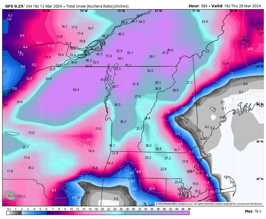
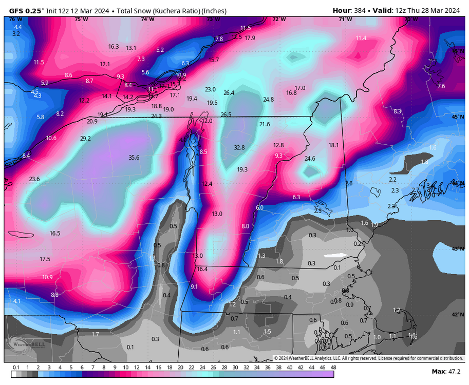
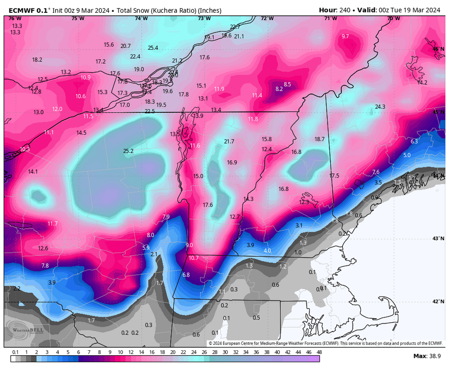
And may I suggest for those that NEED a snow fix...start chasing. My ski hobby helps a lot. For the last few weeks I have been way less worried about the day to day ups and downs of our snow chances here partly because I have been focused on what might happen up in northern New England. Same earlier in the season when I was focused on out west and not worried about the fact our pattern here was going to shit. You don't have to ski... set aside time for one or two trips to a snowy area each year and focus on that instead of it snowing here. Just a suggestion, it helps me, but everyone is different.
-
 1
1
-
-
1 hour ago, CAPE said:
We all really need to move.
Only time the grass is dormant/ I can't put (cool season) tall fescue grass seed down and expect it to germinate is early Dec through late Jan- not necessarily because of temps or lack of precip, but because the sun angle is low/days are too short. Probably would grow if that period torched with a persistent SE ridge. Coming soon..
Yea... but since I'm not going to uproot my kids and take them away from their mom and walk out on a really good job 12 years from earning my pension...just because I love snow...that isn't happening anytime soon. I will probably move to south central Vermont when I retire and the kids are both out of the house. Until then... I just have to accept what it is. The kids love snow but they aren't picky...as long as we get a couple good snows a year (and they define good as like 3") they are happy and we still get that most winters at least.
I have been frustrated the last few years by a couple (mostly stupid) factors...one being I had not come to acceptance with the reality yet. I was still stubbornly holding out hope that MOST of our troubles were just bad luck or cyclical and that things would bounce back. I still think things might bounce back some, eventually the PDO will improve...but truth is things are not what they once were and I need to just come to Jesus about that. The other was my stupid tendency to argue with the people that want to be "less than objectively scientific" about this. I need to let that go.
At this point I just hope the trends slow down...I hope that once the PDO flips it stabilizes things. Because if things keep warming in the eastern US at the same rate it has been the last 30 years...truth is there won't be much of any winter at all soon...we "joke" about us being SC but truth is we are only 10-20 years away from that actually being true if the current warning rate continues. I am NOT saying it is going to, I think we are in a spike due to the 2016 Nino and the PDO cycle in tandem...but just saying...if things don't level off soon in that regard there really wont be any true winter or hope of much snow at all anymore very soon.
-
 1
1
-
 2
2
-
-
-
49 minutes ago, cbmclean said:
I am hopeful that some of the gulf warmth is due to the eternal SER associated with our --------PDO episode. IF (big IF) that backs off in a +PDO hopefully the gulf warmth can back off some.
That map included the last +PDO cycle
-
7 hours ago, cbmclean said:
A fascinating graphic: some musings:
1. The east has clearly been hit harder than the west. This actually gives me a bit of hope. Yeah there is nasty background warming but perhaps there really is a multidecade cycle that happens to be "favoring" eastern NA for warmth.
2. On the other hand, the eastern CONUS is on average lower in elevation than the west which suggests that it is less able to rely on elevation for cold and is this more dependent on cold air advection from the source regions. So it makes sense that combined trends of warmer source region and increased pacific influence are hurting the east worse.
3. Man 1998-2000 looks like it was an ugly period.
Unfortunately I think the fact the boundary layer is warming faster is the simplest most likely culprit of that. Same reason the more elevated parts of our region haven’t suffered as much the last 8 years, and I mean compared to average, obviously they will always get more snow. But places with some elevation in our region are closer to avg over the last 10 years than 95.
Also you’re adding heat from the gulf. That’s probably some of it too. But neither of those factors is going to change.
-
 1
1
-
 1
1
-
-
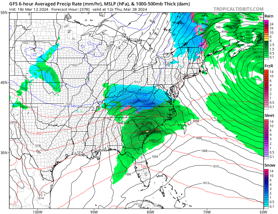
Someone remind me…we want to be on the southern edge of a snowstorm at day 6-10 right?
-
 2
2
-
-
3 hours ago, WEATHER53 said:
Be real careful please as you are stating that the models performed quite poorly.
They did. No one is arguing with you about that.
-
44 minutes ago, CAPE said:
That isn’t even that good a look. Implies the amplification happens too late and north.
-
2 hours ago, WEATHER53 said:
I think we need a modest low traveling from near Atlanta and ne toward East of Norfolk . Not worried about Gulf effect on Stu because if it’s that juicy and if it gets involved with that we will be 40 and rain. Can’t be a phase job or transfer either. Will be really tough if it tries to onset between 10am to 5pm as we would need about -20 departure and that’s too tough.
But. After dark in March it can still snow big time the entire month when the low is right
I actually went the other way. Absent an arctic airmass, which we just don’t have, I was thinking we need NS involvement. Without a phases bomb not sure how we cool the boundary layer enough. I hope we get a test case for our theories.
-
12 minutes ago, stormy said:
I love this triviality on a drizzly Saturday afternoon!
Better luck next time. There is no high to the west or NW.
Nagshead is 75.62 longitude. D.C. is 77.03. Ogdensburg is 75.48 longitude.
Trivial is right. The point is the same.
-
2 minutes ago, stormy said:
I think Ji would be happier with a 976 over Nagshead and a 1036 over Ogdensburg. Me? I can be happy with either as long as we have rain or snow on the 19th, after all, my region has had a dry February and early March. We have been dry slotted again today.
Most of our big snows have an inverted trough feature to their west not a high. That’s often what caused the extreme moisture transport needed to get big snow totals. A high being directly NW of the storm is actually pretty rare.
-
20 minutes ago, WEATHER53 said:
If it has the characteristics of a Miller A, organized low pressure moving from GA to off mid Atlantic coast then that works. Anything else hasn’t and won’t
Serious question. Do you think a STJ gulf storm with the associated heat that would come with it can work this late? I was thinking our only chance would be a NS wave that amplified extremely far south due to the blocking. Like the 18z AI euro showed yesterday. I know normally we want stj dominant waves but that’s in winter. This late would the boundary layer be able to get cold enough?
-
19 minutes ago, mdhokie said:
Yup! I'm headed up that way on the 24th. Hoping for some fresh snow!
At this point I don’t even care about a powder day. But after a low snow season and the last few weeks of extreme heat there was a risk there wouldn’t be much of an April spring season. That’s being alleviated by a cold snowy second half of March.
-
-
14 minutes ago, Ji said:
18z aifs is def snow. May not stick but it’s snow lol
Remember what I said. Give me 2 conserving runs where more than one major global shows snow and I’ll pay more attention. I will accept the AIFS in that.
-
 2
2
-
-
2 hours ago, Ji said:
its not really a perfect track. Its like more like a march 1993 track right?
No it’s a perfect track for a 95 snowstorm if it wasn’t late March. I posted the mslp animation. Go through the KU book. You’ll find plenty similar tracks. Problem is it’s March in a warmer climate.
2 hours ago, CAPE said:That low is inland actually. Pretty low chance for frozen with that track in the lowlands. Not in late March. Head to Canaan.
You’re east of the bay. Your ideal track is east of 95 and frankly you want a track that would fringe me. That track is inside for you. But if this was winter with a normal colder airmass that is a perfect track for a big snow along 95. Maybe it mixes with sleet as is common along 95. But as you said it’s not mid winter it’s late March. Thing is 95 doesn’t want a further east track. That wouldn’t help. There is no low level cold anywhere. We want a tighly tucked bomb. We just need it to be even more amplified. 975 maybe! 970? Yea that’s crazy but that’s what it would take to overcome the time of year and low level crap air mass.
-
 1
1
-
-
-
4 minutes ago, Chris78 said:
Could be quite the paste job for places further west.
Even for my area it’s 35 during the height. It’s definitely snow but I doubt much accumulation at those temps. Places at or above 2000 feet sure!
-
But in seriousness @Ji the low is 985 off OC and it’s 41 in DC at the height of the storm. It’s not even close! It would need to be a ridiculously anomalous event to overcome the temps


What Went Wrong in Winter 23-24/Base State/Will It Ever Snow Again??
in Mid Atlantic
Posted
I am going to address this and your previous post here.
From 2014 to 2018 was a positive PDO spike and taken as a whole was a very snowy period. From 2007 to 2013 the PDO was negative and other than 2010 those years all sucked.
There is more to the PDO than the raw numbers. It is also NOT a magic bullet operating in a vacuum. But if you look at the last 5 deeply negative PDO periods, they all sucked major ass wrt snowfall here. 1949-1957, 1971-1976, 1989-1992, 2007-2013 and 2020-2024 were the last 5 deeply negative PDO periods and they all were incredibly low snowfall here.
But the PDO is not the end all wrt snowfall. We can get a +PDO low snowfall season if other factors are not good. A +AO can offset a +PDO, for example. And we have in the past been able to get a snowy winter in a -PDO, but those mostly came during weak or moderately -PDO periods not strongly -PDO cycles. Look at the 1960s for example...and the snowiest seasons came early in the 60s when the PDO was positive...yes it remained snowy into the -PDO cycle later but it was a weak to moderate -PDO cycle NOT a deeply negative one. Once the PDO went deeply negative in the early 70's the snowfall stopped!
There is a matter of degrees to this. No one factor makes up 100% of the equation wrt our snowfall. But what the last 75 years suggests is that when the PDO goes into a deeply negative cycle we are in big trouble and it tends to suck. A deeply negative PDO cycle seems to overwhelm the rest of the pattern and it's very hard for us to get much snow regardless of what those other factors are doing during these ---PDO periods.
When the PDO improves does it mean we suddenly get a ton of snow? No. We might get a +AO season, in which case the PDO won't matter. The truth is we are south of where it reliably snows and so we need multiple factors to line up in order to get snow. But one of those factors is the PDO and it would be very helpful if it would get out of the suck ass phase that it is in now.