Chattownsnow
-
Posts
355 -
Joined
-
Last visited
Content Type
Profiles
Blogs
Forums
American Weather
Media Demo
Store
Gallery
Everything posted by Chattownsnow
-
Working on a dusting here in east ridge just east of Chattanooga. Ill take it .
-
1-30/2-1-26 Arctic Blast, ULL Snow Event
Chattownsnow replied to John1122's topic in Tennessee Valley
Thank you for this. I know the basics but this more in depth stuff I love and gobble it up lol .- 782 replies
-
- 1
-

-
- extreme cold
- snow
- (and 1 more)
-
Man, that would be falling into some absurdly cold air from top to bottom. .
-
If that southern vort perks up would that help? With the northern piece trending north maybe that can be our saving grace if we are lucky lol. It speeding up couldn’t hurt either I would think .
-
Yeah I’m not sure how far this thing will be able to dive south l. It’s already way down there as it is .
-
We are basically at the mercy of how far that little vort over the Hudson Bay slingshots west and then winds up as it comes south. I used the 0z euro but as of making this the 6Z euro came out on TT but the point remains the same. You can see a piece of energy following this energy around the backside that I think is tugging this west. It’s there on the GFS also but less defined and dives in later, thus more east I tried to upload the GIF but I guess the file is too big and you can see what I’m looking at in action .
-
Been slowing dropping in temps here in east ridge Tennessee about 2 miles from the Georgia border just east of Chattanooga. I’m at 28.9 now and never went above 29.5. Roads are still fine as of now icicles slowly forming now. I’m expecting to wake up above freezing but I guess we will see .
- 618 replies
-
- 3
-
-
- observations
- obs thread
- (and 1 more)
-
With an overrunning set up like this and that intense arctic boundary couldn’t we expect a more robust precip field at go time than modeled? It’s certainly not meager by any means but given this set up, wouldn’t it be at least likely we see more QPF produced at go time? I haven’t looked at Dews during this time though so I’m sure that would play a factor .
-
Thats me [emoji24] .
-
Woke up to a nice little dusting and snowing moderately well. Almost measurable actually. starting driving to work and no one else had anything. Up on missionary ridge in Chattanooga might have made the difference lol
-
Got 1 3/4 inches here in east ridge just east of Chattanooga and still getting light snow falling. Probably not making it to 2 but maybe with some luck if this back side does anything. Time of day will likely not help either. Over performer either way!
-
Would be great if this didn’t happen lol. At least get it more north south but the orientation of the s/w I don’t think allows that
-
Actually looking at modeling it’s not that big a difference in our neck of the woods. Really just noise, maybe slight down tick over all. Reading the doom and gloom in another forum I checked for myself and it’s just all IMB worries and not so much over all picture. Models are flopping around further west though. 18z Euro though looks rough though
-
I did not expect this to dry out on modeling so much. It’s better than amping too much and bringing rain into the area I suppose. One of those situations you can’t have one without the other
-
Chattanooga looks to be on the wrong side of this one. We got a decent snow last month so I’m not complaining. Hopefully the northern part of the valley can hold off the warm nose. Those at elevation look golden though! Still time for a miracle down here but I won’t hold me breath
-
You are correct I actually did not expect that.
-
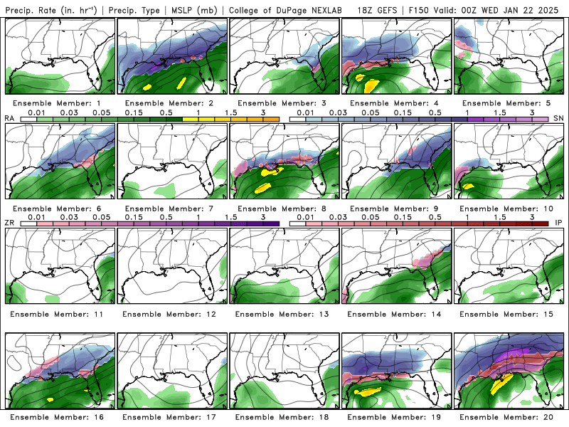
GEFS says the operational is out to lunch. There are a few complete whiffs for the tues - thu storm but most have something. Disappointing to see only one member bring snow to our area. But at least it’s south of us and not north! It’s also the GFS. That, and other models give us a chance.
-
Sleet now in chattanooga
-
Yeah it’s approaching fairly quickly. Huntsville has changed over for the most part I believe. Would be nice if we can hold the line but it appears to be approaching quickly if that’s what it is
-
Pounding down pretty good in East Ridge Just east of Chattanooga. Temp holding pretty good at 27.3
-
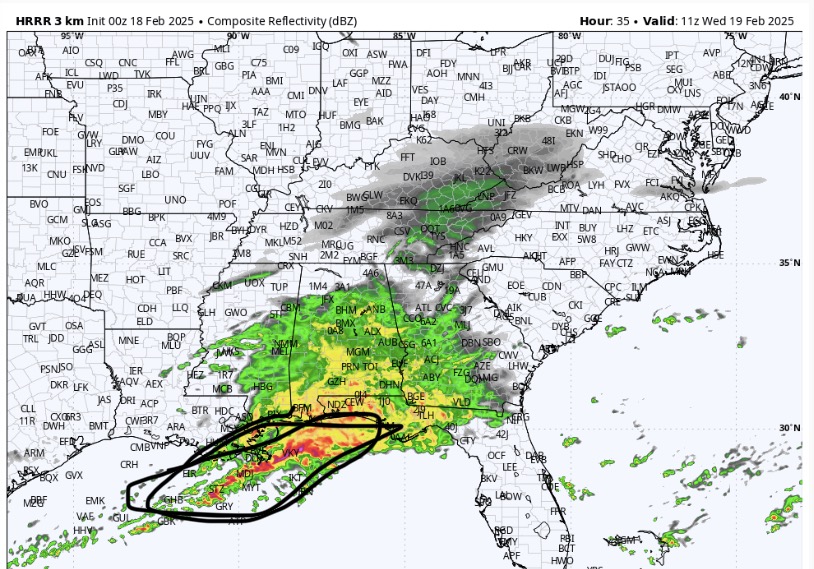
Nooga looks like the place to be right now. Good returns coming in and all snow. Not often I’ve ever been able to say that lol
-
1 3/4 inch so far. Temperature of 27 degrees which is surprising as I was expecting pretty much 32. Things look good. We keep this up we could make it to 5 inches I think
-
All snow 26.1/24.1 on the weather station here in east ridge. Everything seems to be cooperating for snow so far. Here’s hopin!
-
HRRR looking better for southern border counties. Chattanooga stays alive lol
-
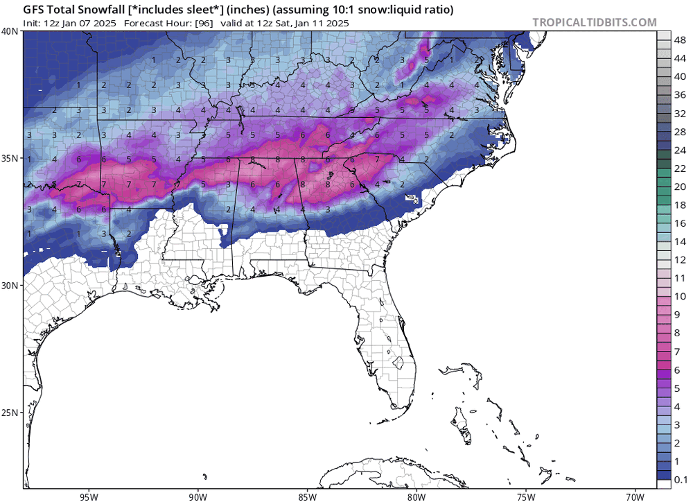
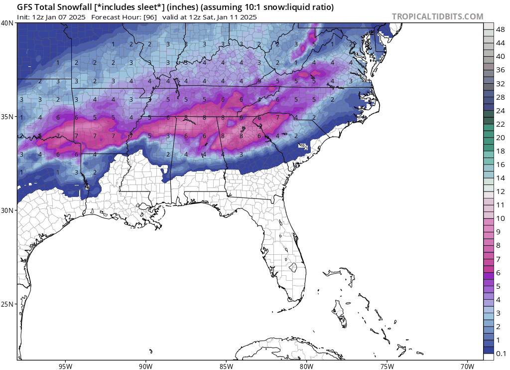
It’s nice to see the snow totals increasing to our west as go time gets closer there. I know these snow maps are flawed but the best forcing is clearly to our west on models but it will be interesting if that can translate some east into our area more. We’ve all seen it happen with systems similar to this before.