

cleetussnow
-
Posts
2,084 -
Joined
-
Last visited
Content Type
Profiles
Blogs
Forums
American Weather
Media Demo
Store
Gallery
Posts posted by cleetussnow
-
-
1 hour ago, RUNNAWAYICEBERG said:
Now its gotten really weird…
I'm like OH NO there's TWO?
But we love MetFan. We have room for 2.
-
 1
1
-
-
24 minutes ago, Layman said:
I imagine Tip will be along shortly to explain how the entropic tendency of the collective psyche on the board has manifested itself into the manifold of the genera and we will likely see a wholesale modal change in that behavior forthwith, likely prior to "clown range" depictions.
Looks like you got it covered! Tip can take a break on this one.
-
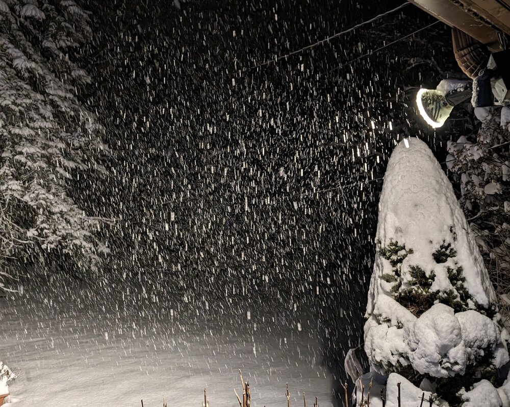
All done. Good little wintry storm. Like 2.5 inches of slop OTG north of HPN but probably 4 to 5 actually fell if I was doing a snowboard.
-
Another snow burst here of mod snow. Looks like 20 to 30 minutes left before the precip cuts off. This has been a pleasant storm here because we did not get much if any rain north of HPN. I’ll be sad to see it wash away so quick esp. since the next 10 days do not look promising, in fact the opposite as it stands. Longer term is a crap shoot.
-
19 minutes ago, psv88 said:
Was -4 in 2018 on this date out here. Haven’t seen anything close in a while. Doubt we see single digits this winter
I was at Stowe - -30. There was a cold outbreak the week after Christmas that winter as well, though not as severe.
-
 1
1
-
-
A lot of models show light snow until like mid afternoon tomorrow. Not much I’m sure, but its there.
-
1
-
-
8 minutes ago, Blizzwalker said:
My snow light west of Middletown is an exquisitely precise meteorological instrument.
Assessment: lot a snow in short time.
Nothing beats a good snow light during a storm. I need to get a good one set up and not piss off my neighbors.
-
3
-
-
More Upton disco re: tomorrow
Otherwise, an elongated area of low pressure passes to the south and east of the area tonight into Sunday. Bulk of the precip will occur the first half of tonight, but a mid-level shortwave trough will result in deepening of the surface low just off the southern New England coast on Sunday. This will keep the area under mainly light precipitation, but there is a chance for a heavier band of snow on the backside of the system, especially eastern areas. Even coastal locations should go back to all snow by early Sunday afternoon.-
1
-
-
Just now, Islandersguy said:
I agree. If we can minimize the snow melt when we mix and have some more snow tomorrow maybe we get to 4 or 5 in?
Exactly what I’m thinking at this point
-
1
-
-
I’m at about 3 inches here north west of HPN.
-
9 minutes ago, NJwx85 said:
No mention of snow tomorrow.
In fact they do
Otherwise, models remain in agreement that low pressure passes to our south tonight and just NW of the 40N/70W benchmark Sunday morning. Bulk of the precip will occur through tonight, but PVA aloft interacting with a surface trough on the backside of the storm brings additional, but lighter precip during the day Sunday. -
Upton disco
NEAR TERM /THROUGH SUNDAY/... The challenge of this forecast will be for areas just inland of the coast the next several hours, particularly interior NE NJ and the CT coast. A strengthening east flow will gradually warm the boundary layer, however, with liquid equivalent rates of .1 to .2"/hr moving up from the south, those areas could see brief snowfall rates of 1 to 2"/hr before mixing with or going over to rain. Inland areas will also see an increase in intensity of the snow the next couple of hours, from SW to NE. Even a slight change in distance north and west will make a difference. For example, KEWR has gone over to plain rain at 37F/34F, while KNYC is right around the freezing mark. Latest dual pol CC from KDIX and KOKX shows lower CC values (marking mixed pcpn going over to rain) near KEWR and along the south shore of LI. This area should advance north with a changeover to all rain across LI and the NYC metro the next 1 to 2 hours. However, model soundings for locations just north and west of NYC, such as KTEB are pointing to a prolonged period of heavy wet snow before the mid levels dry out and an elevated warm layer moves in aloft. At that time, precipitation would transition over to a drizzle or light rain, but the bulk of the heavy precipitation would have fallen as snow. Also, seeing very similar soundings along the CT coast. However, the strengthening easterly flow off the LI Sound is a significant warming factor for the boundary layer. If the wind could stay a bit more north of east the potential is there for higher accumulations. This will have to be watched carefully over the next couple of hours, but for the time will stay the course with the hazards and snowfall amounts.-
1
-
-
Point and click is now 3-5, up from 2-4 for my area north of HPN. HWO warning now 5 to 10, up from 4 - 8.
squeezing an inch on us.
-
My son and his besty are outside in the driveway with my snowblower (broken) and a parts donor snowblower (also broken) trynna make 1 good working snowblower. My driveway looks like a junkyard. I heard something run just now as it started to snow lightly. They have 8 driveways to do tomorrow. Hoping the bodge job gets em through (it will).
Meanwhile my neighbor just called…his won’t start.
Finally some winter around here.
-
7 minutes ago, jbenedet said:
You’ve been tracking a crap storm potential for 10 days. We knew.
Enjoy mostly white rain.
Everyone quote this in the obs thread with pics.
-
4
-
-
I get jacked?
nah. I get jack shit
-
5 minutes ago, vegan_edible said:
corolla vs saw mill pkwy
just send it.
-
1
-
-
At my location for of HPN, I am rooting for:
1) Heavy front end saturday/saturday night
2) Dry slot instead of rain
3) Sunday developer snow
That's the ONLY way we get to accumulation OTG more than a 3 sloppy inches here IMO.
And I don't think there is a single model depiction that shows that exact scenario, but I am also not tracking every single run all day long so maybe there is.
-
Sweet spot is Putnam on this side of the river (that's still inside 'metro' so to speak). NWS Point and click is 7 to13 up yonder and we've seen all that in the models as well. I do see they are factoring in the Sunday bit and that is going to have to happen to touch the higher end numbers.
-
Just now, donsutherland1 said:
The GFS shows snow at HPN until near 42 hours. Then, there's at least some sleet mixing in. Surface temperatures are above freezing, though.
I'm right next to Allgame, so much appreciated, Don! We'll have to see if we can anything out of the Sunday part. NWS disco seems to think that's still on the table.
-
1
-
-
Seems NWS is bullish LHV: https://forecast.weather.gov/product.php?site=OKX&issuedby=OKX&product=AFD&format=CI&version=1&glossary=1&highlight=off
mostly rain metro
-
 1
1
-
-
7 minutes ago, David-LI said:
You just got NAM'D!!
(Now seriously, this is not happening lol, go home NAM you're drunk)

We always knew it'd come.
NAM'oliscious!
but leave it...like as in walking my dog past a McDonalds cheeseburger wrapper left on the ground......leave it...leave it...
-
3
-
-
Looks like the LP is a little more consolidated/stronger this run. Could be good
-
1
-
-
Having Tip posting down here is like having a celebrity guest star on our program tonight.
-
1
-
 1
1
-
4
-
January 2024
in New York City Metro
Posted
Agree. I am going through the GFS Op and already looks good at 144 with a more positive tilt. This could be fun to track and I am already in the op runs myself.
Edit - I need to wait a few more frames on the 12Z run before opening my yap. Doesn't tilt quite like 6z, or how I thought it would.