

cleetussnow
-
Posts
2,080 -
Joined
-
Last visited
Content Type
Profiles
Blogs
Forums
American Weather
Media Demo
Store
Gallery
Posts posted by cleetussnow
-
-
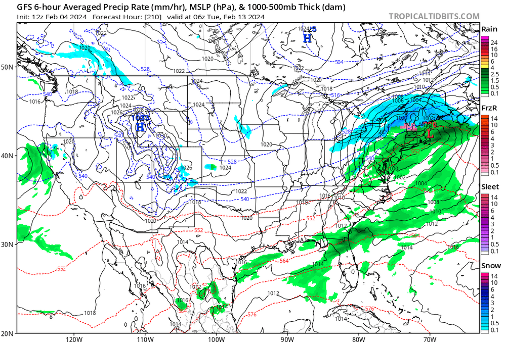
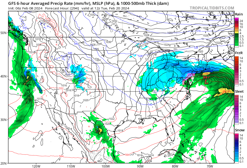
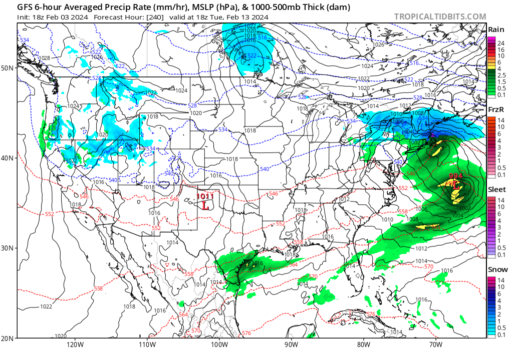
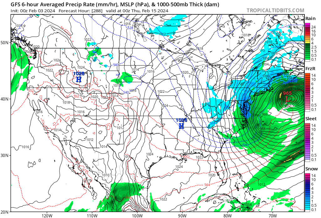
GFS is a beaut. 975 at the BM.
-
52 minutes ago, mikem81 said:
no. Wayyyy too close to the coast.
Your right. Its 39.95 lat, 70.53 long.
Miss?
-
GFS pretty much right on the BM
-
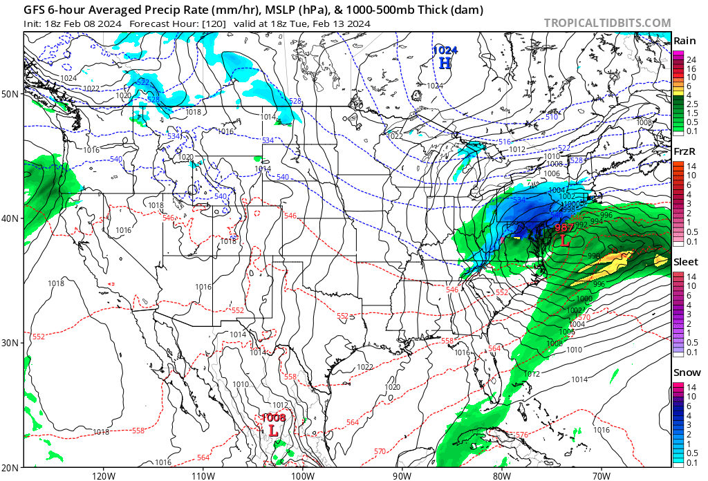
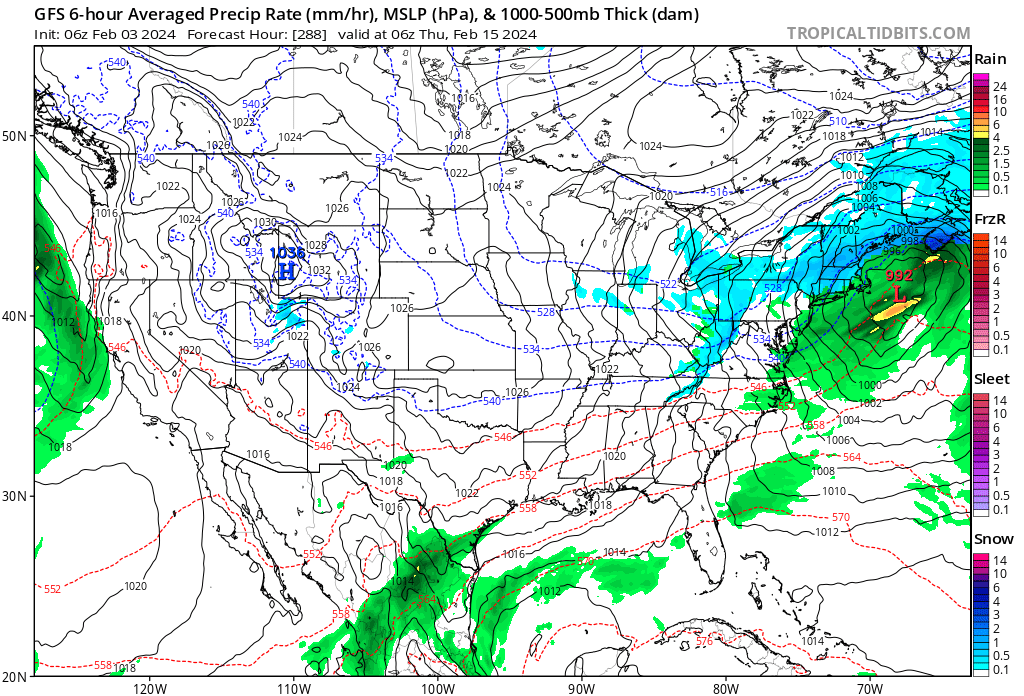
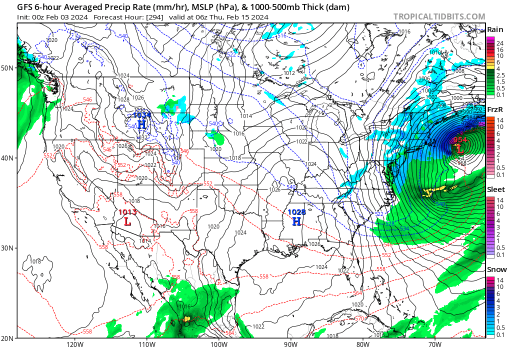
Doesn’t look a whole lot diffo from 18z or 12z for that matter
-
I think we are 4.5 days with the southern vort. Amateur eye says the vort in question, or one of them, comes across the baja peninsula late tomorrow.
-
 1
1
-
-
-
I don’ think we’ll have clarity 4 days out on this one. I think model runs will be all over until gametime. We have to careful not to bite on any particular one, but we are getting three or four runs per day that are closer. Maybe there will be something later to latch onto if this one doesn't’ work out.
like this

or like this one

-
-
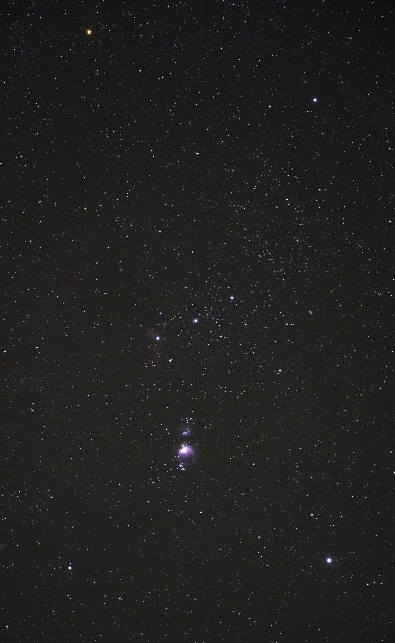
5 hours ago, AstronomyEnjoyer said:
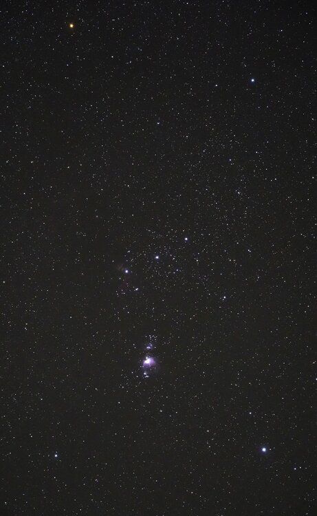
Constellation Orion, taken earlier this evening. 80mm F/4 for 8 seconds ISO 12800. Fairly untouched, just compressed for forum limits. Even still, you can see the Orion Nebula, the Running Man Nebula, The Flame Nebula, and if you really know what to look for, a bit of the Horsehead Nebula. This is far from what a final stacked image could look like. You boost that signal to noise ratio up up and up, and you can pull out incredible details.
Enough of clear skies though, I want it to snow.
How much for Philly?
-
26 minutes ago, DavisStraight said:
No wonder I don't remember it, I got 2.4 inches.
Thats what she said.
-
 2
2
-
-
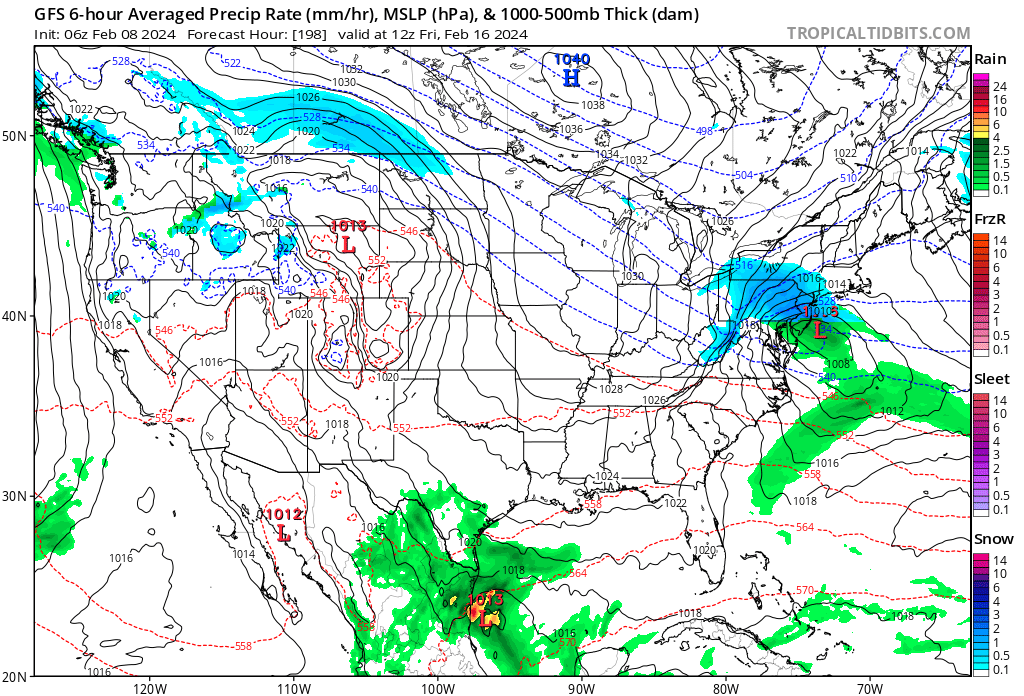
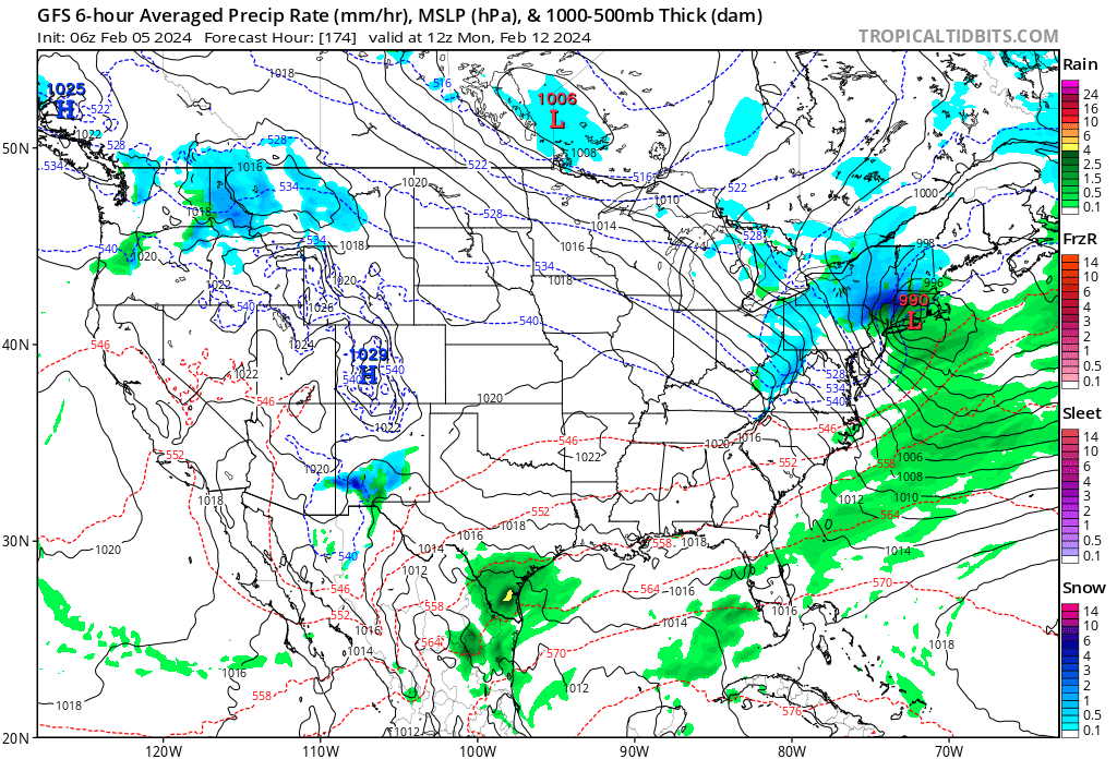
Storminess on the GFS run. I still feel like punts are the tenor of the season (besides blowtorch and rains to Maines), but I'll reserve judgement for now.
-
1
-
-
4 minutes ago, Chrisrotary12 said:
Another 384 hours of GFS for 0.1” of precipitation. Impressive.
If its not going to snow, let’s be dry at least. The overcast and rain has been getting to people.
-
-
52 minutes ago, NEG NAO said:
Better ??? Also its too far out to even speculate

9 days? Is fine to speculate. Thats what we do here…the storm is there, albeit 500 miles south of 12z….so, it IS ‘there’ and thats not meaningless. Its been ‘there’ for a few days. Where is ‘there’ going to be? We can speculate on that, and I say, not where that map puts it.
-
1
-
-
22 minutes ago, NEG NAO said:
when should we begin to see models catching on to this idea ?
Feb 10 2025
-
1
-
-
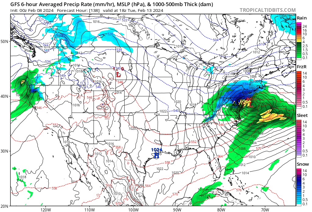
Looked good until the last 48 hrs. Rainer. Again, another punt. Let’s get within field goal range with one this winter and try to put up 3.
-
On 1/29/2024 at 7:57 AM, NorEastermass128 said:
Kind of a shitty flyby if its not coming anywhere near close. And what is this unit of measurement canada geese? Dumshits.
-
-
56 minutes ago, Typhoon Tip said:
I actually think this has legs - it's inCREdibly highly correlated right now in the numerical telecon projections, and the bulk ens layouts, en masse, make it almost physically impossible for just about anything to NOT happen when using the method/approach, too.
Something's gonna take place. Could be a procession of events. Could be one or two more significant scenarios.
I suspect that hyper bomb thing in the prior run would have trouble being an impact here ( more so up the coast toward the lower Maritime, sure -), because well prior to the pieces of that coming together ... heights over Florida and adjacency are too high ... the geostrophic basal wind velocities humming along > 50 kts ...That means the flows already compressed and that doesn't favor the meridian position of a deepening trough - that's why the model simultaneously closes off a multi-contoured 500 mb surface while moving it off to the NE so quickly.. .Usually, that kind of deepening in the mid troposphere slows down - in this sense ... it can't do that. This is what doomed the M/A forecast for the March 2001 "super massive black hole quasar extra double top secret hyper bomb" ... The models waited until the most possible Met careers were on the line to then correct for that compression/velocity in the flow and foisted the total scaffolding to higher latitudes.
Anyway, the 06z is a better solution for the above predicament ... **BUT** ... this is speaking relative to this recent series of run particulars. These aspects could certainly modulate.
We have seen bombs modeled far out on operational runs come to fruition for sure. Sandy was way out. I’d say 1/2 of the gfs operationals have had some sort of coastal for like 4 days now, and a storm of some variation on the others. Its like the operational has to reflect something distant early warning with red lights flashing, sirens wailing pattern developing across model suites. If it didn’t then its like WTF everywhere. If we are tracking a bomb for 15 days on op runs, thats a thriller to me, and we may be doing just that. Or not - but we’ll be 10 days op Euro today ish so lets’s see if we get a signal. I don’t have the Euro out to 10 myself. Lets hope its not another mirage this time and we can ride this baby in to the BM.

-
-
Exotic solutions
-
-
-
2 minutes ago, Layman said:
As a casual and self-proclaimed thoughtful observer who contributes little to nothing to this forum, I follow the momentum and tenor that you experienced folks provide in your comments to gauge what, if anything may happen weather-wise. I've seen a lot of posts with pretty colors and maps showing beautiful patterns that are just over the horizon for many weeks but alas, here we are on February 1st with the season that's been what it is to date - something that seems may approach normal by seasons end. Perhaps this time, the pattern will be favorable for snow and the necessary moisture and storm tracks will follow to produce something meaningful in our area. If it doesn't, well, that seems to be the greater wholesale pattern we've been in for a few years now so no surprise.
It's like we've flipped a coin 15 times and it's been tails every time. We know it's just as likely to be heads on every flip but after a while you kind of fall back on "I don't feel like it's going to".
It definitely seems like there are firmly two majority camps in this realm however, especially this time of year: those who want snowy winters and those who don't. While each party may think they're being objective, scientific, rational, logical, etc with their posts, to the casual observer it's clear there's a bias. Certainly not a problem, but when it clouds good judgement with every decision/forecast it becomes painfully obvious and diminishes the weight of the posters perspective in my eyes at least. The horror, I know

People obviously feel like the coin is loaded - i.e. it flips tails >50% by a lot, so they go with that. They think someone betting heads is wrong or wishcasting despite what models say. That said, I'm leery and already on the ratter train. Hopefully the Brooklynwx train stops at Feb 15th station and we can get on board that for awhile. long way off...
-
1
-


Following a Miller A/B hybrid type coastal potential, Feb 13th ... As yet untapped potential and a higher ceiling with this one
in New England
Posted