BuffaloWeather
-
Posts
25,688 -
Joined
-
Last visited
Content Type
Profiles
Blogs
Forums
American Weather
Media Demo
Store
Gallery
Everything posted by BuffaloWeather
-

Historic Christmas Lake Effect Blizzard
BuffaloWeather replied to BuffaloWeather's topic in Upstate New York/Pennsylvania
Winds picking up and band moving north! Let’s go for a final Jeb walk! -
Historic Christmas Lake Effect Blizzard
BuffaloWeather replied to BuffaloWeather's topic in Upstate New York/Pennsylvania
Have to make sure you clear your airvents https://www.wgrz.com/article/news/local/27-year-old-man-dies-of-carbon-monoxide-poisoning-in-lockport-niagara-county/71-c146f8ce-9865-48b1-8d5b-9afc584ab09d?fbclid=IwAR3ZBVBrw4YY5-xhykOgbuaYZN16wW5ph0_BWZWMJuXXQcyNkyKVqCZA_1c -
Historic Christmas Lake Effect Blizzard
BuffaloWeather replied to BuffaloWeather's topic in Upstate New York/Pennsylvania
I was out in it for 3 hours earlier a little tired. Might go for one more tonight when the band drifts north again. -
Historic Christmas Lake Effect Blizzard
BuffaloWeather replied to BuffaloWeather's topic in Upstate New York/Pennsylvania
Buffalo airport closed until Tuesday. I’ve never seen the airport closed for 4 days. -
Historic Christmas Lake Effect Blizzard
BuffaloWeather replied to BuffaloWeather's topic in Upstate New York/Pennsylvania
-
Historic Christmas Lake Effect Blizzard
BuffaloWeather replied to BuffaloWeather's topic in Upstate New York/Pennsylvania
The warning was early enough. The driving ban should have went into affect at midnight Thursday night instead of 9:30 Friday morning. The wording from the news media wasn’t severe enough -
Historic Christmas Lake Effect Blizzard
BuffaloWeather replied to BuffaloWeather's topic in Upstate New York/Pennsylvania
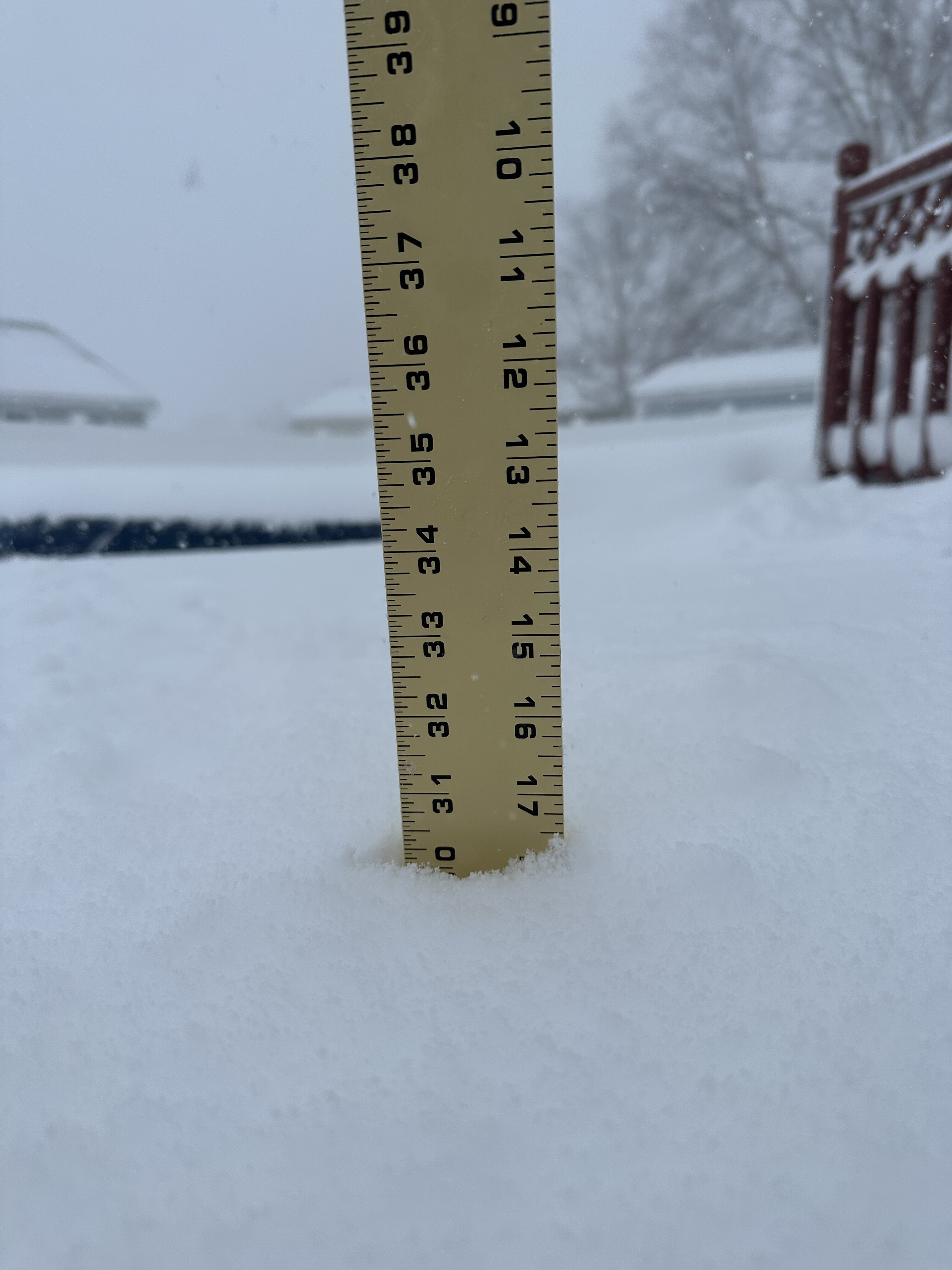
43.5” storm total snow depth 34”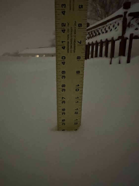
-
Historic Christmas Lake Effect Blizzard
BuffaloWeather replied to BuffaloWeather's topic in Upstate New York/Pennsylvania
-
Historic Christmas Lake Effect Blizzard
BuffaloWeather replied to BuffaloWeather's topic in Upstate New York/Pennsylvania
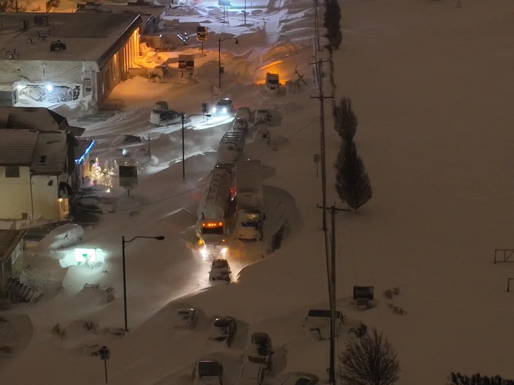
It isn't stopping. Well over 40" and the band isn't moving. It's been locked over my house since 10 pm last night. ...A BAND OF HEAVY SNOW WILL AFFECT SOUTHERN ERIE COUNTY AND FAR NORTHERN CHAUTAUQUA COUNTY... HAZARDS...A band of heavy lake effect snow accompanied by winds of up to 35 MPH which can rapidly reduce visibility to less than a quarter of a mile. This band of heavy snow is producing extremely heavy snow at the rate of 2 inches per hour. LOCATION AND MOVEMENT...At 445 PM EST, a band of heavy snow extended from Silver Creek, to Hamburg, to West Seneca, to Alden. The band will remain nearly stationary through this evening, with only minor shifts in placement expected. -
Historic Christmas Lake Effect Blizzard
BuffaloWeather replied to BuffaloWeather's topic in Upstate New York/Pennsylvania
-
Historic Christmas Lake Effect Blizzard
BuffaloWeather replied to BuffaloWeather's topic in Upstate New York/Pennsylvania
I took a few yesterday. One of them got licensed and is doing really well -
Historic Christmas Lake Effect Blizzard
BuffaloWeather replied to BuffaloWeather's topic in Upstate New York/Pennsylvania
-
Historic Christmas Lake Effect Blizzard
BuffaloWeather replied to BuffaloWeather's topic in Upstate New York/Pennsylvania
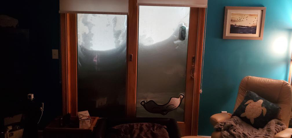
We're over 40" here storm total. This is from Clarence. -
Historic Christmas Lake Effect Blizzard
BuffaloWeather replied to BuffaloWeather's topic in Upstate New York/Pennsylvania
Cheektowaga last night
-
Historic Christmas Lake Effect Blizzard
BuffaloWeather replied to BuffaloWeather's topic in Upstate New York/Pennsylvania
My porch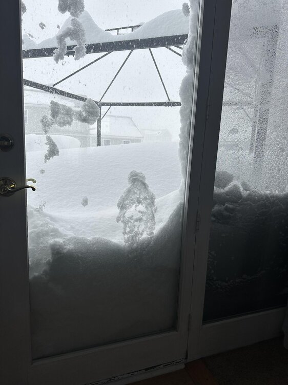
-
Historic Christmas Lake Effect Blizzard
BuffaloWeather replied to BuffaloWeather's topic in Upstate New York/Pennsylvania
35.4” storm totals with heavy snow. Current depth 30”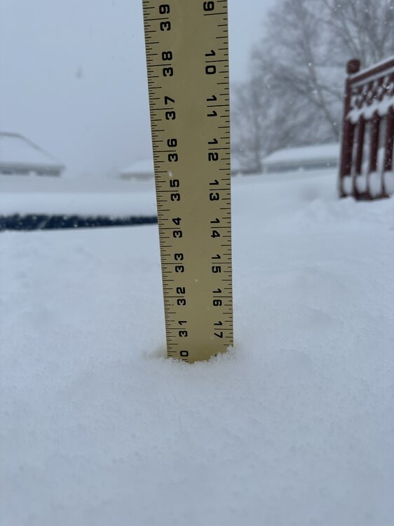
-
Historic Christmas Lake Effect Blizzard
BuffaloWeather replied to BuffaloWeather's topic in Upstate New York/Pennsylvania
Going live in heaviest stuff yet! https://youtu.be/RxdxfC9_6rQ -
Historic Christmas Lake Effect Blizzard
BuffaloWeather replied to BuffaloWeather's topic in Upstate New York/Pennsylvania
As long as we don't get a ton of rain we will be fine. -
Historic Christmas Lake Effect Blizzard
BuffaloWeather replied to BuffaloWeather's topic in Upstate New York/Pennsylvania
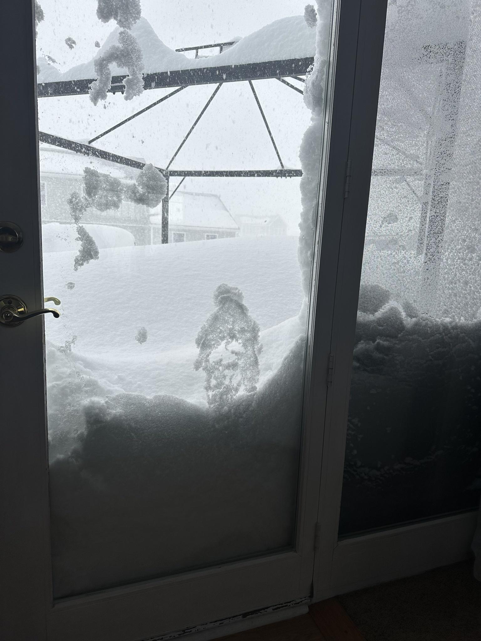
Firehose is back over the southtowns -
Historic Christmas Lake Effect Blizzard
BuffaloWeather replied to BuffaloWeather's topic in Upstate New York/Pennsylvania
-
Historic Christmas Lake Effect Blizzard
BuffaloWeather replied to BuffaloWeather's topic in Upstate New York/Pennsylvania
Yeah Nov 2014 had that same with Dec 2001. The big warmups keep the lake from freezing so we can get more lake effect further into winter. -
Historic Christmas Lake Effect Blizzard
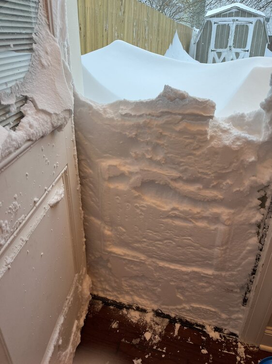
BuffaloWeather replied to BuffaloWeather's topic in Upstate New York/Pennsylvania
Getting destroyed here now storm total almost over 30” we got a ton of snow overnight band locked in over my house -
Historic Christmas Lake Effect Blizzard
BuffaloWeather replied to BuffaloWeather's topic in Upstate New York/Pennsylvania
-
Historic Christmas Lake Effect Blizzard
BuffaloWeather replied to BuffaloWeather's topic in Upstate New York/Pennsylvania
Sisters house
-
Historic Christmas Lake Effect Blizzard
BuffaloWeather replied to BuffaloWeather's topic in Upstate New York/Pennsylvania
This one’s for you Jeb walk time!