BuffaloWeather
-
Posts
25,688 -
Joined
-
Last visited
Content Type
Profiles
Blogs
Forums
American Weather
Media Demo
Store
Gallery
Everything posted by BuffaloWeather
-

Historic Christmas Lake Effect Blizzard
BuffaloWeather replied to BuffaloWeather's topic in Upstate New York/Pennsylvania
...Erie County... Buffalo Airport 34.6 in 0900 PM 12/24 Official NWS Obs -
Historic Christmas Lake Effect Blizzard
BuffaloWeather replied to BuffaloWeather's topic in Upstate New York/Pennsylvania
Amherst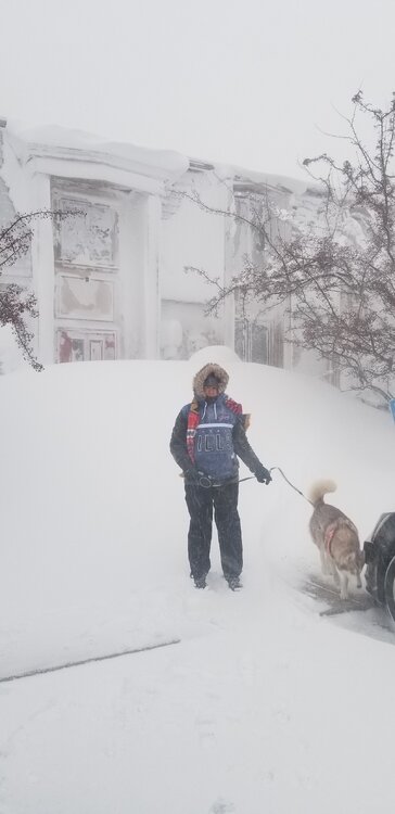
-
Historic Christmas Lake Effect Blizzard
BuffaloWeather replied to BuffaloWeather's topic in Upstate New York/Pennsylvania
-
Historic Christmas Lake Effect Blizzard
BuffaloWeather replied to BuffaloWeather's topic in Upstate New York/Pennsylvania
5:45 Reed is rescuing people in the city, just insane storm... -
Historic Christmas Lake Effect Blizzard
BuffaloWeather replied to BuffaloWeather's topic in Upstate New York/Pennsylvania
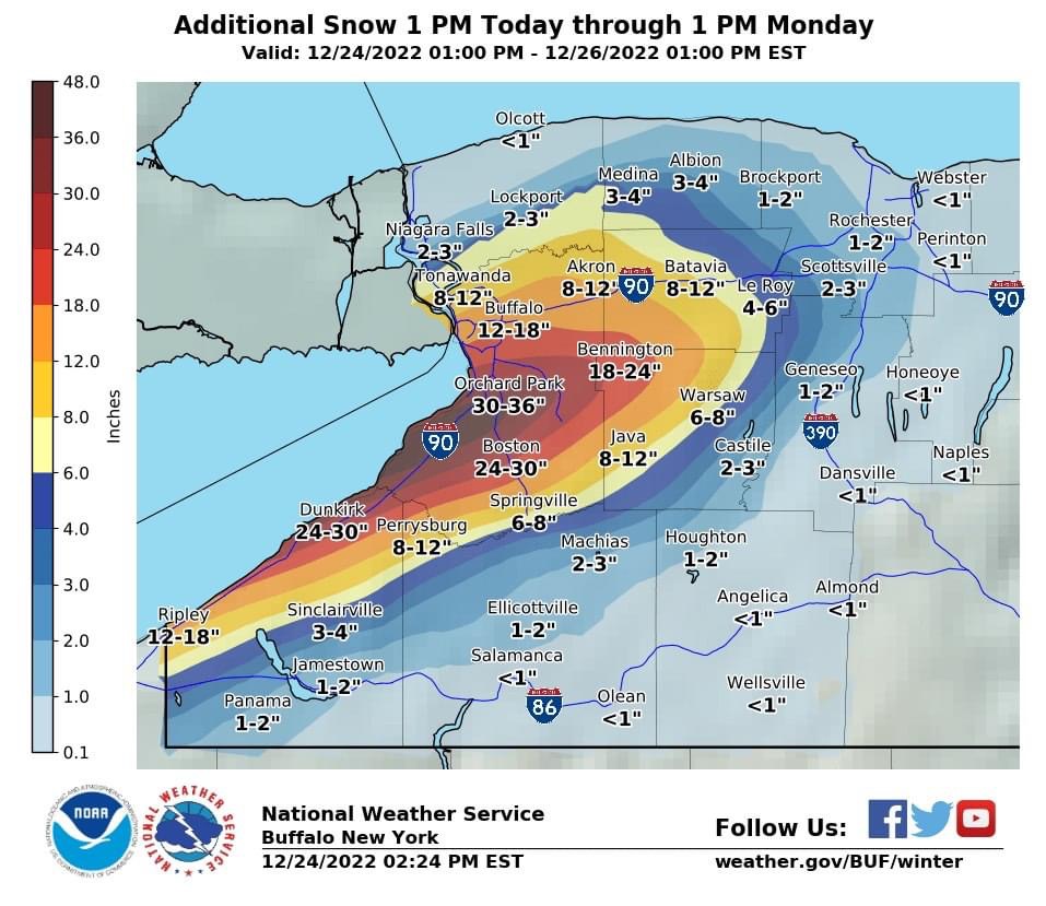
...BLIZZARD WARNING REMAINS IN EFFECT UNTIL 7 AM EST SUNDAY... * WHAT...Life threatening blizzard conditions and heavy lake effect snow. Additional snow accumulations of 1 to 3 feet in the most persistent bands. The greatest additional snow amounts will be across Southern Erie County. Winds gusting as high as 50 mph. Wind chills as cold as 20 below zero. -
Historic Christmas Lake Effect Blizzard
BuffaloWeather replied to BuffaloWeather's topic in Upstate New York/Pennsylvania
Band is getting stronger again, going to be another insane night. -
Historic Christmas Lake Effect Blizzard
BuffaloWeather replied to BuffaloWeather's topic in Upstate New York/Pennsylvania
Sisters house Cheektowaga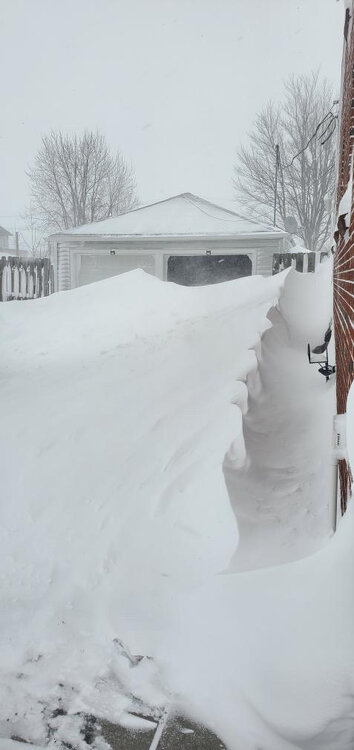
-
Historic Christmas Lake Effect Blizzard
BuffaloWeather replied to BuffaloWeather's topic in Upstate New York/Pennsylvania
The RGEM has the band going until Tuesday. -
Historic Christmas Lake Effect Blizzard
BuffaloWeather replied to BuffaloWeather's topic in Upstate New York/Pennsylvania
-
Historic Christmas Lake Effect Blizzard
BuffaloWeather replied to BuffaloWeather's topic in Upstate New York/Pennsylvania
The county executive is taking a ton of heat on this right now. I have no idea. You should have seen how many cars were out yesterday during the day in complete whiteout conditions. We're more prepared than the city of Buffalo is for this. When the storm hits the city its far more impactful than the southtowns. If you call 911 right now, no one is coming out they shut it all down until the conditions improve. -
Historic Christmas Lake Effect Blizzard
BuffaloWeather replied to BuffaloWeather's topic in Upstate New York/Pennsylvania
Travel ban at 9:30 am was a little too late. Should have been called earlier. People had to go to work and got stuck. -
Historic Christmas Lake Effect Blizzard
BuffaloWeather replied to BuffaloWeather's topic in Upstate New York/Pennsylvania
-
Historic Christmas Lake Effect Blizzard
BuffaloWeather replied to BuffaloWeather's topic in Upstate New York/Pennsylvania
Has me getting 36-48”, im betting the under
-
Historic Christmas Lake Effect Blizzard
BuffaloWeather replied to BuffaloWeather's topic in Upstate New York/Pennsylvania
Friend in grand island said 15-20” today -
Historic Christmas Lake Effect Blizzard
BuffaloWeather replied to BuffaloWeather's topic in Upstate New York/Pennsylvania

-
Historic Christmas Lake Effect Blizzard
BuffaloWeather replied to BuffaloWeather's topic in Upstate New York/Pennsylvania
From buf nws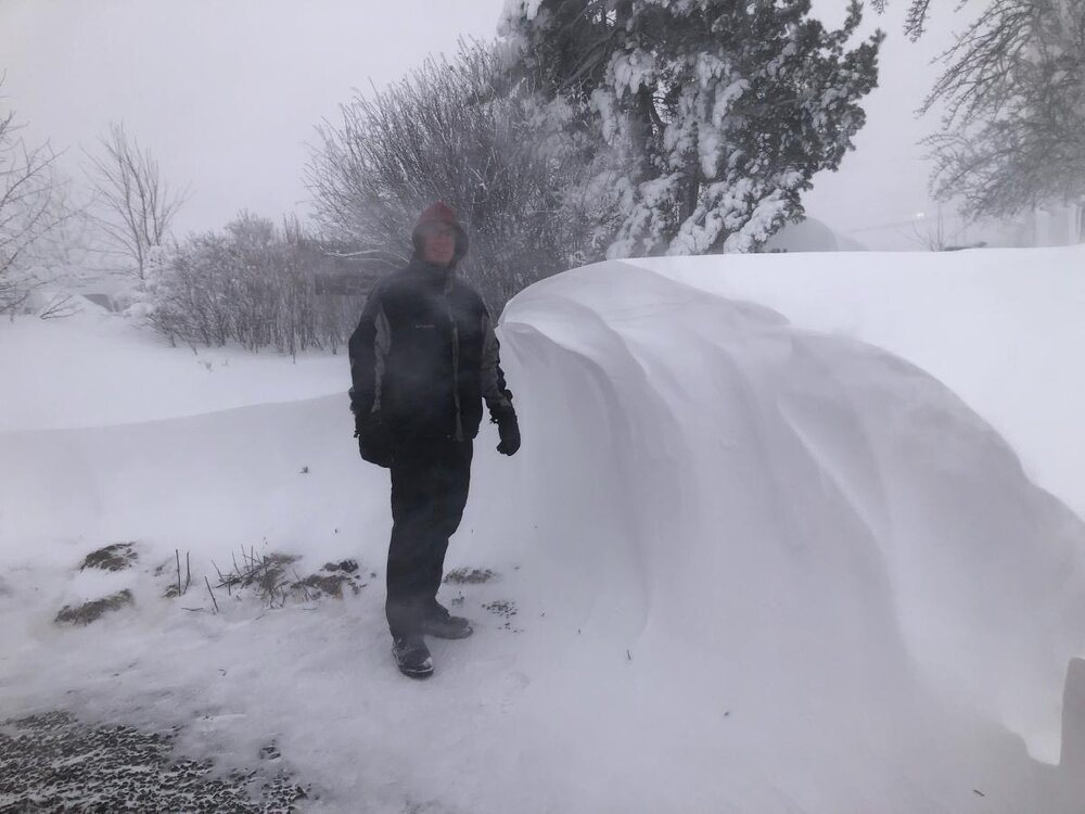
-
Historic Christmas Lake Effect Blizzard
BuffaloWeather replied to BuffaloWeather's topic in Upstate New York/Pennsylvania
-
Historic Christmas Lake Effect Blizzard
BuffaloWeather replied to BuffaloWeather's topic in Upstate New York/Pennsylvania
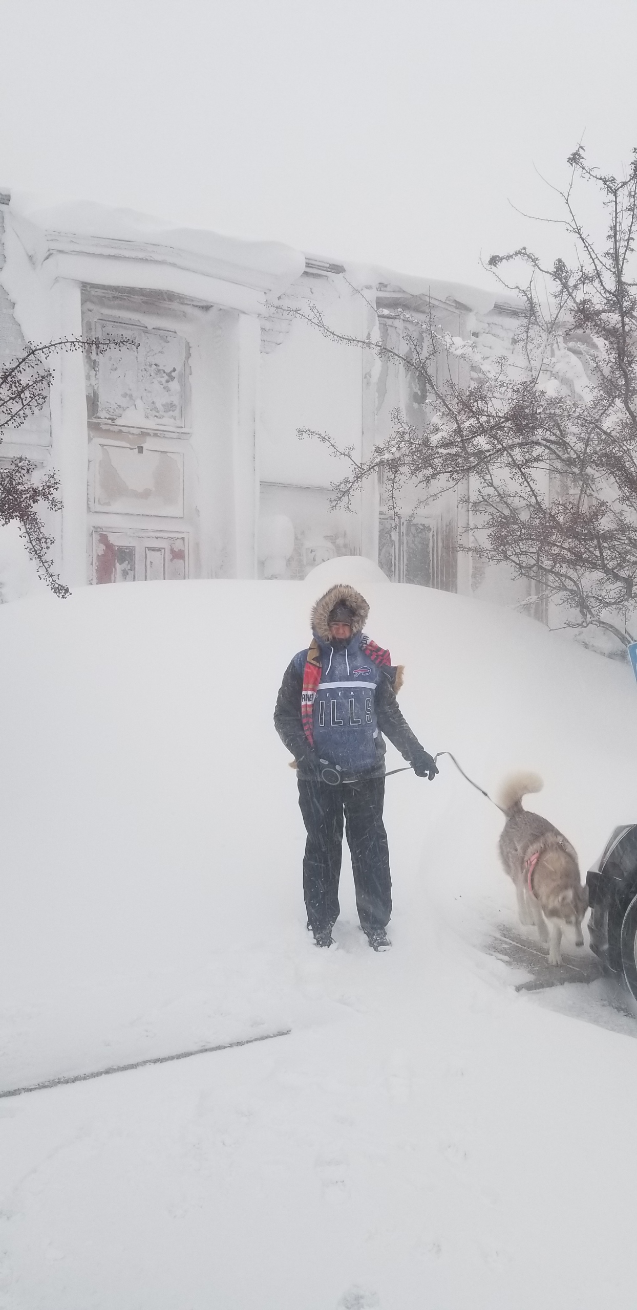
Sisters house in Cheektowaga. -
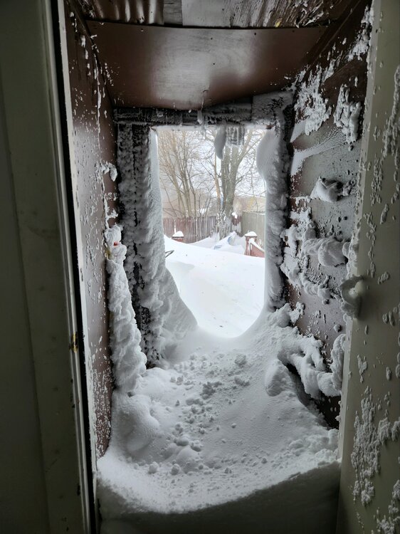
Historic Christmas Lake Effect Blizzard
BuffaloWeather replied to BuffaloWeather's topic in Upstate New York/Pennsylvania
-
Historic Christmas Lake Effect Blizzard
BuffaloWeather replied to BuffaloWeather's topic in Upstate New York/Pennsylvania
-
Historic Christmas Lake Effect Blizzard
BuffaloWeather replied to BuffaloWeather's topic in Upstate New York/Pennsylvania
-
Historic Christmas Lake Effect Blizzard
BuffaloWeather replied to BuffaloWeather's topic in Upstate New York/Pennsylvania
-
Historic Christmas Lake Effect Blizzard
BuffaloWeather replied to BuffaloWeather's topic in Upstate New York/Pennsylvania
-
Historic Christmas Lake Effect Blizzard
BuffaloWeather replied to BuffaloWeather's topic in Upstate New York/Pennsylvania
-
Historic Christmas Lake Effect Blizzard
BuffaloWeather replied to BuffaloWeather's topic in Upstate New York/Pennsylvania