Powerball
-
Posts
14,464 -
Joined
-
Last visited
Content Type
Profiles
Blogs
Forums
American Weather
Media Demo
Store
Gallery
Everything posted by Powerball
-

Spring 2025 Medium/Long Range Discussion
Powerball replied to Chicago Storm's topic in Lakes/Ohio Valley
With the PV stretching out before it dissipates, there should still be a couple opportunities in the 2nd half of March for transient cold blasts and even light snowfall amounts in this subforum. But yeah, the prospects of a significant snowfall and lost-lasting cold look increasingly unlikely at this point between the Teleconnections and MJO forecast. One thing to watch though, as we transition into Summer, will be the worsening drought in the SW USA. It is giving shades of 2011 (although obviously the ENSO state isn't quite the same). -
Yep, this will be another Dixie Alley special...
-
Fall/Winter '24 Banter and Complaints Go Here
Powerball replied to IWXwx's topic in Lakes/Ohio Valley
For winter, my favorites was the animated heavy snow and thundesnow icons. I do distinctively remember seeing the heavy snow icon in particular a whole 7 days out during the Local On The 8s in the run-up to Jan. 2005.... I also loved their animated icon for Strong T'Storms when severe weather was forecasted... (to be clear, I'm referring to the 1998 through 2006-period icons) -
Spring 2025 Medium/Long Range Discussion
Powerball replied to Chicago Storm's topic in Lakes/Ohio Valley
^^^Looks nasty for Dixie Alley... -
Fall/Winter '24 Banter and Complaints Go Here
Powerball replied to IWXwx's topic in Lakes/Ohio Valley
The difference in cumulative totals for the season is one thing, but I'm not getting where this comment specifically about snowstorms is coming from. Detroit has also had a pretty mediocre run with snowstorms the past few years, even despite relatively more nickel & dime events. -
I would imagine Buffalo and its southern suburbs sees true blizzard conditions fairly often, albeit that's due to the convective nature of the snow with the long fetch and friction from the lake enhancing the wind.
-
Spring 2025 Medium/Long Range Discussion
Powerball replied to Chicago Storm's topic in Lakes/Ohio Valley
Don't put your winter coats and snow shovels away just yet... -
Fall/Winter '24 Banter and Complaints Go Here
Powerball replied to IWXwx's topic in Lakes/Ohio Valley
It's not necessarily a bad thing at all... -
That NW cutoff is brutal though.
-
Fall/Winter '24 Banter and Complaints Go Here
Powerball replied to IWXwx's topic in Lakes/Ohio Valley
You are correct... https://banana1015.com/michigan-is-the-safest-state-in-the-nation-when-it-comes-to-this/ -
This ended up being a confirmed EF-1 Tornado...
-
It has been a while since you all have been able to say "Congrats MSP!"
-
Another view: https://x.com/DallasTexasTV/status/1896928531608977490?t=Knu6rVgmt9KKoCbnW9jEbw&s=19
-
Wall collapse at Paint warehouse in Lewisville... https://x.com/wfaa/status/1896951691469115830?t=Oc5mimBCtNyxAWLthV4YKw&s=19
-
Collapsed wall at Apartment complex in Irving... https://x.com/wfaa/status/1896952387765412186?t=Ty598yqvVNnMhpp8b_WBMg&s=19
-
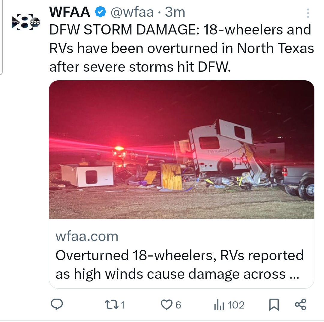
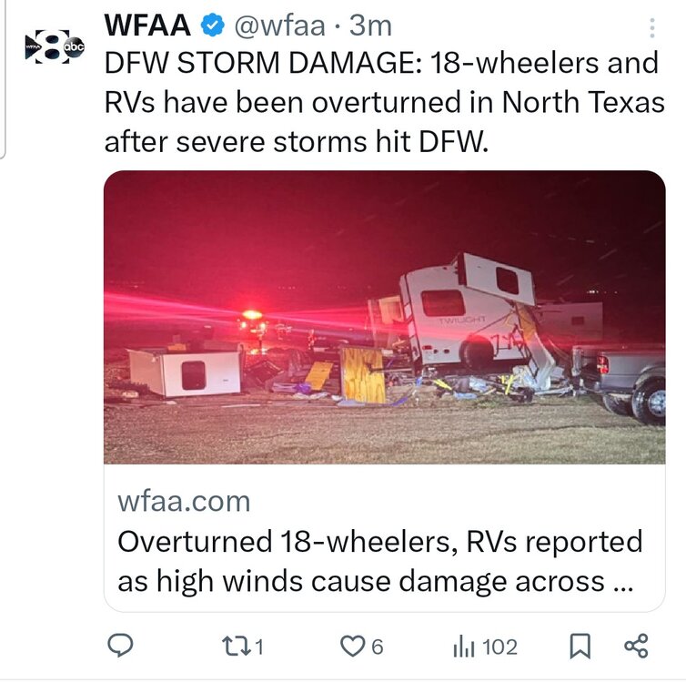
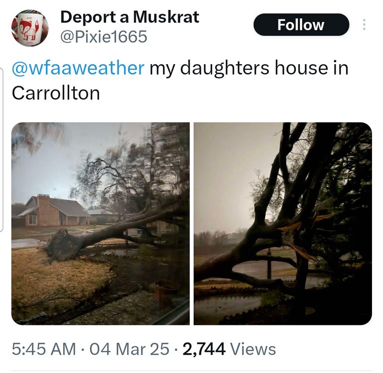
There have been 43 wind reports and 4 hail reports across DFW (thus far), and that includes 4 high wind reports 1. 82 MPH in Carrolton (Josey Ln and Hebron Pkwy) 2. 78 MPH at Dallas Love Field 3. 76 MPH in Haslet 4. 80 MPH in Decatur
-
More storm images / videos: Roof ripped off Plano West High School https://x.com/wfaa/status/1896910924532830713?t=L80vg9rnVS0pvieqJ3Df4Q&s=19 Another Uprooted Tree https://x.com/wfaa/status/1896918576281354477?t=qHC8Bqj8Tq_91uLIVipNFA&s=19 Live report by WFAA as storm moved in https://x.com/wfaa/status/1896909369763074258?t=_nFmSq6UvX4Kiu17bMBFmA&s=19
-
https://www.wfaa.com/article/traffic/north-texas-storms-winds-damage-severe/287-935981da-3b5f-4694-9321-71844f1609fe
-
There's a ground stoppage at DFW until 6:30am.
-
-
78 MPH Wind Gust at DAL...
-
74 MPH gust reported at DFW...
-
Texas 2025 Discussion/Observations
Powerball replied to Stx_Thunder's topic in Central/Western States
The last few days took a massive bite out of the monthly departure for DFW, as February will only end up -1.2*F below average. As far as winter on the whole (Dec - Feb), it ends up with an average temp of 48.6*F (+0.3*F above average). Snowfall-wise, the season (Dec - Feb) ended up being above average with a total of 2.6", all of which fell with the Winter Storm on 1/9 (and was partially sleet contaminated). -
^^^Bring it!!!
-
Fall/Winter '24 Banter and Complaints Go Here
Powerball replied to IWXwx's topic in Lakes/Ohio Valley