Powerball
-
Posts
14,467 -
Joined
-
Last visited
Content Type
Profiles
Blogs
Forums
American Weather
Media Demo
Store
Gallery
Everything posted by Powerball
-
Watching Fox Weather right now. They've ben showing a live cam of Chestefield and the lightning is quite vivid already.
-
There may be a tornado as well near Pinckey, MO... EDIT: Confirmed
-
Confirmed tornado now near St. Clair, MO...
-
It looks like the stronger cell tracked directly over the airport and through the west side of town. Not sure what side of town you're on...
-
Per radar velocity, those storms definitely seem to be producing some impressive straight-line winds as they push into STL, if nothing else.
-
Per the 00z sounding, there's still some weak capping down in MS, which is why the storms are struggling. That said, main show down there will be after midnight as the trailing shortwave out of TX pushes eastward.
-
Radar isn't looking as ominous as it did a few minutes ago on that cell. Wouldn't be surprised if the tornado lifted back up (for now), unless it's rain-wrapped.
-

-
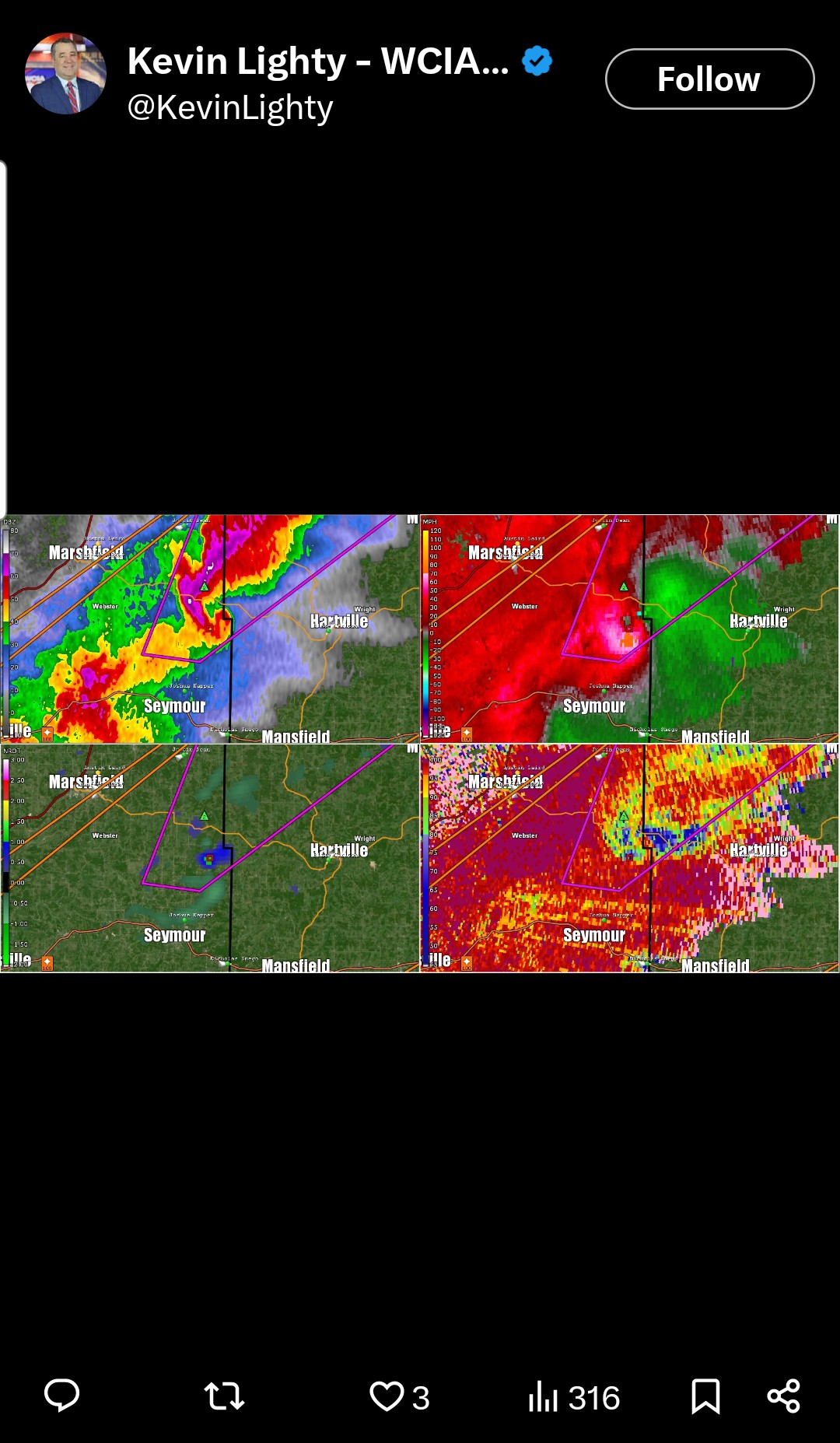
https://x.com/KevinLighty/status/1900695849006465376?t=rEdkbxMy4RdMU9qaT86ajQ&s=19
-
The radar is also indicating Tennis Ball-sized hail with that tornado-warned cell...
-
Can't say it hasn't been an active March, with 2 970s mb lows...
-
Atmosphere is still somewhat worked over from the morning / early afternoon convection. Also, low level flow, while sufficient, isn't the most ideal for a PDS tornado setup. That said, to your point about moisture, that should improve as the afternoon/evening progresses (which should also correspond with an increase in storm coverage / intensity).
-
-
Widespread Blowing Dust Advisories across OK/TX, as well as numerous wildfires & evacuation orders right now. Parts of Norman (home of the SPC) are under an evacuation order as well. I wouldn't be surprised if DFW gets added to the Blowing Dust Advisory as well, given Satellite trends.
-

Spring 2025 Medium/Long Range Discussion
Powerball replied to Chicago Storm's topic in Lakes/Ohio Valley
Pattern definitely looks favorble for more unusually strong/dynamic systems for the remainder of March. -
-
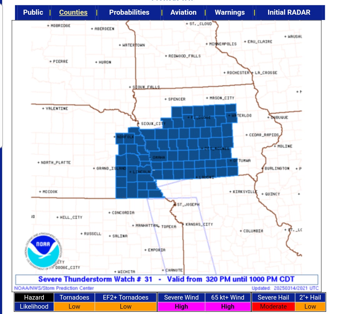
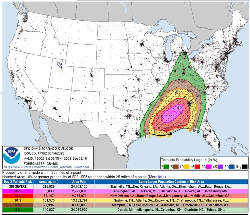
https://x.com/NWSSPC/status/1900627755374379121?t=CRhJ-hEb9K_uNTUgRgzklQ&s=19
-
Kind of interesting, BTW, to see what appears to be some cloud seeding with the dust on Satellite..
-

-
^^^Some of that should be moving in here shortly (within the hour).
-
Winds are underachieving thus far (locally), but temps are overahcieving (currently 85*F)
-
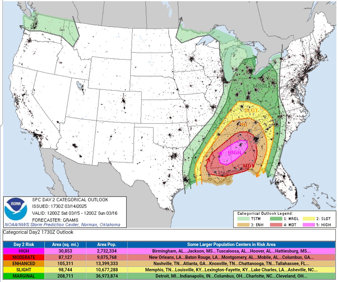
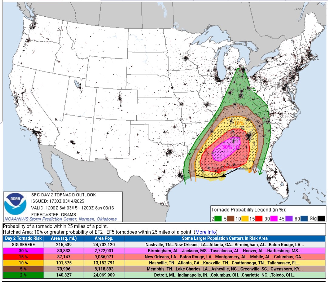
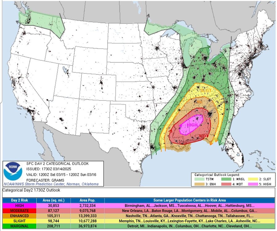
R.I.P Birmingham...
-
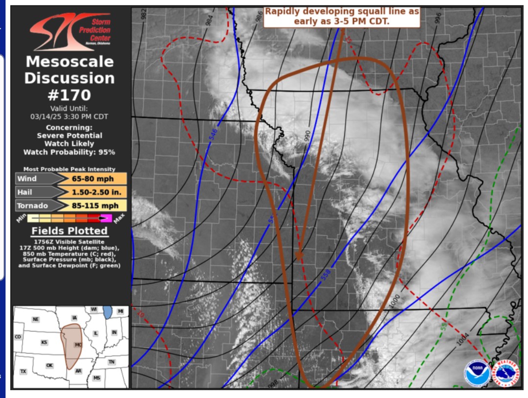
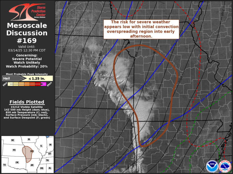
The current initial convection moving through MO which at first did seem like it would rev up (but is outrunning the better dynamics / moisture advection) has somewhat throw a wrench into things (as mentioned, it's not being handled very well by CAMs), especially as it cuts into daytime heating. That's probably another reason why they held off on the high risk.
-
-
Storms are already on the verge of erupting in Eastern OK/KS, with plenty of clear skies ahead of it.