Maggie Valley Steve
-
Posts
979 -
Joined
-
Last visited
Content Type
Profiles
Blogs
Forums
American Weather
Media Demo
Store
Gallery
Everything posted by Maggie Valley Steve
-

2026 Spring/Summer Mountain Thread
Maggie Valley Steve replied to Buckethead's topic in Southeastern States
88 for my high today. -
2026 Spring/Summer Mountain Thread
Maggie Valley Steve replied to Buckethead's topic in Southeastern States
85 here, but very little humidity. Makes for a pleasant evening for our 250 Independence Day celebration! -
2026 Spring/Summer Mountain Thread
Maggie Valley Steve replied to Buckethead's topic in Southeastern States
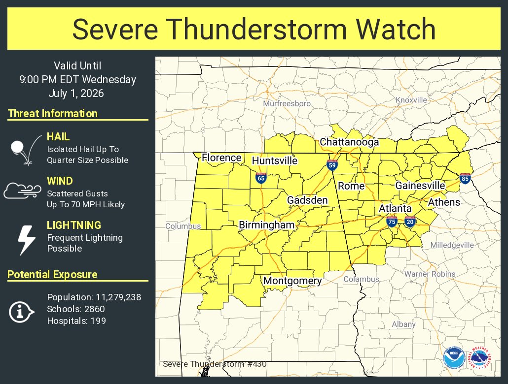
Severe Thunderstorm Watch for portions of the SW Mountains.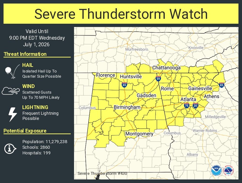
-
2026 Spring/Summer Mountain Thread
Maggie Valley Steve replied to Buckethead's topic in Southeastern States
83 again today for my high. Much cooler this morning with a 65 than the day before. I see signs in the medium to longer range a general troughiness over head. Once we get past Independence Day I believe a more unsettled pattern sets in. -
2026 Spring/Summer Mountain Thread
Maggie Valley Steve replied to Buckethead's topic in Southeastern States
83 for my high temp this afternoon and no rain here today. Congratulations Buckethead! -
Worse for me today Larry!
-
Mid-Long Range Discussion 2026
Maggie Valley Steve replied to BooneWX's topic in Southeastern States
@Wow -
Same problem today, particularly slow loading.
-
2026 Spring/Summer Mountain Thread
Maggie Valley Steve replied to Buckethead's topic in Southeastern States
I had a low of 53 this morning. What a way to run Summer in the Mountains! -
2026 Spring/Summer Mountain Thread
Maggie Valley Steve replied to Buckethead's topic in Southeastern States
Heavy rain in the Valley. -
2026 Spring/Summer Mountain Thread
Maggie Valley Steve replied to Buckethead's topic in Southeastern States
Happy Summer Solstice! It's all downhill from here until Fall! -
2026 Spring/Summer Mountain Thread
Maggie Valley Steve replied to Buckethead's topic in Southeastern States
I just emptied 1.79 inches out of the gage this morning. Not bad at all for yesterday's beneficial rain! -
2026 Spring/Summer Mountain Thread
Maggie Valley Steve replied to Buckethead's topic in Southeastern States
Torrential rain with thunder currently. Winds were gusting to 40 just before the rain started. -
2026 Spring/Summer Mountain Thread
Maggie Valley Steve replied to Buckethead's topic in Southeastern States
Moderate rain this morning in the Valley. -
2026 Spring/Summer Mountain Thread
Maggie Valley Steve replied to Buckethead's topic in Southeastern States
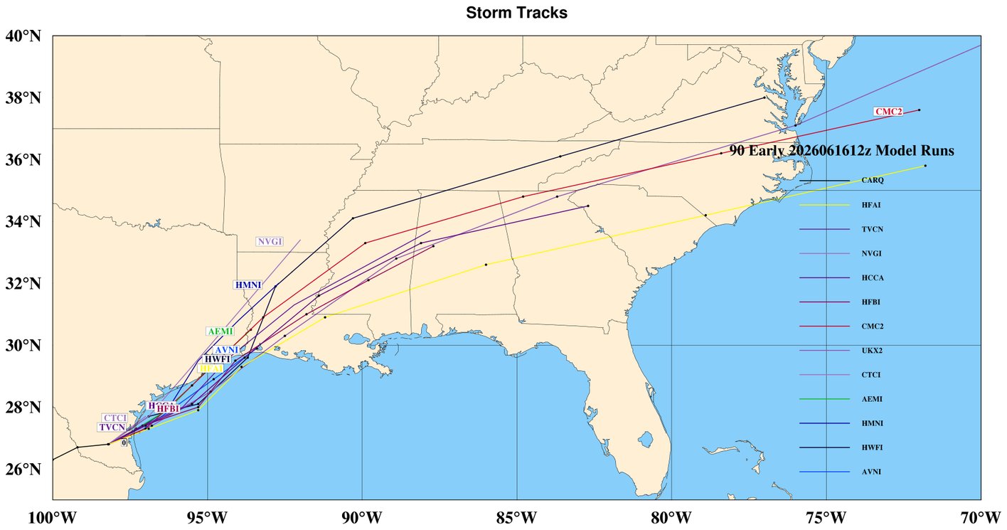
I just had a brief shower that was not expected today. The NHC will begin issuing Advisories for Potential Tropical Cyclone 1 at 11:00 AM Eastern time along the Texas/Louisiana Coast. Current track guidance keep the center passing to our S later this week. I've noticed that rain amounts has been increasing the last 24 hours for our SW Mountains into Haywood County.
-
2026 Spring/Summer Mountain Thread
Maggie Valley Steve replied to Buckethead's topic in Southeastern States
I've had a couple of showers today. Nothing heavy, but none the less rain. Looks like more on the way with the front. We'll need to keep an eye on the rich tropical moisture moving across the SE beyond mid week. -
2026 Spring/Summer Mountain Thread
Maggie Valley Steve replied to Buckethead's topic in Southeastern States
I had a brief shower with a rumble or 2 of thunder around 8 this evening. I'm very grateful for the inch I picked up Monday when most were dry! -
2026 Spring/Summer Mountain Thread
Maggie Valley Steve replied to Buckethead's topic in Southeastern States
Nice downpour this afternoon in the Valley! -
2026 Spring/Summer Mountain Thread
Maggie Valley Steve replied to Buckethead's topic in Southeastern States
What an amazing early June day across the Mountains. It was 49 at the house this morning and warmed to 72 this afternoon. Humidity was non existent and it felt like an October Fall day! -
2026 Spring/Summer Mountain Thread
Maggie Valley Steve replied to Buckethead's topic in Southeastern States
I'm getting another round of showers this afternoon and 60 behind the cold front. We're going to need to clear out this afternoon if we have a chance at the upper 40s in the morning! -
2026 Spring/Summer Mountain Thread
Maggie Valley Steve replied to Buckethead's topic in Southeastern States
I'm getting a nice shower this evening. Grateful for the rain! -
2026 Spring/Summer Mountain Thread
Maggie Valley Steve replied to Buckethead's topic in Southeastern States
I picked up another 3/4 of an inch overnight and closing in on almost 4 inches since the rain return. -
2026 Spring/Summer Mountain Thread
Maggie Valley Steve replied to Buckethead's topic in Southeastern States
Drier air has filtered in behind the front. No rain at the house today, but I drove through a shower between Silva and Waynesville early this afternoon. -
2026 Spring/Summer Mountain Thread
Maggie Valley Steve replied to Buckethead's topic in Southeastern States
I've picked up a little over 3 inches since the rain began last Wednesday night. We had 3 brief tropical downpours today. -
2026 Spring/Summer Mountain Thread
Maggie Valley Steve replied to Buckethead's topic in Southeastern States
Just had a round of torrential rain that lasted about half hour here in the Valley.