Layman
-
Posts
733 -
Joined
-
Last visited
Content Type
Profiles
Blogs
Forums
American Weather
Media Demo
Store
Gallery
Everything posted by Layman
-
Exactly. This happens quite easily. My business partner out in SoCal was wearing a sweatshirt in 70 degree weather the other day on a call. I was like "It was 7 this morning with a 22mph wind". He's lived out here and knows what that's like but once you get some time under your belt in a different weather regime, you adapt to whatever that is. As @powderfreak has been saying, so many people (understandably so) view everything through their individual life experience and think it's either a winter-of-yore in Stowe VT or another non-winter in Taunton MA. Regionally, we seem to still be mired in a sub-par regime for snow lovers. As many have mentioned, at least the mountains have been able to produce and the ski areas blow snow. Winter is always only a couple/few hours away for most of us.
-
Again, I don't know all the ins and outs, but my understanding is this is a flaggable offense in sword fighting and it sounds like he should know better.
-
I'm still learning many of the nuanced expressions in the weather world, but how does one determine if 2 dudes will be: 1) High Fiving 2) Sword Fighting 3) Slapping Dongs on the NJ Turnpike These things seem highly complex to the uneducated viewer.
-
Hold up...
-
Conditions look awesome! It's been a loooong time since I've been over there but am planning to head out that way in a couple weeks. Hopefully the weather cooperates and conditions stay as good as they look in your pics.
-
Another minor quake on the coast? Just had a short loud boom that shook the house. No rumble or aftershock.
-
Is that platform for a specific kind of weather station? Do you two have the same model? I'm looking to upgrade and would be interested in a more sophisticated unit.
-
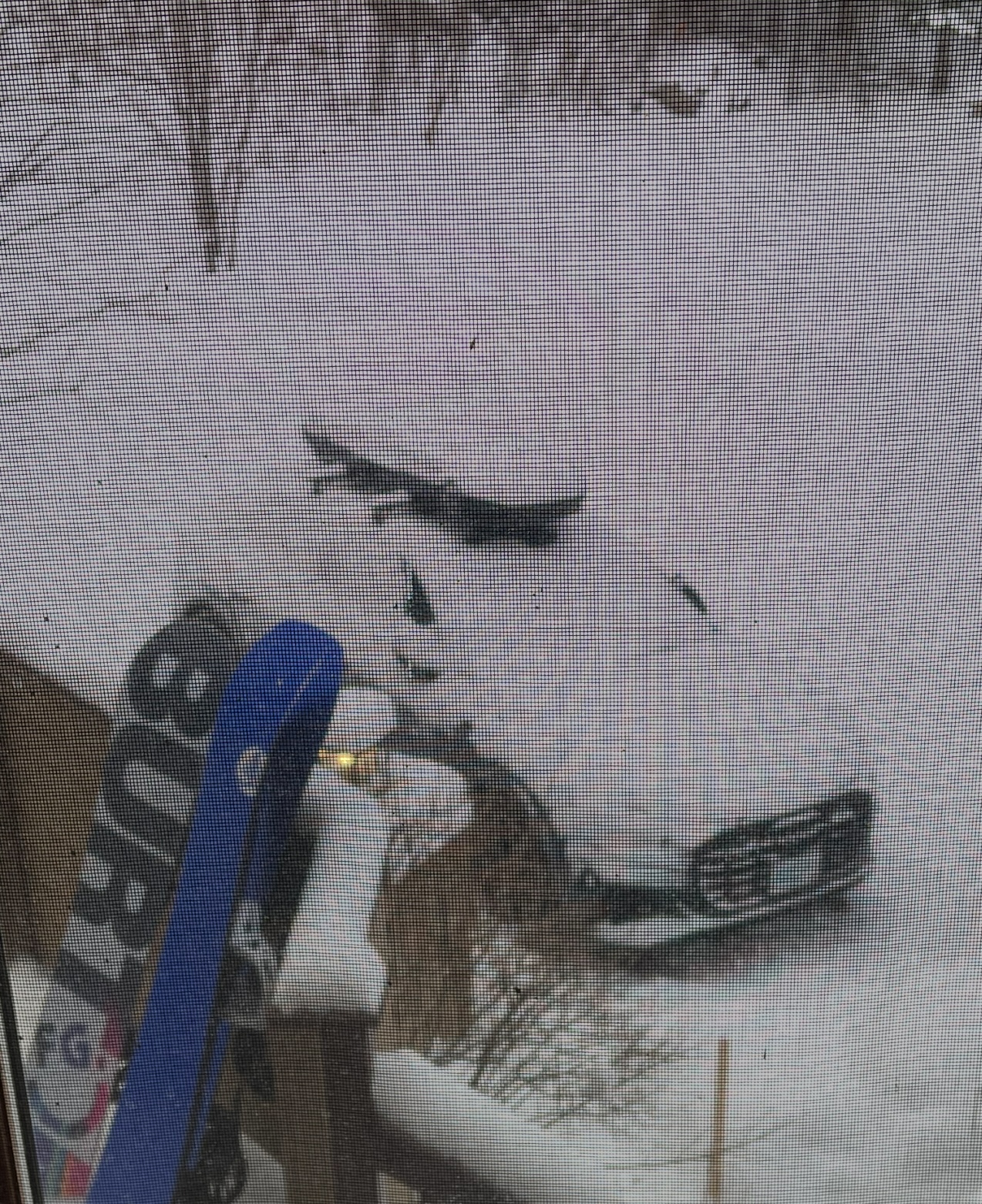
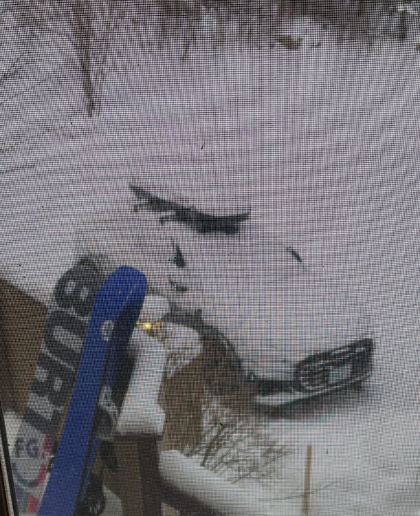
Starting a new day on the slopes steps from the house:
-
While it's not Aspen, Taos or the Matterhorn, we took the kids up to Bretton Woods for a week in mid-January. We started at the Omni for a couple nights then moved over to a slope side home managed by @alex's company. I don't know Alex and only found out about Bretton Woods Vacations via this forum, but would encourage anyone to give them a shot if you're looking for exceptional service and a quality stay in Northern NH. I found their quality of service to be leaps and bounds beyond what we've experienced with AirBNB, VRBO, etc. It snowed every day we were up there and I believe it totaled to 6-8" over that span. Just a little something to keep things fresh throughout. We have always loved riding at Bretton Woods and now that our kids are as old as we were when we met, we wanted to introduce them to that same experience we've enjoyed. We all had a blast! It was cold and snowy, felt like actual winter up there, and conditions were excellent. The home was comfortable, ultra-convenient to the slopes, well maintained and managed. The nights in the hot tub in single digits with snow flying was fun. Getting to and from it was a shock to the system though! It's been years since we've done a winter, snowboarding-specific getaway (due to raising the kids) but will definitely be planning another one. It's really hard to beat slope side access and will absolutely plan to do it again. We woke up every morning to the car re-covered in fresh snow: Lots of snow everywhere, every day:
-
Apparently taken down again to 3.8 https://earthquake.usgs.gov/earthquakes/eventpage/us6000pmk3/executive
-
Thought my boiler blew up for a second there. Scary stuff. Curious what @rimetree felt since he's probably one of the closest to the epicenter. It was a big explosion and several large rumbles here.
-
E36 M3? Hard to tell with the mountains of snow!
-
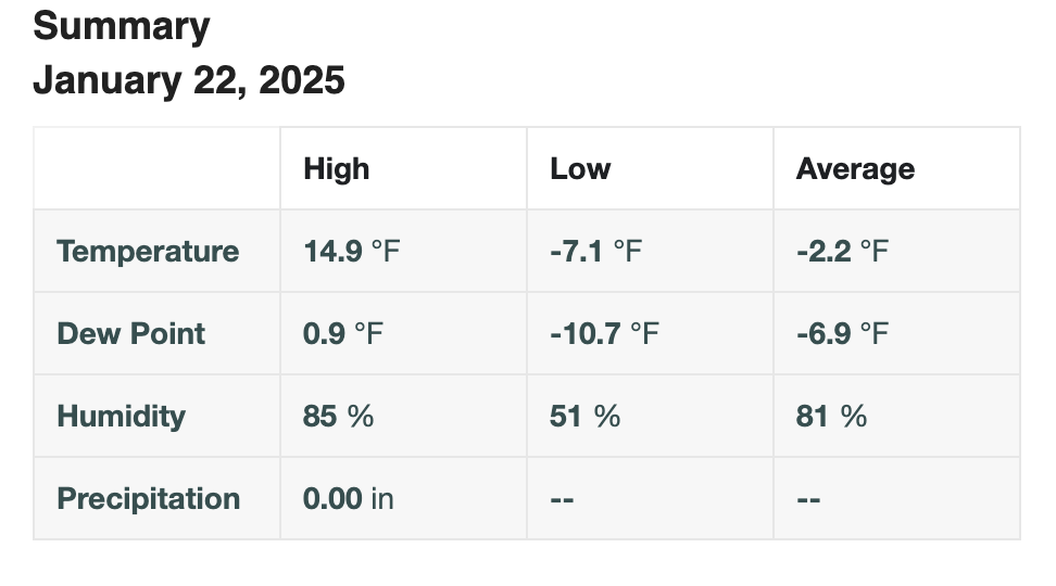
-7.1 for the low this morning. Up to 15 now. Side by side was not interested in starting to help with trash duties.
-
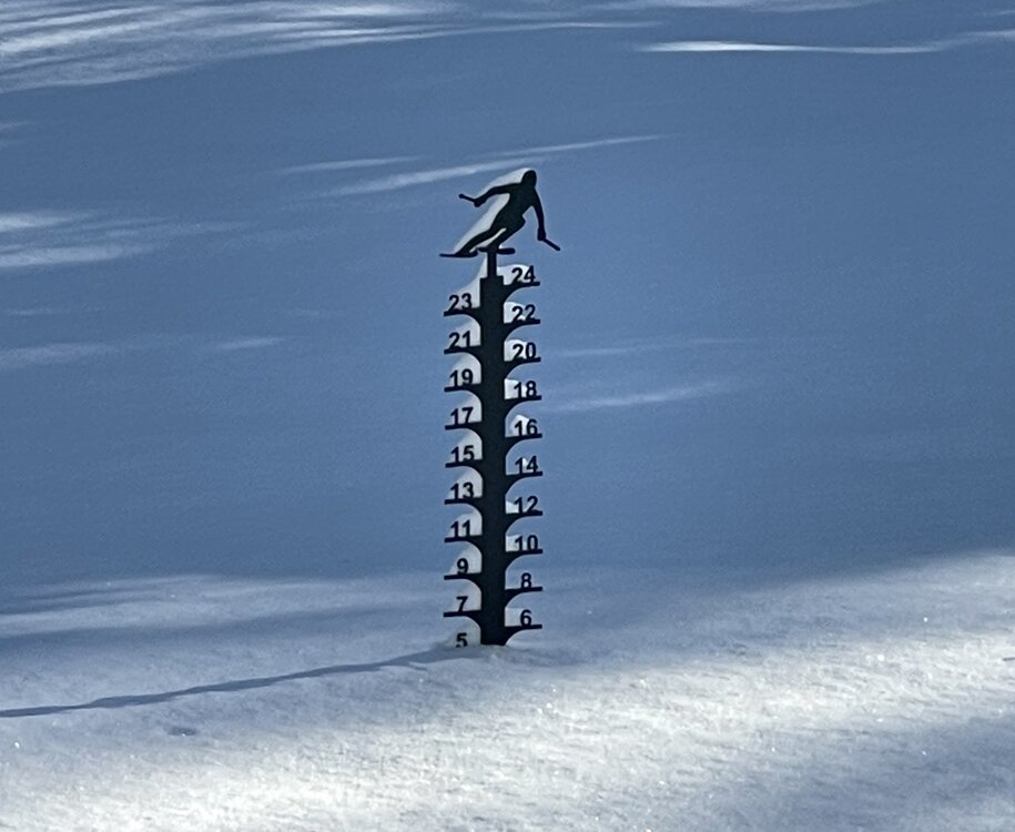
Doesn’t get any more official than this - 5” on the money. Take it to the bank!
-
New England Winter 2024-25 Bantering, Whining, and Sobbing Thread
Layman replied to klw's topic in New England
The devastation from the CA fires is pretty insane. Whole areas gone. Here's a drone pic of an entirely burned neighborhood in Pacific Palisades: https://x.com/WxNB_/status/1877136538229710997 Apparently there's a bunch of arson going on. Not sure if it's copycat/opportunistic stuff or the actual genesis. Crazy to think people would do this: https://x.com/BrooksWeather/status/1876946365802037569 https://x.com/hubermanlab/status/1877236580676493784 https://x.com/Right_Now_Views/status/1877217338883453075 -
I'm very pragmatic, realistic and optimistic so I'm not saying this with any negative bias at all - I simply find it ironic that I recall seeing near identical posts to this regarding the pattern we were supposed to be having at this very point in time about 10-14 days ago. Others have mentioned that the can is continually kicked with respect to getting snow in New England and that certainly can be seen as accurate. My personal take is that all model depictions are wrong, until they aren't. Sounds stupid on the face of it, but it's also 100% true. The models seem to be having moments of accuracy with some characteristics, but depending on lead time and granularity they're puking out a lot of falsehoods.
-
According to Jensen Huang of Nvidia, we're 15-30 years from having "useful" quantum based AI.
-
New England Winter 2024-25 Bantering, Whining, and Sobbing Thread
Layman replied to klw's topic in New England
This is insane. Seems like the fires are nowhere near under control yet. https://x.com/SiaKordestani/status/1876845562328146405 -
Is there any benefit to providing a synopsis post-mortem on this? I seem to recall back in late Dec that there was a "massive" signal for this time period. Something was sniffed out at that time that you caught as well and looked like with a certain evolution could drop a heck of a storm on us. Sure, we watched it collapse in real-time over a period of 10-14 days or so, but thinking back to that initial signal, what needed to happen that didn't? Does it simply boil down to the speed of the N and S jets not capturing the energy in time or at least a proper sequence to manifest a storm here? Alternatively, if the signal was truly massive 10+ days ago, does that automatically imply something is going to happen somewhere down range regardless? If so, what is that end result here on the east coast? I know we're essentially seeing that now, but I guess that's indicative of the necessary evolution falling apart, taking a massive signal and shredding it to nothing along the way. I'm curious about this because I simply follow along and try to keep up but for those of you who do this for a living, I'm interested in your reflections on what went wrong, what went right, what went unexpectedly, etc.
-
A degree’d met moonlighting in sales - I like it!
-
Weren't you one of them?
-
Hopefully warm enough for one of these
-
Is it reasonable to say what we're seeing in the evolution could be chalked up to largely a timing issue? I'm assuming there are other mechanics at play impacting that timing but for the storm to follow a desired path to provide snow in New England, it needs to get captured as you mentioned it sent on up to our doorstep.
-
Are there specific atmospheric mechanics that make or allow this to happen (I'm assuming "yes" because the models are picking up on it actually/potentially happening) that can be discerned at some reasonably defined lead time? Or, is it something that simply just happens? I see terms being used like "holding the energy back" or "not diving in time" etc but am curious if there's something akin to a tangible reason why. Kind of like a block of NE Canada shunting storms eastward. This is an obvious and easy to understand concept for me but some of the other mechanics remain elusive.