.jpg.93eb8afe5d1df4d67bc0eeb78d645380.jpg)
.jpg.7cbeb4b469bd18d447fac5868c43a091.jpg)
Yardstickgozinya
-
Posts
1,665 -
Joined
Content Type
Profiles
Blogs
Forums
American Weather
Media Demo
Store
Gallery
Everything posted by Yardstickgozinya
-
.thumb.jpg.6a4895b2a43f87359e4e7d04a6fa0d14.jpg)
Central PA Summer 2026 Discussion/Obs Thread
Yardstickgozinya replied to Voyager's topic in Upstate New York/Pennsylvania
-
Central PA Summer 2026 Discussion/Obs Thread
Yardstickgozinya replied to Voyager's topic in Upstate New York/Pennsylvania
Hopefully not your tomatoes. The radar is actually starting to fill in and develop some taller echoes at the moment. Hopefully we can get some of those into our area today. -
Central PA Summer 2026 Discussion/Obs Thread
Yardstickgozinya replied to Voyager's topic in Upstate New York/Pennsylvania
Well, at this point it's getting a little out of hand. We really need to get some rain, leading up to this, or it's going to be problematic for plants, animals and humans alike. The herbaceous and ground layer is already exhibiting some edaphic stress in my area. , especially along road and highway verges. -
Central PA Summer 2026 Discussion/Obs Thread
Yardstickgozinya replied to Voyager's topic in Upstate New York/Pennsylvania
This is the first time that i've been able to access the forum in over 24 hours. I'm not even sure if I'll be able to post this without another error. Has anyone reported the bad gateway to admin ? -
Central PA Summer 2026 Discussion/Obs Thread
Yardstickgozinya replied to Voyager's topic in Upstate New York/Pennsylvania
My kind of weather. Let's do this -
Central PA Summer 2026 Discussion/Obs Thread
Yardstickgozinya replied to Voyager's topic in Upstate New York/Pennsylvania
I mean, the NWS very well could be smoking crack. I'm going to keep my hope alive because we do really need the rain . Maybe us local guys need to get together for a powwow and rain dance. I'll bring the brownies.
-
Central PA Summer 2026 Discussion/Obs Thread
Yardstickgozinya replied to Voyager's topic in Upstate New York/Pennsylvania
We had more than enough cape around today to spark off storms and still do. Looks like an inversion problem to me. -
Central PA Summer 2026 Discussion/Obs Thread
Yardstickgozinya replied to Voyager's topic in Upstate New York/Pennsylvania
Just to be clear, i'm speaking of tornado genesis, not of severe weather itself.That possibility is very much still there. -
Central PA Summer 2026 Discussion/Obs Thread
Yardstickgozinya replied to Voyager's topic in Upstate New York/Pennsylvania
There's still time for things to happen. The overlap of surface vorticity and cape that they spoke of yesterday looks to be in jeopardy, to me. -
Central PA Summer 2026 Discussion/Obs Thread
Yardstickgozinya replied to Voyager's topic in Upstate New York/Pennsylvania
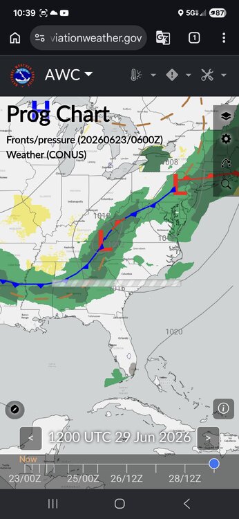
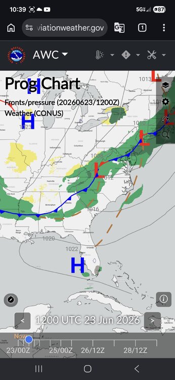
Funday Monday. Stay safe out there, fellas . - Remove Highlighting -- -- Discussion containing changed information from previous version are highlighted. -- 430 FXUS61 KCTP 220840 AFDCTP Area Forecast Discussion National Weather Service State College PA 440 AM EDT Mon Jun 22 2026 .WHAT HAS CHANGED... Level 2/5 severe T-storm risk expanded over the southern tier of central PA for this afternoon and evening && .KEY MESSAGES... 1) Scattered severe thunderstorms with locally heavy rainfall are possible across the southern tier/third of central PA this afternoon and evening && .DISCUSSION... KEY MESSAGE 1: Scattered severe thunderstorms with locally heavy rainfall possible across the southern tier/third of central PA this afternoon and evening Steady warm advection rain has expanded across the northern tier early this morning. This leading edge rain is likely tied to 850mb wind max downstream of dampening mid level shortwave trough/remnant MCV in the Ohio Valley. Hires guidance focuses mean QPF in the 0.50-0.75 inch range to the north of I-80 through 18Z with local rainfall amounts possibly exceeding 1 inch by early afternoon. Attention shifts to the south this afternoon and evening as a warm front will lift north of the MD line to a position somewhere between I-80 and US-22. Sfc dewpoints are projected to surge into the upper 60s to the south of the warm front where some cloud breaks should allow for at least modest destabilization. The moderately sheared and conditionally moist/unstable convective environment should promote scattered t-storm ignition into peak diurnal heating. The initial storm development is expected to evolve into forward propagating clusters with a strong to locally damaging wind threat. As convection intercepts the northward moving warm front over the southern tier of CPA, locally backed flow and more favorable low level shear may support the development of at least transient supercells with some tornado potential. SPC has expanded the level 2/5 slight risk to include the entire southern tier/third of CPA (areas near and south of US-22) along with corresponding severe wind and 2% tornado probs. Heavy rainfall will also be a concern with pwat values between 1.5 and 2 inches. This is around the 95th percentile for this time of year and would support intense rain rates perhaps as high as 2-3"/hr. A warm cloud depth in excess of 11,000 feet and tall, skinny CAPE profiles also support a heavy rain signal. WPC has maintained a level 2/4 slight risk for excessive rainfall (ERO) over roughly the southern third of the forecast area where isolated instances of flash flooding will be possible, particularly in training/repeat storms over urban areas. The two limiting factors going against a more considerable flash flood threat are the ongoing dryness/drought conditions focused over the LSV and fairly progressive storm motions. https://forecast.weather.gov/product.php?site=CTP&issuedby=CTP&product=AFD&format=CI&version=1&highlight=on&glossary=1 -
Central PA Summer 2026 Discussion/Obs Thread
Yardstickgozinya replied to Voyager's topic in Upstate New York/Pennsylvania
It's a 3cape day. The updated outlook should be available soon, but it seems like the days of consistency are over. ...Mid Atlantic into the Mid-South... A midlevel shortwave trough, including the remnant of a prominent MCV, is forecast to move from parts of the Upper OH Valley toward the Northeast and Mid Atlantic later today. While most guidance suggests some dampening of this shortwave trough with time, some flow enhancement will persist within the 850-500 mb layer in the wake of this shortwave across parts of the Mid Atlantic and central/southern Appalachians. Scattered storm development is expected by early/mid afternoon within a moist and moderately unstable environment. Initial development is expected to evolve into forward propagating storm clusters with a threat of damaging winds through the afternoon into the early evening. As convection intercepts a northward-moving warm front across the Mid Atlantic, locally backed flow may support development of at least transient supercells, with some tornado potential. https://www.spc.noaa.gov/products/outlook/day1otlk.html -
Central PA Summer 2026 Discussion/Obs Thread
Yardstickgozinya replied to Voyager's topic in Upstate New York/Pennsylvania
Wow, that sounds familiar. I am only speaking for myself here, but I actually had a bout of something similar about ten years prior that was much shorter in duration.. Looking back, I believe that both times I was dealing with a lot of anxiety. I really have no idea, though. Whatever it was, kept me nauseous 24/7 for well over 2 years. I would vomit at least three or four times a week. One of the other things about the whole ordeal that really p***** me off, is that the gastroentinologist also insisted that I had acid reflux and needed fundoplication . Being a much less invasive procedure, I went through with it. A few months after I had that done I develop chronic acid reflux and this time, I was sure of it, because unlike before the surgery, I actually felt like I had acid reflux. I only had it a few times in my life before that and it was from hot dogs every time. Looking back at it now I realize those sons of b****** took advantage of my health insurance. Not saying, that's what's happening to anybody else but that's surely what happened to me. -
Central PA Summer 2026 Discussion/Obs Thread
Yardstickgozinya replied to Voyager's topic in Upstate New York/Pennsylvania
I went through some serious b*******, and I'd hate to see it happen to anybody else. Reclassification as Non-IBD IBD-related medications (namely, 5-aminosalicylates, thiopurines, corticosteroids, and anti-tumor necrosis factor [TNF]) were used in 55 of the 108 patients (50.9%) misdiagnosed with UC and in 80 of the 184 patients (43.5%) misdiagnosed with CD (Table 3) https://journals.lww.com/ajg/fulltext/2023/10001/s1033_misdiagnosis_of_inflammatory_bowel_disease_.1572.aspx -
Central PA Summer 2026 Discussion/Obs Thread
Yardstickgozinya replied to Voyager's topic in Upstate New York/Pennsylvania
Yes, apparently, if the sun can break through, that'll be key in that possible evolution. -
Central PA Summer 2026 Discussion/Obs Thread
Yardstickgozinya replied to Voyager's topic in Upstate New York/Pennsylvania
I can smell the rain , but I'm left high and dry at home so far. The ground was still wet when I left Mechanicsburg, but it was completely dry when I got home. I'm pretty sure that I heard one rumble of thunder while out in my shed about 25 minutes ago, but I didn't see any lightning and nothing was detected. Some rain before the wild raspberries start to abort and lightning bugs peak, sure as hell would be nice. Some of the main things that I grade my summer on are convection, heat, humidity, frogs, lightning bugs and raspberries all are in danger of being extremely lackluster, this summer, and it's really starting to f****** p*** me off. -
Central PA Summer 2026 Discussion/Obs Thread
Yardstickgozinya replied to Voyager's topic in Upstate New York/Pennsylvania
Yup. No more rumbles of thunder here, but the west end of Mechanicsburg is getting another shower, just enough to get the ground wet.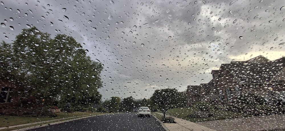
-
Central PA Summer 2026 Discussion/Obs Thread
Yardstickgozinya replied to Voyager's topic in Upstate New York/Pennsylvania
Extremely light, it only lasted a couple minutes . Just heard my first two rumbles of thunder of the day, something off to my northwest right now. -
Central PA Summer 2026 Discussion/Obs Thread
Yardstickgozinya replied to Voyager's topic in Upstate New York/Pennsylvania
Get a second and third opinion, especially if it doesn't run in the family. After nearly 2 years of extreme pain discomfort and weight loss, I too was diagnosed with severe Crohn's disease in 2002 . I was scheduled to get part of my intestines removed, but I was so fearful of the surgery that I didn't follow through. Fast forward a few months later, and I actually started to improve. I decided to see another gastroentinologist and they diagnosed me with chronic gastroparesis and told me that was probably the best that I was ever going to get. Fast forward a few months later and I was fully recovered, and I haven't had any problems since. I've shared this experience with several people over the years. Apparently Gastroenterologists misdiagnose a lot. -
Central PA Summer 2026 Discussion/Obs Thread
Yardstickgozinya replied to Voyager's topic in Upstate New York/Pennsylvania
Light shower here in Mechanicsburg -
Central PA Summer 2026 Discussion/Obs Thread
Yardstickgozinya replied to Voyager's topic in Upstate New York/Pennsylvania
Picking up some LEMP's on my am frequencies. Definitely things trying to happen to the north from my viewpoint here in mechanicsburg. Sorry for the reflection in the picture.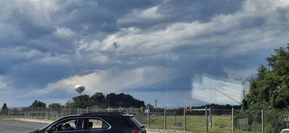
-
Central PA Summer 2026 Discussion/Obs Thread
Yardstickgozinya replied to Voyager's topic in Upstate New York/Pennsylvania
If nothing else, the cumulus out here are getting taller here this afternoon. -
Central PA Summer 2026 Discussion/Obs Thread
Yardstickgozinya replied to Voyager's topic in Upstate New York/Pennsylvania
Nws initially had me extremely excited with there talk of an EML surging this far east out ahead of a potent system.. By the next morning, I was pretty sure they'd picked up the wrong pipe. It seemed to me that the NWS was much more bullish, with their forecast than the SPC. The spc definitely, seemed to use more cautious wording in their forecast and I don't believe they ever mentioned anything about an EML. -
Central PA Summer 2026 Discussion/Obs Thread
Yardstickgozinya replied to Voyager's topic in Upstate New York/Pennsylvania
It's in the billing -
Central PA Summer 2026 Discussion/Obs Thread
Yardstickgozinya replied to Voyager's topic in Upstate New York/Pennsylvania
When you enter this part of town in Mechanicsburg, they literally have a plaque that says you are entering the homes of the Upper Class. They put it up in 2020 when everybody else was struggling. In the twenty years, i've been working at this home I've never even seen it used. I've been trying to get them to fork me out some money for some upper class lawn care but apparently, a new Maserati comes out every month.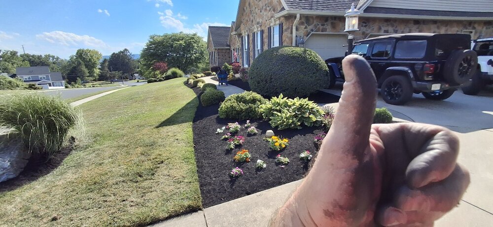
-
Central PA Summer 2026 Discussion/Obs Thread
Yardstickgozinya replied to Voyager's topic in Upstate New York/Pennsylvania
I bet he's feeling good about himself today.