.jpg.93eb8afe5d1df4d67bc0eeb78d645380.jpg)
.jpg.7cbeb4b469bd18d447fac5868c43a091.jpg)
Yardstickgozinya
-
Posts
1,534 -
Joined
Content Type
Profiles
Blogs
Forums
American Weather
Media Demo
Store
Gallery
Everything posted by Yardstickgozinya
-
.thumb.jpg.6a4895b2a43f87359e4e7d04a6fa0d14.jpg)
Central PA Spring 2026 Discussion/Obs Thread
Yardstickgozinya replied to Voyager's topic in Upstate New York/Pennsylvania
Hope cherry picked from the nws forecast discussion . As we head into next week, all model signals point to aresurgence of Spring warmth to close out the month and kick off April. An anomalous ridge of high pressure will shift from the western US to the east coast and bring a prolonged stretch of southwesterly flow. This will support temperatures in the 60s and 70s for the middle of next week. As the western US ridge is replaced by a deep trough, severe weather chances will increase across the Plains. This will lead to a resurgence of moisture and a fairly active/rainy/stormy pattern in the Ohio Valley and Mid Atlantic through Easter weekend. Warm & wet looks like the theme for Central PA for the first couple weeks of April. Spring growth should commence with haste over the next few weeks. -
Central PA Spring 2026 Discussion/Obs Thread
Yardstickgozinya replied to Voyager's topic in Upstate New York/Pennsylvania
Just as I hit enter on my last post,several rembles of thunder before I could even get this one off. -
Central PA Spring 2026 Discussion/Obs Thread
Yardstickgozinya replied to Voyager's topic in Upstate New York/Pennsylvania
Nice, steady rain here, of varying intensities for the nearly an hour. No thunder so far or strokes being detected anywhere close to my home . -
Central PA Spring 2026 Discussion/Obs Thread
Yardstickgozinya replied to Voyager's topic in Upstate New York/Pennsylvania
It's funny, I was actually thinking about including your name in the post because, I realized we've been on the same level atleat in the terms of this topic. But then I figured I better not speak for @Itstrainingtime. There has been days i've gotten up and to check, and it's been scaled back.But it's very few and far between and it's generally done in the early morning update. -
Central PA Spring 2026 Discussion/Obs Thread
Yardstickgozinya replied to Voyager's topic in Upstate New York/Pennsylvania
I think most of us realize expansion this time of year is many times the likely outcome . I wonder if anybody here could figure out the likelihood of spc expansions versus, reduction versus a consistent forecast in the final 24 and 8 hours before zero hour. -
Central PA Spring 2026 Discussion/Obs Thread
Yardstickgozinya replied to Voyager's topic in Upstate New York/Pennsylvania
Wpc has highlighted a marginal risk for excessive rainfall ,to include all but, South central and South eastern Pennsylvania. https://www.wpc.ncep.noaa.gov/qpf/ero.php?opt=curr&day=1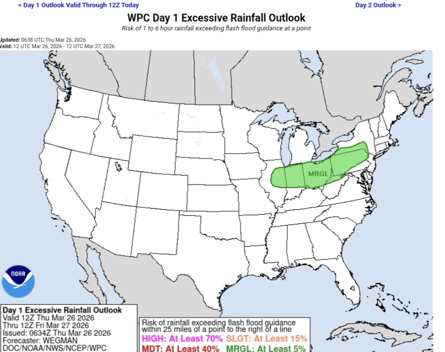
-
Central PA Spring 2026 Discussion/Obs Thread
Yardstickgozinya replied to Voyager's topic in Upstate New York/Pennsylvania
Nws forecast discussion concerning this evening and tonight's thunderstorms and potentially heavy rain. Highlight Changed Discussion -- 755 FXUS61 KCTP 260823 AFDCTP Area Forecast Discussion National Weather Service State College PA 423 AM EDT Thu Mar 26 2026 .WHAT HAS CHANGED... * Leaning warmer with max temperature forecast today * SPC severe t-storm and WPC excessive rain outlooks expanded && .KEY MESSAGES... 1) Noticeable warmup today will precede rain and thunderstorms this evening followed by a chilly/raw cool down for the end of the week into the last weekend of March && .DISCUSSION... KEY MESSAGE 1: Noticeable warmup today will precede rain and thunderstorms this evening followed by a chilly/raw cool down for the end of the week into the last weekend of March Partly to mostly cloudy and relatively mild start today as south to southwest flow ramps up ahead of strong cold front moving southeast from the Lower Great Lakes. We still expect rain free conditions in most places to last into the afternoon (through 18Z) although can`t rule out a passing shower in the increasingly moist warm air advection pattern. Breaks in the clouds combined with the southwest breeze will support a very warm day relative to late March climo - with fcst max temps in the 65-75F range or +15-25 degrees above the historical average/within 5 degrees or so of daily record highs (see climate section). The aforementioned strong cold front will provide the primary forcing for a band of rain and thunderstorms to track from NW to SE across central PA this evening through tonight. SPC has extended the MRGL and SLGT risk convective outlooks farther eastward into western and central PA, however calibrated severe storm probs continue to focus the greatest hail/wind/tor risk in the Ohio Valley where CAPE and shear profiles are more insync. Influx of 1-1.5" pwats brings the prospect of locally heavy rainfall more into play and fcst QPF amounts have increased a bit particularly over southwest PA. It`s not clear how much fast movement and average soil moisture can be offset by training storms and orographics, but like the severe t-storm risk, the probability of runoff issues has increased on the margin and WPC will be monitoring for a targeted upgrade in the ERO. The highest rainfall totals are 1.50-2.00 inches in the Laurel Highlands. -
Central PA Spring 2026 Discussion/Obs Thread
Yardstickgozinya replied to Voyager's topic in Upstate New York/Pennsylvania
Slight risk expanded into Western Pennsylvania Marginal Expanded well into central pennsylvania. https://www.spc.noaa.gov/products/outlook/day1otlk.html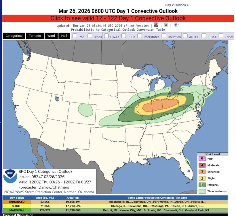
-
Central PA Spring 2026 Discussion/Obs Thread
Yardstickgozinya replied to Voyager's topic in Upstate New York/Pennsylvania
Some hassles dealing with keeping my debris tarp, open today, but all in all, not a bad spring day and afternoon for putting in some work. -
Central PA Spring 2026 Discussion/Obs Thread
Yardstickgozinya replied to Voyager's topic in Upstate New York/Pennsylvania
I apologize if it's already been mentioned. Looks like many of us around the area could be racking up those rain totals tomorrow night. -
Central PA Spring 2026 Discussion/Obs Thread
Yardstickgozinya replied to Voyager's topic in Upstate New York/Pennsylvania
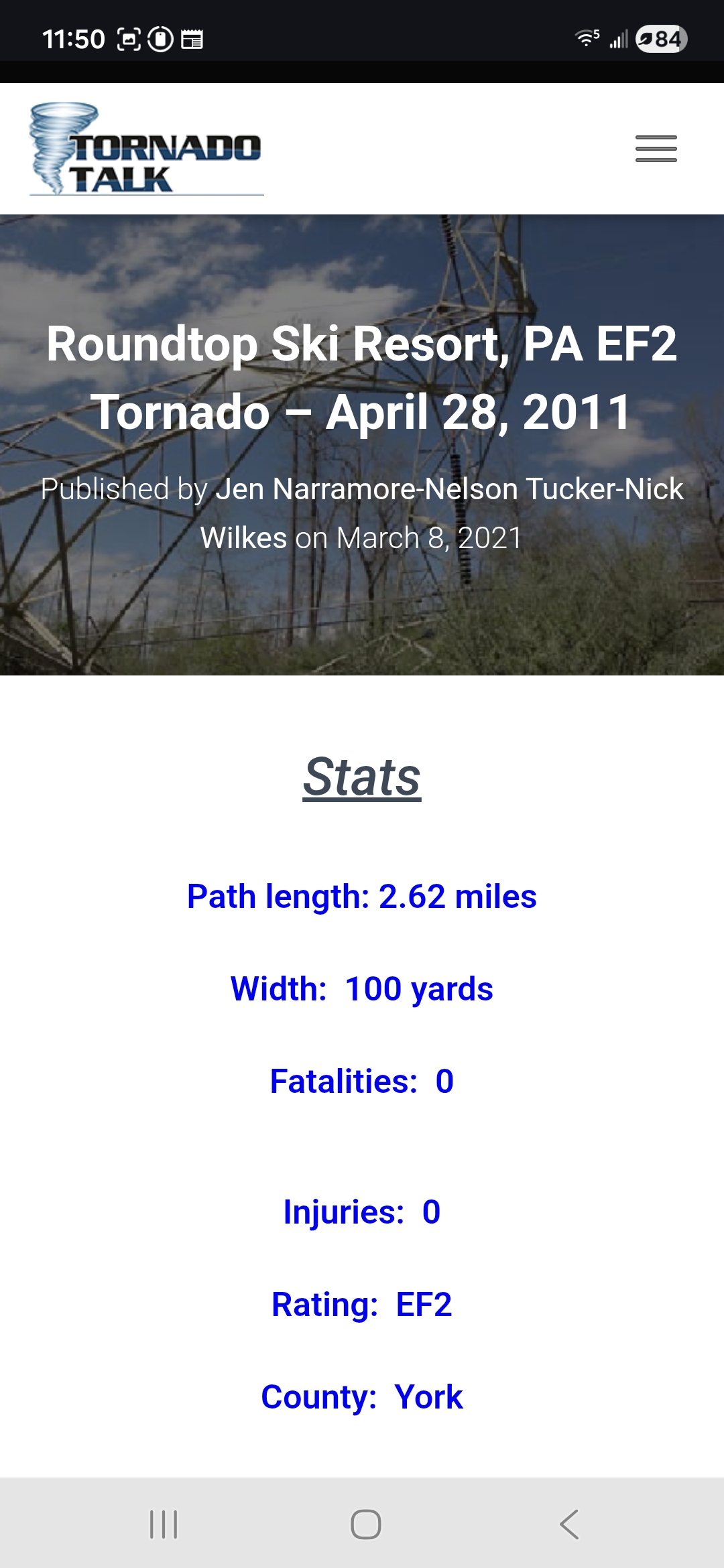
https://www.tornadotalk.com/roundtop-ski-resort-pa-ef2-tornado-april-28-2011/ I was thinking about the last time I ever went to my basement. The same cell that dropped the F2 at Ski round top tracked directly over my home back on april 28 2011 right around 6:25am. It was one hell of a storm and it's the first and only time water filled up my window wells and flooded my basement. I just found this article, put together about it on tornado talk from 2021 With images and videos of the damage.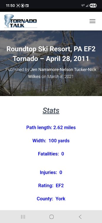
-
Central PA Spring 2026 Discussion/Obs Thread
Yardstickgozinya replied to Voyager's topic in Upstate New York/Pennsylvania
I certainly can't answer any of your questions about the science. What I can tell you, is thst you're absolutely correct In you're observations. I actually brought this up in one of my posts during a storm this year.. I'm sure some people were quite confused by my statement, because of its goes against everything we've been taught and told. -
Central PA Spring 2026 Discussion/Obs Thread
Yardstickgozinya replied to Voyager's topic in Upstate New York/Pennsylvania
-
Central PA Spring 2026 Discussion/Obs Thread
Yardstickgozinya replied to Voyager's topic in Upstate New York/Pennsylvania
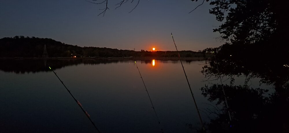
I use 20lb braid, tied off to a 15lb Fluorocarbon leader when i'm targeting Smallies. -
Central PA Spring 2026 Discussion/Obs Thread
Yardstickgozinya replied to Voyager's topic in Upstate New York/Pennsylvania
Smallie fishings has made such a great comeback around here. Last year was epic. My son has really started on a heater this year. I never specifically targeted them until last year , and that was only when my buddy came home from Maui . Even though I never specifically targeted them , I used to routinely catch them while bait fishing until around 2010ish then i rarely caught any until maybe about 4 or 5 years ago . By Last year I couldn't quit catching them while bait fishing. I caught and lost several absolute pigs last year, and over my life because I only use 3 pound test while bait fishing. I -
Central PA Spring 2026 Discussion/Obs Thread
Yardstickgozinya replied to Voyager's topic in Upstate New York/Pennsylvania
Its settled down here.. But it's been doing this on and off for a while, just not at that intensity, I'm going to live stream in case it does that again. That seemed to be the grand finale. If anything else should occur with intensity, I'll pop the live stream back up if I'm awake. All live stream post will be deleted after closure. -
Central PA Spring 2026 Discussion/Obs Thread
Yardstickgozinya replied to Voyager's topic in Upstate New York/Pennsylvania
Those little blips mean business. As noted earlier, this stuff looked extremely saturated at the base, although not very tall. It's hammering down snow and sleet here.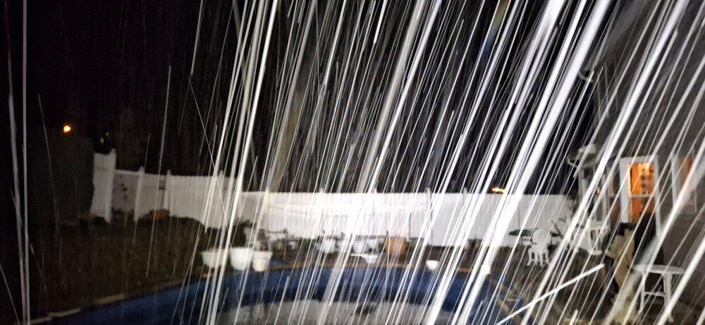
-
Central PA Spring 2026 Discussion/Obs Thread
Yardstickgozinya replied to Voyager's topic in Upstate New York/Pennsylvania
It's been flurrying here since my initial post, About ten minutes ago, it switched over to sleet ,at a pretty moderate rate. It's still increasing in intensity.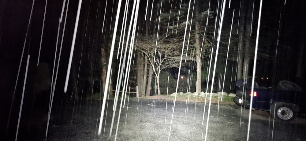
-
Central PA Spring 2026 Discussion/Obs Thread
Yardstickgozinya replied to Voyager's topic in Upstate New York/Pennsylvania
Flurry's here at the moment. -
Central PA Spring 2026 Discussion/Obs Thread
Yardstickgozinya replied to Voyager's topic in Upstate New York/Pennsylvania
I'm sitting in my truck in Mechanicsburg wrapping up some paperwork and there's a very snow squalish, low top convective look to the clouds out here. I'm not seeing any virga at this point..I love cold , but something about today made me consider laying my rake on the ground , tines up, and hopping on it ,hands behind my back. -
Central PA Spring 2026 Discussion/Obs Thread
Yardstickgozinya replied to Voyager's topic in Upstate New York/Pennsylvania
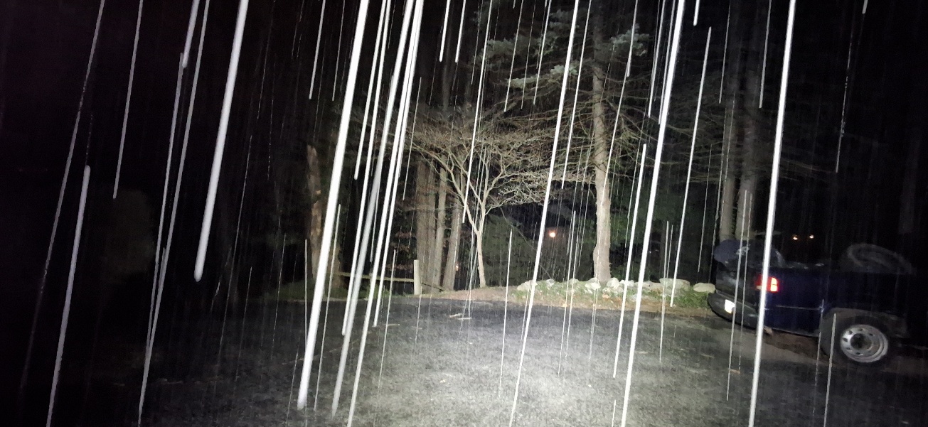
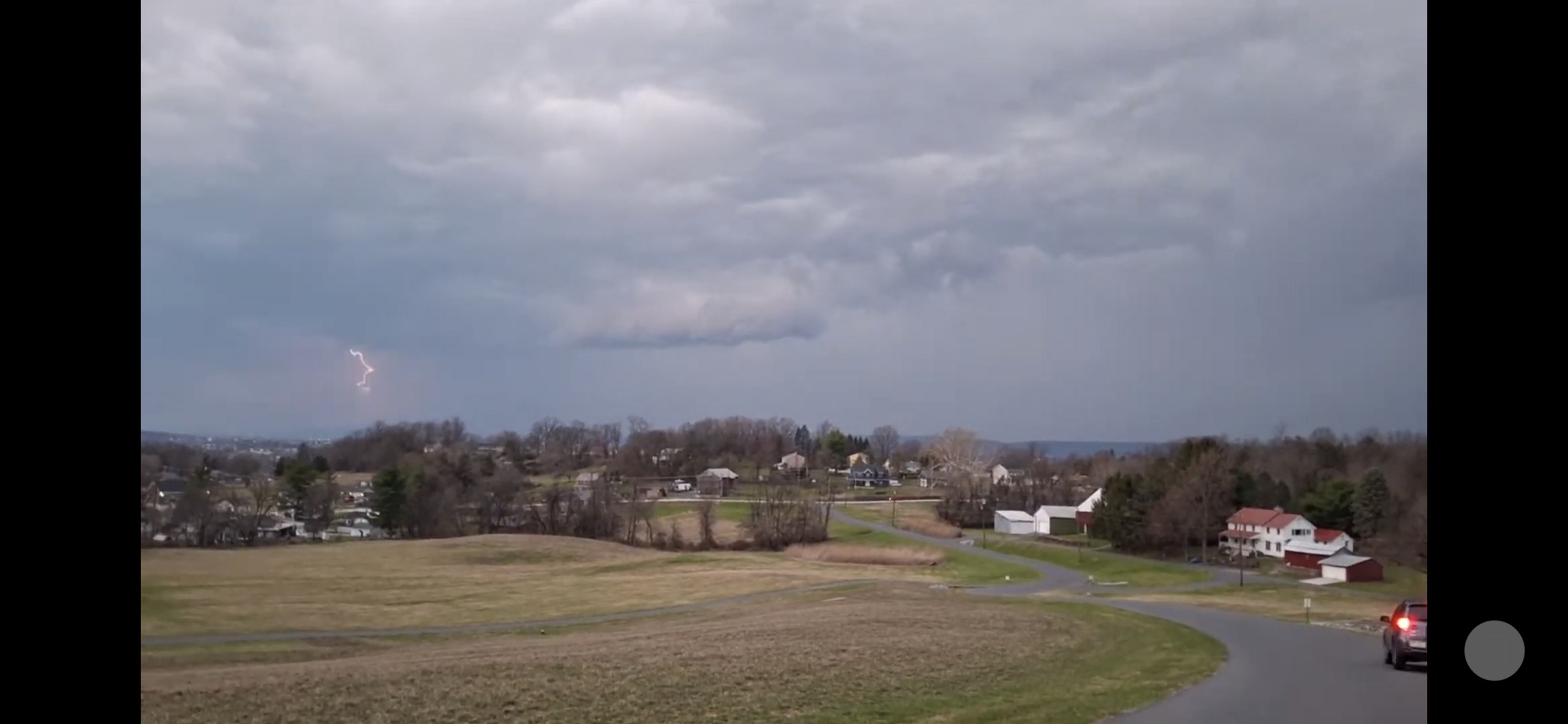
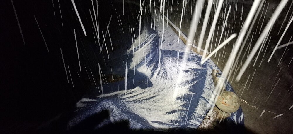
A few stills from my live srteam test yesterday . I was live streaming for over 5 hours yesterday at not a single person here could tell me if my link, sound, video were working from the forum end. A little frustrating I must say, unless of course it wasn't working from this end, which for I have no g****** idea.
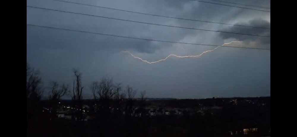
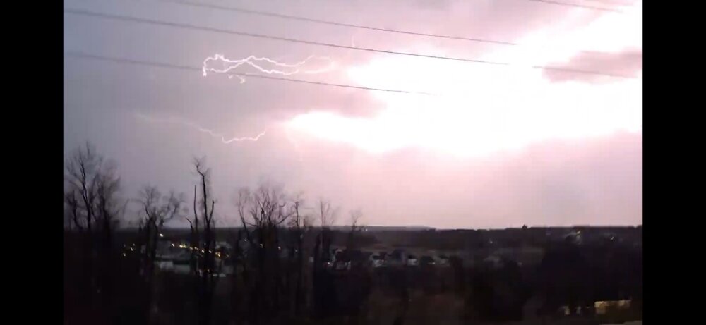

-
Central PA Spring 2026 Discussion/Obs Thread
Yardstickgozinya replied to Voyager's topic in Upstate New York/Pennsylvania
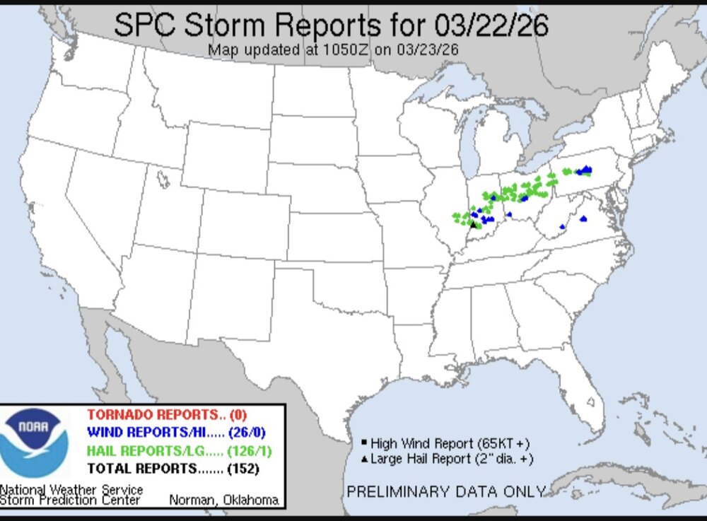
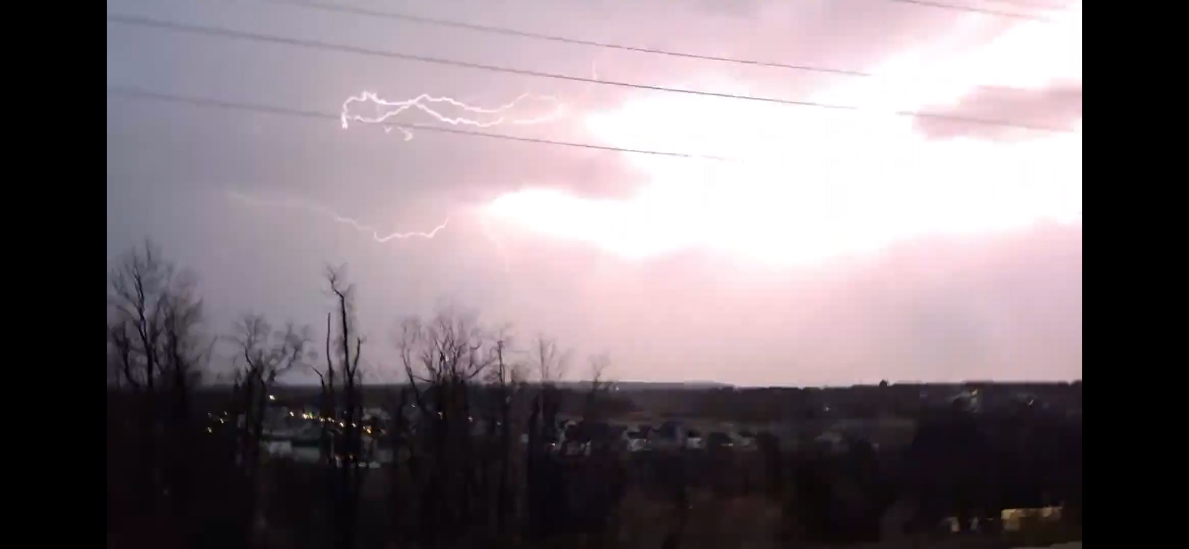
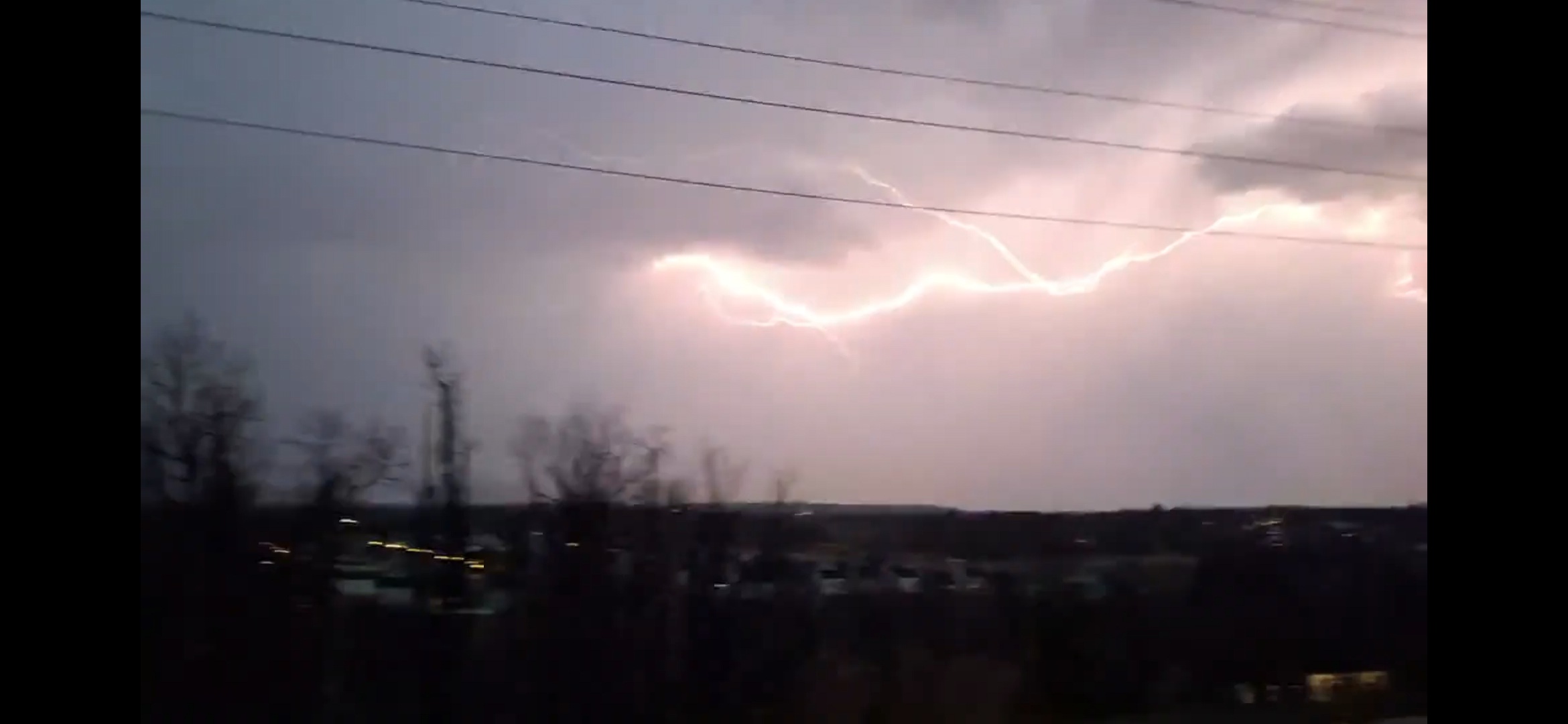
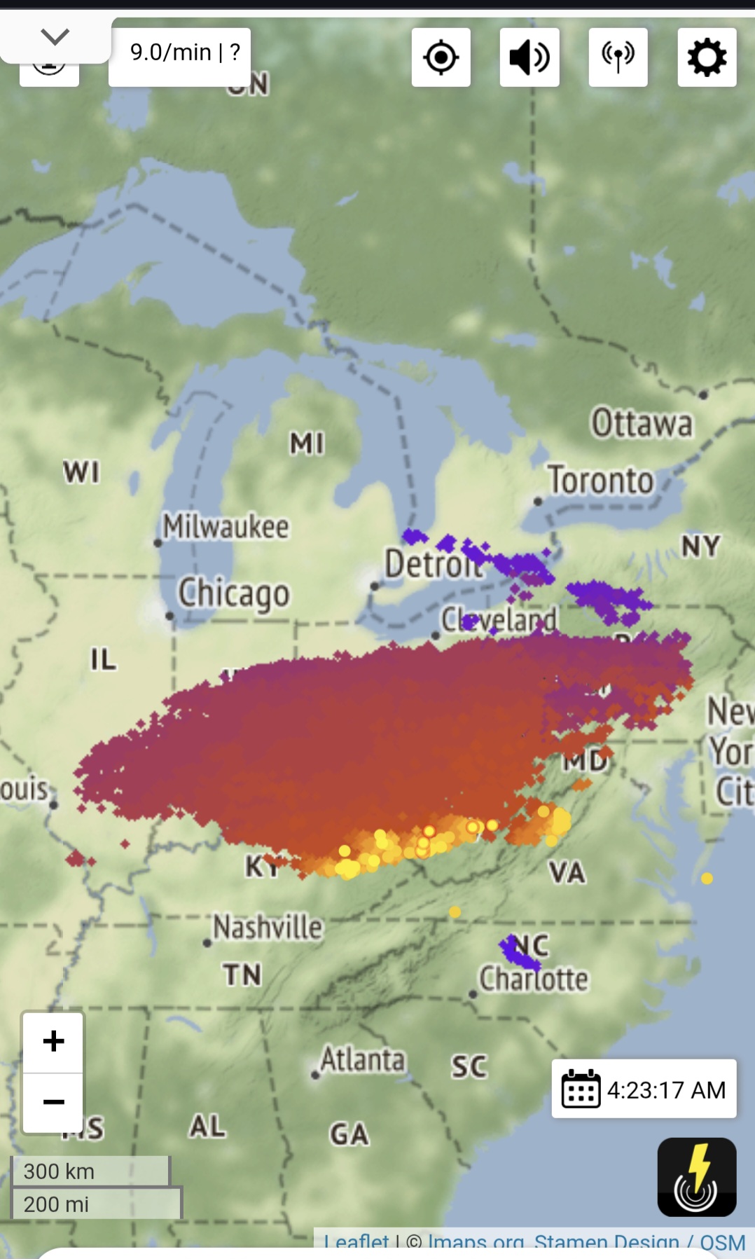
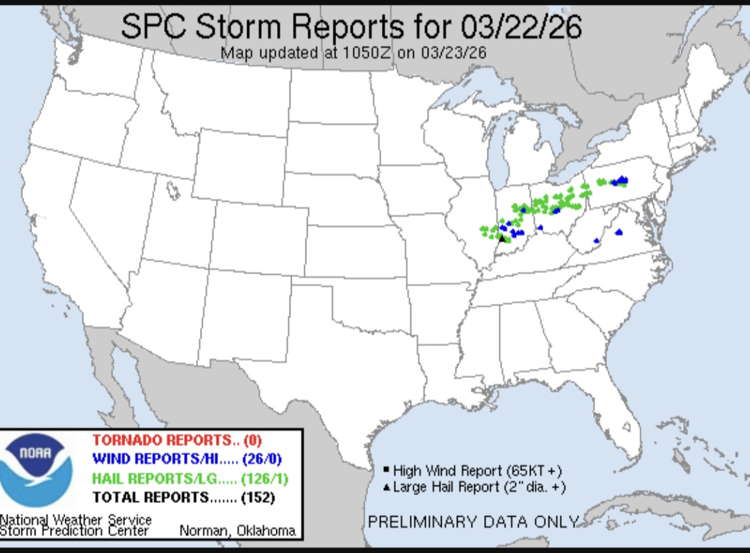
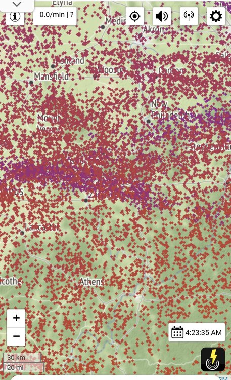
For the most part we ended up on the outside looking in. I think this is a pretty decent lightning event even for the Ohio Valley. Lots of talk about the duration and the sound of the thunder last night on the internet coming from out that way. I was really thinking that that would be us last night. Im dying for a lightning event like this.9
-
Central PA Spring 2026 Discussion/Obs Thread
Yardstickgozinya replied to Voyager's topic in Upstate New York/Pennsylvania
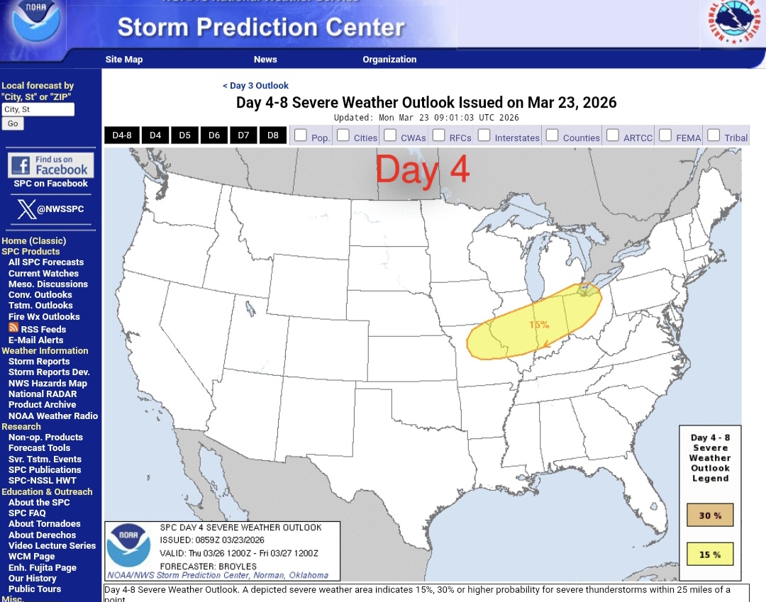
There's some severe risk on Thursday in the Upper Mississippi and Ohio valleys. Getting an expansion and shift this for east, is asking for a lot, but, I don't think it's outside the realm of possibilities considering the expansions, we've seen the last two weeks. Expansion/ shifts or not. It keeps up the pattern of early spring severe risk being displaced north and east.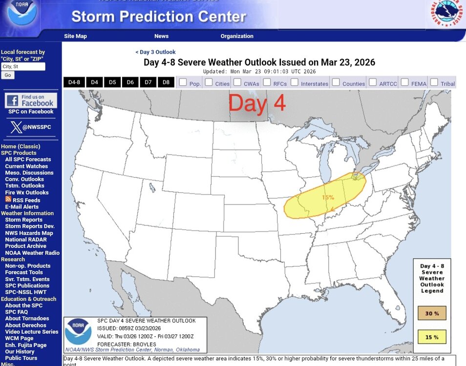
-
Central PA Spring 2026 Discussion/Obs Thread
Yardstickgozinya replied to Voyager's topic in Upstate New York/Pennsylvania
I'll behave myself, but this made me think of Mama June. In all seriousness, if humanity makes it untill the end of the month, I think it's possible. -
Central PA Spring 2026 Discussion/Obs Thread
Yardstickgozinya replied to Voyager's topic in Upstate New York/Pennsylvania
https://www.spc.noaa.gov/climo/reports/today.html