Winterweatherlover
-
Posts
1,582 -
Joined
-
Last visited
Content Type
Profiles
Blogs
Forums
American Weather
Media Demo
Store
Gallery
Everything posted by Winterweatherlover
-
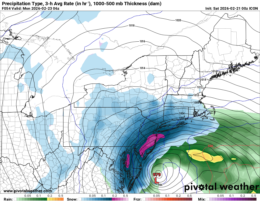
No artic high for once is actually probably helping and allowing this to come more north and have less of a sharp cutoff.
-
HRRR is 1 to 2 feet for everyone even well inland.
-
Still not showing the really big totals but the fact it expanded warning level snow way inland is a good sign.
-
SE tick but not much
-
I mean it had this storm as a total miss like 2 days ago so it doesn’t seem like it’s had a great handle on this storm.
-
Depends sometimes I’ve seen tight cutoffs in these setups and sometimes not. Im not sure exactly what it depends on truthfully.
-
I don’t think it matters that much. Under 48 hours I wouldn’t focus on euro too much.
-
Agree although if it sets up in Catskills HV may get subsidence/shafted but that is a reality of these storms sometimes .
-
Given the positive adjustments of Ukie and GGEM I’d say 12-18 for NYC likely. GFS/NAM likely too extreme but Euro is not the model it once was where I think it beats out everything.
-
Honestly this feels somewhat realistic not necessarily in totals but in terms of how jackpot will go. The best storm dynamics def favor long island and Jersey coast but you’ll get surprise banding in spots further west that will bump up totals in some areas.
-
I don't think so with this one. If anything it'll be a rain at start to heavy snow scenario, not prolonged rain during height of storm anywhere.
-
Yes plus temps a little above freezing means probably white rain in NYC until early-mid afternoon. I was surprised rhe blizzard warning starts 6 am but I guess that's as a precaution.
-
Boxing Day still seems like one of the best analogs to me and the same model led the way on both.
-
Yes I said earlier I'd like to see some non American model support for a HECS, since we didn't get it I think it's on the table but not necessarily a likely outcome. Still think mostly everyone in the subforum gets a foot barring a major last second east shift.
-
Yea it’s not like the lower qpf models are showing huge totals south but less here they aren’t showing 2 inch liquid anywhere which is hard to buy in this setup.
-
Anyone worried about rain should see how that rain/snow line crashes rapidly even as the low barely moves. This storm is very dynamic!
-
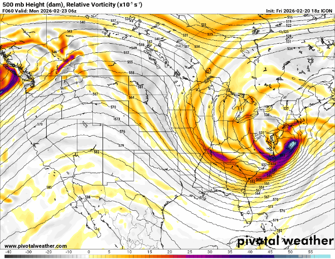
Seems to still be in trending toward gfs mode.
-
The banding def looks like it shifted north this run
-
The reality is I realize a day ago we would've been overjoyed at this map and today it's meh lol
-
What? I think it's a reasonable take that a SECS is the minimum with this and there is potential for it to be a HECS but having the non US globals on board would increase confidence.
-
If Euro and/or CMC are on board I'd be more confident in a HECS. Right now SECS seems like the floor which is still great.
-
Timing of the heavy stuff def seems delayed compared to NAM

-
Dont know if this verifies but wonder when was the last time Philly, NYC, and Boston all got 20 plus
-
I'll definitely take this but I think the last run had 2 feet into NYC or maybe I'm mixing it up with the gfs
-
Seems like precipitation moves in faster on the nam than other models?