AtlanticWx
-
Posts
650 -
Joined
-
Last visited
Content Type
Profiles
Blogs
Forums
American Weather
Media Demo
Store
Gallery
Everything posted by AtlanticWx
-
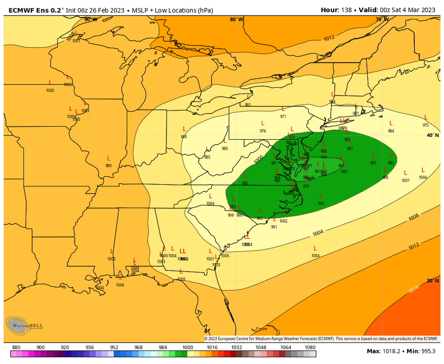
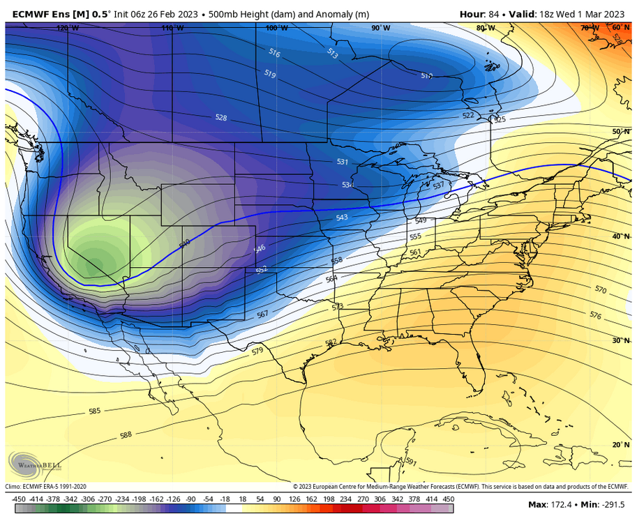
hard to go off of persistence when we have a different pattern on our hands. honestly, there are some p stark similarities to march 2018 which i know scares a lot of people here but it's something we should take happily (a -NAO, post SSW, 50/50 low and troughing off the EC, troughing off the west coast and central ridging as a result) i'd be worried about suppression in this pattern though given the low heights and the nature of a ridge pretty east but we'll see, definitely gonna take this look tho
-
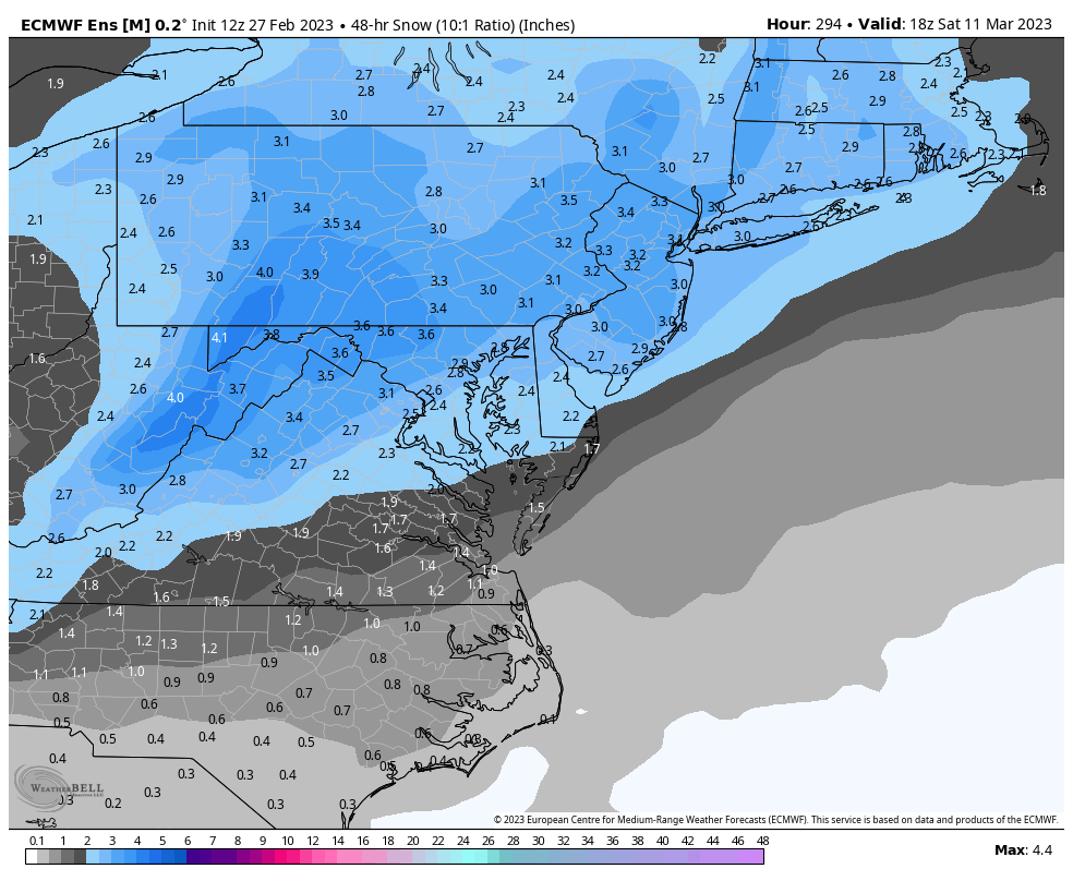
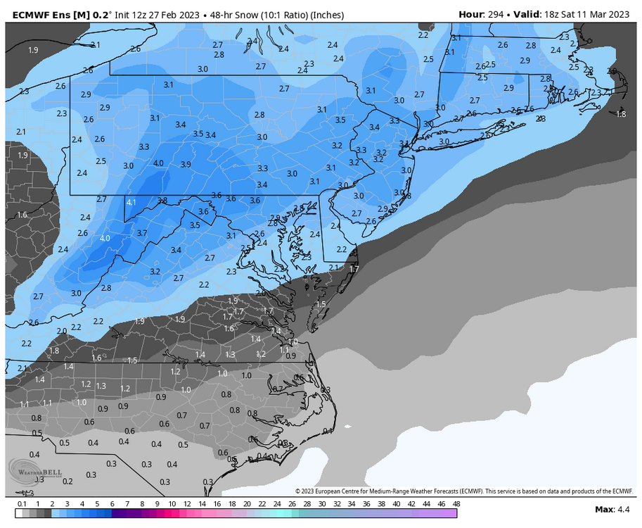
true but 3" of snow is 11 days out is a pretty remarkable siganl
-
awesome signal ~10-11 days out
-
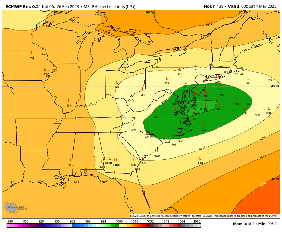
pretty awesome longwave pattern but the questions is if we can get something during that timeframe now
-
ukmet just ran and it should indicate how euros gonna go but i'm too tired to interpret it, someone else could take a shot tho
-
i mean the actual storm was colder and souther, we get less snow bc the initial precip is lacking but that's virtually it
-
if it's any hope 18z eps as a whole did tick se so if euro gets on board that'd be awesome but i'd guess not after the fools cmc/icon runs this morning
-
if euro/eps/geps improve like cmc did or hold i wouldn't be worried
-
has there been a reason why december and march have pretty much swapped places recently? march has been very snowy recently (since 2012-13, 8 winters at KIAD had >1" in march and 5 of them had >5")
-
what??
-
it's good that the eps is flip flopping from nw to se ever since 00z yesterday, we're at a good place rn
-
6z eps was a nod to the gefs/gfs in the sense that it went nw but really there were so many members that slammed us just the nw camp skewing it
-
there have to be some amazing members in there, overall it looks like there's less spread but the same as 0z, will post snow map when it comes out
-
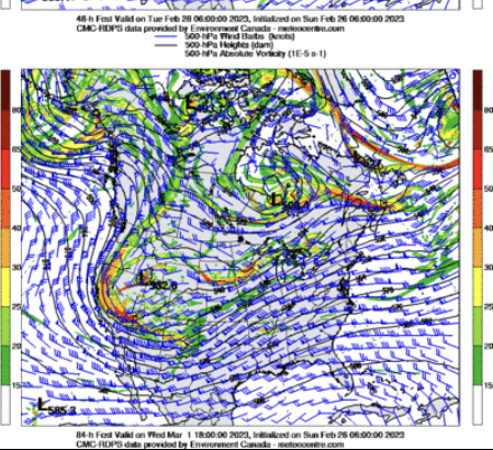
what's interesting is that the 6z eps continues the trend of more separation between the NS and our actual trough. gonna be interesting to see what it does
-
looking at eps from 0z -> 6z, at hour 84 looks like our main trough is weaker and maybe digging a bit more while our NS is a bit faster, gonna see how this plays out in a second
-
and 06z shifted favorably from 0z too. at hour 90, the shortwave is less amped and faster and the NS is stronger + faster - good to see!
-
taking a glance at the 06z cmc just for fun, below is the 6z cmc compared to 0z - it looks virtually the same but maybe the western trough is a little held back but overall its the same which is encouraging

-
looking at h5 this is exactly what we want tbh, our shortwave is making a pass right under the NS. sure it might start off as rain like the icon shows but it's dynamic enough and would pass south enough to be snow if we're extrapolating it. 06z icons actually faster which could be a good thing

-
eps shifting se at 0z was good, hoping it keeps it up
-
if my posts are affecting ur mood then that's on you lmao and i said how the icon and cmc being great were good and bad in their own ways respectively so
-
my bad for posting model outputs and then giving my take on the general trend this could go in!
-
gefs looks nw so far, but maybe it's good we get our nw trend now rather than later?
-
with the mood in here you'd think that we went from snow to cold rain on every model lmao
-
a gut feeling that things downtrend from here on out but i'll 100% take this!!
-
what would be perfect is a uniform south and colder shift, then the mid range NW trend will do the trick