AtlanticWx
-
Posts
650 -
Joined
-
Last visited
Content Type
Profiles
Blogs
Forums
American Weather
Media Demo
Store
Gallery
Everything posted by AtlanticWx
-
March Medium/Long Range Thread: The Empire Strikes Back
AtlanticWx replied to stormtracker's topic in Mid Atlantic
imo that's just a result in wave spacing and a ridge being built in front of the s/w. that's not a "real ridge", temps are still below average and so are 850s, i think it's just a response from wavespafong -
March Medium/Long Range Thread: The Empire Strikes Back
AtlanticWx replied to stormtracker's topic in Mid Atlantic
could anykne explain to me as to how this is a midwest snowstorm look? genuine questikn -
March Medium/Long Range Thread: The Empire Strikes Back
AtlanticWx replied to stormtracker's topic in Mid Atlantic
please keep doing PBPs, ur analysis is great -
March Medium/Long Range Thread: The Empire Strikes Back
AtlanticWx replied to stormtracker's topic in Mid Atlantic
i mean a lot of those are from the march 3rd storm and actually have no snow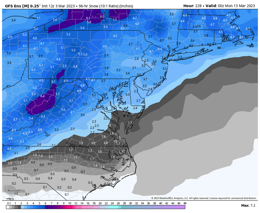
-
March Medium/Long Range Thread: The Empire Strikes Back
AtlanticWx replied to stormtracker's topic in Mid Atlantic
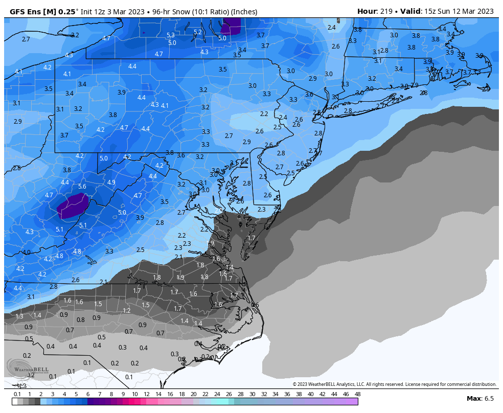
finished* snow map, holy shit
-
March Medium/Long Range Thread: The Empire Strikes Back
AtlanticWx replied to stormtracker's topic in Mid Atlantic
snow mean so far but it's still going at 219
-
March Medium/Long Range Thread: The Empire Strikes Back
AtlanticWx replied to stormtracker's topic in Mid Atlantic
It's still going LMAO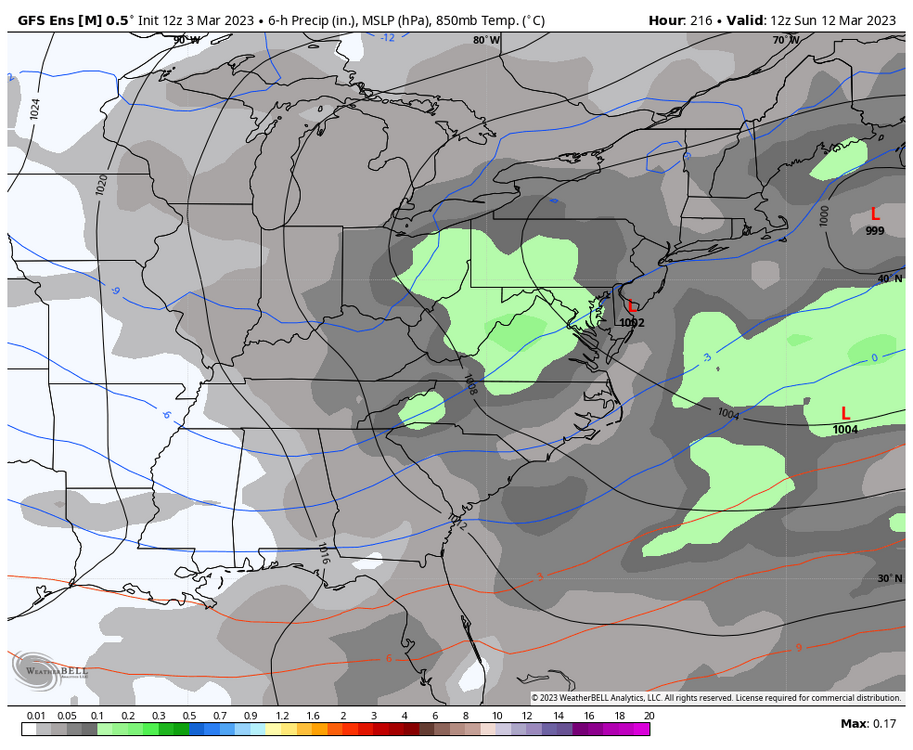
-
March Medium/Long Range Thread: The Empire Strikes Back
AtlanticWx replied to stormtracker's topic in Mid Atlantic
yep! -
March Medium/Long Range Thread: The Empire Strikes Back
AtlanticWx replied to stormtracker's topic in Mid Atlantic
gefs is still going at hr 204 lmao, if there's a threat that has an amazing longwave pattern and could be long duration, it could be this one. @brooklynwx99 props to u for spotting this out and staying consistent on it when no one was -
March Medium/Long Range Thread: The Empire Strikes Back
AtlanticWx replied to stormtracker's topic in Mid Atlantic
amazing look at this range!
-
March Medium/Long Range Thread: The Empire Strikes Back
AtlanticWx replied to stormtracker's topic in Mid Atlantic
i already know this run is gonna go crazy. textbook look
-
March Medium/Long Range Thread: The Empire Strikes Back
AtlanticWx replied to stormtracker's topic in Mid Atlantic
no that's good - we want a more west based block -
March Medium/Long Range Thread: The Empire Strikes Back
AtlanticWx replied to stormtracker's topic in Mid Atlantic
i think what we want is for it to dig. 12z -> 00z eps shifted to be slower and more amped w the incoming wave but 00z was more SE, probably because of digging? -
March Medium/Long Range Thread: The Empire Strikes Back
AtlanticWx replied to stormtracker's topic in Mid Atlantic
there's no trend? it's been going back and forth for a few runs now -
March Medium/Long Range Thread: The Empire Strikes Back
AtlanticWx replied to stormtracker's topic in Mid Atlantic
6z gfs would be a dream -
March Medium/Long Range Thread: The Empire Strikes Back
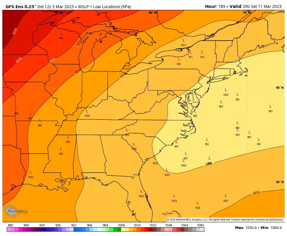
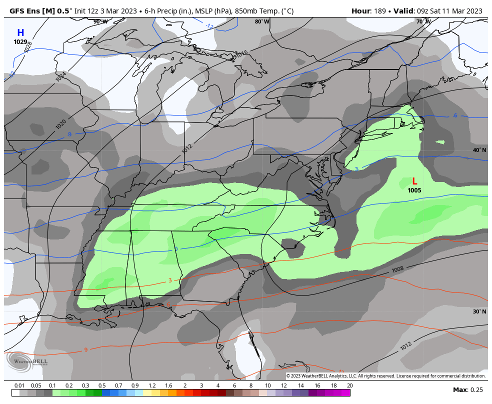
AtlanticWx replied to stormtracker's topic in Mid Atlantic
all models have the storm now and ensembles have 2"+ for this storm only -
March Medium/Long Range Thread: The Empire Strikes Back
AtlanticWx replied to stormtracker's topic in Mid Atlantic
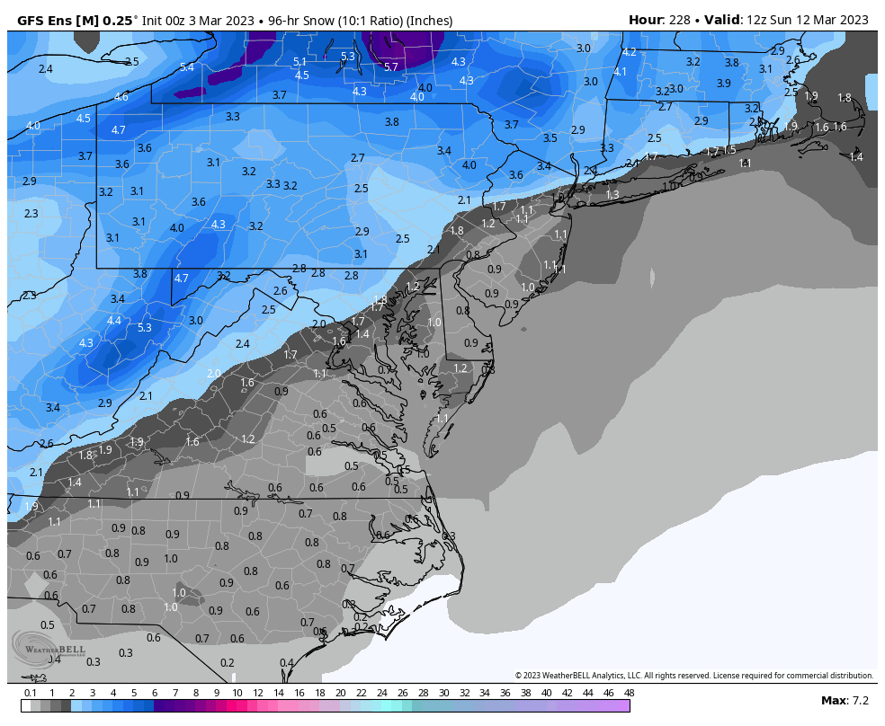
that's all from the march 12th signal? it's a 5 day snow map from march 12th before so march 7-march 12 but we never get any snow on the gefs still march 10-12 -
March Medium/Long Range Thread: The Empire Strikes Back
AtlanticWx replied to stormtracker's topic in Mid Atlantic
gefs mean fwiw, kinda an impressive signal rn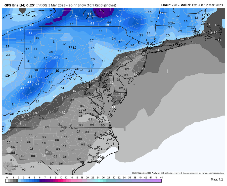
-
March Medium/Long Range Thread: The Empire Strikes Back
AtlanticWx replied to stormtracker's topic in Mid Atlantic
gfs is close for the first wave just phases too late. would 100% take it at this time, lfg! -
March Medium/Long Range Thread: The Empire Strikes Back
AtlanticWx replied to stormtracker's topic in Mid Atlantic
given that we just need it to dig more and go further south, im not rlly worried at this juncture. when both the optimistic and the rarely optimistic people are excited, i think it's when we know we could get something big -
March Medium/Long Range Thread: The Empire Strikes Back
AtlanticWx replied to stormtracker's topic in Mid Atlantic
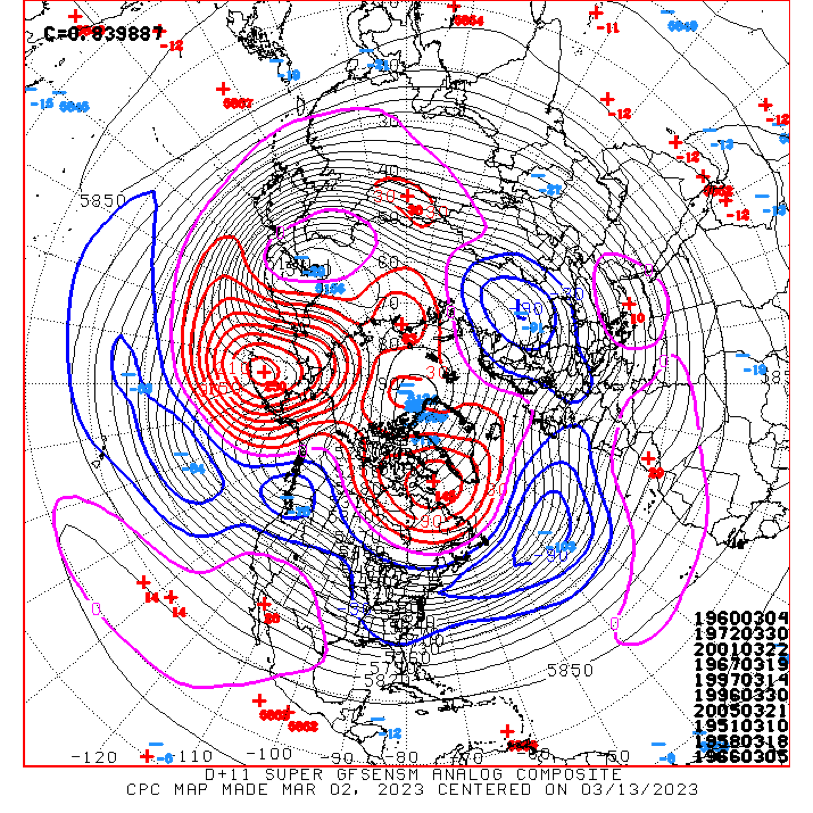
analogs are important too, and 1960 being at the top of these analogs is encouraging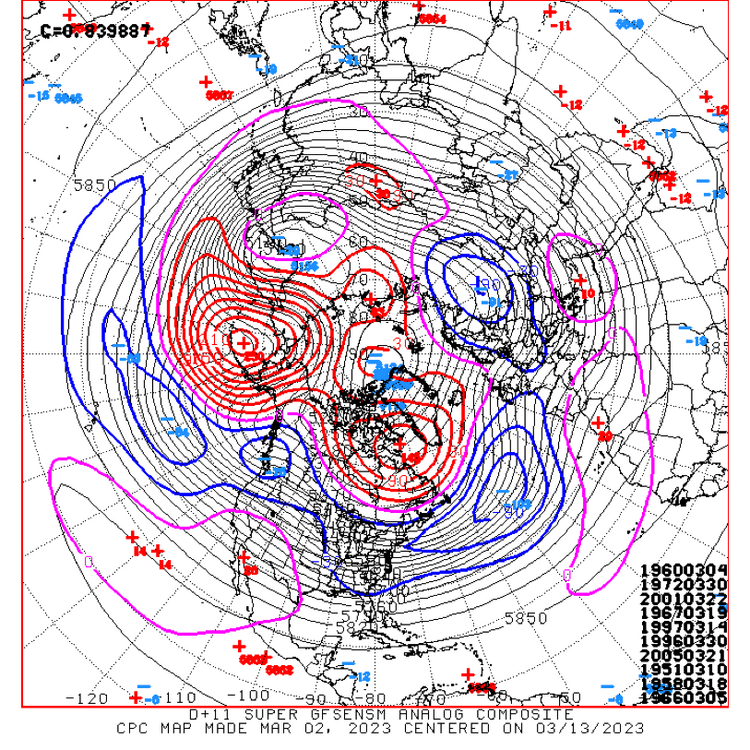
-
March Medium/Long Range Thread: The Empire Strikes Back
AtlanticWx replied to stormtracker's topic in Mid Atlantic
meteorology > taking what models say verbatim -
March Medium/Long Range Thread: The Empire Strikes Back
AtlanticWx replied to stormtracker's topic in Mid Atlantic
my primary worry is a cold/dry pattern but i'm not sure if that worry is valid or not cause i haven't looked at ensembles much lately -
March Medium/Long Range Thread: The Empire Strikes Back
AtlanticWx replied to stormtracker's topic in Mid Atlantic
looks like it's caving, even pops a +PNA now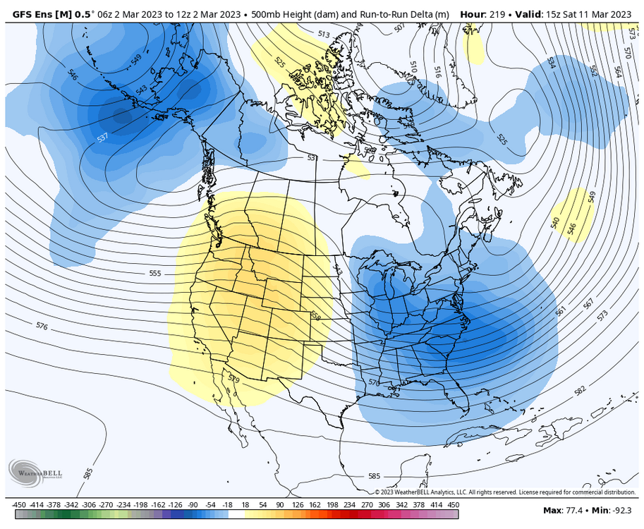
-
a 9" snowstorm in march sucks!