DarkSharkWX
-
Posts
695 -
Joined
-
Last visited
Content Type
Profiles
Blogs
Forums
American Weather
Media Demo
Store
Gallery
Everything posted by DarkSharkWX
-
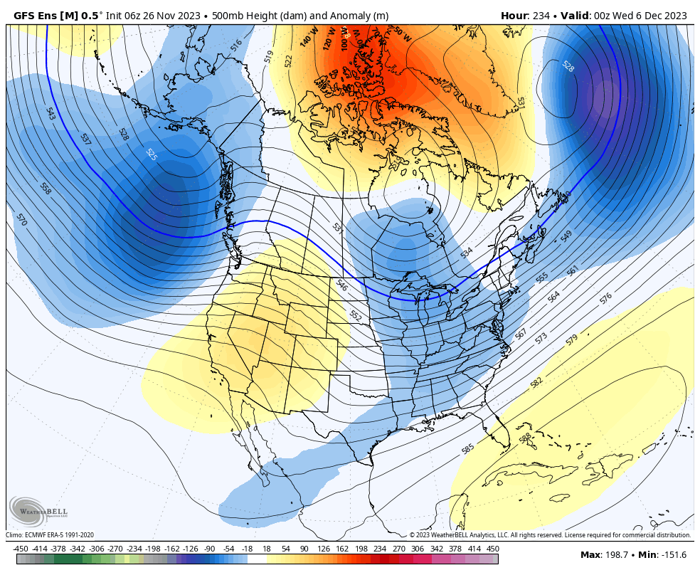
todays 0z suite is kinda the last global suite that really matters as mesoscale models start to become very good, but its very good to see that all of them trended postively in the way we want besides rgem i think every global / mesoscale model trended better
-
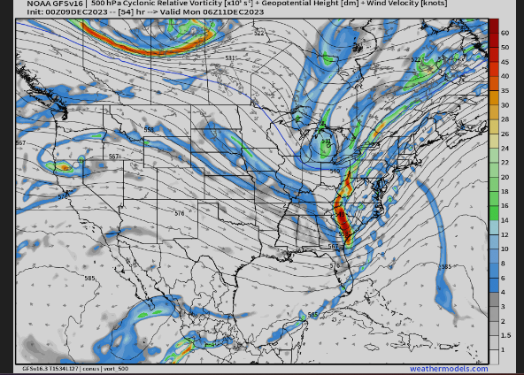
euro better Kuchera: 10:1: overall vort digs more and is more amped, trend towards nam in right direction
-
cobb ratio gfs
-
yeah way more negatilt, cooking this run
-
GFS looks better, more negative tilt compare gfs to nam 3km
.thumb.gif.ea18ec0efe9cfc4d4a9f2ce317bea25a.gif)
-
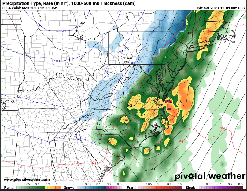
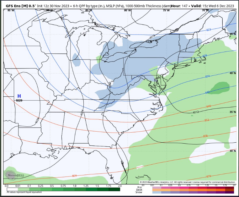
0.5" of qpf of snow.. in 1 hour tears this is some buffalo type shit, obv hella overdone but verabritm this would def get the job done and accum wouldnt be too far off the snow maps; -6 omega within DGZ w saturated column would cook
-
yea lol, its going to take some time to transition to a good pattern for here, it j isnt going to magically flip from warm to cold and snowy, not sure why some people were expecting it
-
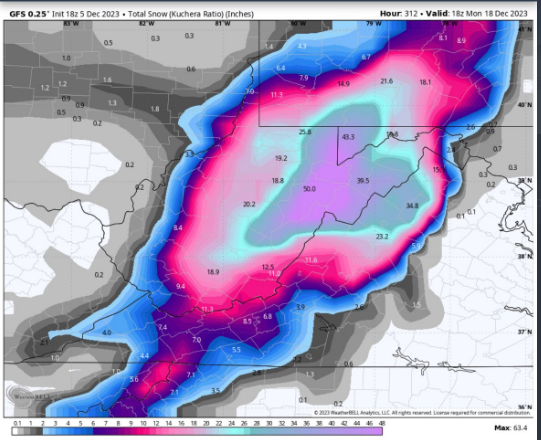
crazy ass gfs run for the mountains and W of I81

-
over 5 feet tears
-
im p sure if you remove the super nino years with crazy goa low phase 8/1 would still gen be good tropical forcing for cold/snow here
-
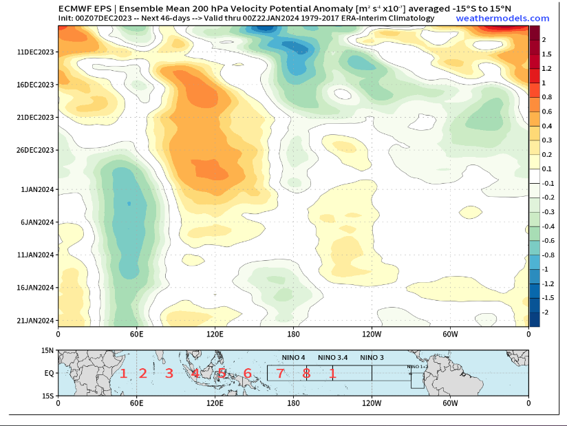
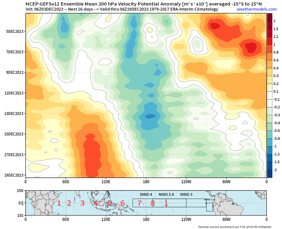
the warm phases of the mjo(4/5/6) seem to be generally transient and help to weaken the SPV bc of configs in the NPAC pattern(which are most associated w tropospheric wave driving), along w a +SCAND and an existing -NAO/-AO increasing the chances of it coupling
-
weeklies been very consistent w late dec-early jan signal and is moving in time, fits w mjo/spv progression
-
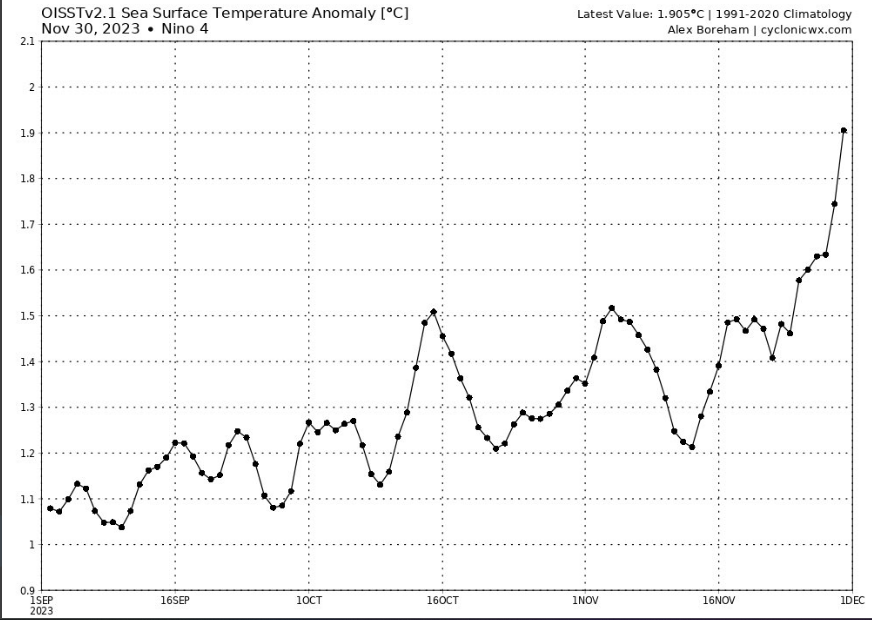
woah , nino 4 at 1.9 rn, might beat all time nino 4 record
-
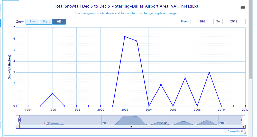
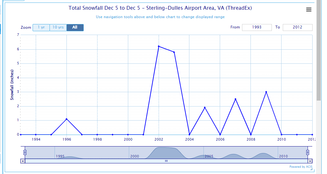
DCA : 27.8" BWI : 35.4" IAD : 39.6" RIC: 16.2" SBY: 13.4"
-
so many times in the 2000s lmao
-
GEFS improved
-
whats the highest daily? on the monthly index highest i could find was 1.44 set on nov 2015
-
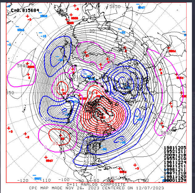
nice -NAO/+PNA showing up here snowfall at DCA in these months: Dec 1981: 1.7" Dec 1952: 2.0" Dec 2009: 16.6" Dec 1955: 0.5" Dec 1961: 1.2" Dec 1996: 0.2" Dec 1987: T Nov 1981:T Dec 2000: 2.0"
-
super torch!
.thumb.png.f8f10efcb076df89ecda67a33a248c78.png)
.thumb.png.1461a96fdd1ce6a6017a168def95b9e8.png)
.thumb.png.95c53706623f6f68320866bd06ab1050.png)
.thumb.png.30d503a7ebd480200ecaf4864ff90d13.png)
-
even with a great pattern its going to take some time to flush the previous pac puke warm air out
-
big improvements on GEFS it seems so far
-
main reason I went BN for SNE was due to suppression issues, but now I think SNE could end up around N - especially more inland SNE(should prob have elaborated more lmao), i think there'll be a few miller A systems that go up the coast and hit NYC/BOS in addition to the MA and i def should have added 2003 to my top analogs as well as polar, didn't add it bc of the +PDO/modoki, but looking back in retrospect i def should have sm posted an analog snowfall anomaly map that gen echoes my snowfall thoughts in terms of distrubtion on the EC on twitter:
-
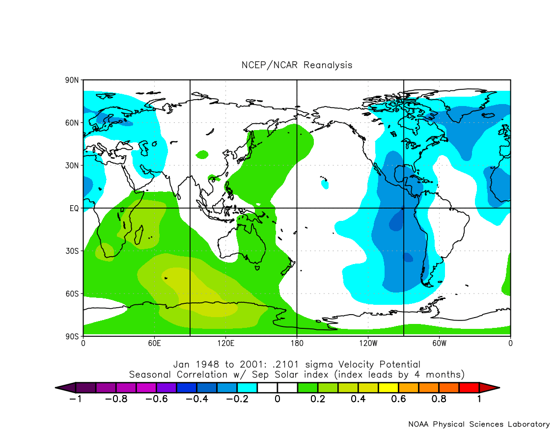
i didn't account for solar much in my forecast cause i couldn't find too much of a correlation w/ solar cycle and polar domain, and i thought other factors were going to override it, but ill prob have to look into it more later on

-
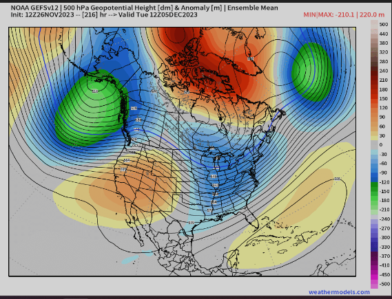
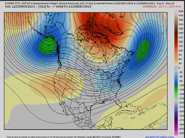
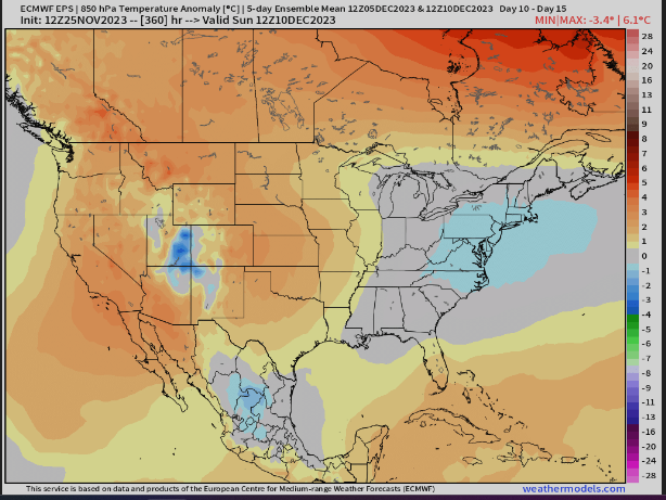
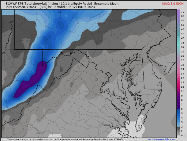
EPS still looks good


.gif.f8fef9ad11d015e6b8985d94d1af5536.gif)

.png.d654710b40eb5079e83fd0a4b58087b0.png)
.png.838c7243ca4a44a9f46259f6819569da.png)
.png.55289b8f0e9e4ce59f6ac39818b225af.png)
.png.28971aa2a8c9f18122fe0a45bfe2288c.png)