Stormchaserchuck1
-
Posts
4,691 -
Joined
-
Last visited
Content Type
Profiles
Blogs
Forums
American Weather
Media Demo
Store
Gallery
Everything posted by Stormchaserchuck1
-

March Medium/Long Range Discussion
Stormchaserchuck1 replied to WinterWxLuvr's topic in Mid Atlantic
March is a wetter month.. this would give us snow a lot of times, but we average 2-3" in December
-
Thank you PSU for taking all my trash.. put on me. (college)
-
March Medium/Long Range Discussion
Stormchaserchuck1 replied to WinterWxLuvr's topic in Mid Atlantic
12z NAM -
March Medium/Long Range Discussion
Stormchaserchuck1 replied to WinterWxLuvr's topic in Mid Atlantic
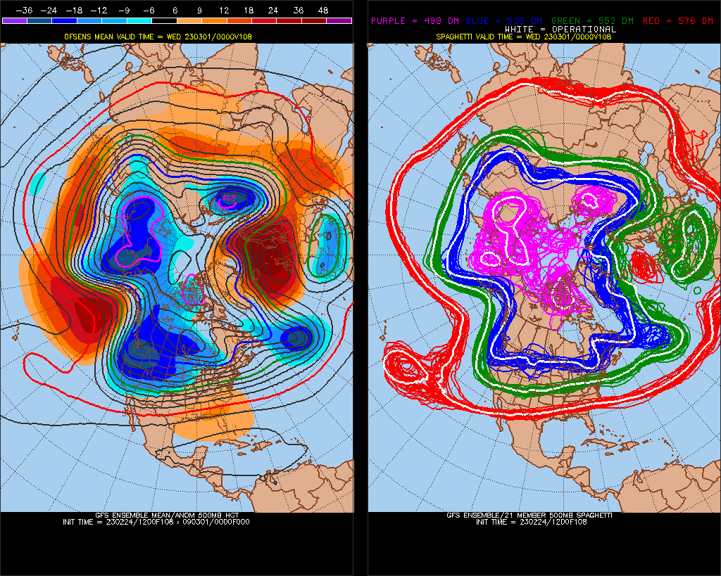
Ensembles are south of the OP with the rising-out of-NAO block-potential/storm. -NAO/50-50 low/wet pattern They really pop this SE ridge strong, but it's not going to be this bad, (unless models shift toward an Aleutian high). mustering up potential energy The hit.. restrengthening 50/50 low after -NAO wanes (rising up out of NAOindex#research).. EPO's are colder at the surface if it holds. It's a window of time. I'm still generally worried about warm air, but it could be a big hit before it melts.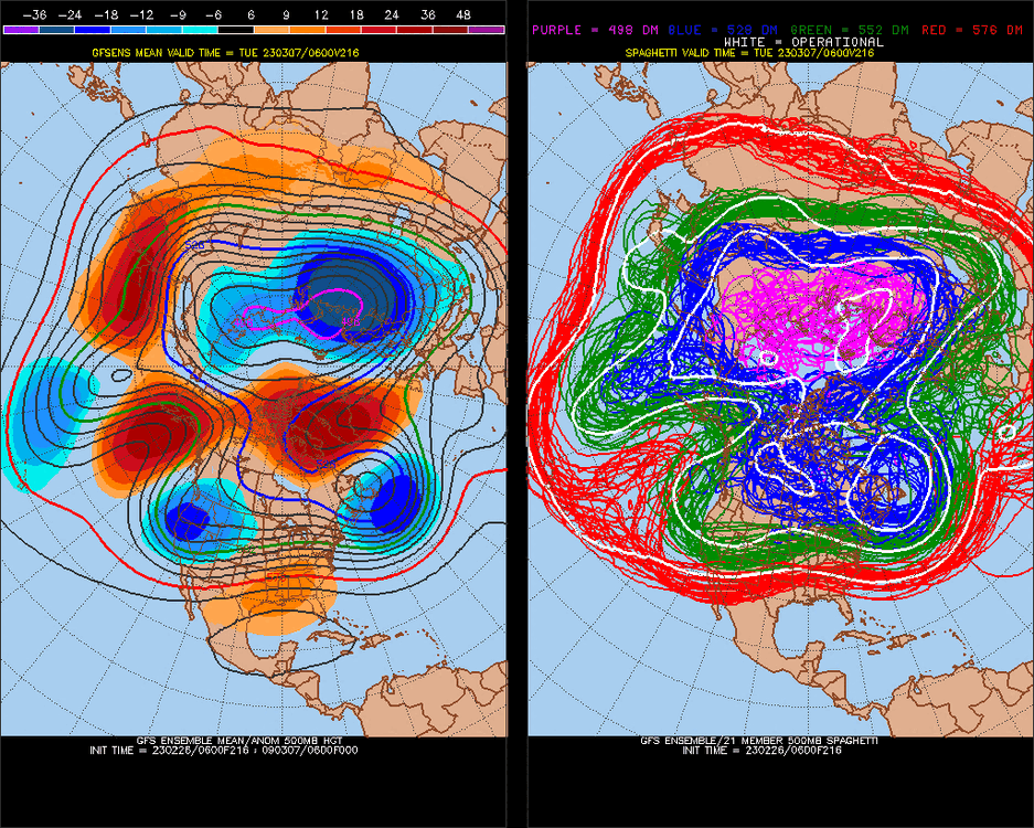
.thumb.gif.0a020ca3efeb691efcbd7d210c4369b2.gif)
-
What's remarkable is we have had a -NAO/-AO for the Winter. (This is suppose to be our coldest pattern).
-
March Medium/Long Range Discussion
Stormchaserchuck1 replied to WinterWxLuvr's topic in Mid Atlantic
This storm? wow.. what a miss Pattern is really wet through the whole model run...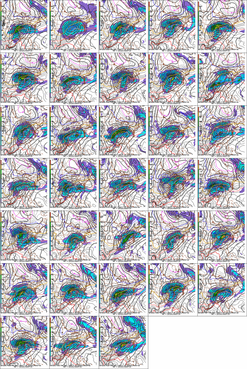
-
E PA/NJ/DE Winter 2022-2023 OBS Thread
Stormchaserchuck1 replied to Ralph Wiggum's topic in Philadelphia Region
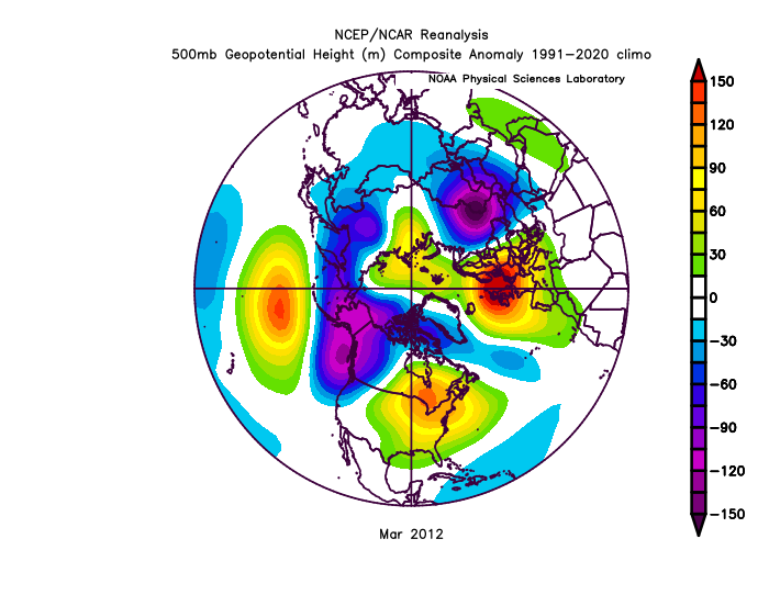
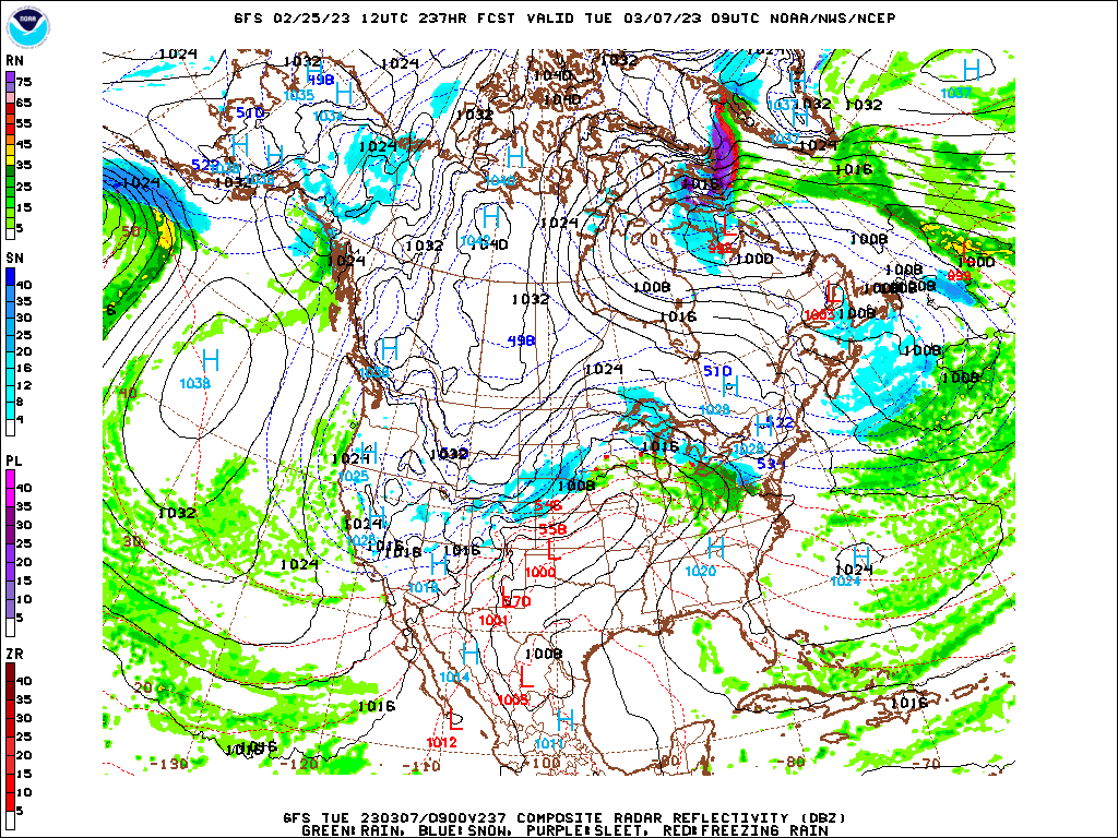
Actually, China is the only place in the world that doesn't match March 2012. -
E PA/NJ/DE Winter 2022-2023 OBS Thread
Stormchaserchuck1 replied to Ralph Wiggum's topic in Philadelphia Region
Looks wet Too bad we're going to waste this to warm air. There are like 5 strong N. Hemisphere pattern matches to March 2012, through Day 6. Then they just like zoom away, like a kite? -
March Medium/Long Range Discussion
Stormchaserchuck1 replied to WinterWxLuvr's topic in Mid Atlantic
Look at how the Pacific is the worst possible when the -NAO starts to move in ^This fits really well until the NAO overtakes Greenland, still I contend that since 2019, W->E has overstated S->N.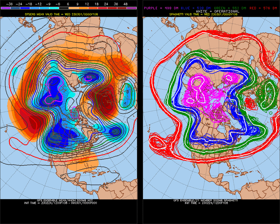
-
March Medium/Long Range Discussion
Stormchaserchuck1 replied to WinterWxLuvr's topic in Mid Atlantic
It's trending away from a colder pattern in general, like a see-saw, duality matrix. -
March Medium/Long Range Discussion
Stormchaserchuck1 replied to WinterWxLuvr's topic in Mid Atlantic
I bet you the soundings at the surface are marginal all across the board(model runs). -
March Medium/Long Range Discussion
Stormchaserchuck1 replied to WinterWxLuvr's topic in Mid Atlantic
You don't want that ++EPO. The cold air will get cutoff (for the MA). -
March Medium/Long Range Discussion
Stormchaserchuck1 replied to WinterWxLuvr's topic in Mid Atlantic
40s over the Davis Straight and rain to central Greenland does not really bode well. -
March Medium/Long Range Discussion
Stormchaserchuck1 replied to WinterWxLuvr's topic in Mid Atlantic
We have been blasting the Pacific when/as soon as the NAO goes negative, since 2019. -
March Medium/Long Range Discussion
Stormchaserchuck1 replied to WinterWxLuvr's topic in Mid Atlantic
Look at how warm the N. Hemisphere pattern is.. near Greenland/Davis straight a lot of times these latitude disproportionates even out in time/future model runs
-
Models have had an active STJ for the timeperiod.. looks nice if it holds
.thumb.gif.00d114cf1094cbaabbf775c28de2a1f8.gif)
-
March Medium/Long Range Discussion
Stormchaserchuck1 replied to WinterWxLuvr's topic in Mid Atlantic
ensembles got better.thumb.gif.44e2bd5ff1ecb59ffa6a259c30078ceb.gif)
-
March Medium/Long Range Discussion
Stormchaserchuck1 replied to WinterWxLuvr's topic in Mid Atlantic
Give you the dream pattern -
March Medium/Long Range Discussion
Stormchaserchuck1 replied to WinterWxLuvr's topic in Mid Atlantic
-NAO's aren't usually so wet.. 2nd time this year. Bodes well for our future imo. -
March Medium/Long Range Discussion
Stormchaserchuck1 replied to WinterWxLuvr's topic in Mid Atlantic
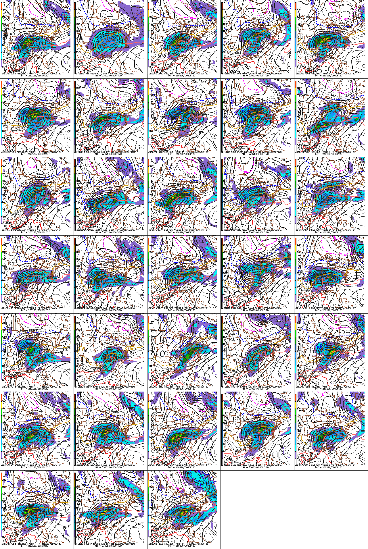
Straight up blizzard for the Great Lakes in about half of these ensemble runs.
-
March Medium/Long Range Discussion
Stormchaserchuck1 replied to WinterWxLuvr's topic in Mid Atlantic
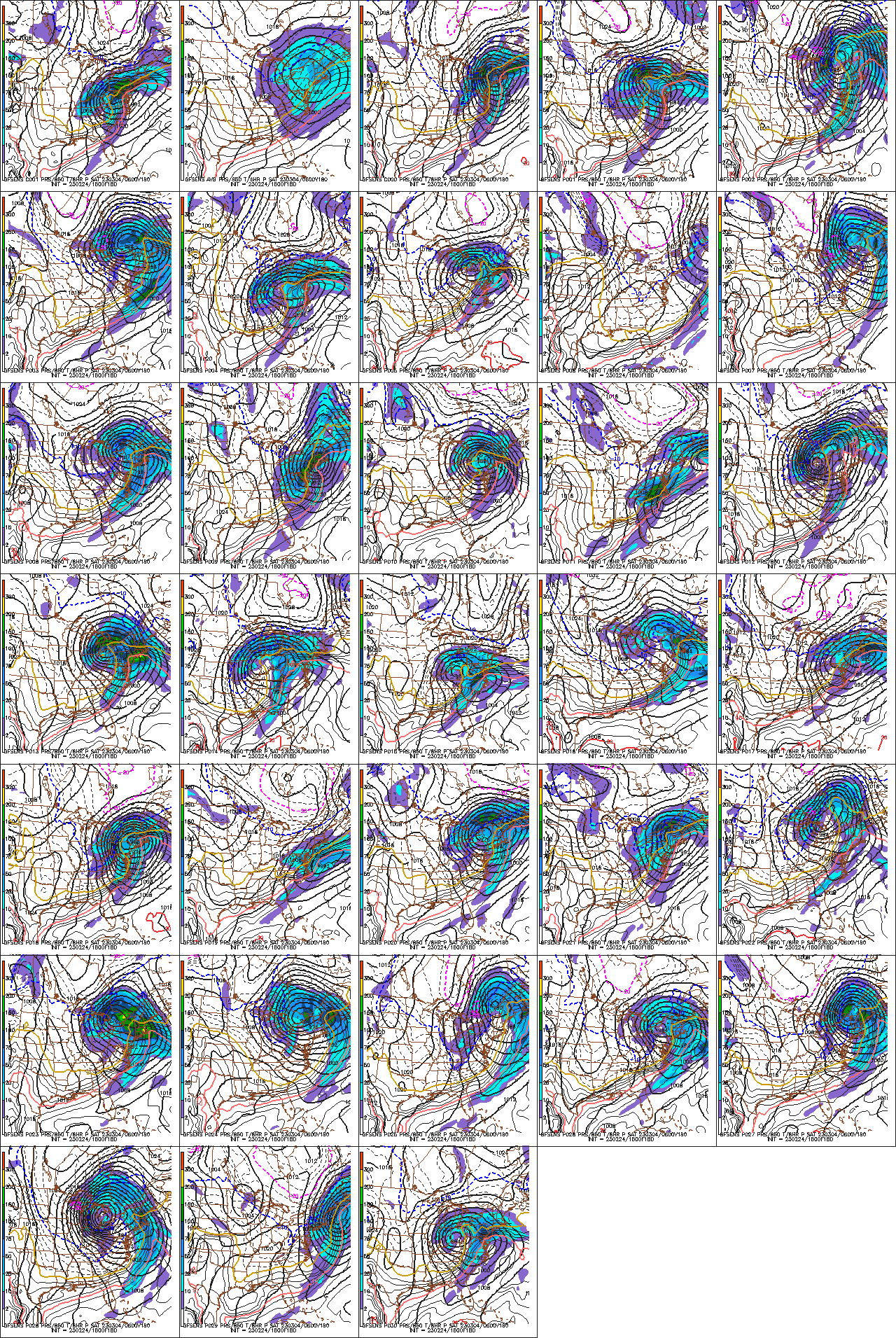
Let's initialize this <492dm AK vortex. -
March Medium/Long Range Discussion
Stormchaserchuck1 replied to WinterWxLuvr's topic in Mid Atlantic
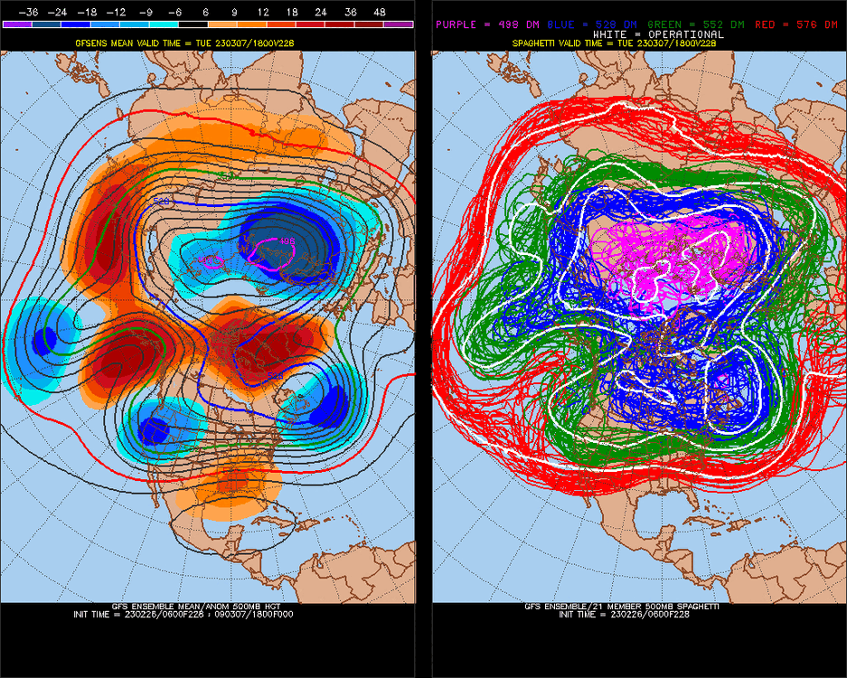
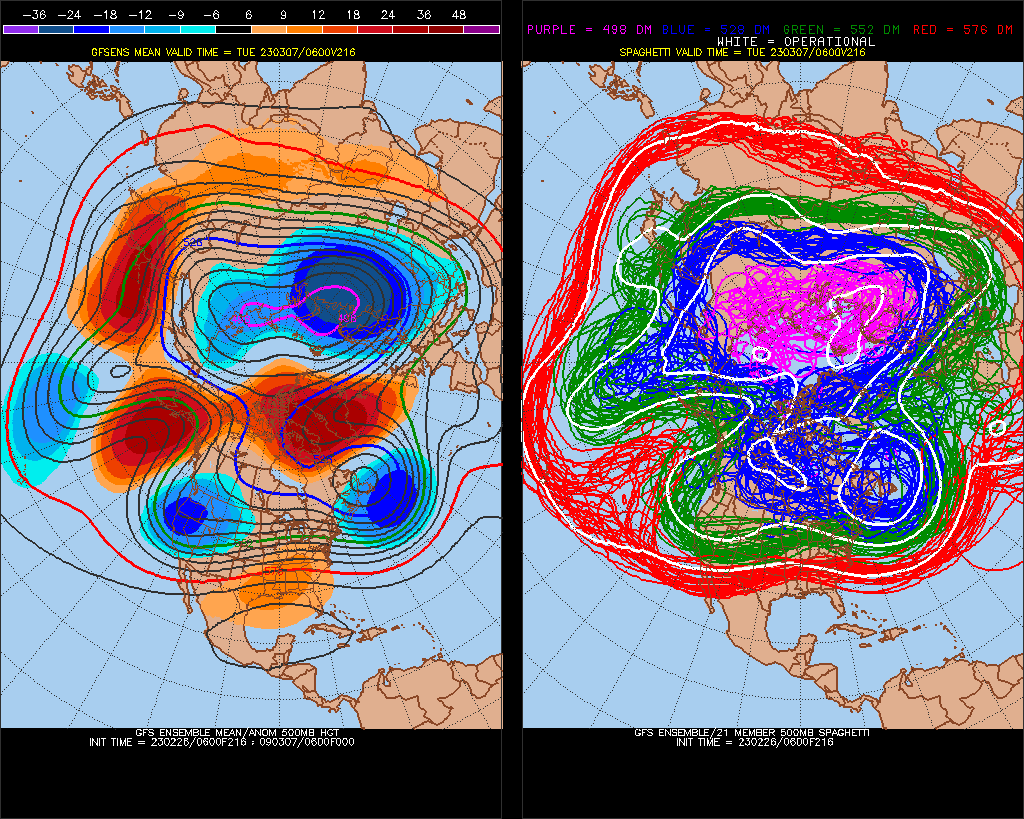
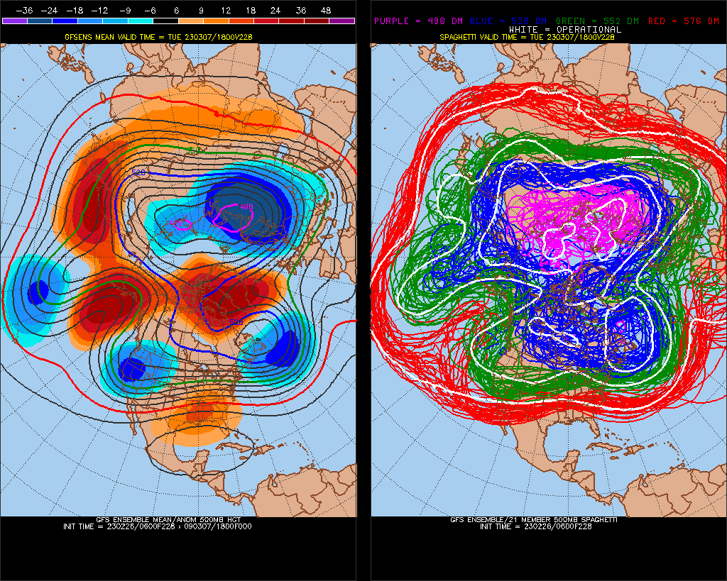
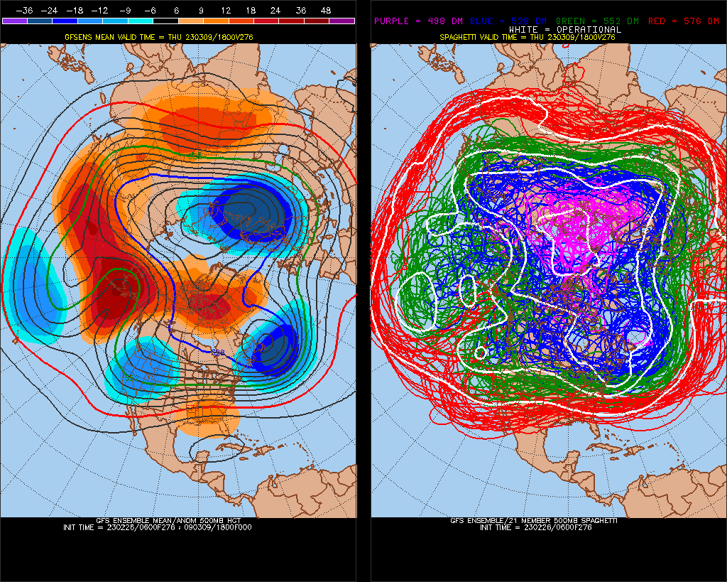
Nice cross-polar anomaly ridge.. -EPO, +PNA, west-based -NAO, active STJ. All good but the heavy -PNA next 10 days does still render the forward pattern a little weak.. We have been over-initializing current conditions to the models full run so let's see what happens as we get closer.. right now I like it. 50/50 low
-
March Medium/Long Range Discussion
Stormchaserchuck1 replied to WinterWxLuvr's topic in Mid Atlantic
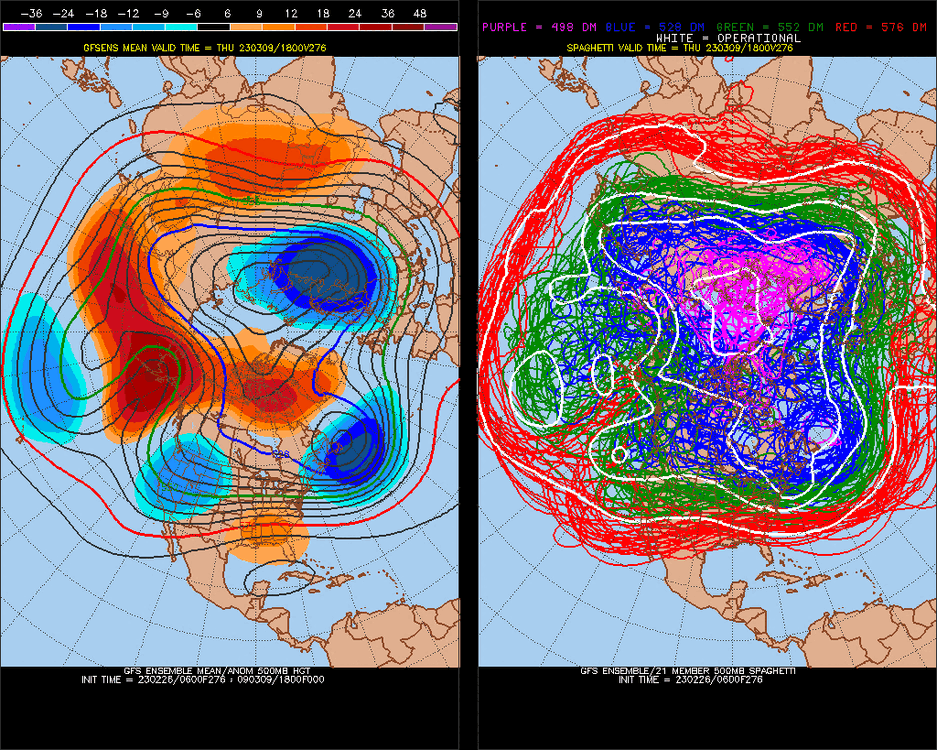
Healthy March precip pattern -
March Medium/Long Range Discussion
Stormchaserchuck1 replied to WinterWxLuvr's topic in Mid Atlantic
You might really need some time for this to clear. This is a very warm pattern. -
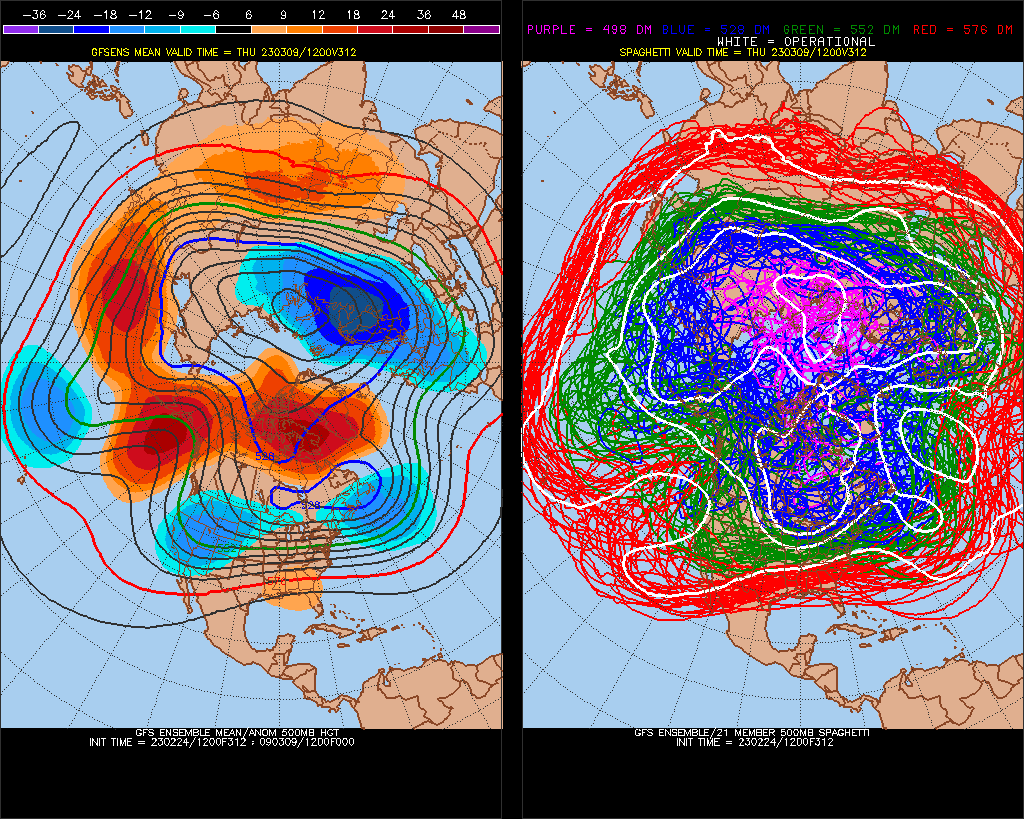
I wouldn't be surprised if this entire -NAO occurs with equally bad Pacific until it breaks.. That +EPO projected for March 1-3 is really strong. Models give a small window around March 10th of a -epo connecting with -nao ridge, but if the Pacific gets good, we might expect a +nao to coincide. (I have a -NAO signal until March 19th, but maybe that will be wrong if the Pac is good.) I think we look a little bit better overall for March 8-19, but it will be interesting because the NAO-Pacific inverse correlation shows no signs of going anywhere, at least in the medium range, at the start of this -NAO.


.gif.78ce8239ce00c506e62b9bf79ae766fa.gif)


.gif.943d7110c9ad2e2513521105d311e566.gif)
.gif.6047c04cb9a4c116bb92817f2b294fbd.gif)