Hurricane Agnes
-
Posts
9,344 -
Joined
Content Type
Profiles
Blogs
Forums
American Weather
Media Demo
Store
Gallery
Everything posted by Hurricane Agnes
-
E PA/NJ/DE Winter 2022-2023 OBS Thread
Hurricane Agnes replied to Ralph Wiggum's topic in Philadelphia Region
Sun out, clearing rapidly, and now partly cloudy. Temp is up to 30 with dp 24. As soon as the temp goes above freezing, whatever is out there will go poof. -
E PA/NJ/DE Winter 2022-2023 OBS Thread
Hurricane Agnes replied to Ralph Wiggum's topic in Philadelphia Region
PHL finally reported measurable - 0.3".
-
E PA/NJ/DE Winter 2022-2023 OBS Thread
Hurricane Agnes replied to Ralph Wiggum's topic in Philadelphia Region
Went out with the ruler and got 0.2" - and was actually examining what fell and it looked like quite a bit of small graupel mixed in because the surface coating had piles of tiny foam-bead-looking stuff mixed in that was definitely not sleet (was softer). Am currently at my low of 29 (so far) this morning and it's overcast and somewhat misty, with dp 24. -
E PA/NJ/DE Winter 2022-2023 OBS Thread
Hurricane Agnes replied to Ralph Wiggum's topic in Philadelphia Region
That's all you'll have absent the squirrel snow pile. I suppose some of it could be scraped and gathered into one place to make a mound. -
E PA/NJ/DE Winter 2022-2023 OBS Thread
Hurricane Agnes replied to Ralph Wiggum's topic in Philadelphia Region
Car topper 1/4" here. Not much on the grass but just some of the coldest surfaces. Currently SN-- and 30 with dp 24. Below was when some of the heavier stuff came through...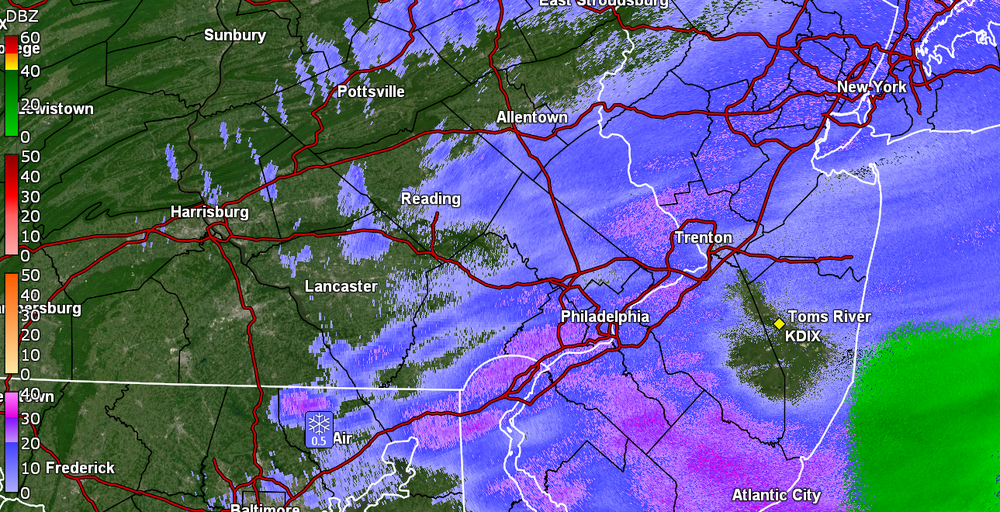
-
E PA/NJ/DE Winter 2022-2023 OBS Thread
Hurricane Agnes replied to Ralph Wiggum's topic in Philadelphia Region
Getting more flakes flying but not sticking because the ground and other surfaces are wet and too warm. Temp is 37 with dp 31. -
E PA/NJ/DE Winter 2022-2023 OBS Thread
Hurricane Agnes replied to Ralph Wiggum's topic in Philadelphia Region
Flakes had been briefly flying here when I got the mail so get to add a "trace" to the tally. Otherwise picked up 0.04" of rain earlier this morning and had a low of 34. Currently drizzling and 36 with dp 31. -
E PA/NJ/DE Winter 2022-2023 OBS Thread
Hurricane Agnes replied to Ralph Wiggum's topic in Philadelphia Region
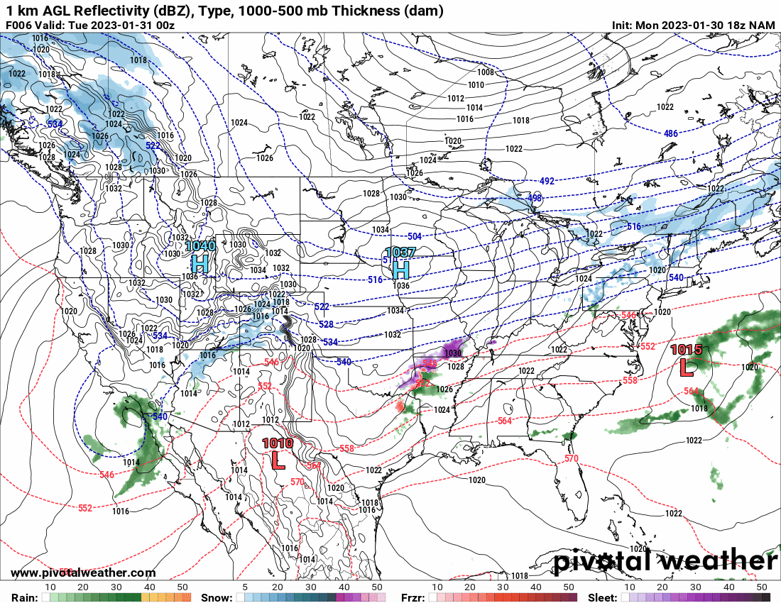
Well after being overcast all day, the sun finally came out about 10 minutes ago. Low this morning was 37 and am currently at my high of 52 with dp 42. 18z NAM showing no accumulation mood flakes for Feb 1...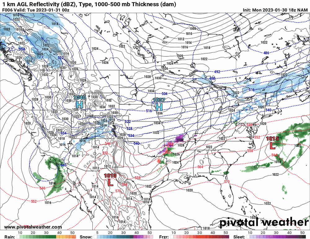
-

-
E PA/NJ/DE Winter 2022-2023 OBS Thread
Hurricane Agnes replied to Ralph Wiggum's topic in Philadelphia Region
I had seen a -25 current temp for International Falls, MN early this morning and their HWO is calling for possible Wind Chill Advisories/Warnings every day through to next Saturday. They even have one of these on their 7-day forecast page - Don't recall ever seeing that one here. Had a 33 low this morning and it's currently overcast and 49 with dp 36. -
E PA/NJ/DE Winter 2022-2023 OBS Thread
Hurricane Agnes replied to Ralph Wiggum's topic in Philadelphia Region
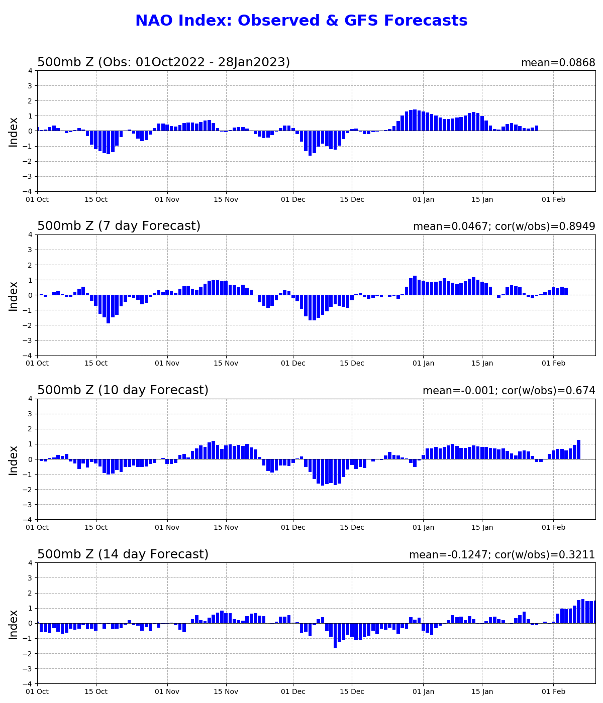
Good discussion about this - https://www.severe-weather.eu/global-weather/winter-season-coldest-air-january-2023-deep-freeze-snow-canada-united-states-mk/ Ralph-style anomaly map for next week's (probably transient) cold intrusion (from above linked discussion) - This seems to be what is triggering suppression and the slider storms. What is shocking is that only about 5% of the Great Lakes have ice coverage meaning any arctic intrusion is going to generate another massive lake-effect snow event. But even with that, the handwriting on the wall with the MJO - And the NAO -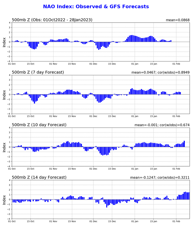
-
E PA/NJ/DE Winter 2022-2023 OBS Thread
Hurricane Agnes replied to Ralph Wiggum's topic in Philadelphia Region
Here's an idea - Made it up to 51 today after a low of 28 and it's currently 46 with dp that did creep up to 33. -
E PA/NJ/DE Winter 2022-2023 OBS Thread
Hurricane Agnes replied to Ralph Wiggum's topic in Philadelphia Region
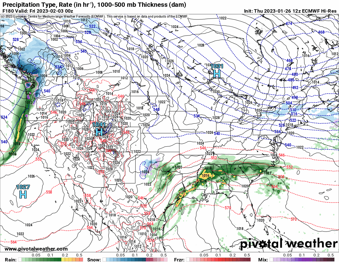
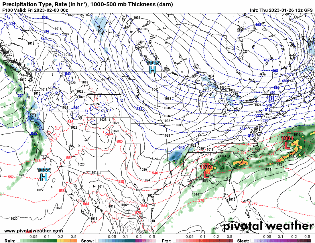
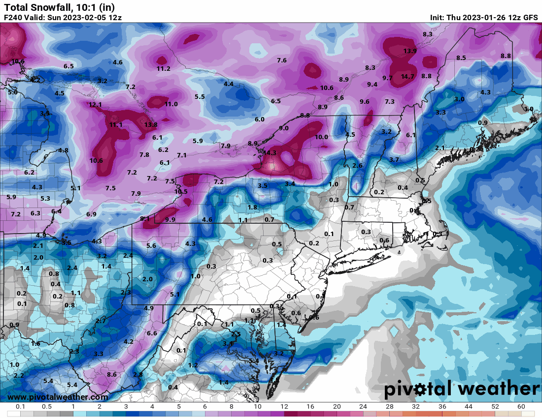
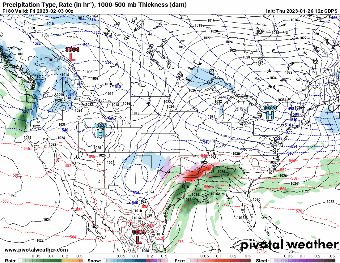
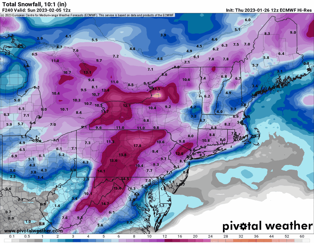
Looks like the EC has sortof caved to the suppressed/slider idea that the GFS has been showing. I think it's gonna depend on the position and amount of amplification of the western ridge. I would wait for now since at least the 2/3 - 2/5 storm is still over a week away and we have seen these midrange undulations before. Looks like my low was 31 this morning and am currently 33 and partly cloudy with dp 25. -
E PA/NJ/DE Winter 2022-2023 OBS Thread
Hurricane Agnes replied to Ralph Wiggum's topic in Philadelphia Region
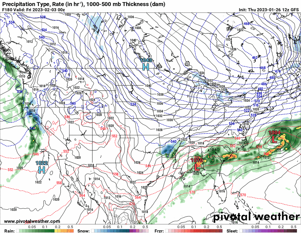
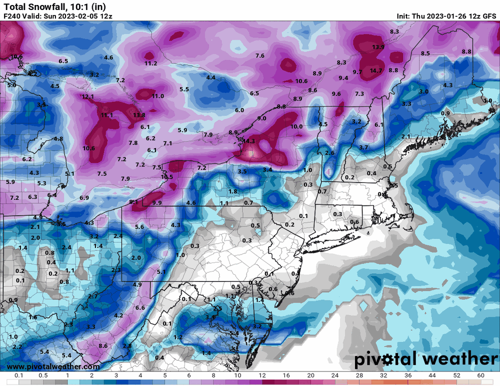
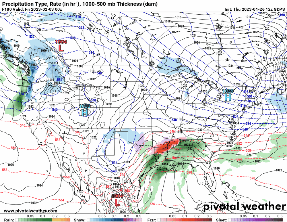
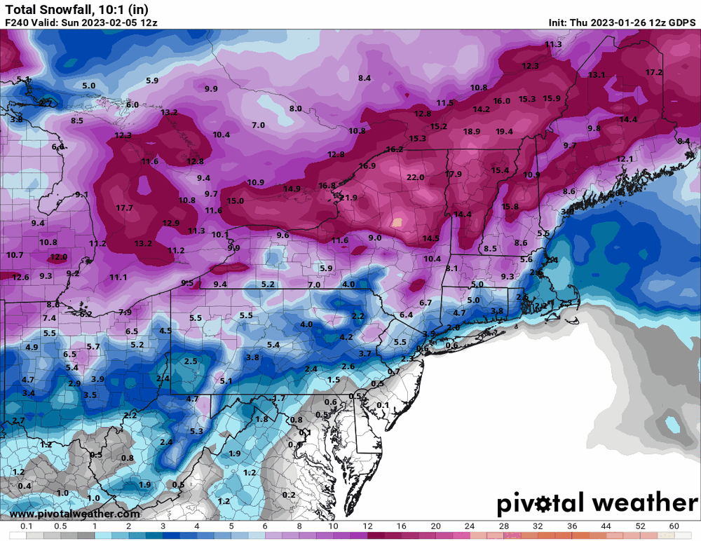
What is wild are the opposite solutions from the EC and GFS for the storms. They have all been honking at something that week so I think something is going to happen but the actual dates/p-types/amounts are all over the place! The Canadian seems to tilt towards the EC 2/4 timeframe though.
-
E PA/NJ/DE Winter 2022-2023 OBS Thread
Hurricane Agnes replied to Ralph Wiggum's topic in Philadelphia Region
I'm surprised 2009 - 2010 didn't show up on your graph unless most of that was down this way. Here IMBY, I had something like 70" that blew past the 1995 - 1996 season and even the 2013/2014 season with something like 60" measured. Well my "high" remains as the post-midnight temp of 57 and my "low" was 41. Currently overcast after changeable skies started up this afternoon, and 43, with dp 31. -
E PA/NJ/DE Winter 2022-2023 OBS Thread
Hurricane Agnes replied to Ralph Wiggum's topic in Philadelphia Region
Actually hit a non-diurnal high of 57 about 11:45 pm last night making that the high for yesterday and that temp persisted after midnight before a slow drop, potentially make that the high for today. Picked up 1.37" of rain yesterday and 0.26" early this morning for a 2-day event total of 1.63". Currently damp and 44 with dp 41. -
E PA/NJ/DE Winter 2022-2023 OBS Thread
Hurricane Agnes replied to Ralph Wiggum's topic in Philadelphia Region
Temps continue to rise and have now hit 50, with light rain, 0.64" for today so far, and dp 50. -
E PA/NJ/DE Winter 2022-2023 OBS Thread
Hurricane Agnes replied to Ralph Wiggum's topic in Philadelphia Region
Non-diurnal temp change continues. Temp now up to 48/dp 47, with a steadier rain and 0.44" in the bucket so far at post time. -
E PA/NJ/DE Winter 2022-2023 OBS Thread
Hurricane Agnes replied to Ralph Wiggum's topic in Philadelphia Region
Temp has been slowly creeping up here and have 0.19" of rain so far today. Currently 42 and misty with dp 41. -
E PA/NJ/DE Winter 2022-2023 OBS Thread
Hurricane Agnes replied to Ralph Wiggum's topic in Philadelphia Region
Getting light rain now enough to tip the bucket and have 0.02". So far have had no frozen either alone or mixed at this point here in NW Philly. Still 38 and dp 35. -
E PA/NJ/DE Winter 2022-2023 OBS Thread
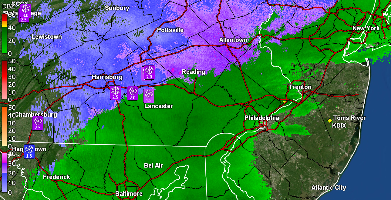
Hurricane Agnes replied to Ralph Wiggum's topic in Philadelphia Region
Looks like 4 reports with 1.5 - 2.3" reports in Berks (Sinking Spring, Reading, Mertztown, Huffs Church). Still light drizzle/mist and now 38 with dp 33. -
E PA/NJ/DE Winter 2022-2023 OBS Thread
Hurricane Agnes replied to Ralph Wiggum's topic in Philadelphia Region
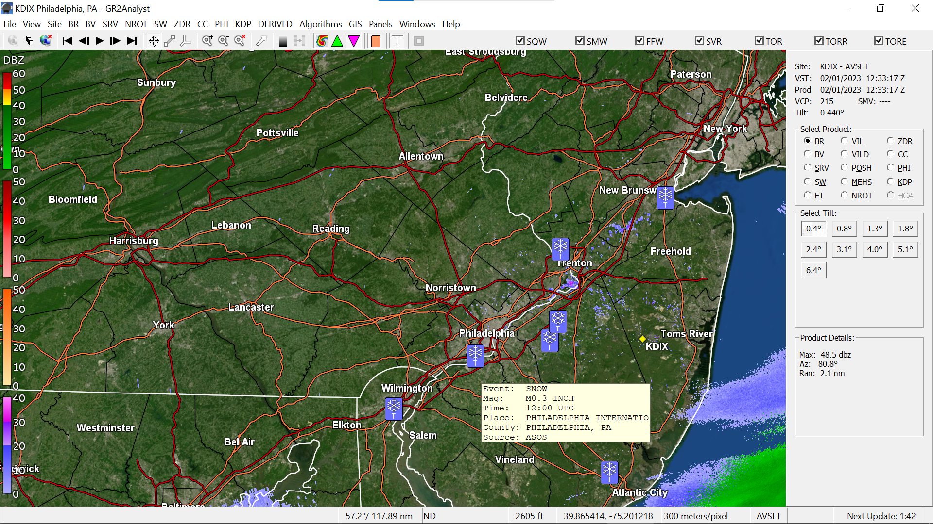
In this case,this is level 2 data (Gr2Analyst) and I just have it up for visuals to get some of the spotter reports. I have no snow down this way in NW Philly. -
E PA/NJ/DE Winter 2022-2023 OBS Thread
Hurricane Agnes replied to Ralph Wiggum's topic in Philadelphia Region
Getting good accumulations N/W.
-
E PA/NJ/DE Winter 2022-2023 OBS Thread
Hurricane Agnes replied to Ralph Wiggum's topic in Philadelphia Region
Getting drizzle here. Nothing anywhere near measurable yet. Temp is 37 with dp 30. -
E PA/NJ/DE Winter 2022-2023 OBS Thread
Hurricane Agnes replied to Ralph Wiggum's topic in Philadelphia Region
Had popped outside about 10 minutes ago and you can smell the snow in the air although it's many miles away. LOL Had a 29 low this morning and it's currently overcast and 37 with dp 27.