Hurricane Agnes
-
Posts
9,344 -
Joined
Content Type
Profiles
Blogs
Forums
American Weather
Media Demo
Store
Gallery
Everything posted by Hurricane Agnes
-
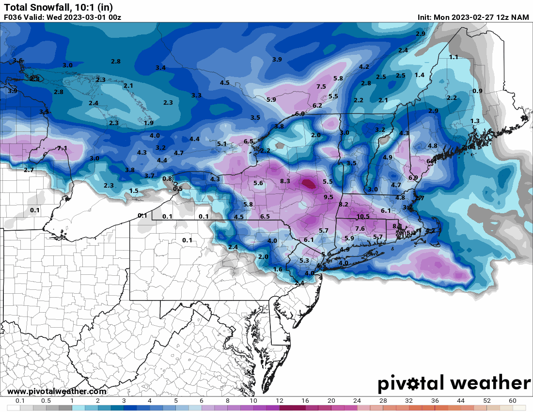
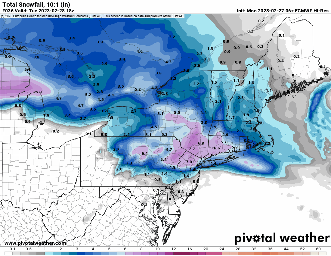
E PA/NJ/DE Winter 2022-2023 OBS Thread
Hurricane Agnes replied to Ralph Wiggum's topic in Philadelphia Region
ANNNNDDD it has started to cloud up here. Temp 46/dp 23. -
E PA/NJ/DE Winter 2022-2023 OBS Thread
Hurricane Agnes replied to Ralph Wiggum's topic in Philadelphia Region
Looks like it may be showtime for the negatively tilted NW --> SE band of something to our west/south. Currently partly sunny and 47 but with a dryish dp of 22.
-
E PA/NJ/DE Winter 2022-2023 OBS Thread
Hurricane Agnes replied to Ralph Wiggum's topic in Philadelphia Region
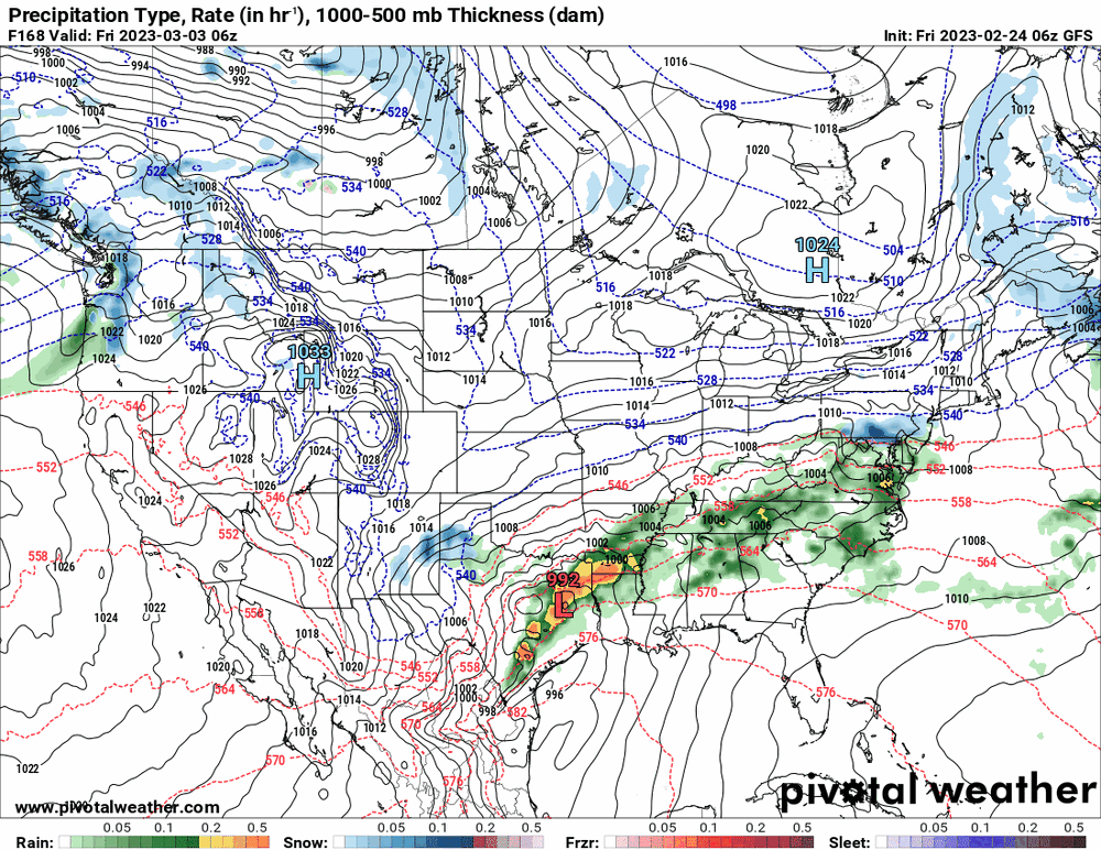
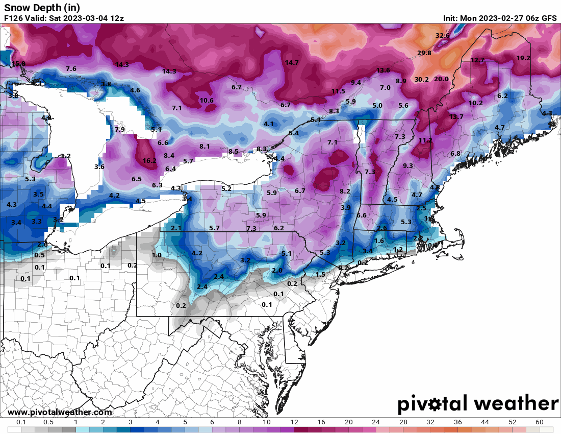
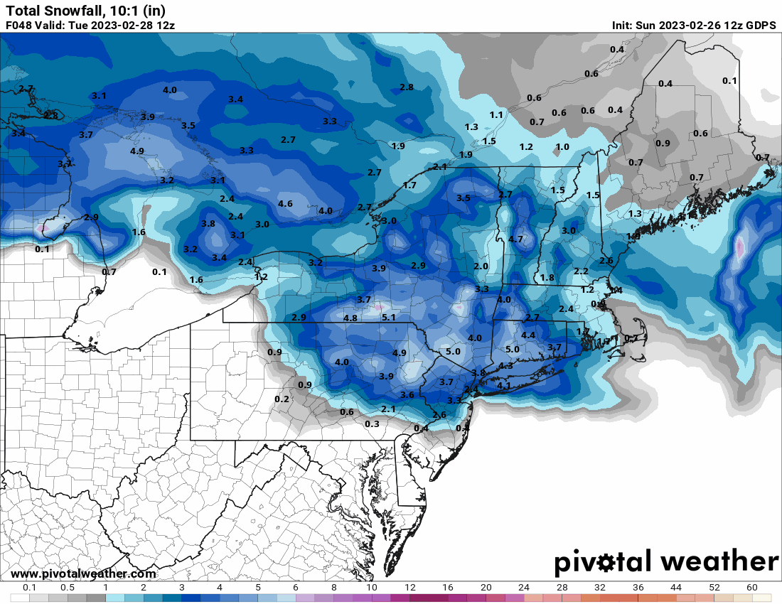
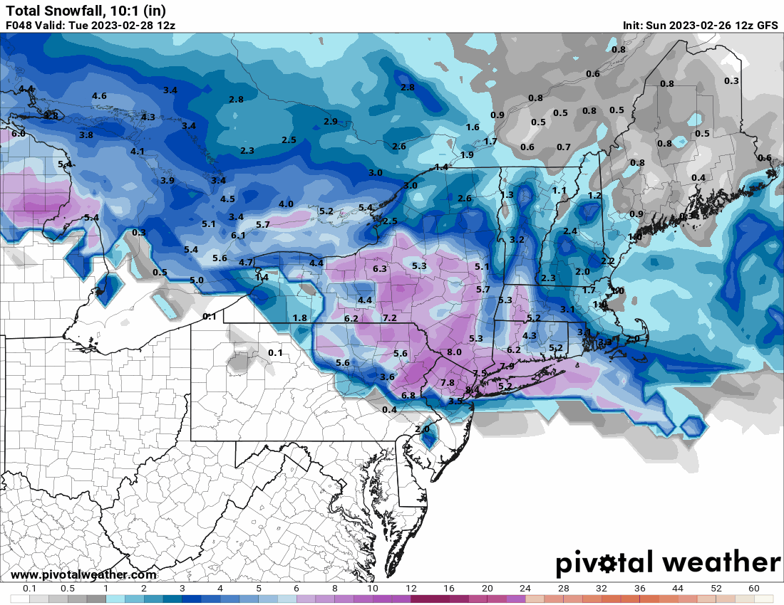
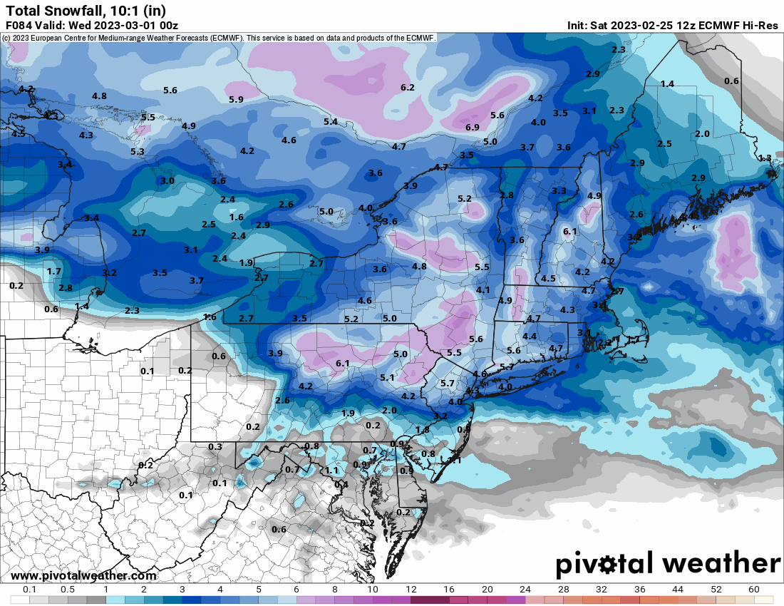
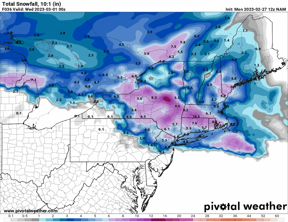
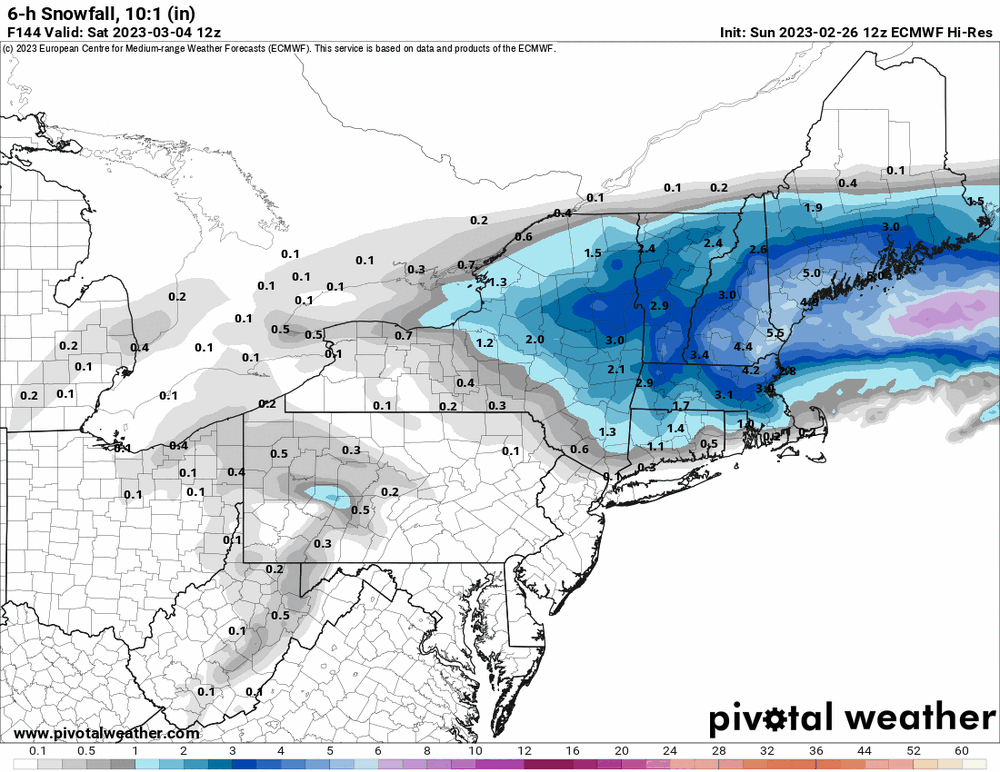
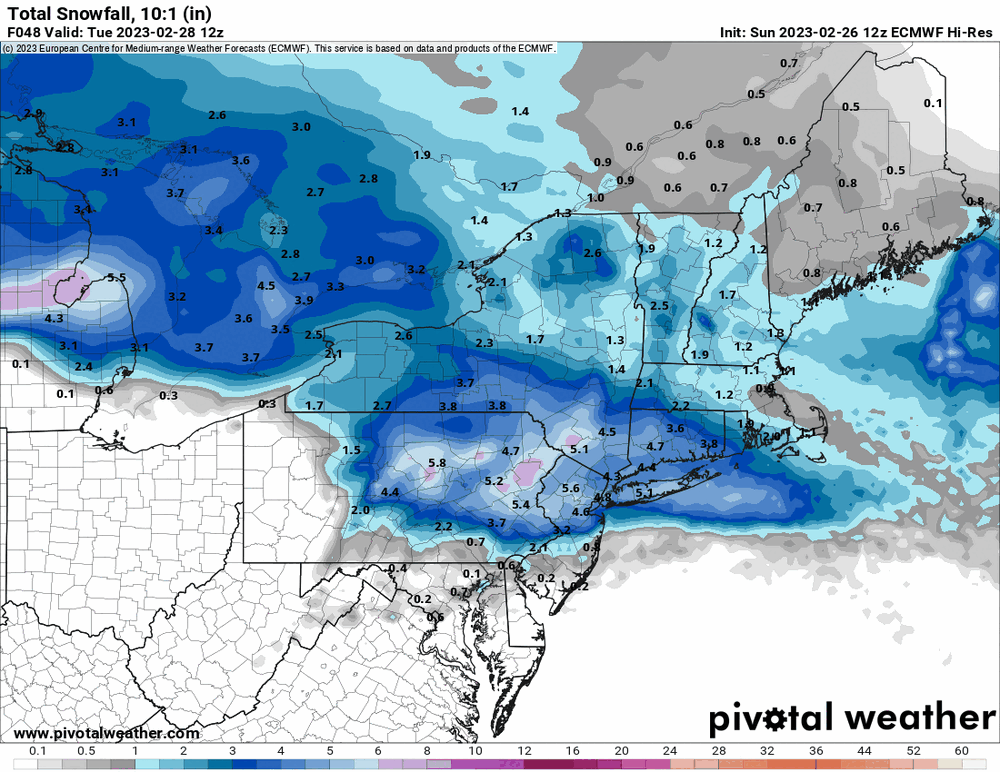
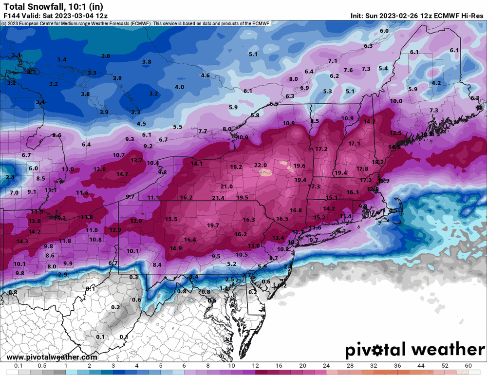
12z GFS & NAM seem to agree about tomorrow's storm. The GFS also wants a similar setup for the 3/4 event and shows some definitely Warning level snow up north.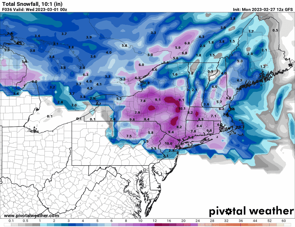
-
E PA/NJ/DE Winter 2022-2023 OBS Thread
Hurricane Agnes replied to Ralph Wiggum's topic in Philadelphia Region
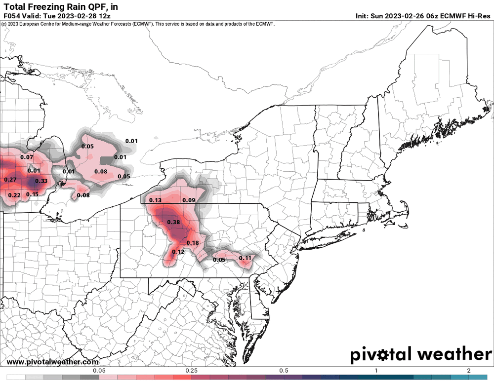
Ended up with a high of 50 yesterday and a low of 30 this morning. Currently partly sunny and 36 with dp 21. 6z EC brought some frozen all the way down to the MD border for tomorrow's storm. Will have to see where the freezing line sets up regarding whether that pans out or not.
-
E PA/NJ/DE Winter 2022-2023 OBS Thread
Hurricane Agnes replied to Ralph Wiggum's topic in Philadelphia Region
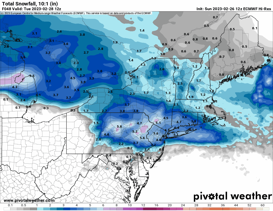
6z GFS dried up the SE area the 3/4 storm but I would agree with Mt. Holly's take that it will probably manifest similarly to how this 2/28 storm does...
-
E PA/NJ/DE Winter 2022-2023 OBS Thread
Hurricane Agnes replied to Ralph Wiggum's topic in Philadelphia Region
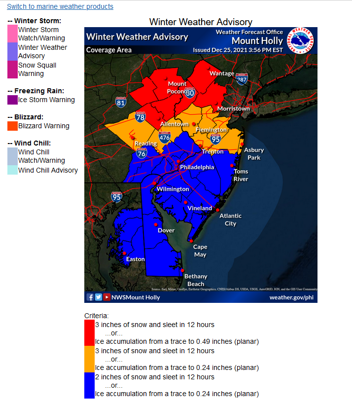
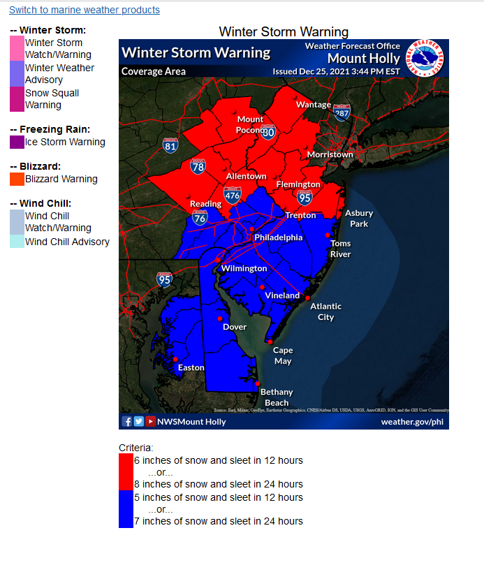
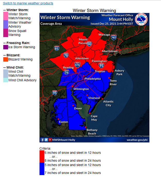
Meant to follow up on this because I had remembered seeing the criteria depending on where you are in the CWA and I did finally find it - https://www.weather.gov/phi/criteria-winter So for up that way you have this for WWAs & WSWs -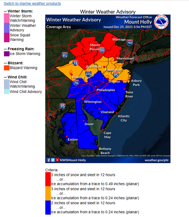
-
E PA/NJ/DE Winter 2022-2023 OBS Thread
Hurricane Agnes replied to Ralph Wiggum's topic in Philadelphia Region
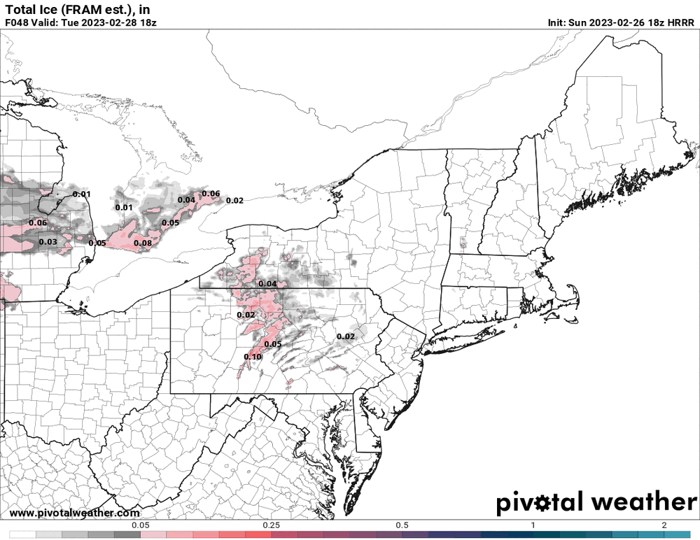
Could be if there is sleet/ZR in there too (heard on KYW about possible sleet up north - Steve Sosna).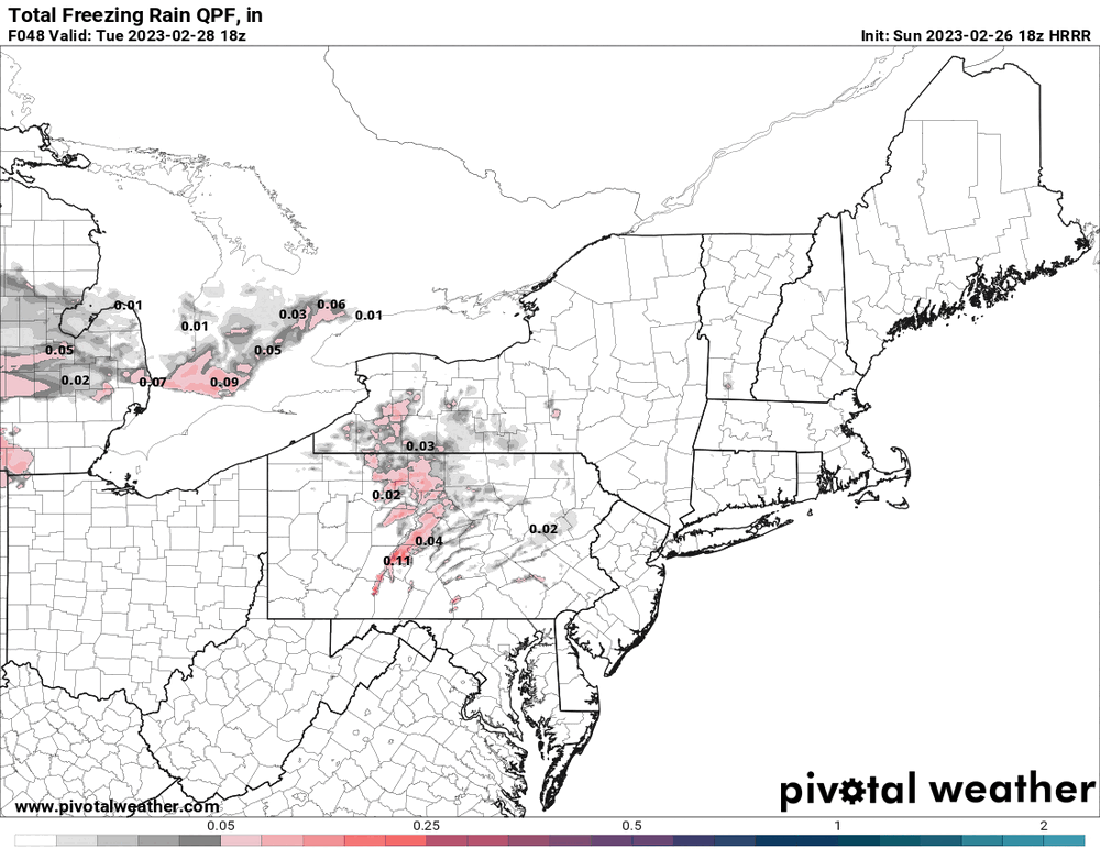
-
E PA/NJ/DE Winter 2022-2023 OBS Thread
Hurricane Agnes replied to Ralph Wiggum's topic in Philadelphia Region
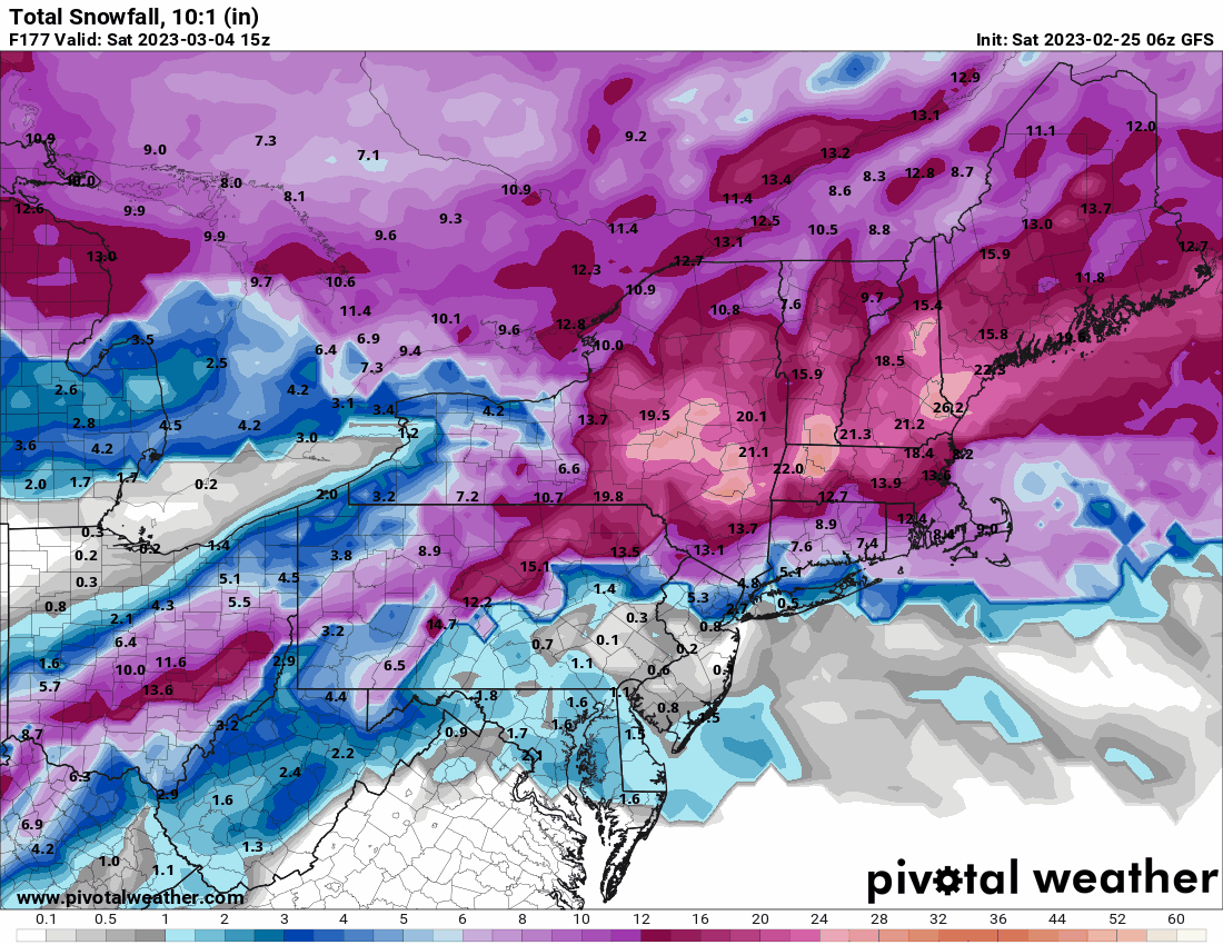
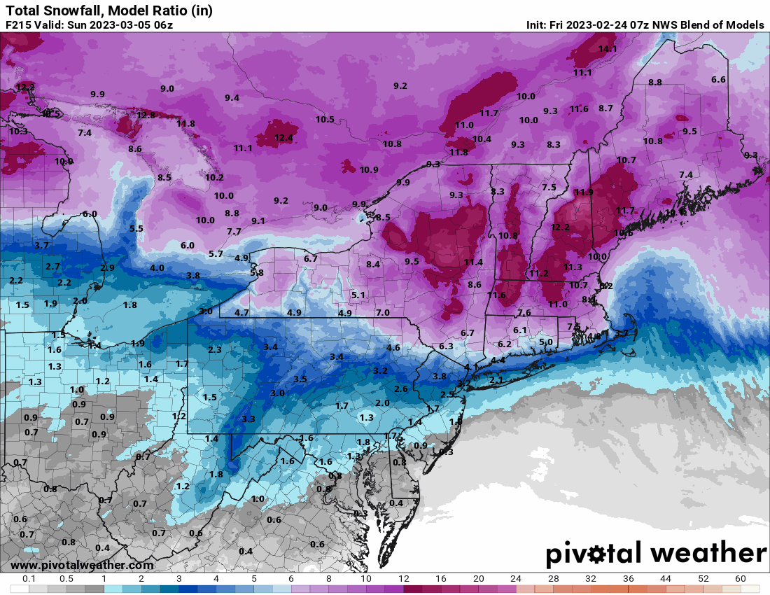
Was looking at the timing - the final totals were the last ones posted to try to line up. I know at least for the 3/4 storm, it'll probably change a few times. Will have to see what they all look like on Wednesday! -
E PA/NJ/DE Winter 2022-2023 OBS Thread
Hurricane Agnes replied to Ralph Wiggum's topic in Philadelphia Region
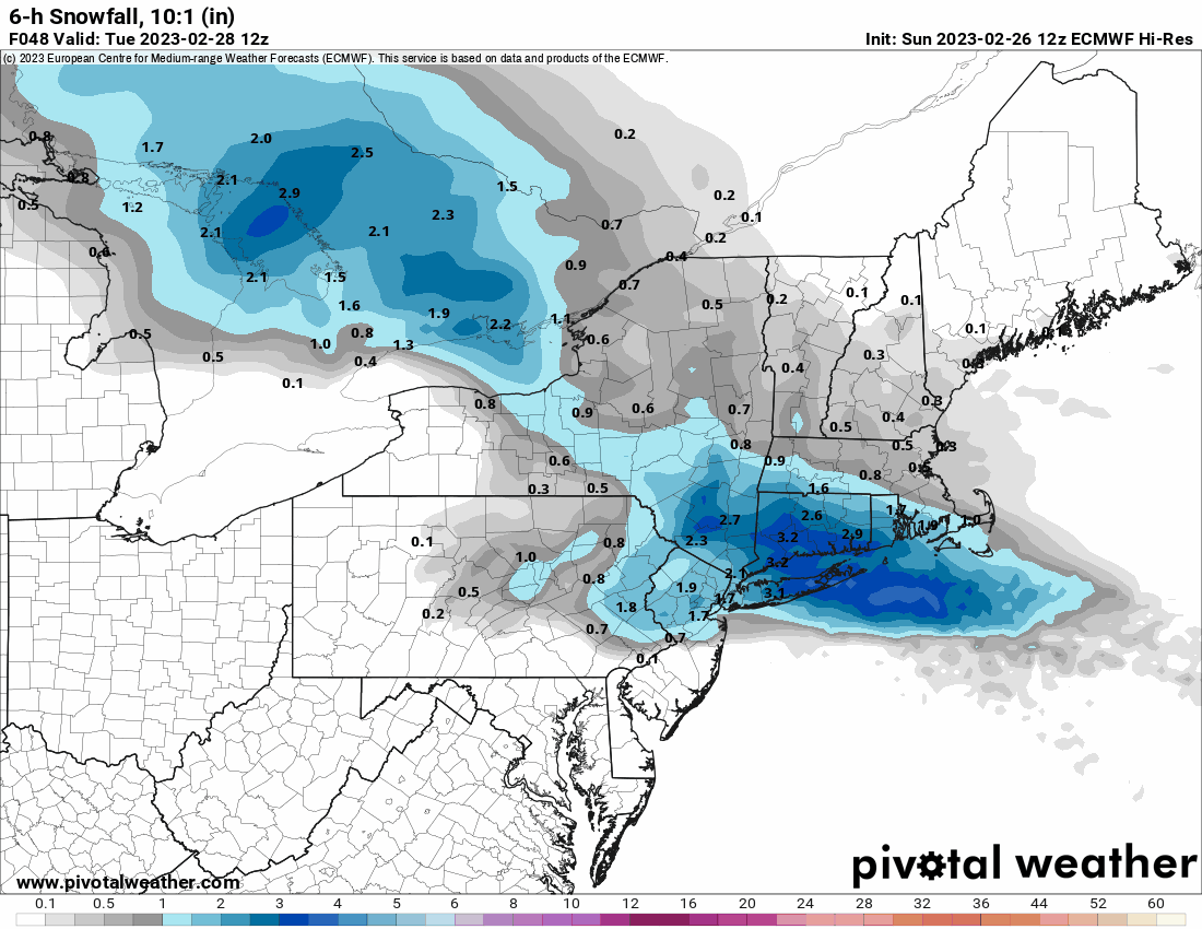
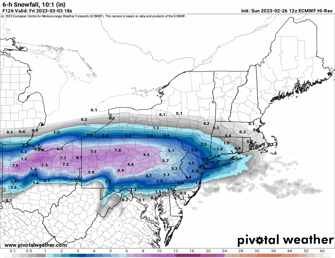
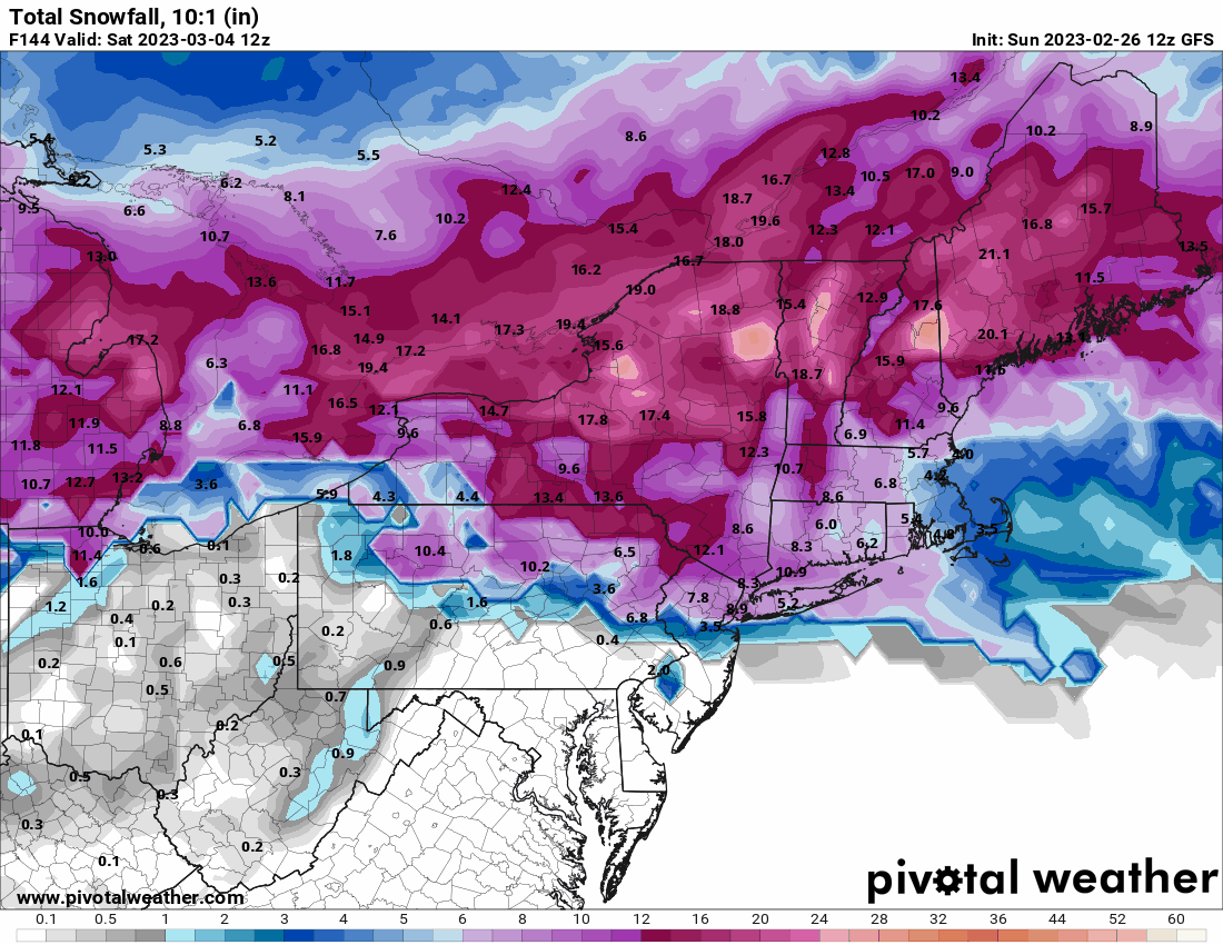
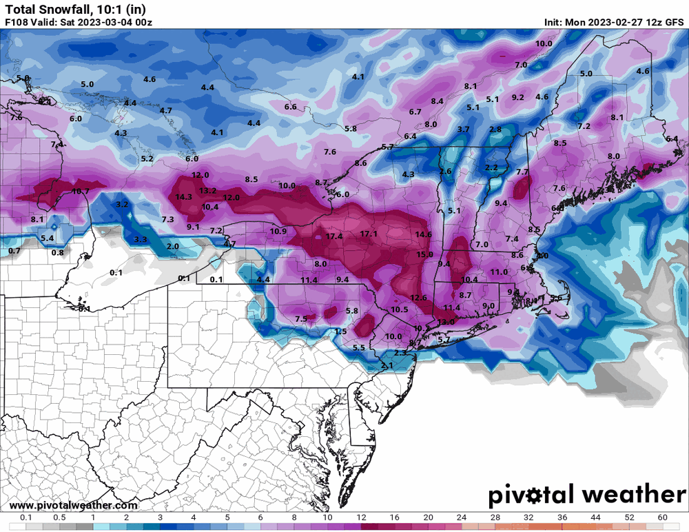
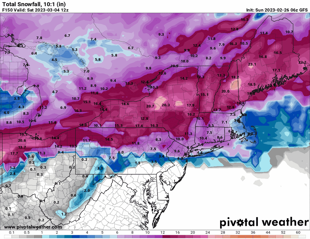
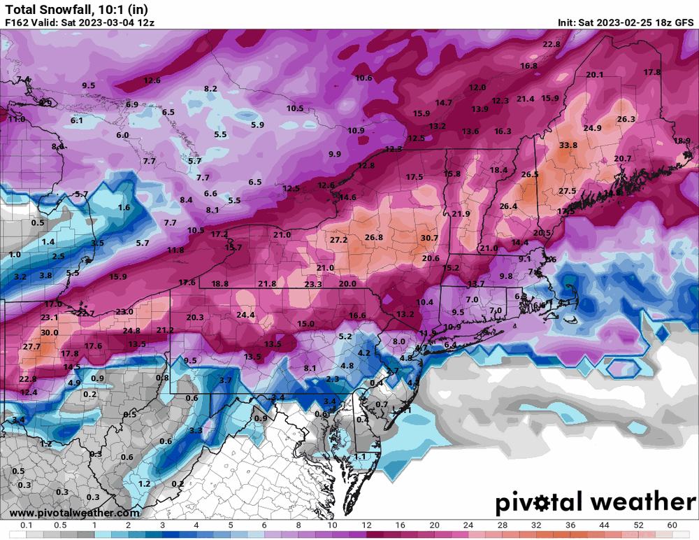
The Euro caved to the GFS for 2/28 but seems to be something like 18 hours faster for the 3/4 storm bringing the heaviest stuff in earlier.

-
E PA/NJ/DE Winter 2022-2023 OBS Thread
Hurricane Agnes replied to Ralph Wiggum's topic in Philadelphia Region
Yup. But it's sortof getting into the mid-range now and we have seen this before as all of them start churning out options different from their long-range guesses, before deciding (or getting close to deciding) on a solution a few days out. -
E PA/NJ/DE Winter 2022-2023 OBS Thread
Hurricane Agnes replied to Ralph Wiggum's topic in Philadelphia Region
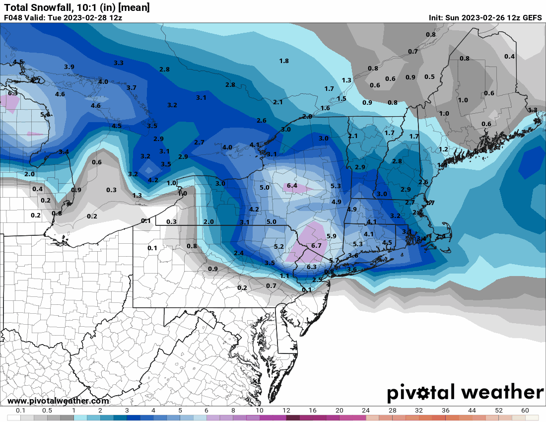
The GEFS is still hanging tough for 2/28 but has some SE-PA love for 3/4.

-
E PA/NJ/DE Winter 2022-2023 OBS Thread
Hurricane Agnes replied to Ralph Wiggum's topic in Philadelphia Region
And for 3/4 -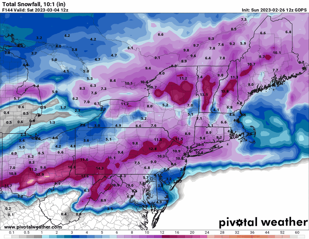
-
E PA/NJ/DE Winter 2022-2023 OBS Thread
Hurricane Agnes replied to Ralph Wiggum's topic in Philadelphia Region
Canadian splits the difference between the Euro and GFS and brings some more down this way for the 2/28 storm.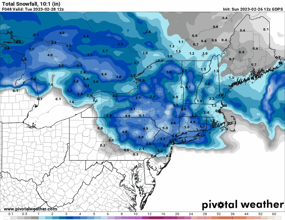
-
E PA/NJ/DE Winter 2022-2023 OBS Thread
Hurricane Agnes replied to Ralph Wiggum's topic in Philadelphia Region
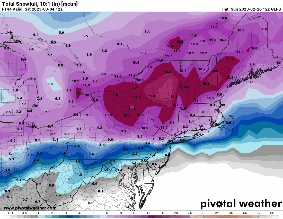
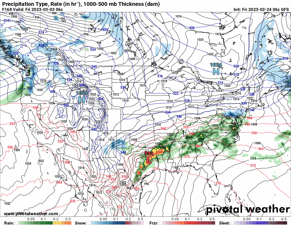
GFS still ignoring SE for the 3/4 - 3/5 storm although it looks like it's slower from previous runs.
-
E PA/NJ/DE Winter 2022-2023 OBS Thread
Hurricane Agnes replied to Ralph Wiggum's topic in Philadelphia Region
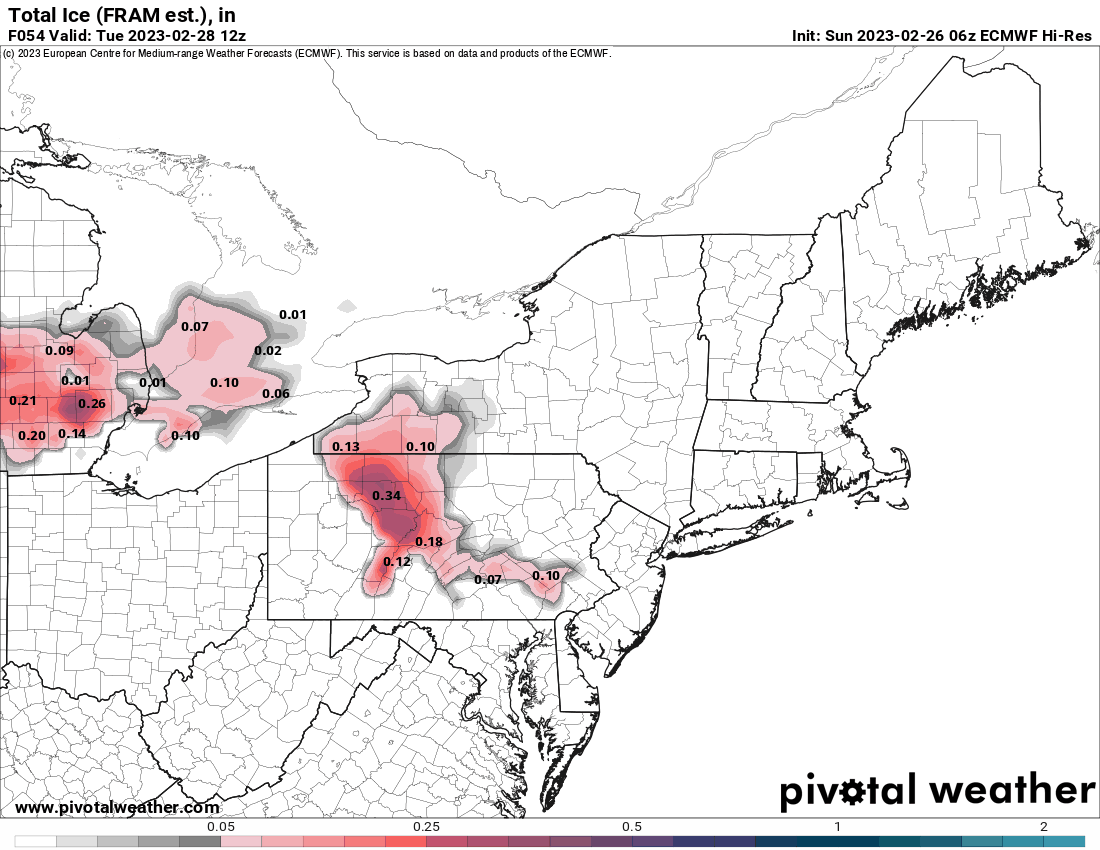
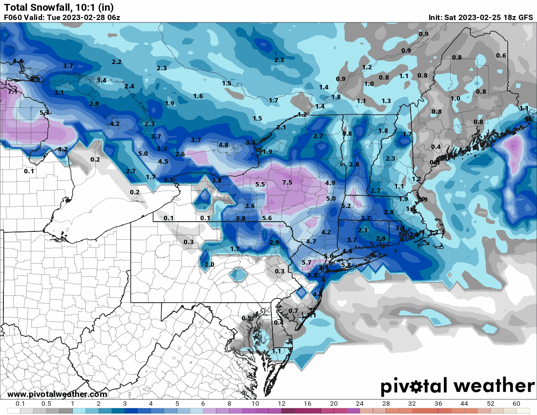
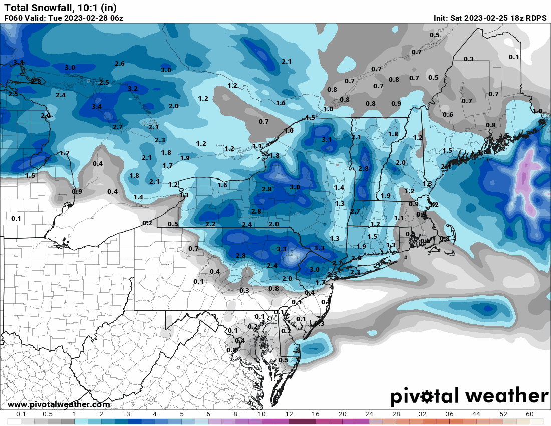
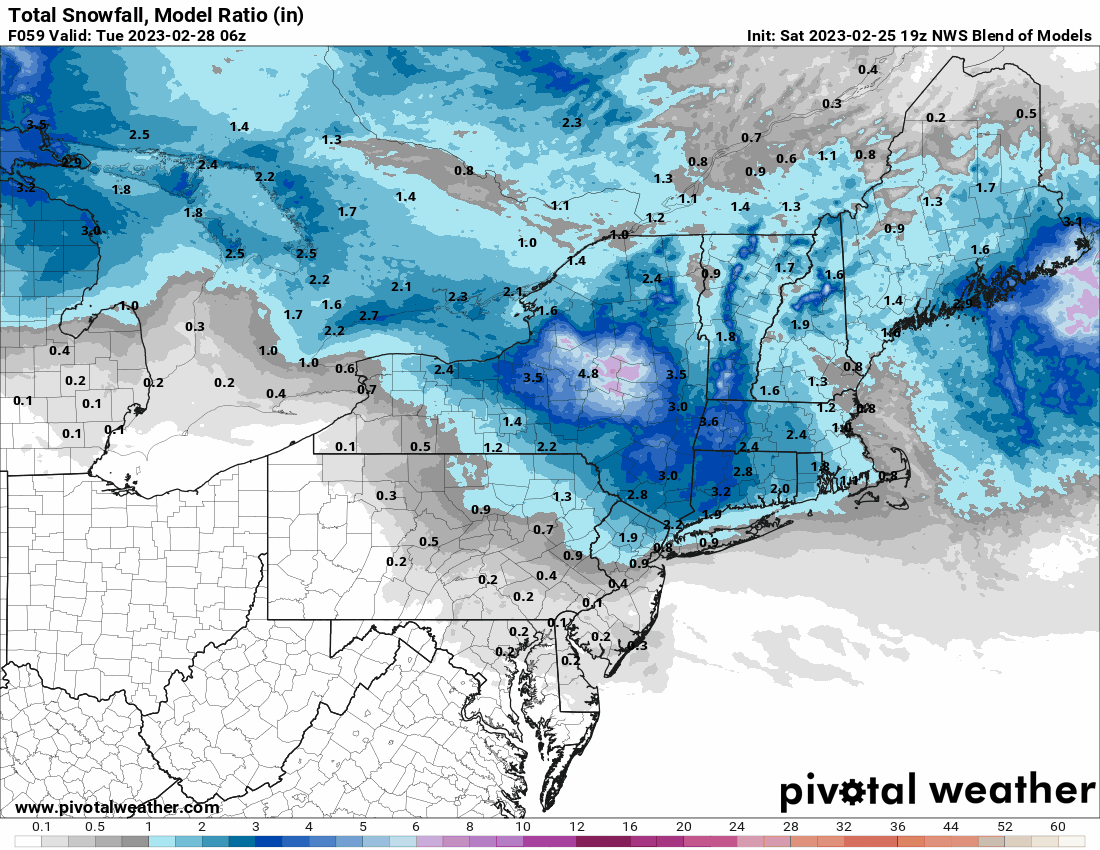
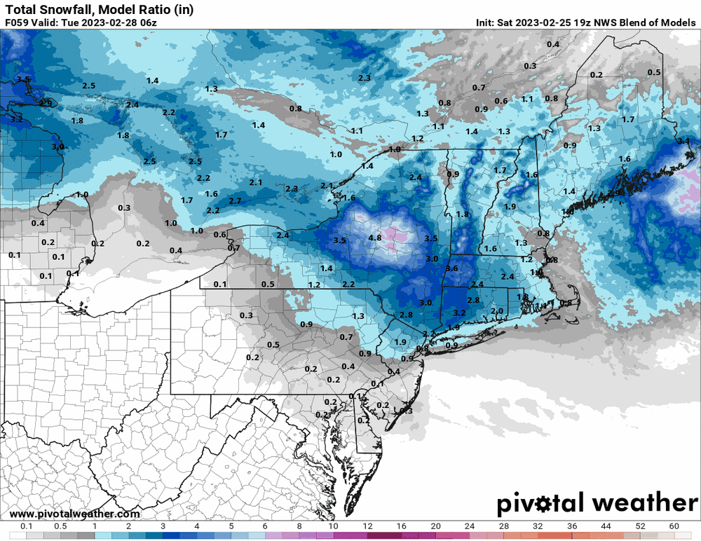
12z GFS cherry-picked a spot in Philly, as well as Camden, Burlington, and Gloucester Counties in Jersey to get some luvin' for 2/28.
-
E PA/NJ/DE Winter 2022-2023 OBS Thread
Hurricane Agnes replied to Ralph Wiggum's topic in Philadelphia Region
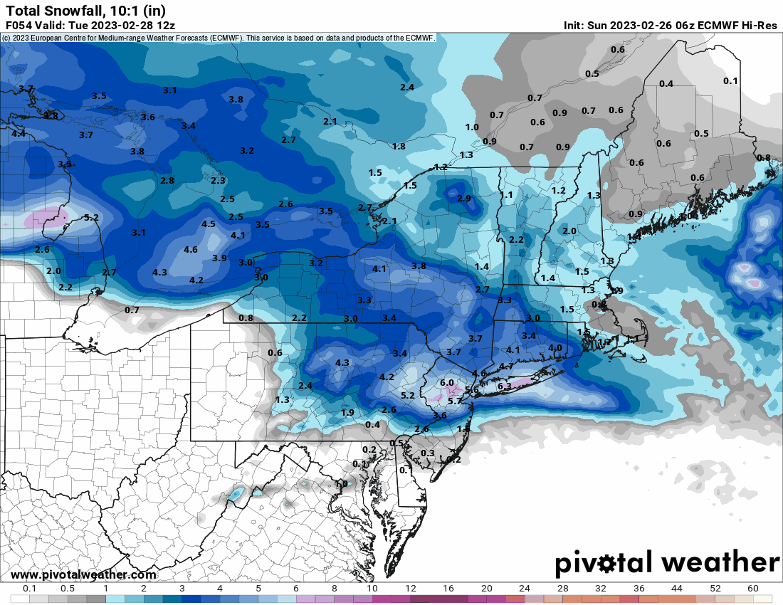
6z EC the 2/28 storm is one of those split the difference things vs the GFS 6z.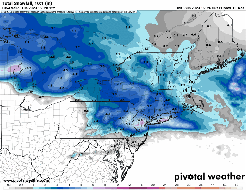

-
E PA/NJ/DE Winter 2022-2023 OBS Thread
Hurricane Agnes replied to Ralph Wiggum's topic in Philadelphia Region
6z GFS continues keeping the stuff north of I95 for both Monday and next Saturday, but has gotten some down into the rim counties. For some obs - I eventually made it up to 34 yesterday after it started clearing and the sun was trying to come out. This morning started out cold (low 24) but the temp has quickly rebounded since and is up to 29, with dp 27. Getting some low stratus at the moment and what looks like fog to my north.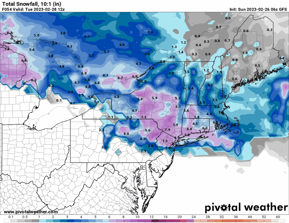
-
E PA/NJ/DE Winter 2022-2023 OBS Thread
Hurricane Agnes replied to Ralph Wiggum's topic in Philadelphia Region
For next weekend's storm, the GFS looks to be an apps runner with that freezing line in a marginal position for the southern part of the CWA. Still have a ways to go with how that is going to eventually resolve.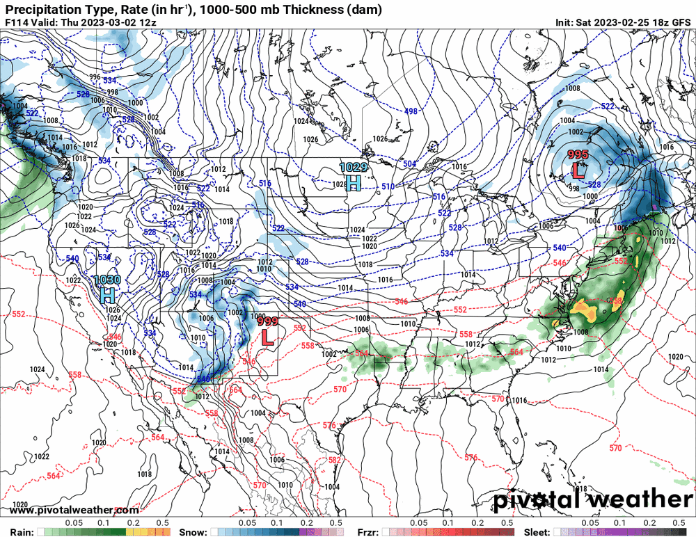
-
E PA/NJ/DE Winter 2022-2023 OBS Thread
Hurricane Agnes replied to Ralph Wiggum's topic in Philadelphia Region
There has been some antecedent cold but this storm looks to be another lakes cutter pulling some warm air up from the south as the cold air recedes. Meanwhile the 18z GFS hot off the press says "You get nothing!" (well... unless you are in S. Jersey including 1 little square area in Burlington County, Monmouth County, and a piece of Ocean County, and if you are where RedSky is with a nod to some marginal frozen ).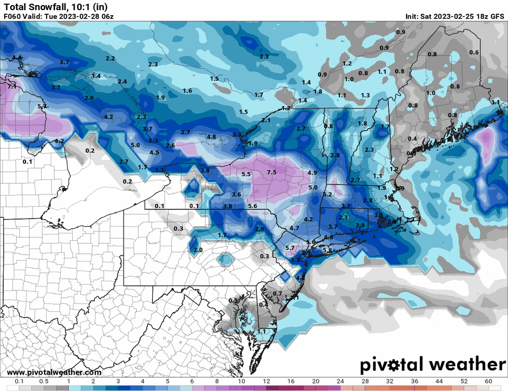
-
E PA/NJ/DE Winter 2022-2023 OBS Thread
Hurricane Agnes replied to Ralph Wiggum's topic in Philadelphia Region
Canadian has the frozen north as does the NBM, so may be more wet than frozen in the southern part of the CWA.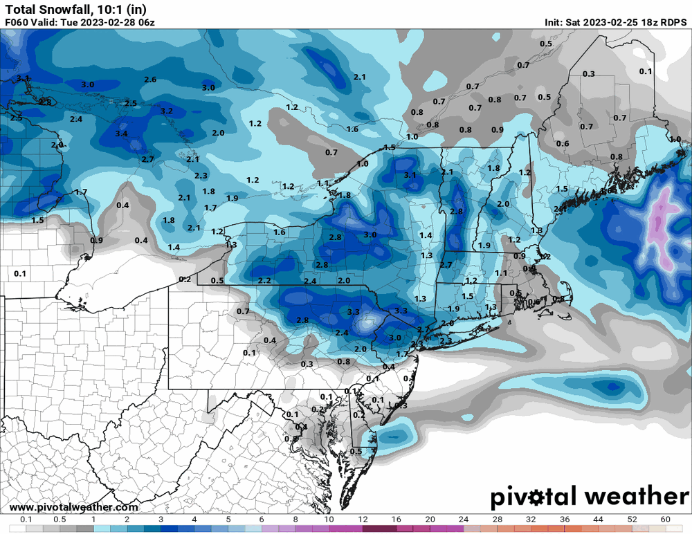
-
E PA/NJ/DE Winter 2022-2023 OBS Thread
Hurricane Agnes replied to Ralph Wiggum's topic in Philadelphia Region
Looks like the back edge is headed off the coast and it is starting to clear here with the sun struggling to show through the clouds. I also finally made it to just above freezing. Currently 33 and mostly cloudy but brightening, with dp 21. -
E PA/NJ/DE Winter 2022-2023 OBS Thread
Hurricane Agnes replied to Ralph Wiggum's topic in Philadelphia Region

-
E PA/NJ/DE Winter 2022-2023 OBS Thread
Hurricane Agnes replied to Ralph Wiggum's topic in Philadelphia Region
I actually got a very light dusting of some flakes and graupel on a few spots am currently getting some microscopic flakes. Temp is 30 with dp 17 after a low of 24. -
E PA/NJ/DE Winter 2022-2023 OBS Thread
Hurricane Agnes replied to Ralph Wiggum's topic in Philadelphia Region
6z GFS pushed it north and brought the warmer air with it to the S/E.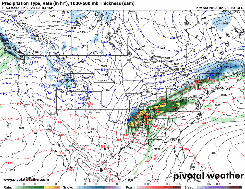

-
E PA/NJ/DE Winter 2022-2023 OBS Thread
Hurricane Agnes replied to Ralph Wiggum's topic in Philadelphia Region
6z GFS has an interesting setup for a crush. The NBM isn't buying it yet though. My "high" of 47 (so far) for the day actually started after 8 am since the temps took a nose dive yesterday and overnight. Am currently mostly sunny and 47 with dp 28.