-
Posts
9,273 -
Joined
Content Type
Profiles
Blogs
Forums
American Weather
Media Demo
Store
Gallery
Everything posted by Hurricane Agnes
-

E PA/NJ/DE Spring 2023 OBS Thread
Hurricane Agnes replied to Hurricane Agnes's topic in Philadelphia Region
Well the overcast hung on all morning and the sun struggled mightily but has now finally come out, with the cloud deck clearing. Bottomed out at 34 and am currently at 51 with a dp that has finally trudged back into the 20s at 23, after going as low as 5 sometime just after midnight, and slowly recovering the rest of the morning. -

E PA/NJ/DE Spring 2023 OBS Thread
Hurricane Agnes replied to Hurricane Agnes's topic in Philadelphia Region
It's like what I always would hear midwesterners talk about - the endless "cloudy gray winters". -

E PA/NJ/DE Spring 2023 OBS Thread
Hurricane Agnes replied to Hurricane Agnes's topic in Philadelphia Region
I went to the Flower Show this past Saturday and never saw it here in Philly! Today is the first time it is fully out since last week! -

E PA/NJ/DE Spring 2023 OBS Thread
Hurricane Agnes replied to Hurricane Agnes's topic in Philadelphia Region
My high yesterday ended up being 39 after most of the precip ended after 2:30 pm (with nothing really measurable than maybe the 0.1" brief dusting). The low was 33 this morning and it's currently not much warmer at 35 with dp 22. The frontal passage definitely hit on the dps. The winds have been fierce as well. When I had to step out front yesterday to grab a delivery that had just been dropped off, I had to struggle with the door just to get out there. -

E PA/NJ/DE Spring 2023 OBS Thread
Hurricane Agnes replied to Hurricane Agnes's topic in Philadelphia Region
I have continued with the pixie dust and pity flakes the past hour or so and whatever managed to briefly "dust" the car is long gone. Meanwhile the sun keeps trying to shine through the cloud deck and the temp is up to 37 with dp 28. -

E PA/NJ/DE Spring 2023 OBS Thread
Hurricane Agnes replied to Hurricane Agnes's topic in Philadelphia Region
Getting some almost pancake-sized flakes at near a SN rate and the persistence has chilled the normally-colder surfaces, so there is some stickage on light-colored cars and on the grass, but it's struggling. Currently 33 with dp 31. -

E PA/NJ/DE Spring 2023 OBS Thread
Hurricane Agnes replied to Hurricane Agnes's topic in Philadelphia Region
Have pixie dust flakes here with nothing sticking yet but it has taken the temp down a bit. Currently 34 with dp 31. -

E PA/NJ/DE Spring 2023 OBS Thread
Hurricane Agnes replied to Hurricane Agnes's topic in Philadelphia Region
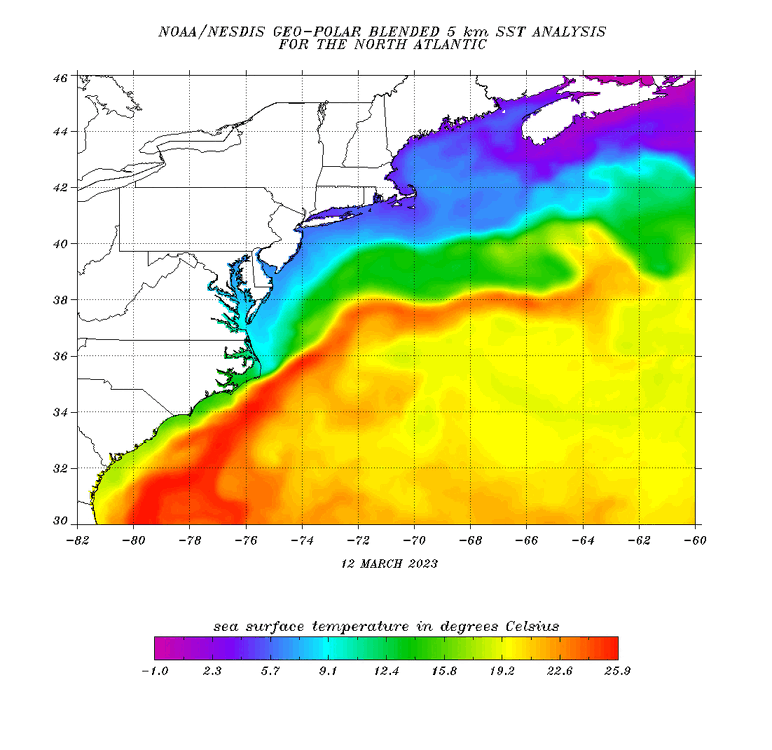
Yeah and unless there is some arctic outbreak that oozes down that week, the ssts certainly won't help (except maybe helping it bomb out). -

E PA/NJ/DE Spring 2023 OBS Thread
Hurricane Agnes replied to Hurricane Agnes's topic in Philadelphia Region
And the flakes have moved in. SN- and also breezy. -

E PA/NJ/DE Spring 2023 OBS Thread
Hurricane Agnes replied to Hurricane Agnes's topic in Philadelphia Region
-

E PA/NJ/DE Spring 2023 OBS Thread
Hurricane Agnes replied to Hurricane Agnes's topic in Philadelphia Region
The sun has been trying to come out here with a fast flow of various types of clouds out of the NW. But I know I'm between bands of "something" that is incoming. Currently mostly cloudy with breaks in the cloud deck, and 35 with dp 29. -

E PA/NJ/DE Spring 2023 OBS Thread
Hurricane Agnes replied to Hurricane Agnes's topic in Philadelphia Region
I know.... (was just adding the update for the thread) As an obs, ended up with the 44 as a high and 0.19" of rain yesterday. This morning it's currently damp and 35 with dp 29. -

E PA/NJ/DE Spring 2023 OBS Thread
Hurricane Agnes replied to Hurricane Agnes's topic in Philadelphia Region
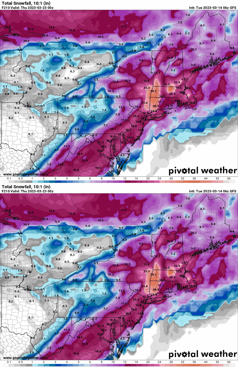
Last tweet with the summary graphic caps it at 12" up north at the higher elevations - -

E PA/NJ/DE Spring 2023 OBS Thread
Hurricane Agnes replied to Hurricane Agnes's topic in Philadelphia Region
Made it up to 45 as a high yesterday and after a 37 low, am at my high for the day so far, of 44, with dp 42. Have gotten 0.05" of precipitation through the day and it's currently misty and still 44. -

E PA/NJ/DE Spring 2023 OBS Thread
Hurricane Agnes replied to Hurricane Agnes's topic in Philadelphia Region
-

E PA/NJ/DE Spring 2023 OBS Thread
Hurricane Agnes replied to Hurricane Agnes's topic in Philadelphia Region
-

E PA/NJ/DE Spring 2023 OBS Thread
Hurricane Agnes replied to Hurricane Agnes's topic in Philadelphia Region
-

E PA/NJ/DE Spring 2023 OBS Thread
Hurricane Agnes replied to Hurricane Agnes's topic in Philadelphia Region
I think Ray worked a deal with the models to throw some lollipops at his parents' house in Ewing. -

E PA/NJ/DE Spring 2023 OBS Thread
Hurricane Agnes replied to Hurricane Agnes's topic in Philadelphia Region
Now getting all light rain here with temp up to 36 and dp 35. Have 0.09" for the day so far at post time (0.39" for the 2-day event). -

E PA/NJ/DE Spring 2023 OBS Thread
Hurricane Agnes replied to Hurricane Agnes's topic in Philadelphia Region
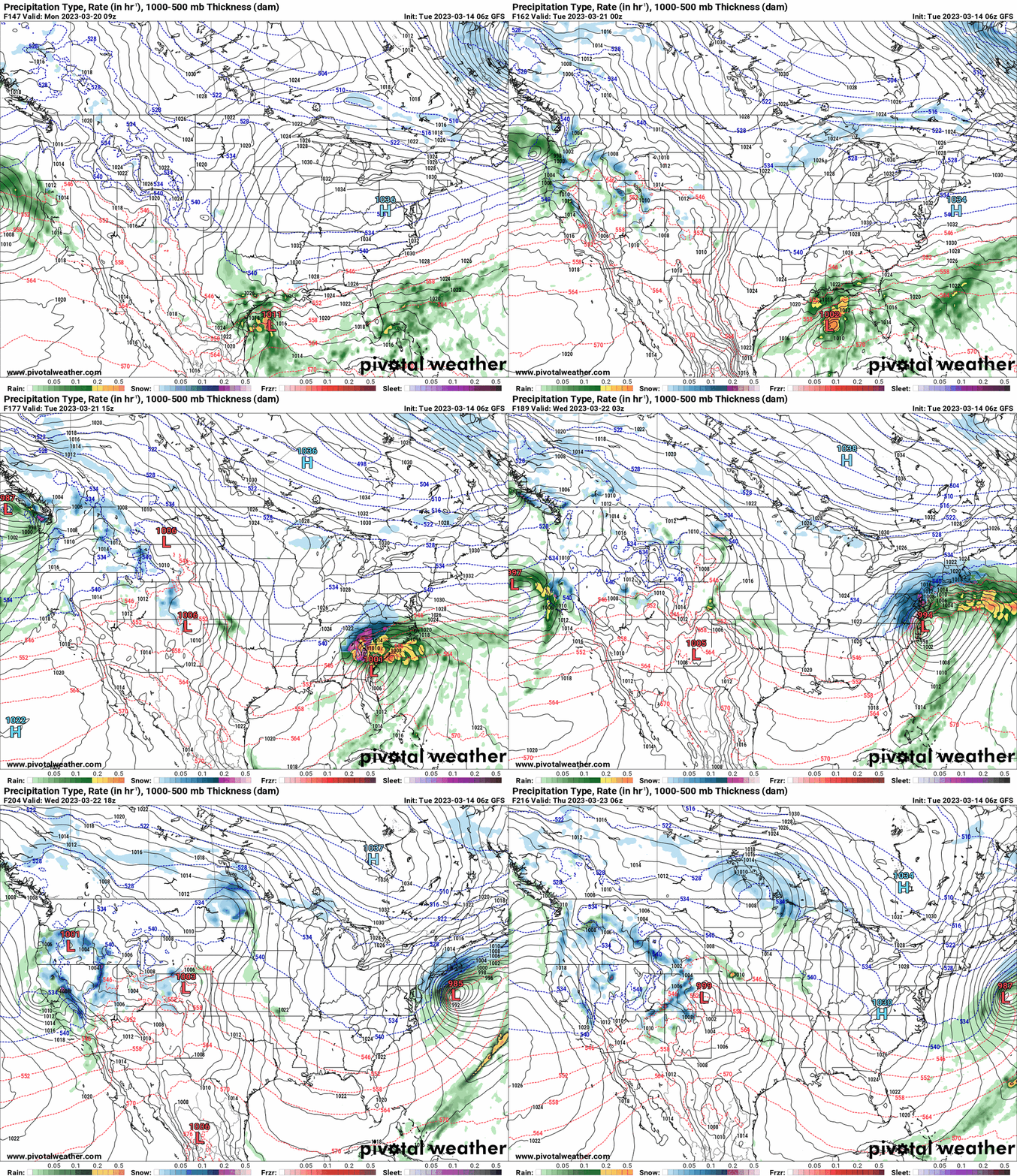
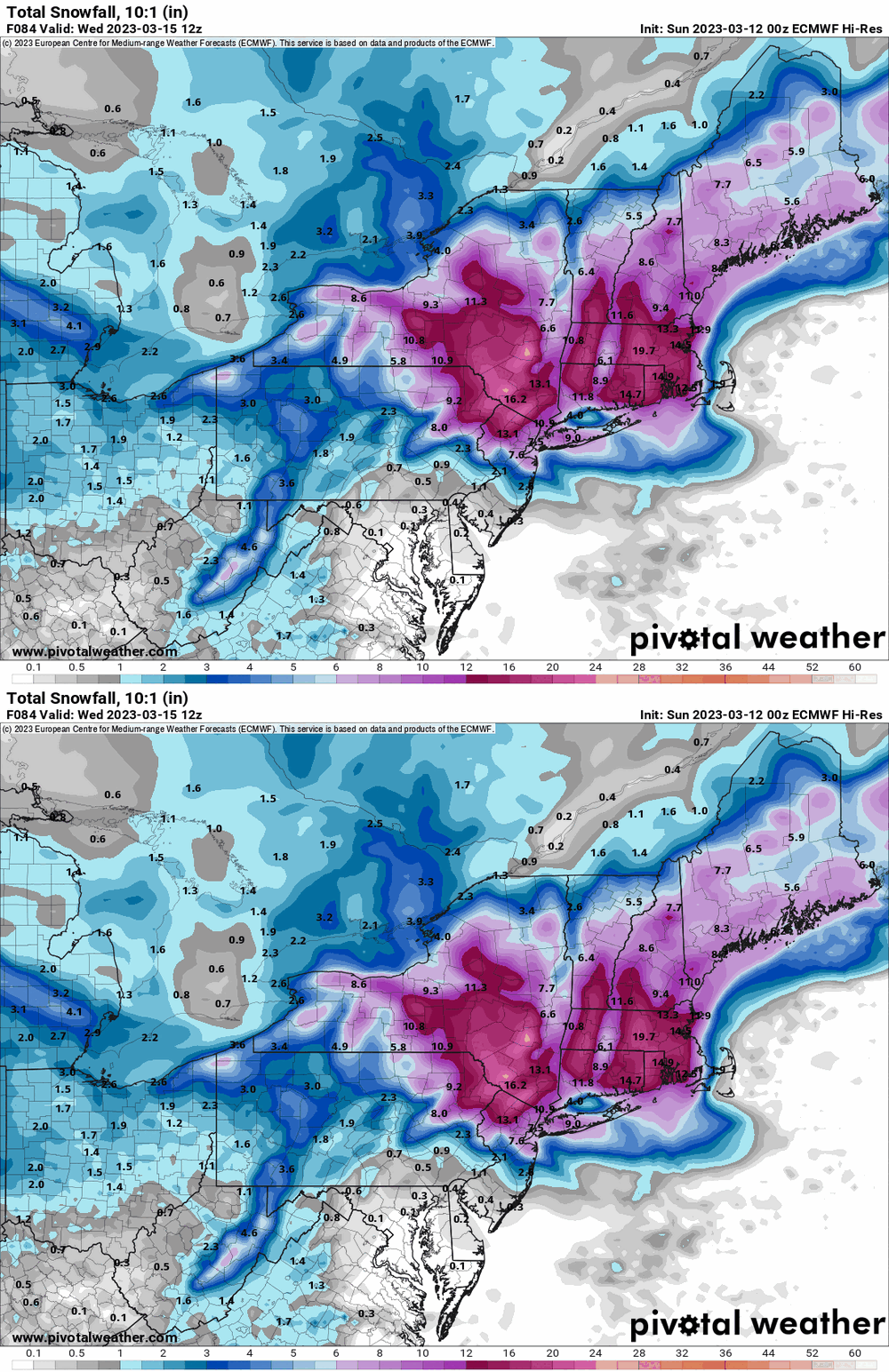
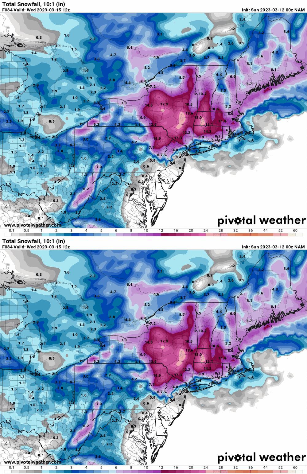
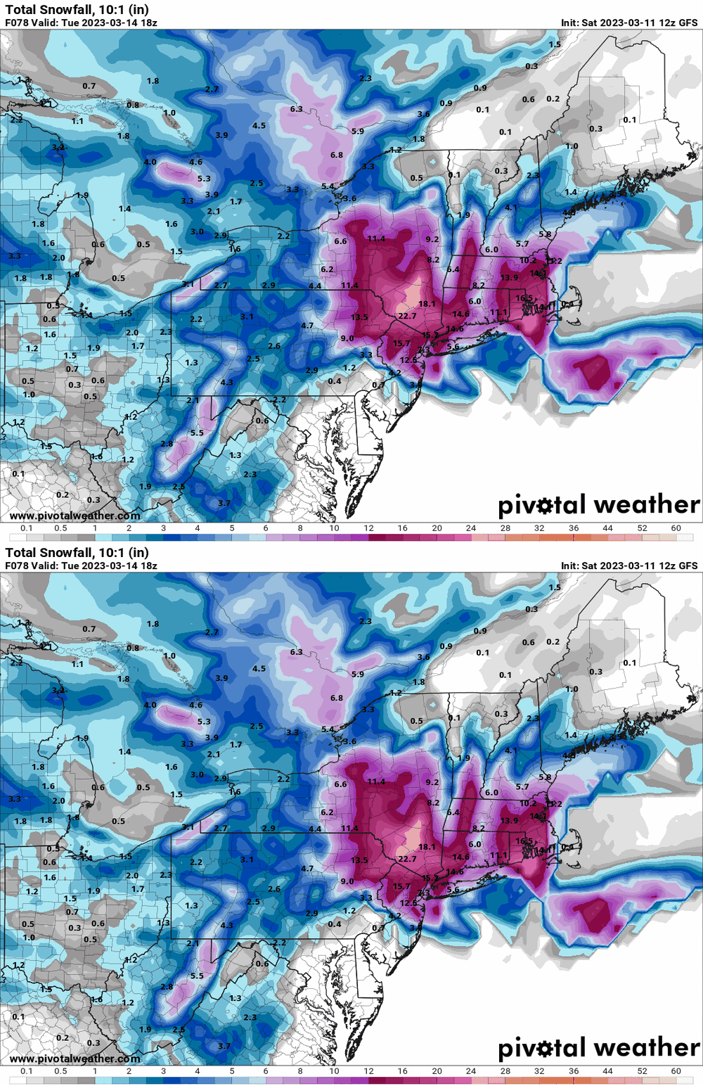
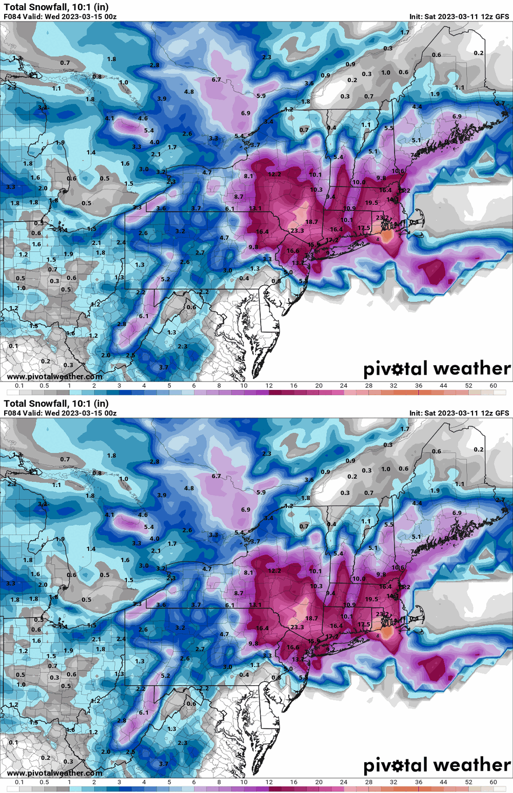
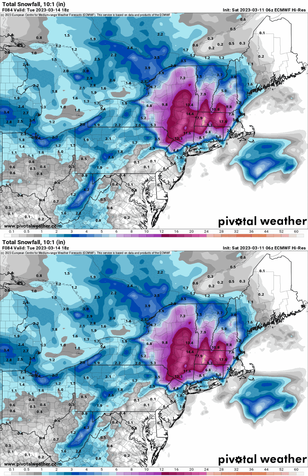
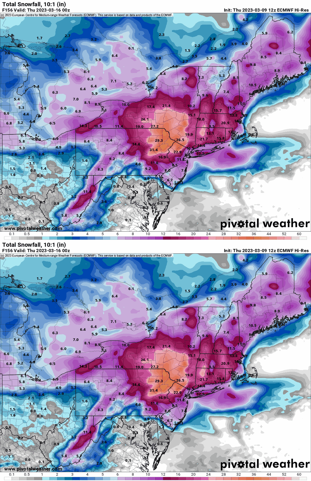
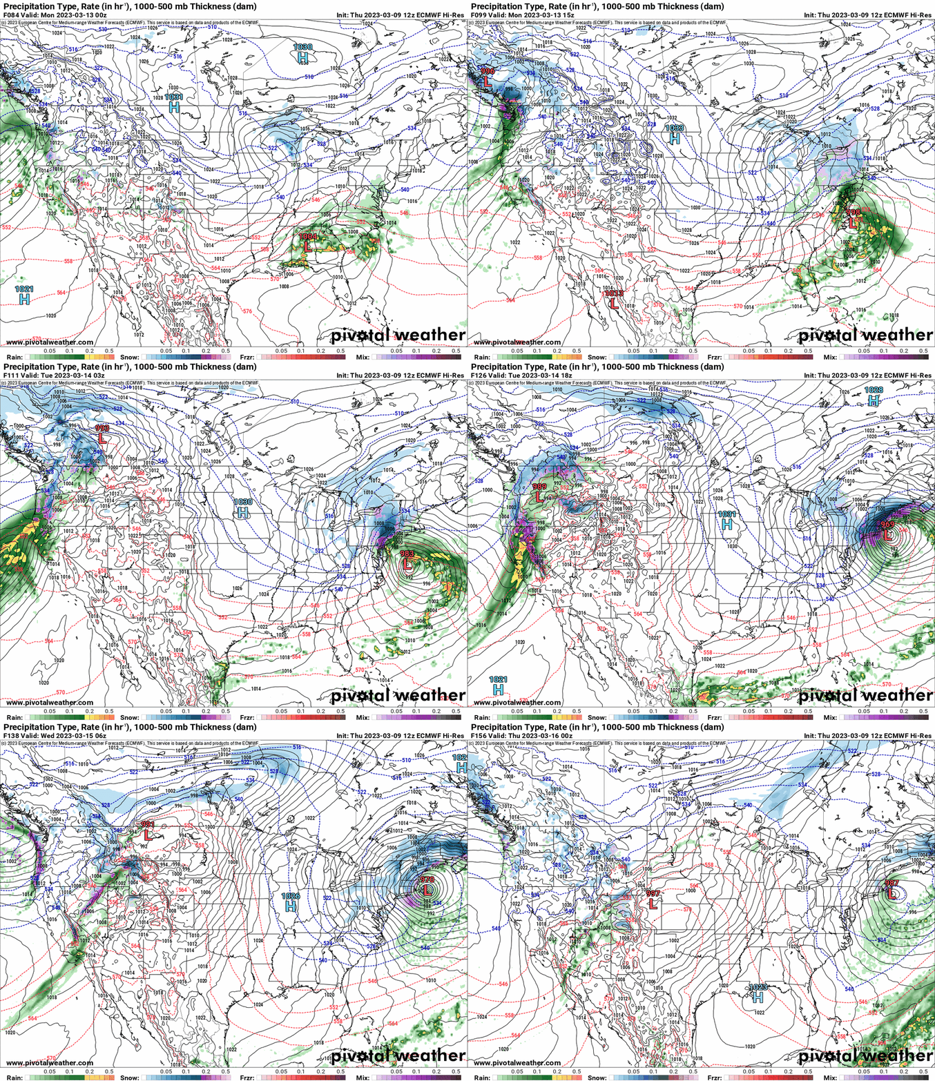
6z EC to go with the earlier maps. All of the guidance is showing the effect of that bombing nor'easter in downstate & eastern NY state. -

E PA/NJ/DE Spring 2023 OBS Thread
Hurricane Agnes replied to Hurricane Agnes's topic in Philadelphia Region
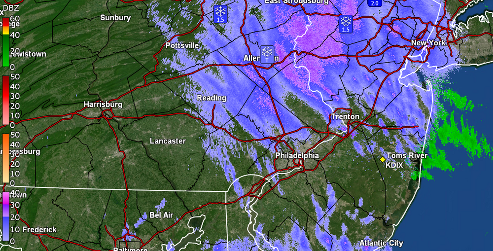
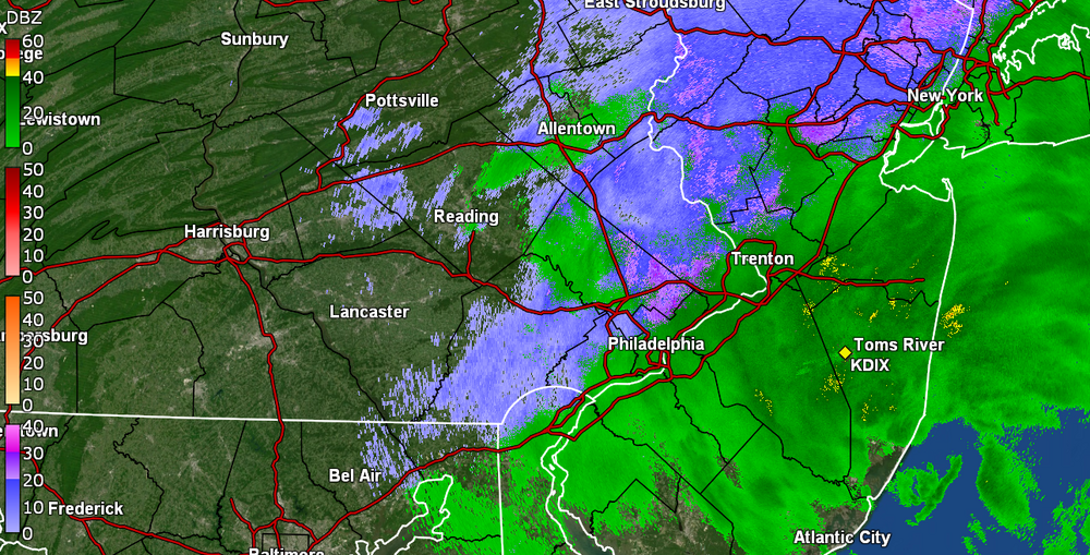
Now getting all flakes. Initially there was about a 0.1" slushy wet dusting on the cars but there is continual melting going on. Currently wet SN- and 35 with dp 34. -

E PA/NJ/DE Spring 2023 OBS Thread
Hurricane Agnes replied to Hurricane Agnes's topic in Philadelphia Region
-

E PA/NJ/DE Spring 2023 OBS Thread
Hurricane Agnes replied to Hurricane Agnes's topic in Philadelphia Region
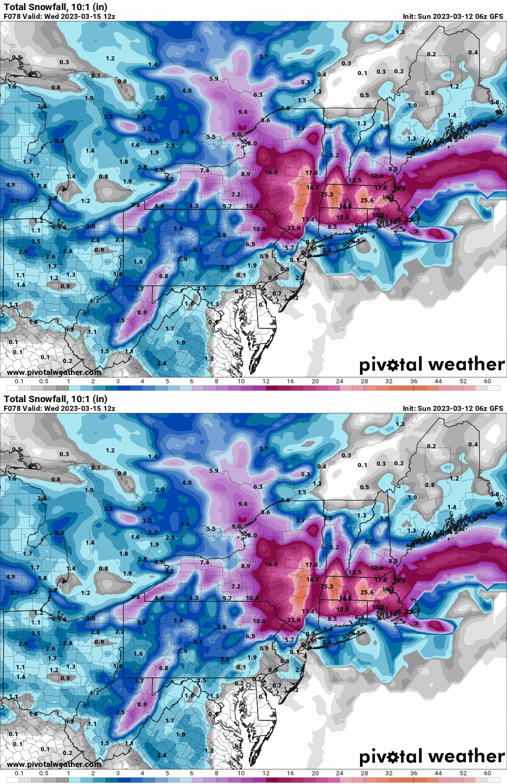
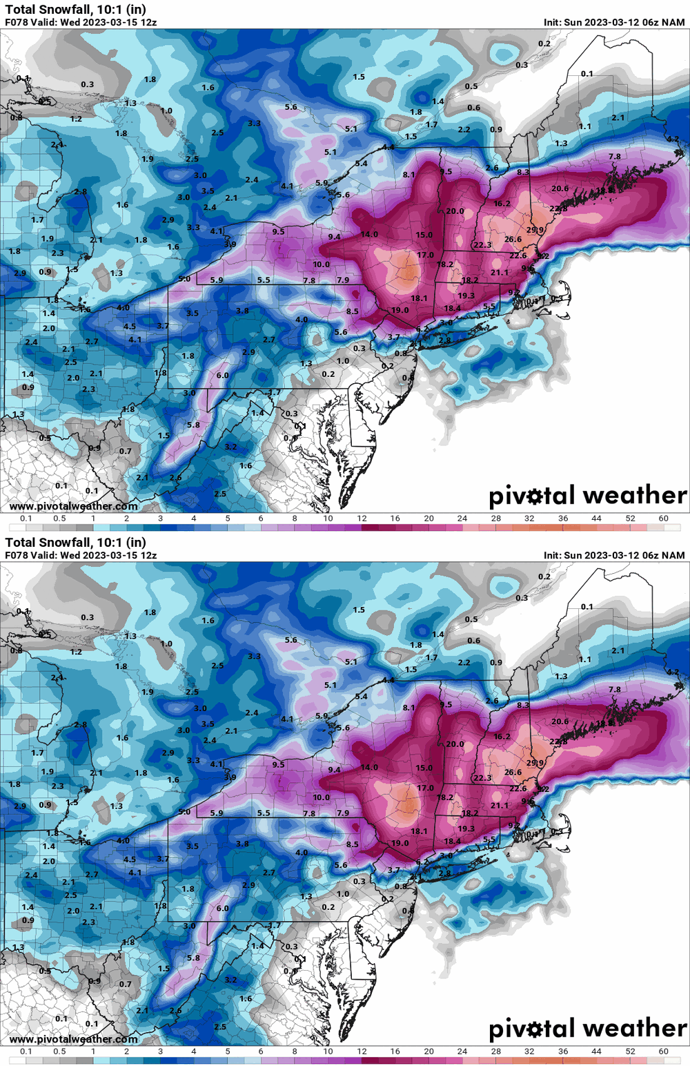
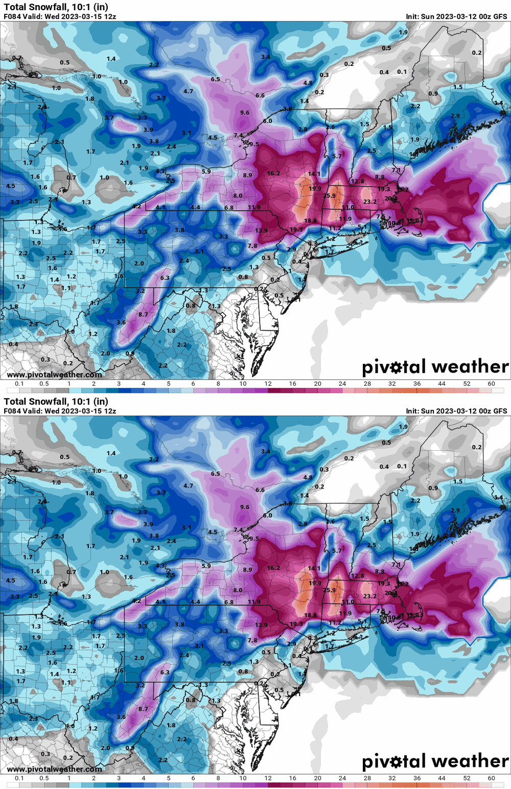
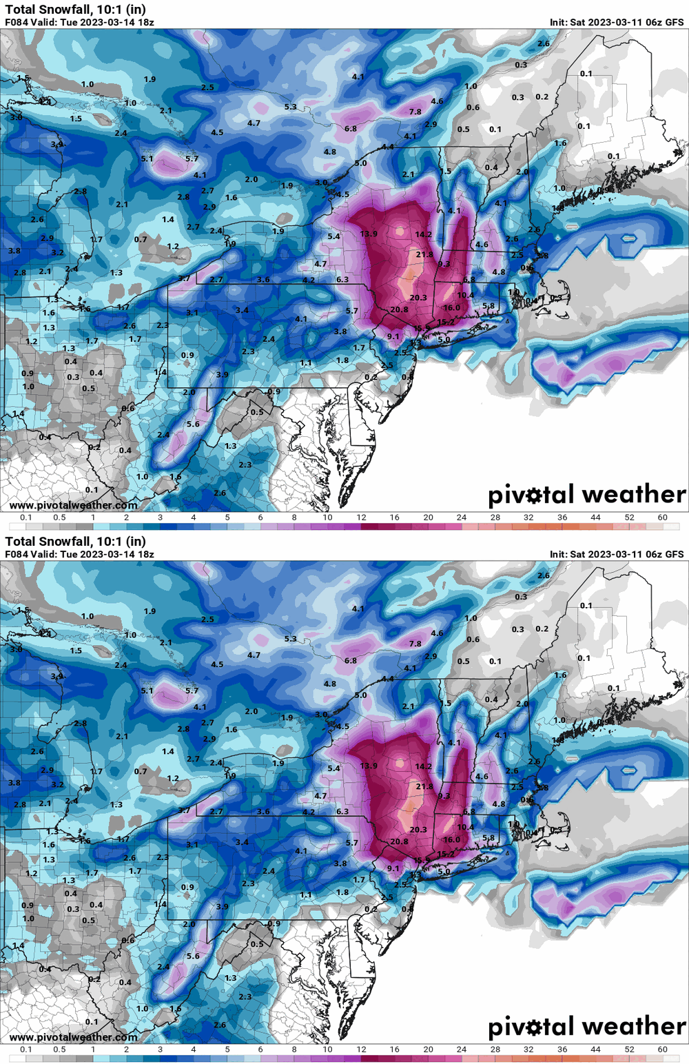
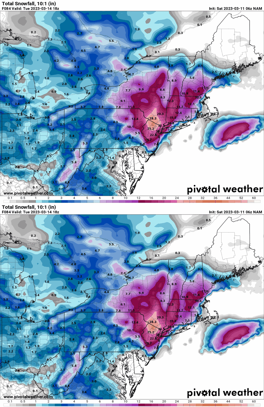
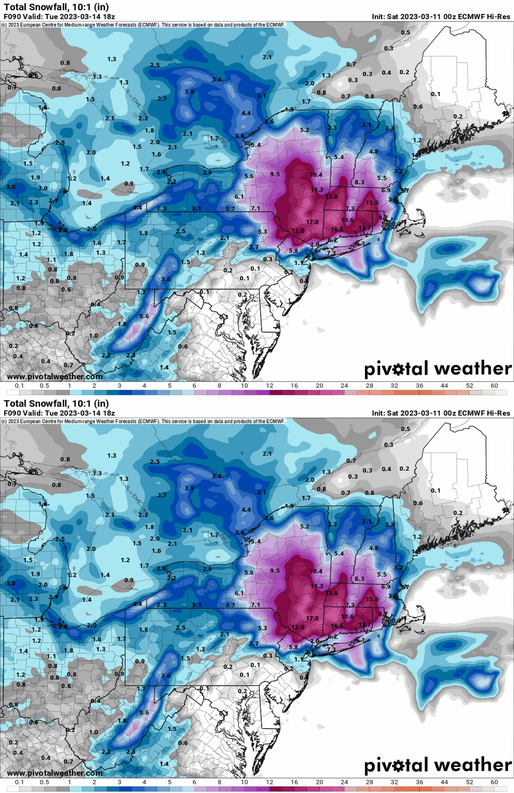
Ended up with a high of 46 yesterday and 0.30" of rain. Currently 37 and with dp 34 and mist, plus have 0.01" rain recorded. 6z GFS & NAM (GFS at NAM's max time). Edit to throw in the 0z EC (at the same timeframe). -

E PA/NJ/DE Spring 2023 OBS Thread
Hurricane Agnes replied to Hurricane Agnes's topic in Philadelphia Region
-

E PA/NJ/DE Spring 2023 OBS Thread
Hurricane Agnes replied to Hurricane Agnes's topic in Philadelphia Region
Good early morning (from where you are right now with the scorpions )! Sounds like you are describing what can happen with a nor'easter where the western side would be leeward to the moisture - the rain shadow! As an obs, I made it up to 46 for a high yesterday and bottomed out at 30 this morning. Currently partly sunny and 33.


