Hurricane Agnes
-
Posts
9,344 -
Joined
Content Type
Profiles
Blogs
Forums
American Weather
Media Demo
Store
Gallery
Everything posted by Hurricane Agnes
-
Now up to 0.97" and grateful!!! Getting a little over 1/4"/hr rates at the moment but so far, it has all been at varying rates in order to soak into the dry ground. Currently light rain and 67 with dp 67.
-
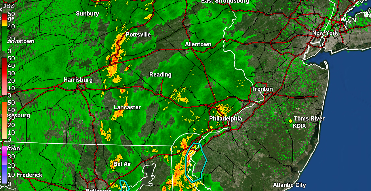
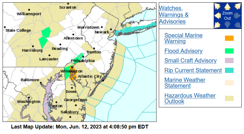
Flash Flood Warning for Wilmington and northern Delaware -
-
-
Now have twice as much in the bucket than all of May. Now up to 0.63" so far and saw that a Flood Advisory got lofted for Philly and Montco (but not on the sites yet). EDIT - finally up -
-
Finally getting some >0.5"/hr rain moving up from the southwest. Now up to 0.15" from the event so far. Temp is 70 with dp 68. Nice to have some yellows over me.

-
Zeus in his carriage has appeared! Thunder (and some convection in the area). Now up to 0.07".
-
Finally hit 0.02", which is 0.04" total for the month and 0.35" total for the past 6 weeks. I did get down to 70 earlier this morning as a "low" and made it to 82 before it started really clouding up. Currently 74 with light rain and dp a steamy 68.
-
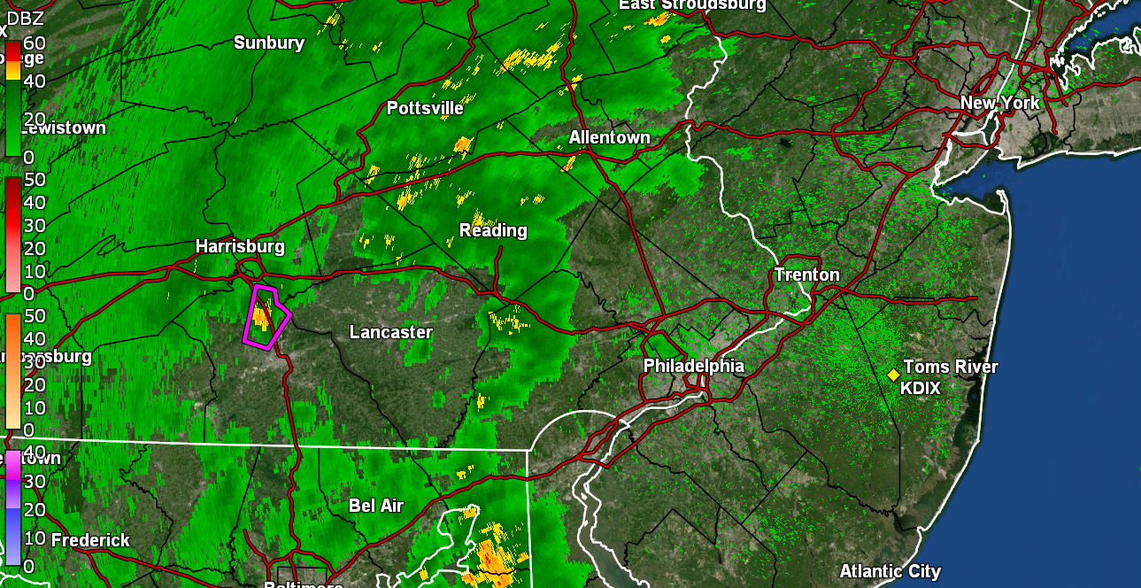
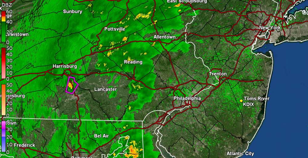
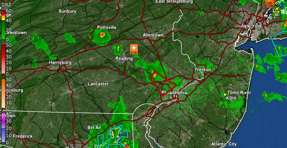
Looks like a TORR up south of Harrisburg.
-
SPC DY2 has the CWA in a Marginal Risk for severe tomorrow - Made it up to 89 today after a low of 60, before it clouded over and it's currently a hazy overcast and 84 with dp 59.
-
I ended up getting enough to wet the walks yesterday but not enough to tip the bucket. Was at 55 for a low this morning and made it up to 82 for a high and its currently 71 with dp 54. Hoping hoping hoping the Monday rain pans out.
-
Big old dry slot here in NW Philly. I doubt what is left will stay together as it all moves to the SE but hope I'll be lucky to get a a hundredth or so. Currently down to 61 with dp 53.
-
All north of my so far but the sky is angry! Lightning detector picking up some nearby convection although I haven seen/heard any yet. Low was 56 this morning and got up to 75 for a high. I am currently overcast and 69 with dp 49.
-
Yeah, the same happens with volcanic ash (like what Mt. Kilauea is spewing in Hawai'i at the moment). But I would think at night, it would act as a "blanket" and keep the "heat" in too. I managed to get up to 75 today, with the sun out (or at least visible) much more than yesterday and am currently down to a sunny but hazy 73 with dp 43.
-
I don't know how radiational cooling could even be effective with a thick cloud of soot overhanging the area. Must mean the cold air coming down from those Canadian providences thanks to that low up near there, is still pretty cold. I did get down to 51 as a low this morning and currently have a hazy, smoke-filled overcast sky and a temp of 57, with dp 43.
-
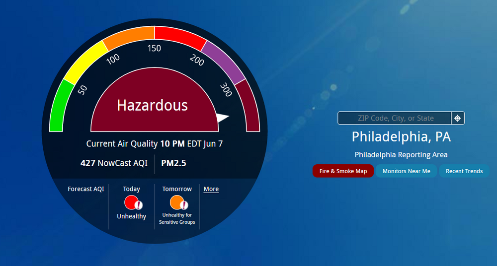
Okay thanks! I know some around here some actually have intake and exhaust vents outside (including those with heat pumps) so I never really looked. High was 75 and and it's currently a smokey 63 with dp 40 and vis. down to about a mile.
-
Did a quick search because I remembered we had a similar bad couple days with smoke from Canadian wildfires and it was 2002 - https://earthobservatory.nasa.gov/images/2596/smoke-from-canadian-fires-blankets-eastern-us https://earthobservatory.nasa.gov/images/9822/fires-in-quebec-canada-send-smoke-to-us Back then, it happened in July but as we know, there was a similar drought going on that year. This tweet was done around noon but it looks like that thick plume in the video clip is down here now -
-
Didn't have that much of a haze down at ground level yesterday (mostly overhead) as I was out and about but was just out watering before 3 pm and OMG, it's like a fog of it that has settled around the woods and buildings in this area. I turned my central air off so it wouldn't suck the smoke in and have my air purifiers going on the highest setting. Had bottomed out at 55 this morning and hit 75 for a high so far today, but i think the smoke blocked out enough to drop me down to a current smokey 73 and dp a dry 40.
-
And.... out came the sun and dried up all the rain and the entsy weentsy spider when up the spout again. Everything is blowing to the S/W of me. Temp is 71 with dp 55.
-
Finally got a brief sprinkle enough to wet the walk and tip the bucket with 0.01". Lock it in!
-
Am still waiting for something more than drops. The one cell that survived the early trip has been running along where the Schuylkill enters the city to the SW of me. There are are some darker greens on radar but it's like the air is so dry that it's pretty much virga at the moment. My lightning detector is picking up some convection although I'm not hearing any thunder. Temp is down to 70 with dp 53.
-
They just threw you guys under a STS.
-
Went out to put my patio umbrella down so I can cash in on the 40 drops I have gotten so far. Before it really started clouding over, it did touch 83 this afternoon but is now down to 78 with dp 50, and some drops.
-
LOL Just got all the STS warning notifications. Will see if that stays together by the time it gets to me (IF it gets to me).
-
Was wondering what was up with the notifications and checked my radar and should have known! Those cells look like they will probably miss me to the southwest (unless something else bubbles up). The sun did manage to come out later this morning although there has still been a haze and air quality alert was just announced for tomorrow too. Currently a dry 81 with hazy skies and dp 53.
-
Got up to 78 for a high yesterday and bottomed out at 58 this morning. Definitely have a yellowish, crayola "dandelion" colored hazy wash over a background of slate. Currently hazy overcast and 61 with dp 45 and knowing we have a Red Flag Warning up for the area.