Hurricane Agnes
-
Posts
9,344 -
Joined
Content Type
Profiles
Blogs
Forums
American Weather
Media Demo
Store
Gallery
Everything posted by Hurricane Agnes
-
E PA/NJ/DE Spring 2023 OBS Thread
Hurricane Agnes replied to Hurricane Agnes's topic in Philadelphia Region
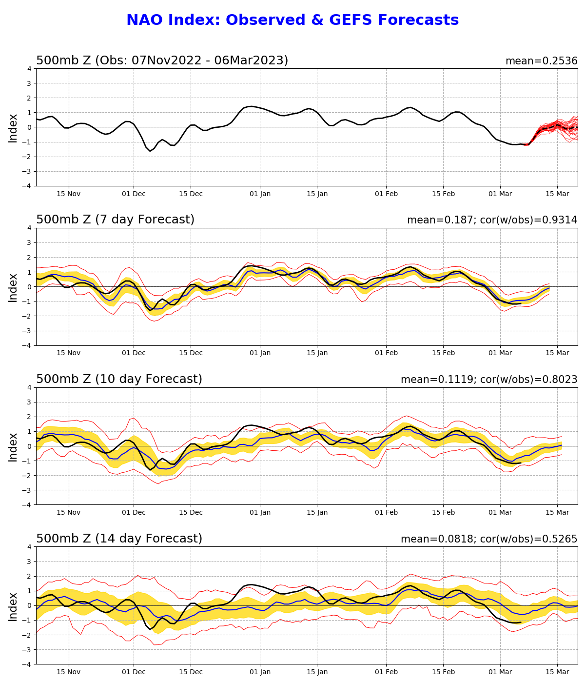
But by then we will be well into spring and moving to summer. Meanwhile, the NAO is heading for neutral to positive in that storm's time frame. I know the NAO is less an indicator out of met winter, but this past year, no matter how negative it has been, it has been unable to overcome other factors.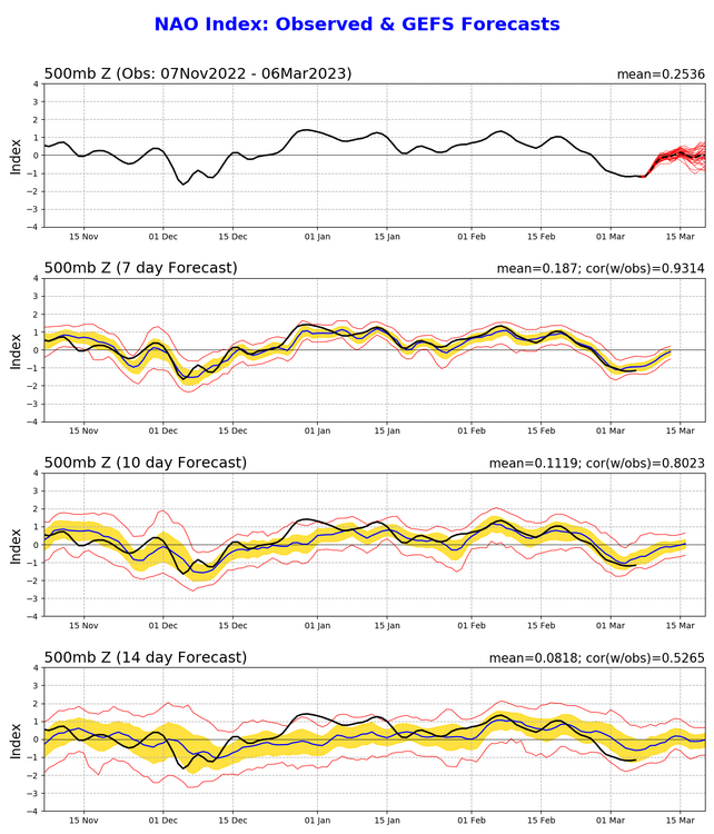
-
E PA/NJ/DE Spring 2023 OBS Thread
Hurricane Agnes replied to Hurricane Agnes's topic in Philadelphia Region
La Nina is not dead yet. Excerpt from the last update - The Great Lakes never froze over let alone have much frozen on them at all. As of last month, there was only about 7% ice coverage on them (which did make them open for business for the huge lake effect events that we saw whenever a PV dropped down) - https://research.noaa.gov/article/ArtMID/587/ArticleID/2941/Low-ice-on-the-Great-Lakes-this-winter What HAS changed is the MJO, which is favorable to get more cold air down into the CONUS. But the equinox is in a couple weeks.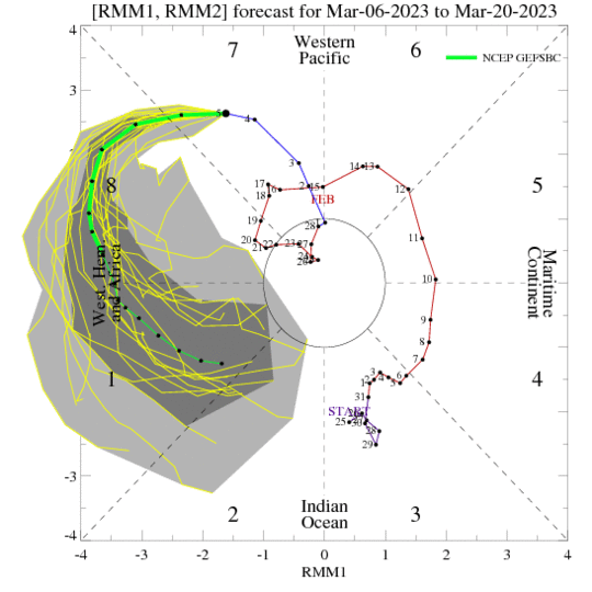
-
E PA/NJ/DE Spring 2023 OBS Thread
Hurricane Agnes replied to Hurricane Agnes's topic in Philadelphia Region
The issue had been lack of cold air and a warm ocean. The models have been unable to deal with a three-peat La Nina pattern as we have seen since November chasing "10-day storms". The surface maps tell us we are going to get "something" but what the p-type is will continually be up in the air. ETA - the below has been the case all winter -
-
E PA/NJ/DE Spring 2023 OBS Thread
Hurricane Agnes replied to Hurricane Agnes's topic in Philadelphia Region
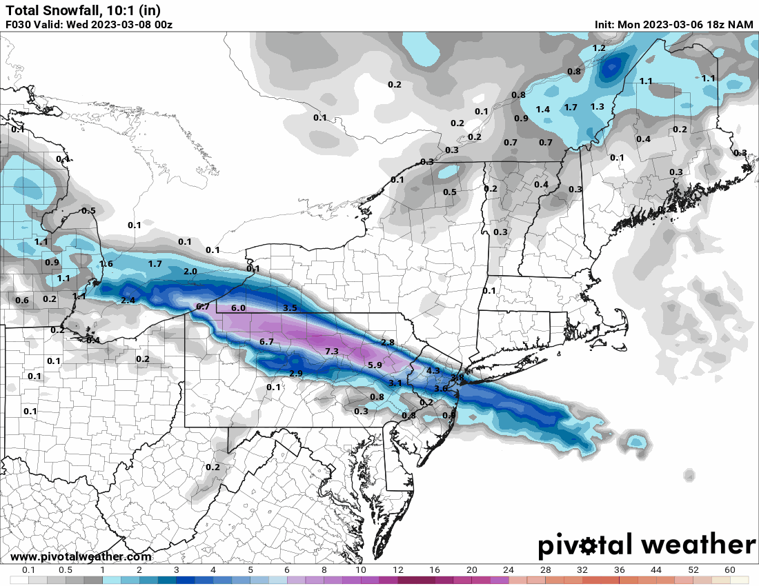
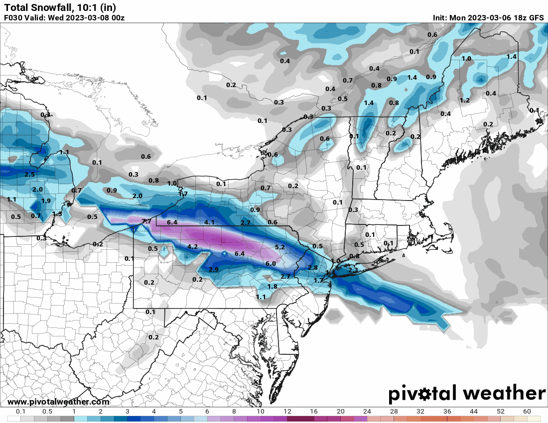
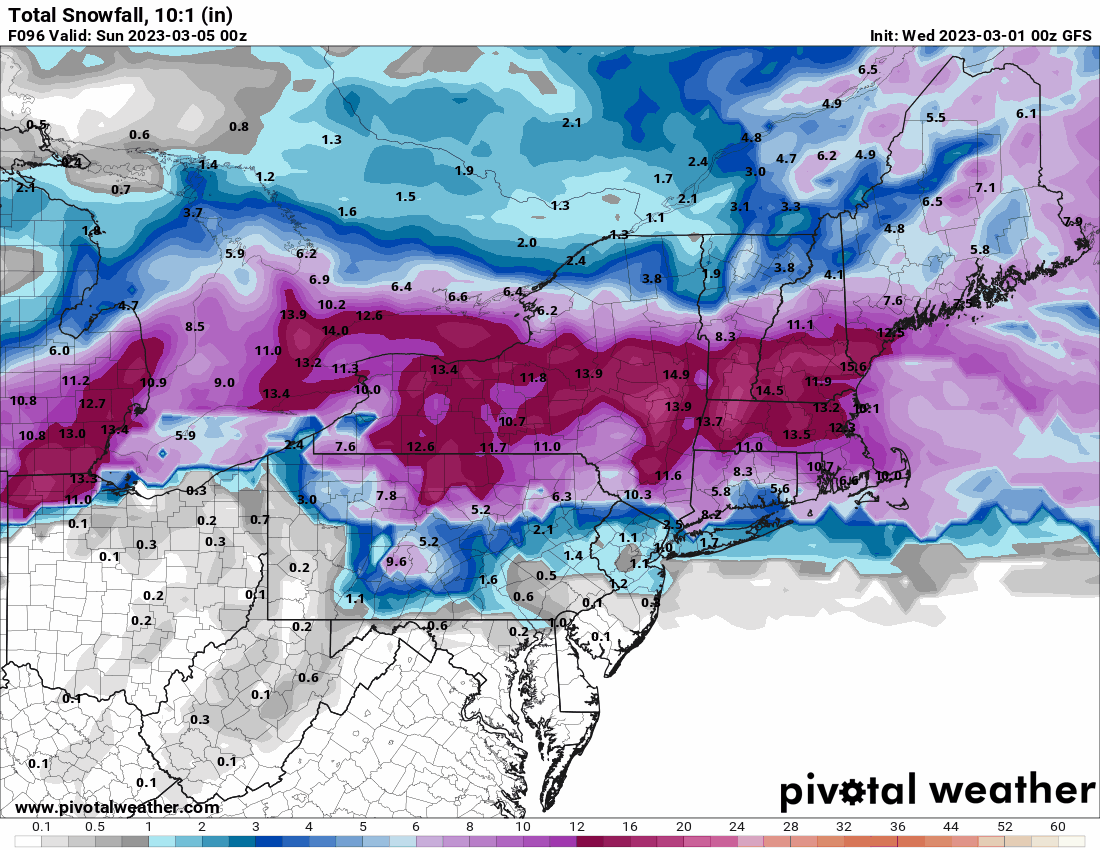
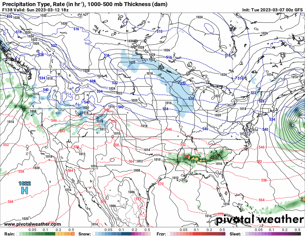
0z Euro MECS, 0z GFS slider!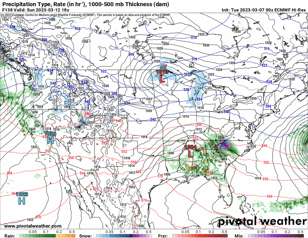
-
E PA/NJ/DE Spring 2023 OBS Thread
Hurricane Agnes replied to Hurricane Agnes's topic in Philadelphia Region
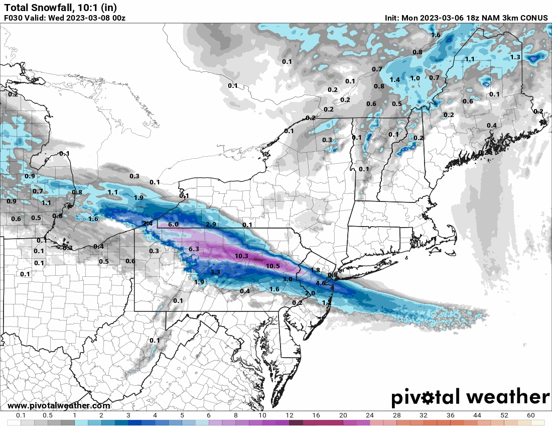
Both 3k & 12k 18z NAMs. Also as an obs given today was a rare sunny day (although it did start clouding up on and off), I bottomed out at 36 this morning and am currently at my high of 52 with dp 29. (edit to add in the 18z GFS that I meant to post earlier)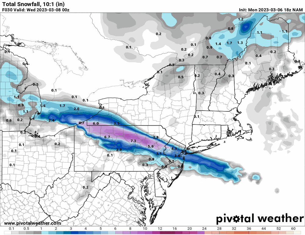


-
E PA/NJ/DE Spring 2023 OBS Thread
Hurricane Agnes replied to Hurricane Agnes's topic in Philadelphia Region
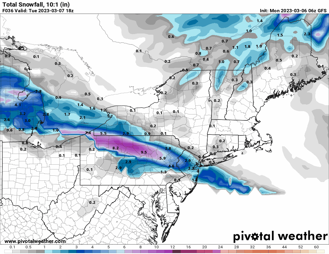
6z GFS.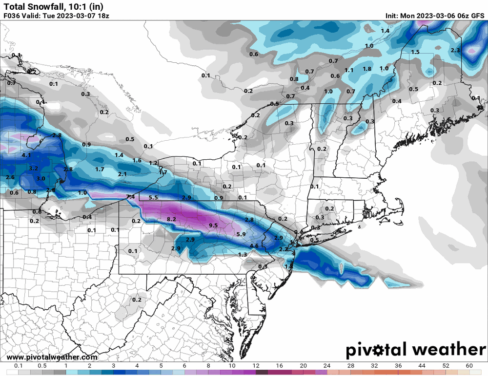
-
E PA/NJ/DE Spring 2023 OBS Thread
Hurricane Agnes replied to Hurricane Agnes's topic in Philadelphia Region
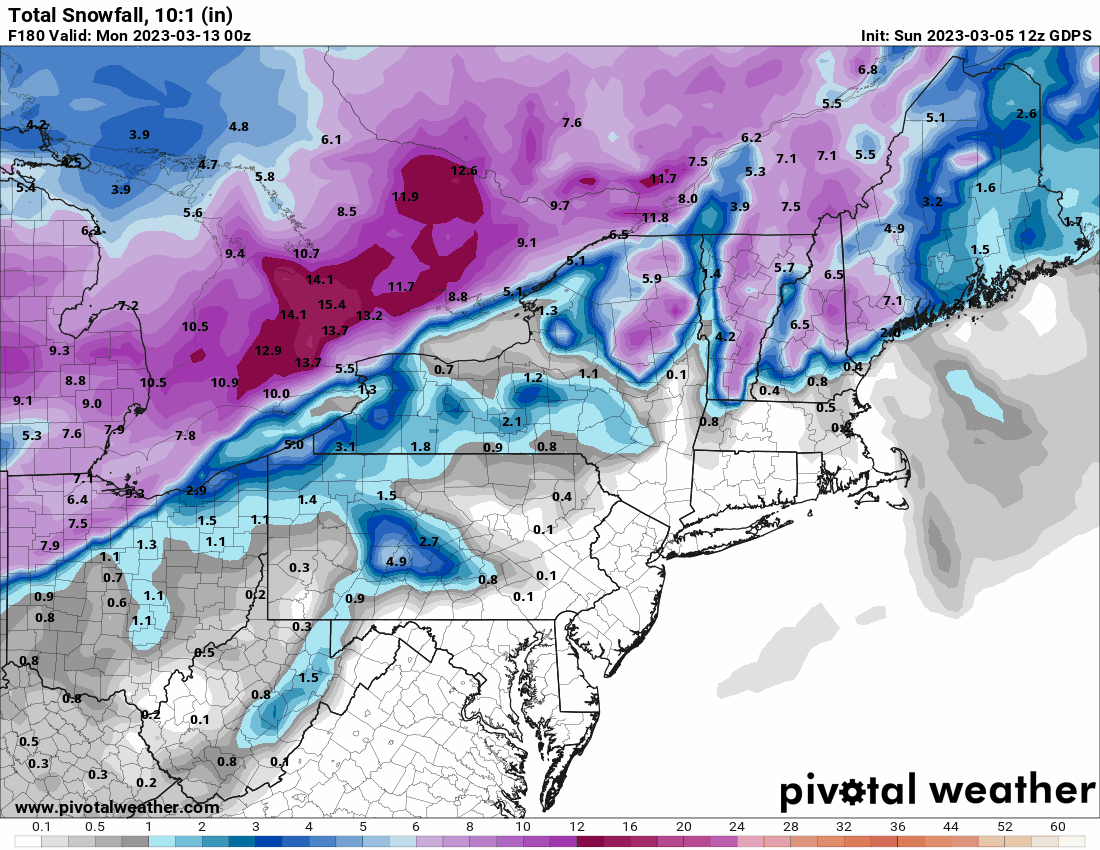
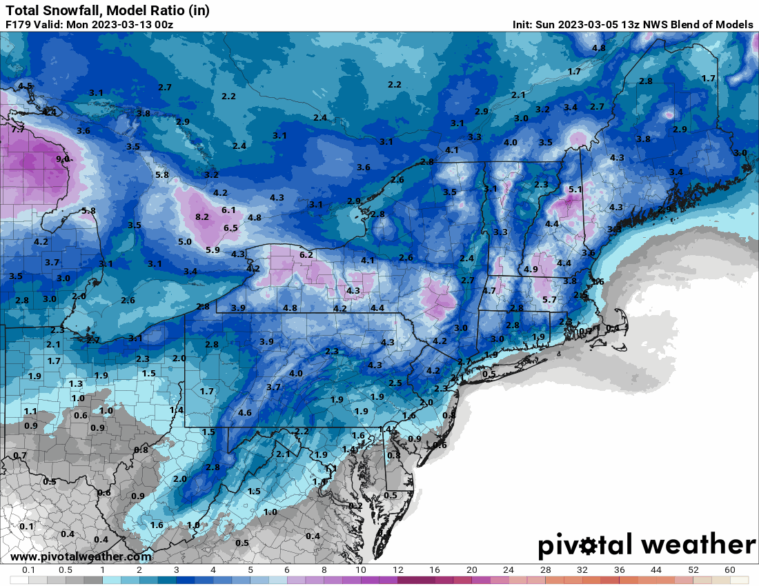
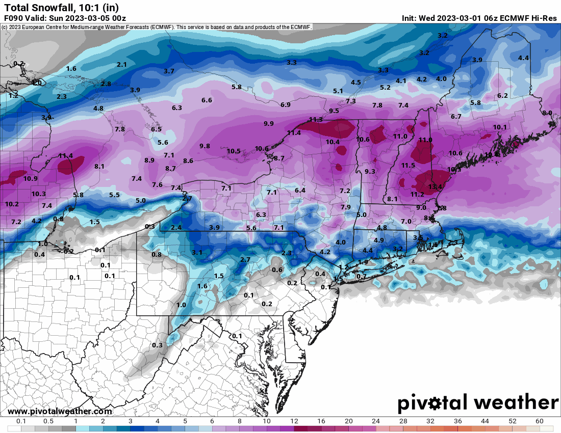
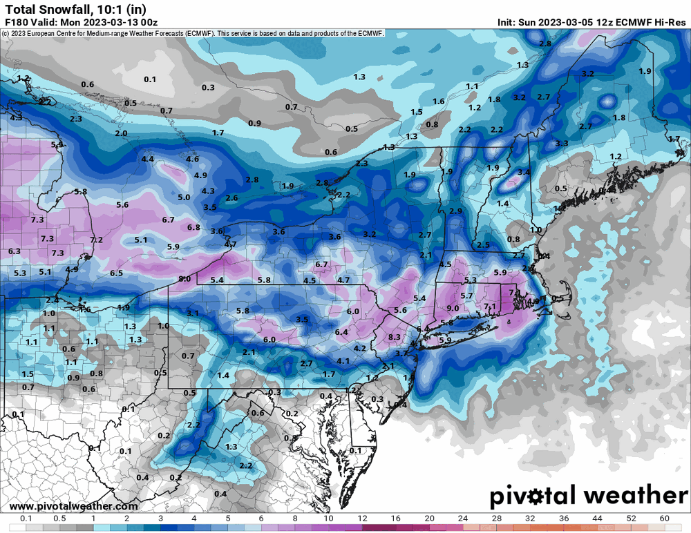
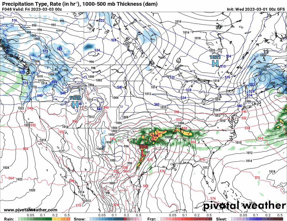
The options (12z) for next weekend (when I was planning to attempt to go to the Flower Show) -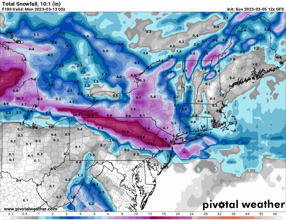


-
E PA/NJ/DE Spring 2023 OBS Thread
Hurricane Agnes replied to Hurricane Agnes's topic in Philadelphia Region
As long as we get normal or close to normal precipitation, that helps to stave off triple digit temps in the summer. If we get into a dry begets dry pattern, then the temps can soar fairly quickly as there would be no need to waste energy and time evaporating ground moisture. As an obs, I ended hitting 47 for a high yesterday after a 33 low, and had a trace snow and a total 0.83" liquid (mostly rain). This morning I got an additional 0.37" (so far), for a 2-day event total of 1.20". Currently misty with low stratus and 45 with dp 45. -
E PA/NJ/DE Spring 2023 OBS Thread
Hurricane Agnes replied to Hurricane Agnes's topic in Philadelphia Region
No more mix but just some light drizzle with temp at 37 and dp 34. Have 0.01" in the bucket so far. -
E PA/NJ/DE Spring 2023 OBS Thread
Hurricane Agnes replied to Hurricane Agnes's topic in Philadelphia Region
Had popped out to adjust a temp probe and am getting a snow/rain mix. Have been having virga for the past hour. Currently light rain/snow mix and 41 with dp 29, -
E PA/NJ/DE Spring 2023 OBS Thread
Hurricane Agnes replied to Hurricane Agnes's topic in Philadelphia Region
WPC DY1 has the area blocked off for possible flood risks - SPC DY2 has us penciled in for poss. thunderstorms - After the fog and drizzle and mist ended (no measurable precip) had some sun before it eventually clouded up again. Temp did make it up to 57 for a high after a low of 41. Currently overcast and 56 with dp 33. -
E PA/NJ/DE Spring 2023 OBS Thread
Hurricane Agnes replied to Hurricane Agnes's topic in Philadelphia Region
6z Euro says "No snow for you" (down in the SE) this weekend.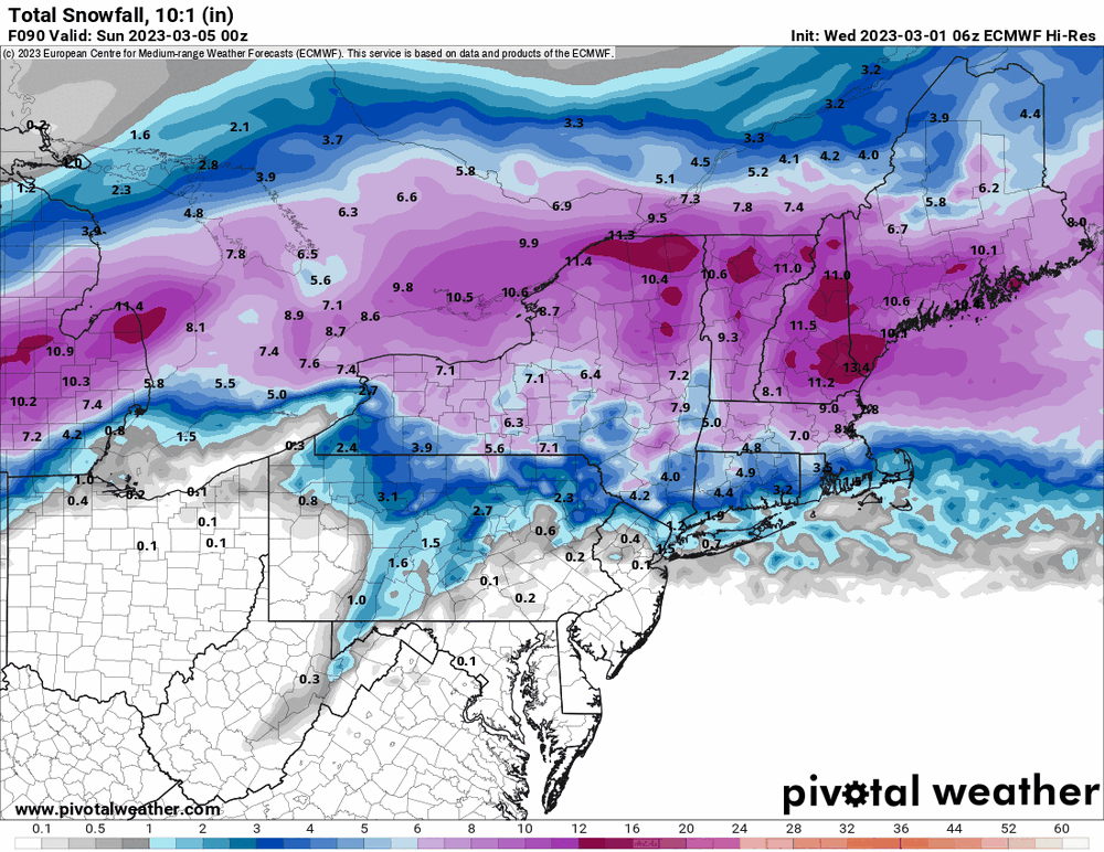
-
E PA/NJ/DE Spring 2023 OBS Thread
Hurricane Agnes replied to Hurricane Agnes's topic in Philadelphia Region
Bottomed out at 31 this morning and Jack Frost had whipped out the spray bottle and painted the land silvery... But all his work is gone now after the puffs of breezes killed any further radiational cooling. Currently partly sunny and 41 with dp 32. -
E PA/NJ/DE Spring 2023 OBS Thread
Hurricane Agnes replied to Hurricane Agnes's topic in Philadelphia Region
Met winter stats in and not unexpected! -
E PA/NJ/DE Spring 2023 OBS Thread
Hurricane Agnes replied to Hurricane Agnes's topic in Philadelphia Region
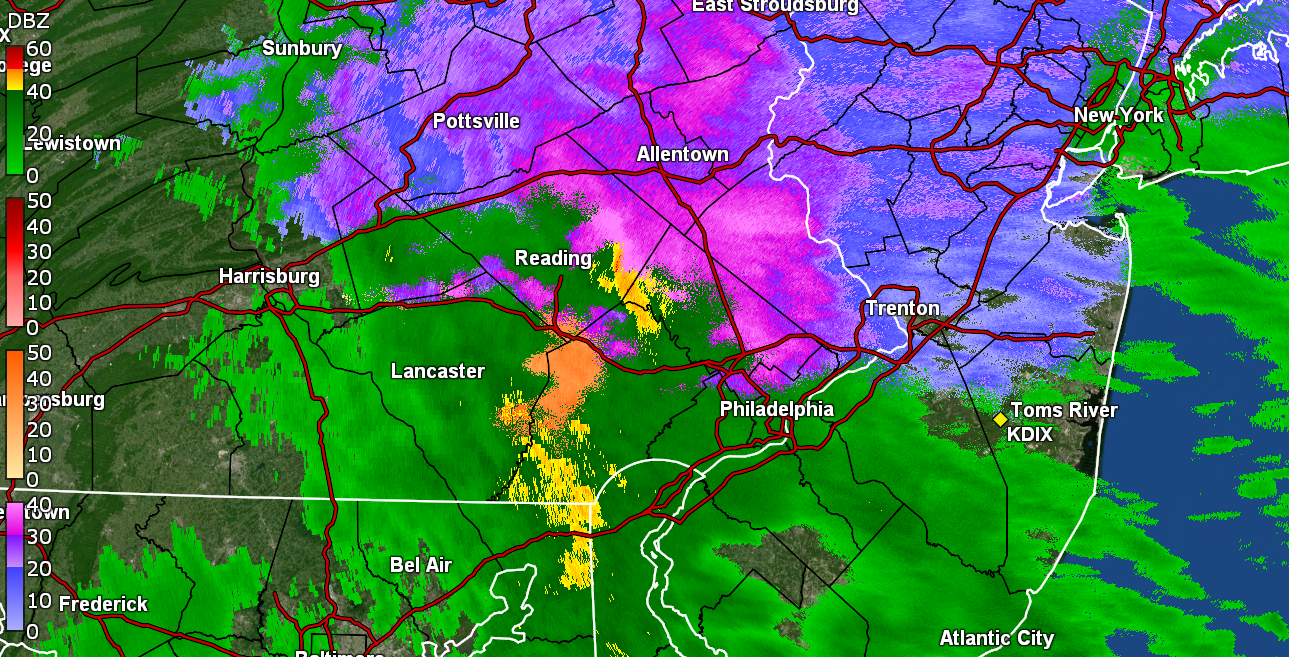
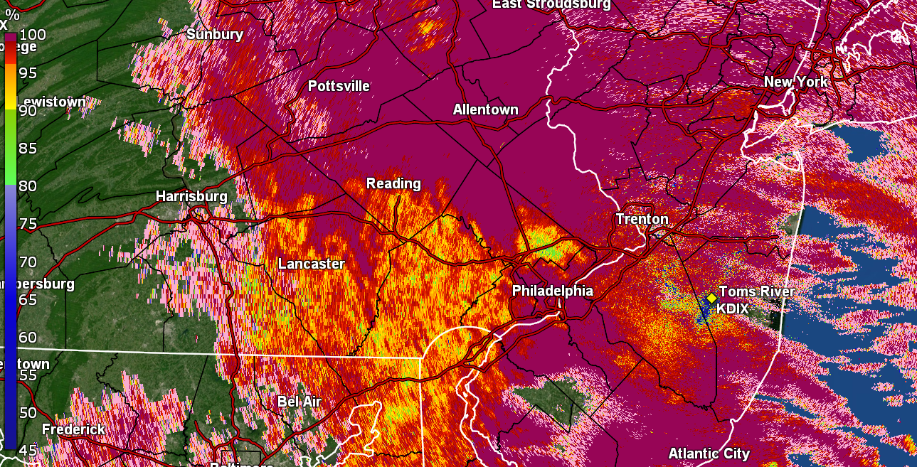
Crush job! (looks like some kind of double-low/Miller B setup)

-
E PA/NJ/DE Spring 2023 OBS Thread
Hurricane Agnes replied to Hurricane Agnes's topic in Philadelphia Region
Although I didn't see any "visible" fog here, the cars and even roofs of houses have some heavy frost that settled on them. Almost looks like a light coating of snow. The temp here is now 32 with dp 30 just before sunrise. -
E PA/NJ/DE Spring 2023 OBS Thread
Hurricane Agnes replied to Hurricane Agnes's topic in Philadelphia Region
6z GFS a bit more frozen down this way than 0z.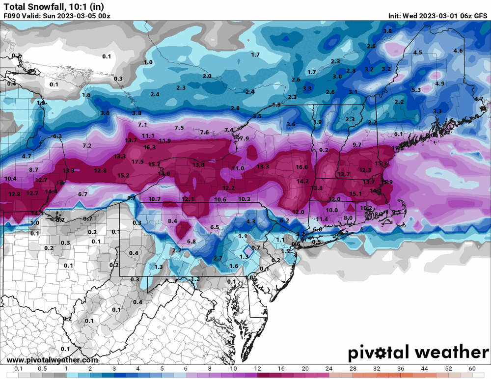
-
E PA/NJ/DE Spring 2023 OBS Thread
Hurricane Agnes replied to Hurricane Agnes's topic in Philadelphia Region
Mt. Holly's look at February stats including 2nd warmest on record for a couple CWA sites - +6.8 for PHL. -
I remember dragging one of my younger sisters to go see that '74 cup on display downtown in the lobby of one of the old bank buildings (we were both going to school downtown at the time).
-
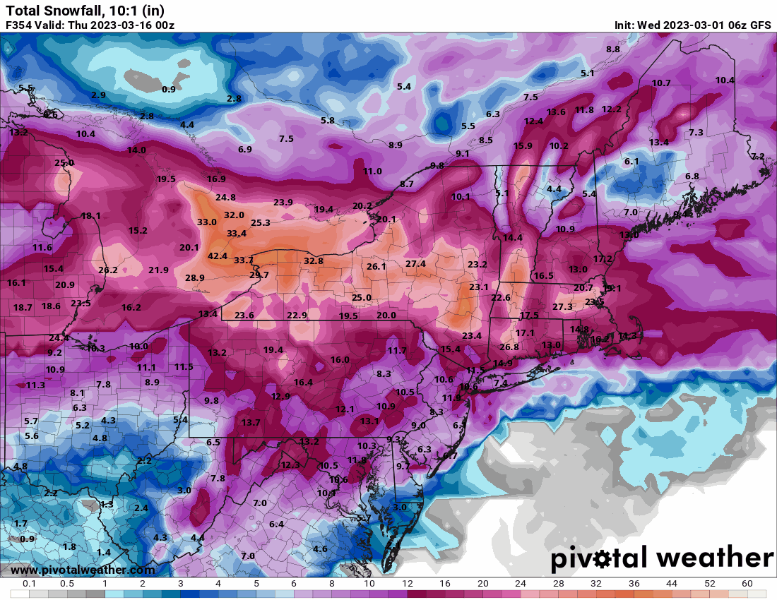
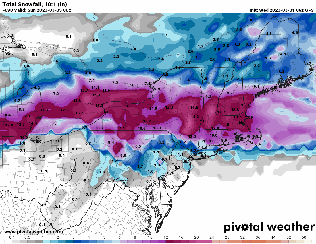
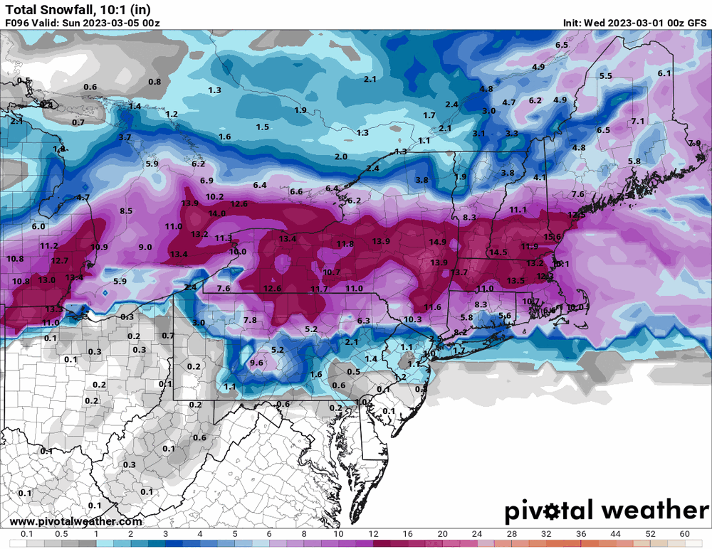
Currently 33 with dp 33 IMBY as all eyes are on a repeat event this coming weekend. Throwing in the 0z GFS for this weekend. Looks like this last storm.
-
E PA/NJ/DE Winter 2022-2023 OBS Thread
Hurricane Agnes replied to Ralph Wiggum's topic in Philadelphia Region
As the last of precip appears to crawling away to the east, I so far got 0.32" of liquid total yesterday and another 0.22" today, for a 2-day event total of 0.54", along with 0.30" of snow/sleet/graupel before it all melted away. Temp has actually crept up overnight (low 34 just after midnight) and it is currently misty with low stratus and 36, with dp 36. -
E PA/NJ/DE Winter 2022-2023 OBS Thread
Hurricane Agnes replied to Ralph Wiggum's topic in Philadelphia Region
Getting heavy drippage here with the melting but did get out there to measure 0.30" once the frozen pretty much stopped, which is the most this season so far and will take me over the 1" mark. Currently light rain and mist and 33 with dp 33 and 0.09" liquid. -
E PA/NJ/DE Winter 2022-2023 OBS Thread
Hurricane Agnes replied to Ralph Wiggum's topic in Philadelphia Region
Finally got chance to go look outside and have a good coating. Looks like a snow/rain mix (mostly snow but wet flakes coming down like white rain). Has accumulated on the cars and grassy surfaces but not so much the walks or streets (yet). Current temp is a marginal 33 with dp 32, snow mix and fog, and have 0.07" precip. -
E PA/NJ/DE Winter 2022-2023 OBS Thread
Hurricane Agnes replied to Ralph Wiggum's topic in Philadelphia Region
Have been getting a rain/sleet mix - heavy enough to hear the pingers bouncing off stuff outside. Currently 37 with dp 33 and 0.03" registered precip.
-
E PA/NJ/DE Winter 2022-2023 OBS Thread
Hurricane Agnes replied to Ralph Wiggum's topic in Philadelphia Region
Getting a light ip/rain mix. Nothing measurable yet but it is wetting the walk. DP "shot up" to 33 and temp is down to 42. My Upper Darby sis just texted that she is getting some sleet.