Hurricane Agnes
-
Posts
9,344 -
Joined
Content Type
Profiles
Blogs
Forums
American Weather
Media Demo
Store
Gallery
Everything posted by Hurricane Agnes
-
E PA/NJ/DE Winter 2022-2023 OBS Thread
Hurricane Agnes replied to Ralph Wiggum's topic in Philadelphia Region
My non-diurnal "high" was 60 just after 2 am and I'm currently at my "low "with it mostly sunny and 50 with dp 35 (I expect the temp will drop further overnight to revise the low for the day). I did have some kind of non-measurable precip the past couple days that wet the walks but didn't tip the bucket. -
E PA/NJ/DE Winter 2022-2023 OBS Thread
Hurricane Agnes replied to Ralph Wiggum's topic in Philadelphia Region
Amazing but after a low of 32 this morning, I tapped 61 today and that happened about 30 minutes ago despite the sun going in and out. My snowdrops are up and blooming to boot. Currently partly sunny and 60 with dp 50. -
E PA/NJ/DE Winter 2022-2023 OBS Thread
Hurricane Agnes replied to Ralph Wiggum's topic in Philadelphia Region
Made it up to 48 as a high yesterday and after a low of 38 this morning, I'm currently partly sunny and bopping between 50 and 51 with dp 34, with an interesting cloud deck of stratocumulus advecting in from the south and west but with sparse cumulus to the north and east. I had noticed the sidewalk damp this morning so not sure if that was due to some overnight fog that had dissipated by the time I checked very early or was from some passing, non-measurable precip. -
E PA/NJ/DE Winter 2022-2023 OBS Thread
Hurricane Agnes replied to Ralph Wiggum's topic in Philadelphia Region
When I spotted the moon last night it briefly looked like a chocolate chip cookie with a bite out it thanks to a cloud. Just popped out this morning and it's definitely shining with a hazy halo as it is soon to be setting in the west at post time. Temp and dewpoint have been slowly rising overnight and it's currently29 with dp 20. -
E PA/NJ/DE Winter 2022-2023 OBS Thread
Hurricane Agnes replied to Ralph Wiggum's topic in Philadelphia Region
And I spoke too soon. Clouds seemed to have been dispersed out front that faces S and SW but out back facing where the comet would be (N and NE), there was that high deck, although some of the brighter stars could shine through it as did the moon, but still. -
E PA/NJ/DE Winter 2022-2023 OBS Thread
Hurricane Agnes replied to Ralph Wiggum's topic in Philadelphia Region
Ended up with a 26 high today with that low confirmed as 12 (am assuming I might not drop back down to that overnight). Currently clear for the first time in weeks (without a hazy deck of cirrus since the high is overhead) and 23 with dp finally out of the negatives but still bone dry at 12. -
E PA/NJ/DE Winter 2022-2023 OBS Thread
Hurricane Agnes replied to Ralph Wiggum's topic in Philadelphia Region
Just spotted this tweet with a video of Mt. Washington this morning - That's like Rura Penthe! -
E PA/NJ/DE Winter 2022-2023 OBS Thread
Hurricane Agnes replied to Ralph Wiggum's topic in Philadelphia Region
Am now a few minutes past sunrise and have been holding at 12 here in NW Philly since about 5:30 am. Dp is fluctuating between -2 and -1. Opened the front door briefly and am noting that same very high hazy deck of thin cirrus and that may have kept radiational cooling down. -
E PA/NJ/DE Winter 2022-2023 OBS Thread
Hurricane Agnes replied to Ralph Wiggum's topic in Philadelphia Region
"Snow on snow" is an interesting concept missing this season (so far). My dp has crashed to below 0 and my "high" today did end up being 35 just before the arctic front blew through here around 5:30 am. Currently down to 21 with dp -3 (although it has dropped to as low as -5 briefly). -
E PA/NJ/DE Winter 2022-2023 OBS Thread
Hurricane Agnes replied to Ralph Wiggum's topic in Philadelphia Region
Boom! Cold air is now oozing in. Temp down to 26 with dp 17 and mostly cloudy. -
E PA/NJ/DE Winter 2022-2023 OBS Thread
Hurricane Agnes replied to Ralph Wiggum's topic in Philadelphia Region
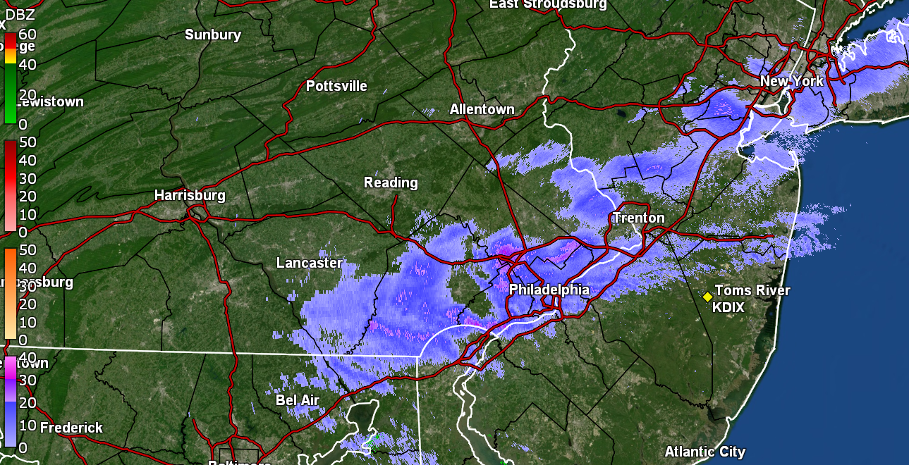
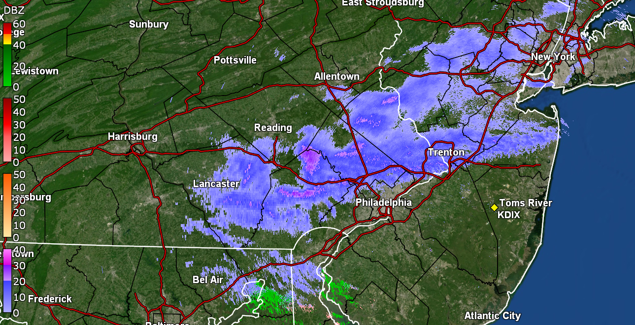
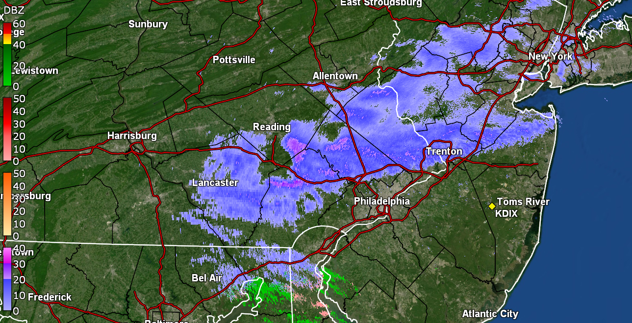
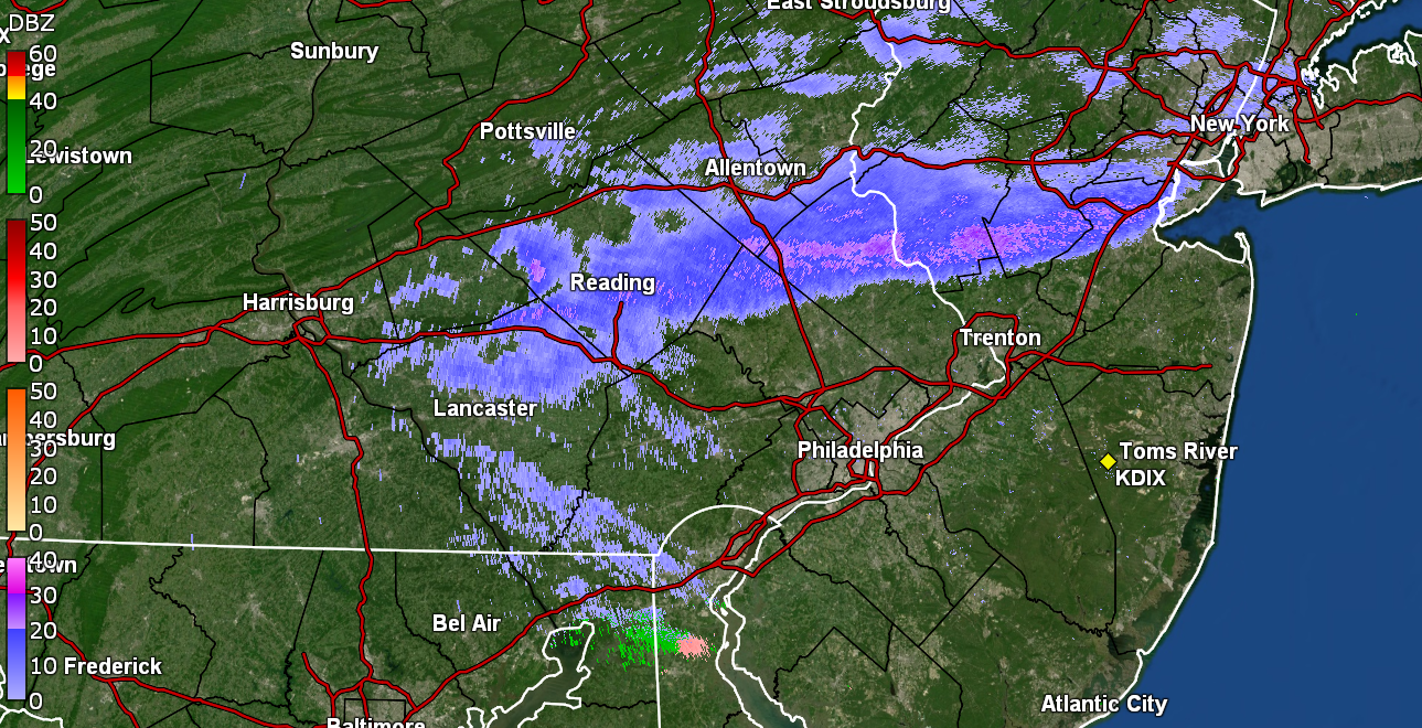
Literally missed being under the heavier blobs by a couple miles. Down to a broken cloud deck with a few flurries and a dusting. Temp stabilizing a bit at 29/dp 22.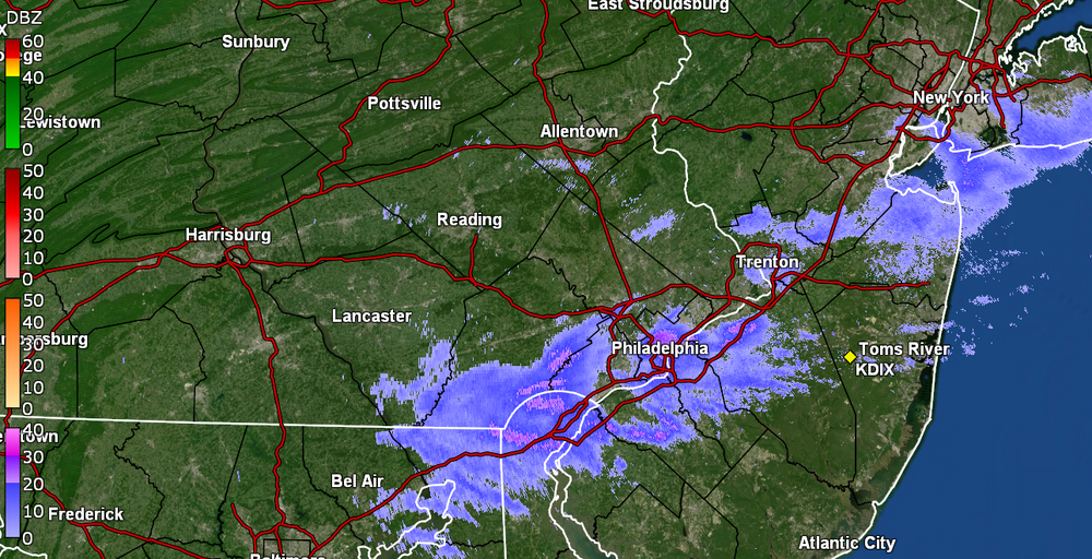
-
E PA/NJ/DE Winter 2022-2023 OBS Thread
Hurricane Agnes replied to Ralph Wiggum's topic in Philadelphia Region
Now have a dusting on cars, ground, and other colder surfaces. Light snow showers continue... I may end up in a donut hole between 2 heavier blobs.
-
E PA/NJ/DE Winter 2022-2023 OBS Thread
Hurricane Agnes replied to Ralph Wiggum's topic in Philadelphia Region
It was like a downsloping warming and as the front hit with the winds, the temp has been dropping. Temp now down to 30 w/dp 24. Edit - now down to 29 and continuing to fall.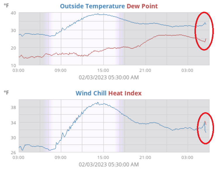
-
E PA/NJ/DE Winter 2022-2023 OBS Thread
Hurricane Agnes replied to Ralph Wiggum's topic in Philadelphia Region
Getting a snow shower and flakes are sticking to cold surfaces (cars). Temp is now rapidly dropping and is down to 31 and falling, with dp 25. -
E PA/NJ/DE Winter 2022-2023 OBS Thread
Hurricane Agnes replied to Ralph Wiggum's topic in Philadelphia Region
Front is here and now getting a few flakes but also the winds. Temp has increased up to 35 ahead of it. -
E PA/NJ/DE Winter 2022-2023 OBS Thread
Hurricane Agnes replied to Ralph Wiggum's topic in Philadelphia Region
Currently virga and not a solid cloud deck yet. Temp 34, dp 23.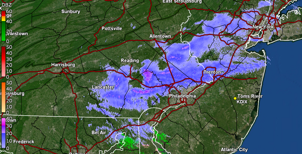
-
E PA/NJ/DE Winter 2022-2023 OBS Thread
Hurricane Agnes replied to Ralph Wiggum's topic in Philadelphia Region
Looks to be over you and on my doorstep!
-
E PA/NJ/DE Winter 2022-2023 OBS Thread
Hurricane Agnes replied to Ralph Wiggum's topic in Philadelphia Region
It looks to be a fast mover so will be through rather quickly. -
E PA/NJ/DE Winter 2022-2023 OBS Thread
Hurricane Agnes replied to Ralph Wiggum's topic in Philadelphia Region
Am guessing that is riding along the arctic front. I was surprised that it was still at or above freezing here but then there are clouds that kept the radiational cooling down. KYW Traffic report already reporting the snow up around I-78 (Justin Drabick). Temp here is 33 with dp 24.
-
E PA/NJ/DE Winter 2022-2023 OBS Thread
Hurricane Agnes replied to Ralph Wiggum's topic in Philadelphia Region
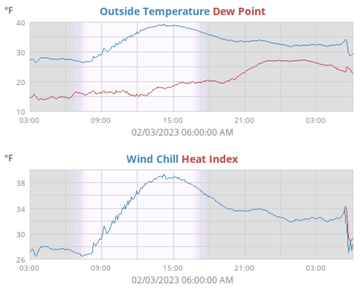
Yeah am now back to overcast with that, with an occasional break as a reminder that the sun is still up. Currently at my high (so far) for the day - 39, with dp 19. That might be the warmest it gets through the first part of the weekend. -
E PA/NJ/DE Winter 2022-2023 OBS Thread
Hurricane Agnes replied to Ralph Wiggum's topic in Philadelphia Region
That's better than the GFS this winter with those long-range storms that didn't verify. Almost not a cloud in the sky* save for some contrails here and there. (*although looks like there may be a fuzzy deck of very high cirrus that has still allowed a "blue" cast to shine through for a faux blue sky ) Currently 37 and mostly sunny with dp 16. -
E PA/NJ/DE Winter 2022-2023 OBS Thread
Hurricane Agnes replied to Ralph Wiggum's topic in Philadelphia Region
Phil came through! Mt. Holly had some historic data on him - I dropped down to 25 as a low this morning and it's currently partly sunny and 27 with dp 16. -
E PA/NJ/DE Winter 2022-2023 OBS Thread
Hurricane Agnes replied to Ralph Wiggum's topic in Philadelphia Region
Well all gone - and before it hit 32. And it is currently 32 here with dp 24 and the clouds have returned! <Jim Nabors voice> Surprise surprise surprise. -
E PA/NJ/DE Winter 2022-2023 OBS Thread
Hurricane Agnes replied to Ralph Wiggum's topic in Philadelphia Region
And LOL - -
E PA/NJ/DE Winter 2022-2023 OBS Thread
Hurricane Agnes replied to Ralph Wiggum's topic in Philadelphia Region
As I had somewhat expected (but wasn't definitive about), I apparently didn't even have to wait to go above freezing... the snow on the east side of my car's windshield has already started to disappear, and fairly quickly at that (about 1/3rd gone)!