Hurricane Agnes
-
Posts
9,263 -
Joined
Content Type
Profiles
Blogs
Forums
American Weather
Media Demo
Store
Gallery
Everything posted by Hurricane Agnes
-
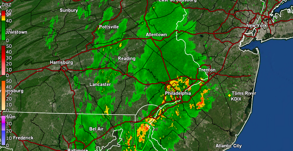
Sun has popped out here but wonder if it might result in some self-destruct tendencies if it destabilizes this already-muggy atmosphere. I picked up a couple hundredths more rain this morning for a total of 0.08" for the day and 2.08 over the past 2 days. After a low of 68 earlier, currently have changeable skies with clouds and sun and 73, with dp 72.
-
Picked up some more rain - 0.06" - sometime between 2 am - 3 am, making for a total of 2.06" over the 2-days and 2.09" the past week. Total for June to date has been 4.46" vs May that was 0.31". Currently a muggy and misty 69 with lots of low stratus, and dp 68.
-
Currently in a pause and dry slot at the moment but managed to pick up a total of 2.00" for the day so far. Temp has been creeping up since the rain stopped and I'm currently at 71 with dp 71.
-
Latest tally - now up to 1.95" here in NW Philly and still getting ~1/2" per hr rates. Temp is 69 with dp 69. Most welcome since I missed some of the rain earlier this week.
-
Am now up to 1.55" and just over 1"/hr rates. Also getting convection around the area.
-
The rain has been stingy all day and I'm finally getting some bucket tips and even a gully washer, with thunder/lightning. Getting 2.75"/hr at the moment and after a bare 0.03" about an hour ago, am up to 0.90". Had a low of 63 this morning and am currently at my high of 69 with dp a muggy 68.
-
Finished up yesterday with a whopping 0.03" and nothing measurable overnight. The radar looks sparse at the moment.
-
And I finally got enough to register 0.01". Currently a misty and drizzly 59 with dp 56.
-
Still waiting for a bucket tip. It has been lightly drizzling for hours and the walk is finally wet but... Currently drizzling and 62 with dp 57.
-
It has been virga here for a couple hours now and am finally getting some drizzle, but nothing measurable yet. Had a low of 60 this morning and made it up to 68 in what was a pretty breezy day - much of it out of the E and ESE. Currently 67 and breezy, with on and off drizzle, and a sun trying to break through the overcast.
-
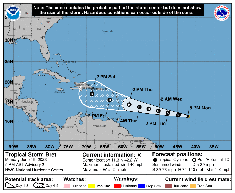
Got up to 87 today after a low of 61, and overall, a fairly nice day. I saw that TS Bret has formed out in the central Atlantic, so that might be the end of month rain producer depending on the final track of it and/or its remnants. Currently mostly cloudy as the sun sets, and 74 with dp 60.
-
Just ran in here to say that you found the magic formula for rain!

-
Hmmm.... Went to go look at MBY and I got 1.67" Monday (6/12), 0.07 on Wednesday (6/14), and 0.61" on Friday (6/16) for a total of 2.35" this past week, almost 8 times as much as I got all of last month! As an obs - I hit 76 for a high yesterday and bottomed out at 56 for a low this morning. Currently partly sunny with peaks of sun and 77, with dp 57.
-
Sun is out and the temp has recovered to 69 with dp 62, so a bit juicy out there.
-
Back edge has come through here and I picked up 0.61" for the event so far. Temp is currently 61 with dp 60.
-
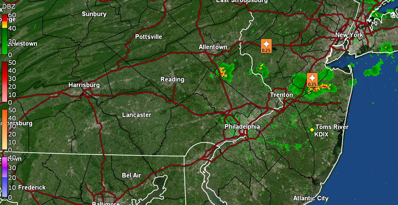
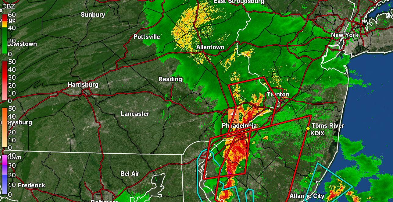
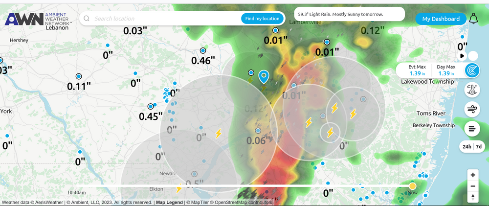
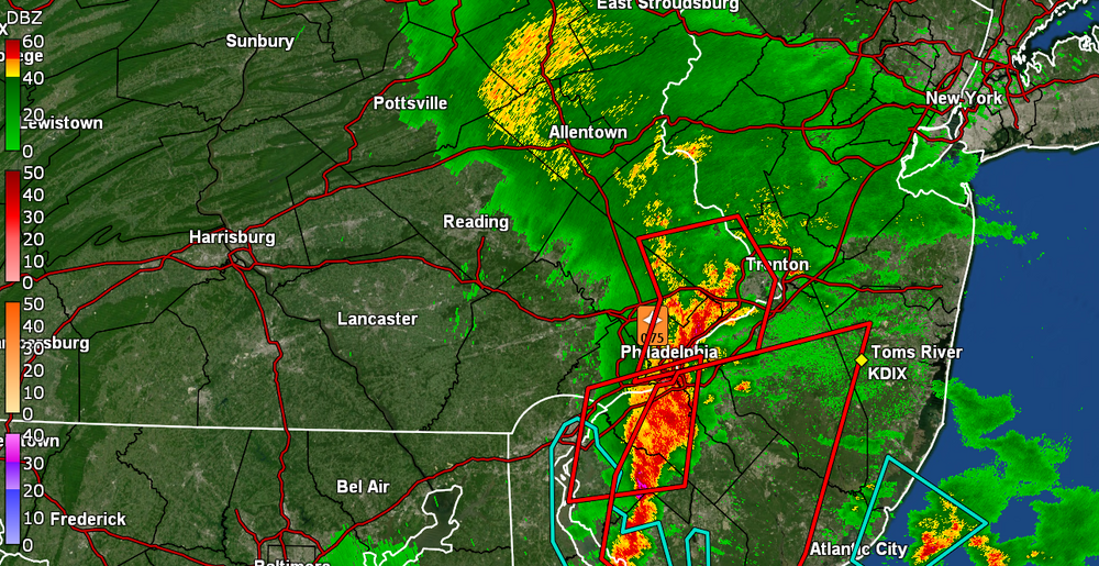
A TORR up in Jersey -
-
Lots of convection with the line.
-
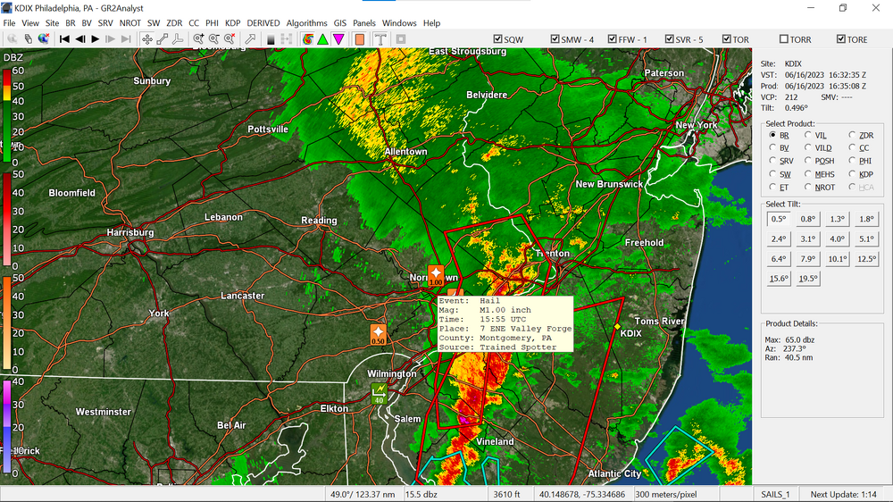
Spotter near Valley Forge reported 1" hail.
-
The line is over the city. Getting 1.6"/hr rain and have 0.55" in the bucket so far.
-
Getting a gully washer. 1.4"/hr rates. At 0.45" so far.
-
Pitch black out here and rain has picked up. Currently have 0.27" in the bucket and temp down to 63.
-
Warnings up now in the city -
-
I saw one got dropped... but there is now one over northern Chester County.
-
TORR up for parts of Chesco, Delco, Montco -
-
Warnings up for Delco, most of Chesco, and part of Montco -