Hurricane Agnes
-
Posts
9,343 -
Joined
Content Type
Profiles
Blogs
Forums
American Weather
Media Demo
Store
Gallery
Everything posted by Hurricane Agnes
-
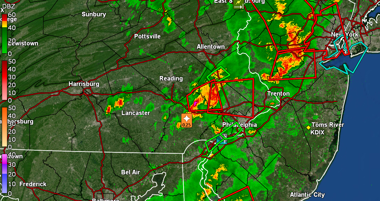
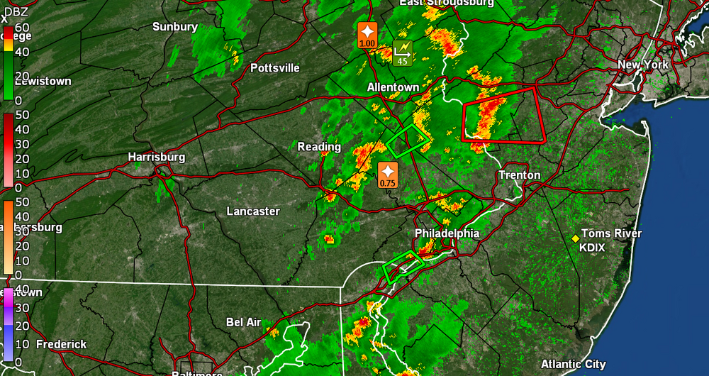
Am under the yellows and finally getting the heavier rain. Temp down to 77 with dp 73. Have 0.06" in the bucket and 1/3" per hr rate so far.
-
Starting to get some rain. Nothing measurable yet but the outflow boundary knocked the temp down to 78 with dp 73.
-
Outflow coming through. All kinds of crazy lightning going on out there! It's non-stop. Not much thunder though.
-
Picking up nearby convection. There's a solid N-> S outflow boundary just head of the line that is right on the border between Philly, Montco, and Delco. Current temp here is 86 with dp ugh (78).
-
And to quote Birds - Stuff. Don't know if that will survive the trip but we'll see. I made it up to 94 as a high today and here it is 6:30 pm and still 91, with dp 77.

-
Hit 90 just before noon after bottoming out at 76 this morning. Had already hit 91 just before 12:30 pm, briefly dropped back down to 90, but am back to a mostly sunny 91 and an awful dp of 75, with a few small scattered cumulus clouds just starting to form.
-
And they're off... So far I have had a high of 93 today (so far) and it has started clouding up with the temp back down to 88 and dp mixing out a bit and at 77.
-
Bottomed out at 73 this morning and have hit my high (so far) with my current 88. What is different is that the dp has gone into the stratosphere, bopping between 78 & 79 and just stepped outside and I think that rain we had a few days ago juiced it up here.
-
I was expecting some kind of "low battery" indicator but never got anything. It was still sending data for the anemometer. And I did have to swap out the batts on the key fob a couple years ago. At least those lasted about 5 years. I have been pretty happy with the Energizer lithium batts for that. Also use those for my temp sensors and even have one in my deep freezer (with lithium batteries). Have dropped down to 76 now with dp 67. Will see if it hangs around that temp through dawn in order to start out warmer tomorrow ahead of the blast.
-
And my high ended up being 89. I know the heat products have pretty much focused on the Thurs. - Sat. period. I actually had to go swap out the batts in my WS-2000 a couple hours ago as it had suddenly stopped sending temp/humidity data around 5 pm (after the high for the day). I had bought this station in the summer of 2020 (as a replacement to a WS-1001 from 2015) and it still had the original lithium batts that I had put in it when I first set it up, so I knew this day was coming! Anyway, it's partly sunny and 83 with dp a reasonable 66 and doesn't feel bad out there at all.
-
I bottomed out at 65 this morning, my "coolest" low during the entire month of July. Tat will be a memory come tomorrow and the days after. It's currently mostly sunny with cumulus here and there, and 87 (don't think I will make 90), with dp 70 so not too bad out.
-
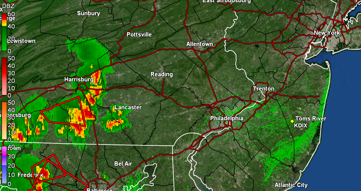
Sun has popped out and looks like I finished up with 0.92" total from both rounds today (so far). Me take. Temp is currently 69 with dp 68. ETA - have 6.45" of rain for July (so far).
-
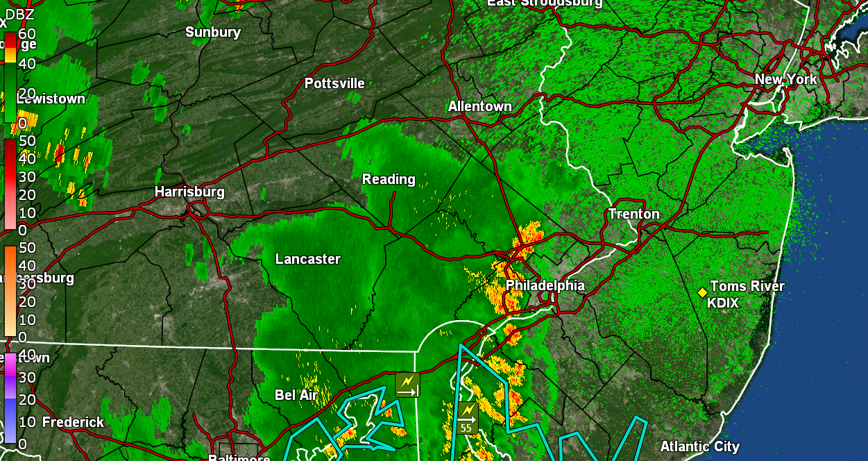
Managed to get under a band from that to pick up another 0.31" for 0.91" so far. Rates went as high as 2"/hr at one point during the peak. Currently light rain and 68 with dp 67. Appreciated that 'cause that general rule of thumb is that most plants around here prefer bout 1" of rain per week.
-
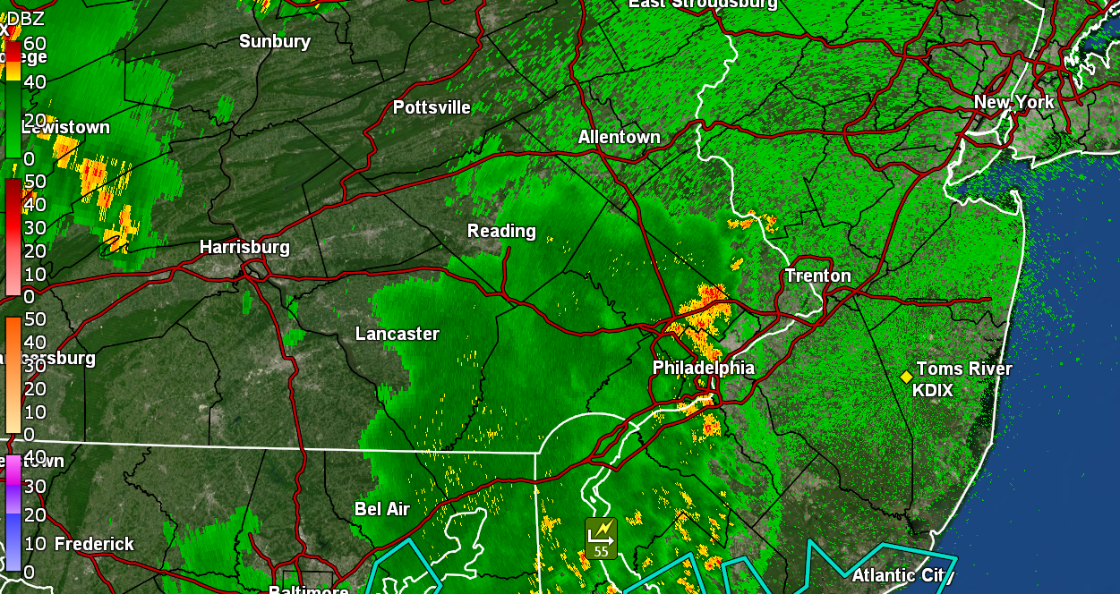
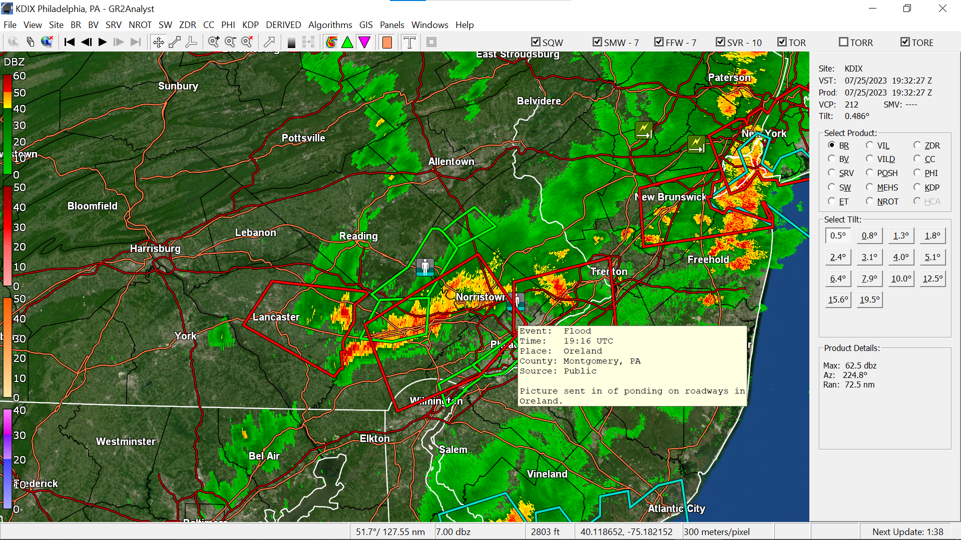
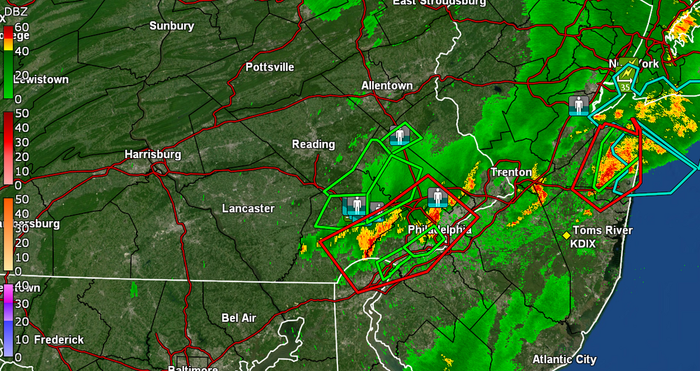
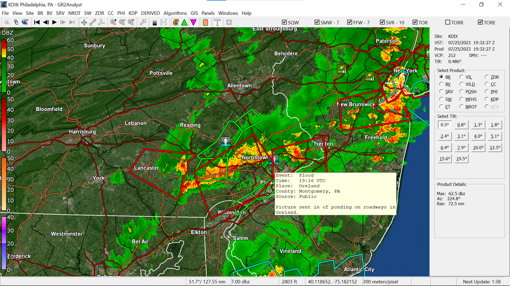
Initial round gave me another 0.40" of rain for 0.60" so far. Looks like another blob may be coming. I saw a flood reported in Oreland which is a few miles from me in Springfield township. Steamy window temp is 70 with dp 69.
-
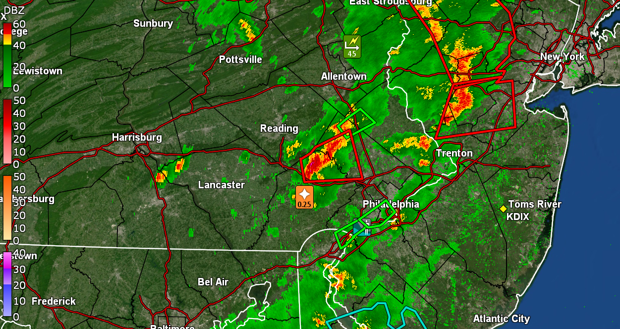
Starting getting some big droplets from some incoming and it just started to ratchet up with winds. Right on my door step.
-
Am under a STS. Seeing some dark clouds off to the west. Currently 76 with dp 72.

-
If Paul is still down in Sea Isle this week, he's missing that wild stuff going on over northern Chesco. Well the rain left me with just the 0.20" but I'll take it at this point. I don't know if that band coming across from the west is going to survive but will see.
-
Managed to get under a cell of some heavier rain with upwards of about 3/4" - 1" per hr. Currently have 0.20" in the bucket but hoping to get a bit more to hold me through the week with the flame about to be turned up. Currently ave some lighter rain and 76 with dp 73.
-
Glad you are cashing in on some of that, although not long ago, you were wishing some of it away when you were under a deluge. Currently 85 here with dp 73 and on and off threatening clouds.
-
Here we go...
-
Thanks to the persistent clouds yesterday morning until the sun finally emerged, I only got up to 86 yesterday for a high. This morning I bottomed out at 69 and it's currently a partly sunny 73 with dp now up to 70.
-
Didn't get to 90 as a high yesterday (only made it to 89) but it felt hotter though with the dp having crept up a bit. Bottomed out at 69 this morning and am currently getting light rain, not enough to tip the bucket yet but heavier bands appear to be advecting up from the SW and will see if any make it up here. So far it has wet the pavement and I rolled the umbrella down so plants nearby can get a little. Temp is 73 with dp 68.
-
Miracle of miracles but the dp had actually dropped below 60 (so far as low as 58). I made it up to 84 for a high. Saw that Don became the first hurricane of the Atlantic season with the latest update, all while it is getting closer to being extra-tropical. In any case, it's currently partly sunny and 82 with dp bopping between 59 and 60.
-
What a difference a day makes! I bottomed out at 67 this morning and am currently at my high (so far) of 82, with a dp (that had been promised previously but never got there until today) below the 70s and at 61. Lots of cirrus and a nice breeze make it a pleasantly warm mid-summer day.
-
Assuming I don't get any surprise pop-ups, looks like I'm done with this round and finished with 0.60" in the bucket. The temp had spiked a bit to 75 before the front came through and knocked me down to what is probably my low for today - 66. Currently misty and 68 with dp 68. Will see if the sun manages to come out to fire up anything for later this afternoon.