Hurricane Agnes
-
Posts
9,343 -
Joined
Content Type
Profiles
Blogs
Forums
American Weather
Media Demo
Store
Gallery
Everything posted by Hurricane Agnes
-
Got warned overnight and apparently a lot sound and fury signifying nothing here, with no measurable rain. Most seemed to have gone north of me. Did try to peep out earlier this morning and there was cirrus with some breaks enough to see stars but not really as clear as hoped if wanting to catch any stray Perseid streaks that would be visible from the city. I did see a cool crescent moon rising though. Currently partly sunny and 68 (my low so far) with dp 67.
-
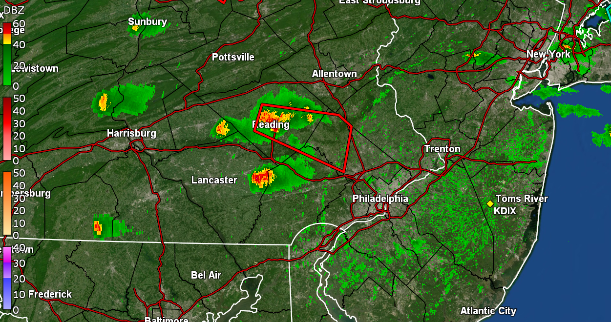
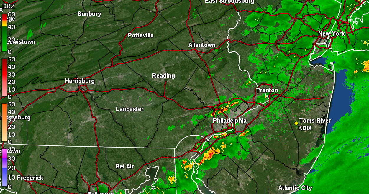
That southern blob looks like it's headed for the ballpark. I think the game starts at 6:05 so it might hit there before game time. RedSky might be getting fringed by the northern blob.
-
That is getting warned right now. Currently partly sunny and 84 with dp 74 IMBY.
-
Captured a recent frame that looked like it was trying to do something but it seems to have dissipated a bit.
-
You lucked out. Those storms generated an outflow boundary that came barreling over me from SE to NW but it didn't really drop my temps much. My temp is back up to what is currently my high of 85 with dp now 76.
-
Got up to 85 as a high yesterday and had a 66 low this morning and it wasn't too bad out. But then I guess the warm front went into motion and ugh. I was up in Cheltenham on Cheltenham Ave just before noon when I saw a similar shelf cloud to my south. I was like, awwwwww sh****t. Got to my pharmacy and it unleashed as I was about to get out the car so I waited a bit (I did have an umbrella), then it was done. Then went to the supermarket and while inside I looked out the big pane glass windows and more unleashing. Got home and saw I picked up 0.10" from what appeared to be a couple cells. In any case, that rain took the slop level up to max. It's currently partly sunny and 82 with dp 75.
-
Got up to as high as a just over 2"/hr rate and added 0.37" from a round 2 for a total today of 1.26". Sun has been trying to pop out and it's currently overcast with occasional break of sun, and73 with dp 72.
-
Getting another round with about 1" hr rates. Currently up to 1.09" total in the bucket (0.20" for round 2).
-
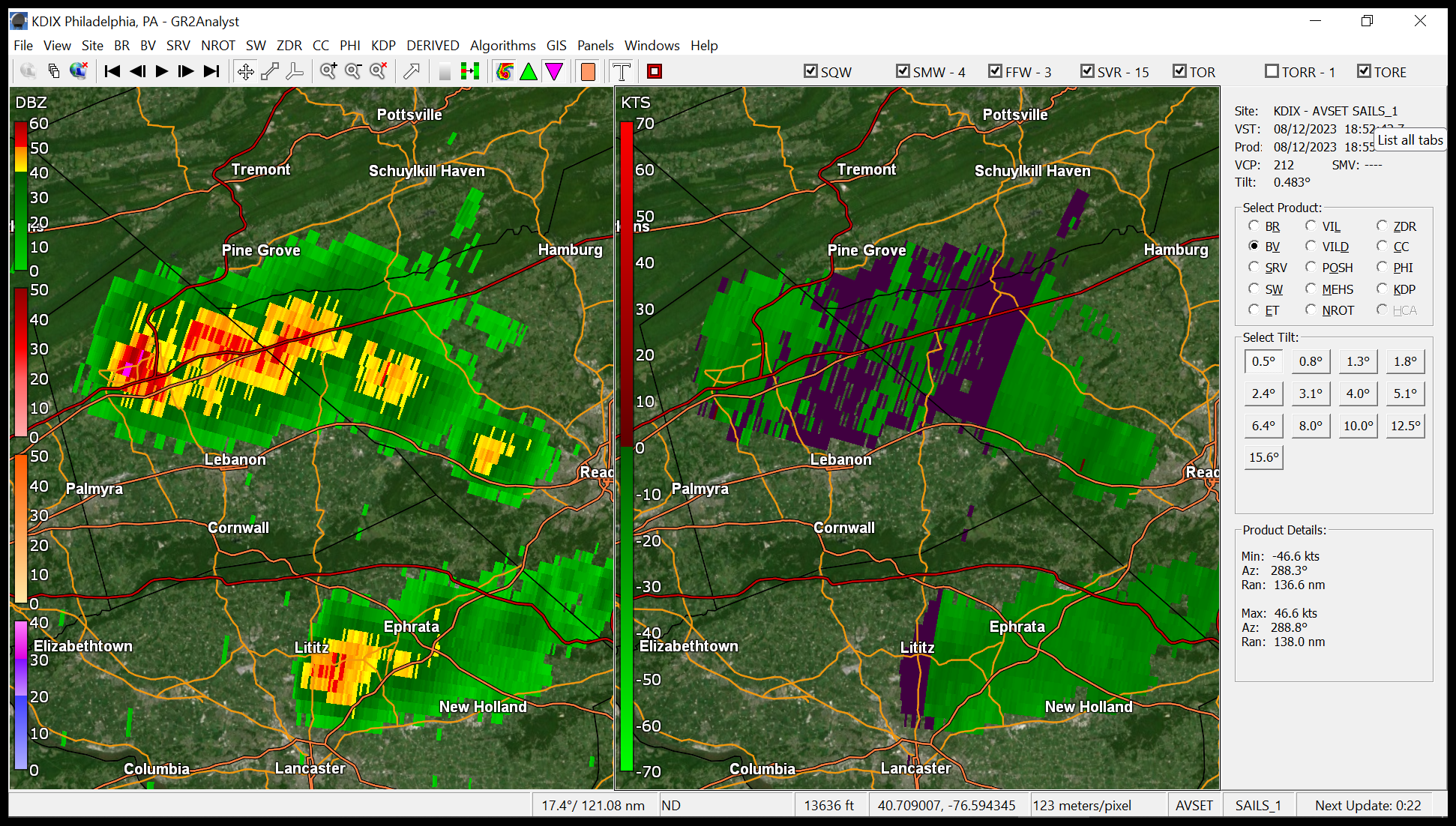
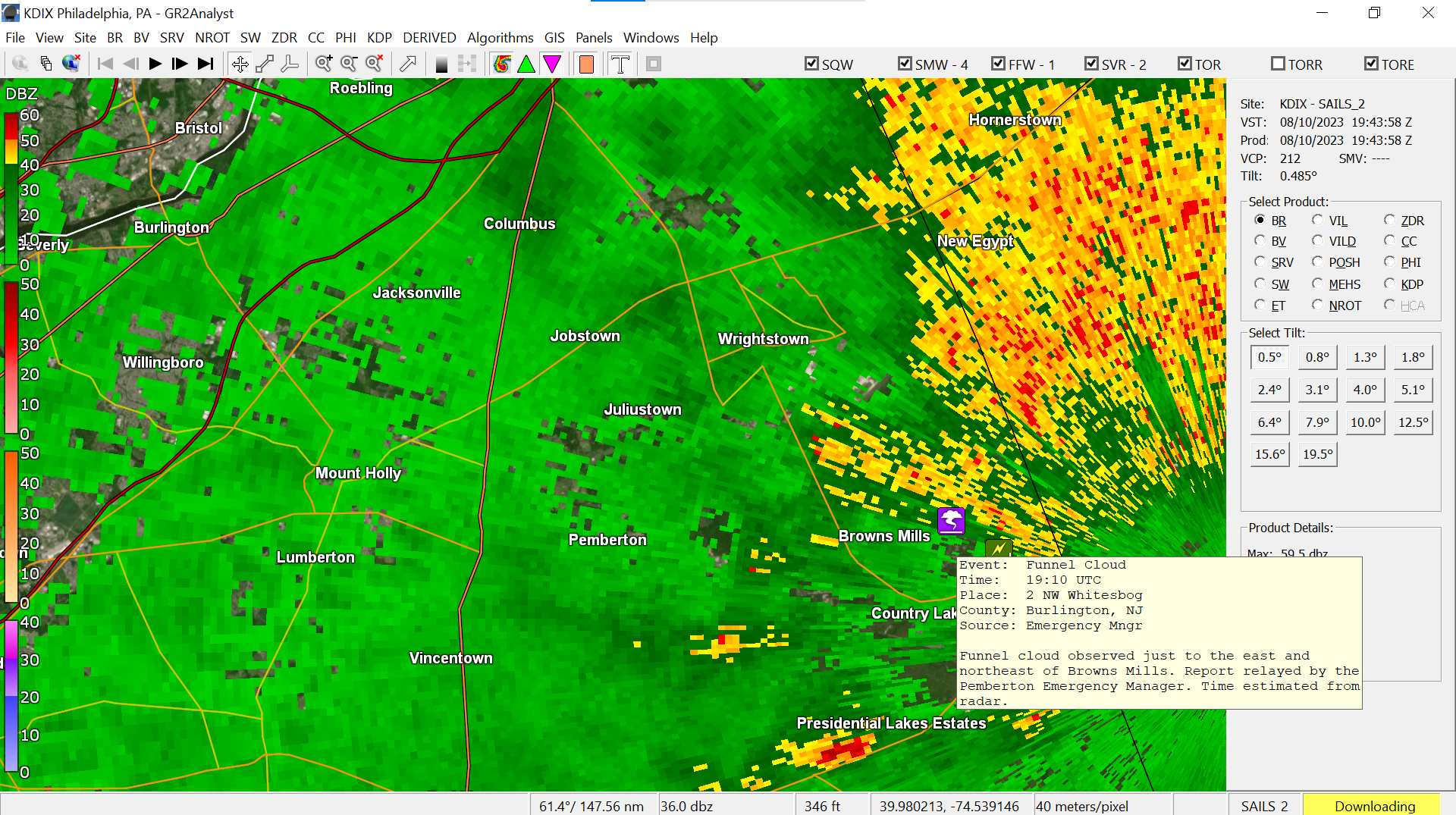
IIRC when KYW radio was simulcasting Justin Drabick's play-by-play, he mentioned that it appeared to be in a pretty rural area in/near the Pine Barrens. A Pemberton, Burlco Emergency Manager had reported seeing a funnel cloud.

-
Have 0.89" in the bucket so far at post time. It's currently an overcast and misty 74 with dp 73.
-
TOR over in Jersey. KYW EAS'd and they cut over to NBC10.

-
Rain has arrived here and have 0.03" in the bucket so far. Ended up with a high of 86 yesterday and a low of 69 this morning. Currently 74 with light rain and dp 72.
-
I just posted just below your reply that Mt. Holly reported that all of the surveyed locations experienced straight line wind damage.
-
Mt. Holly did surveys of various areas of interest including Glen Mills and reported that it was straight line winds. Looks like my current 80 is my high for today and dp is still 64.
-
I figured you were out driving yesterday and saw one of these - I drove around here earlier this morning and there were some small branches and other leaf debris on the streets but didn't see any obvious trees down. I did see a few streets where Verizon was out blocking lanes and I guess working on their downed wires. There was (and still is) an active breeze trying to mix the humid air out so that was welcome. Currently breezy with changeable skies, 75 and a not-as-horrid dp of 64.
-
Looks to be near Harrisburg. Ended up with a high of 87 yesterday and 1.52" total rain from both rounds. This morning's low was 69 and it's currently mostly cloudy with occasional sun and 73, with dp 70. ETA to note that one of my sisters (the Upper Darby one) who travels up this way to go to the Flourtown Swim Club said that she got a notice that they were closed due to downed trees there (it is in Springfield (Montco) Township) a few miles from me.
-
I saw a big blob that headed right for you so thanks for the confirm! Still getting light rain here and have 1.43" (0.76" r2) total so far for the day.
-
now have 1.38" (0.71 from this latest round). Cold front looks to be way out in western PA near Pittsburgh.
-
Still getting light - moderate rain currently at 1/4" per hr and have 1.32" total for today (0.65" from round 2). Temp holding at 69 with dp 69.
-
Saw a spotter in Glenside report a 55mph gust. I'm about 4 miles south of there. I know I heard a gust but it didn't last long. Currently down to light rain and 69 with dp 69 and 1.18" in the bucket total (0.51" from round 2).
-
It's a fast mover. Getting 1.6"/hr rates and have 1.17 in the bucket (0.50" on the nose for round 2 so far).
-
Now getting 2.5+"/hr rates. Have total of 1.12" in the bucket at post time. (0.45 from round 2). Temp 70 with dp 68.
-
Getting 1.5+"/hr rates. Picked up about 0.30" of ran so far from it.

-
Under the initial leading edge. Lights are blinking. Gully washer.
-
My sis in Upper Darby said it got dark and windy and is pouring.