-
Posts
9,273 -
Joined
Content Type
Profiles
Blogs
Forums
American Weather
Media Demo
Store
Gallery
Everything posted by Hurricane Agnes
-
I just checked and I am at 89 with dp 74. And yeah, just some fluffy fair weather cumulus out there. Not the thick deck of hazy stuff.
-
And here we go!
-
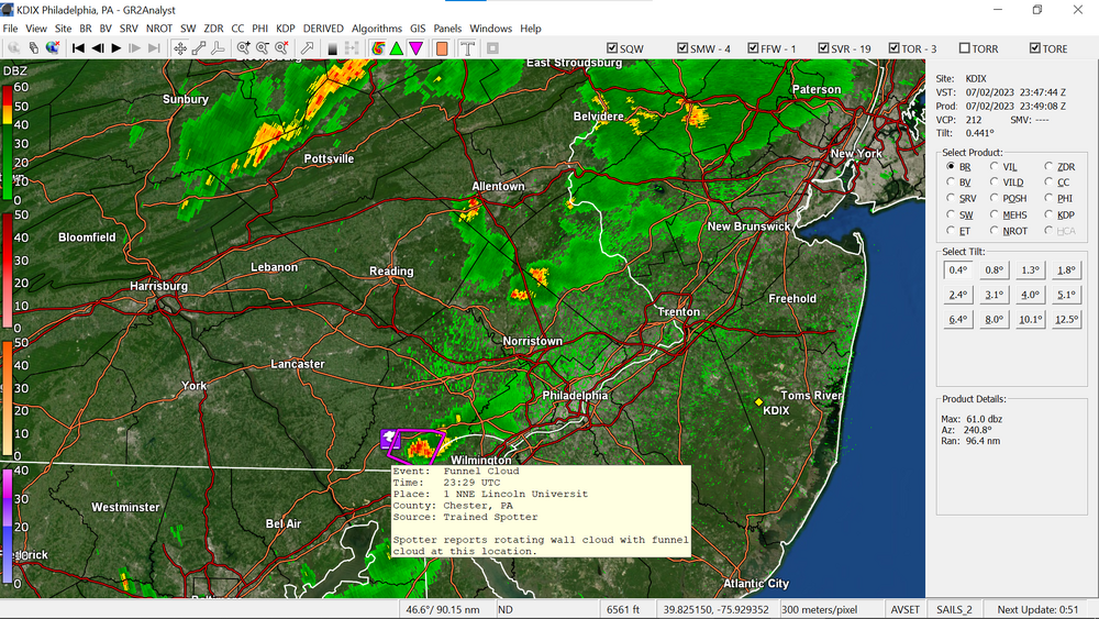
(Our) Ray gets a couple feature quotes! "Channel 10" (is not the NWS). I actually posted a screenshot with the LSR that had been submitted from there by a spotter. I think all of the reports, including in Berks, were some variation of them being a "funnel cloud". As an obs of current conditions IMBY, it's 85 with dp 75. I did hit 86 earlier but the temp has been fluctuating as the sun goes in and out.
-
I don't know what you have your thermostat set for but with mine set for 68 (which is what the guy who last replaced my thermostat and fixed a circuit board for my inside central air blower thingy had set it for to test, and I left it), I just did a temp check and the air coming out of the vents is around 55. That (at least this time of the morning, sortof the "coolest time of the day") is able to keep the house at around 68. As it heats up in the '80s and '90s during the hottest part of the day, the house ends up settling into the low - mid 70s (the latter on the 2nd floor which is where the heat "rises" ), which is fine given the house is a 2-story brick "townhouse" style. Am currently off to the races this morning with a temp of 75 and dp 73 (the low earlier ended up being 73).
-
Am glad to see those who missed out the past week or so, finally cash in. I got nada here. Zero. Zilch. But at this point, that's okay for the moment as I had about 3" of rain during the last week of June. In any case, currently 73, with full moon peeping through the high clouds, and dp 73.
-
Yeah I expect they EAS broadcast to any (enabled) phone within a TOR Warning's area (and have done it with FFWs, SSWs, etc). I know my weather radio (Sangean) will suddenly go to a real loud volume with TORs and I have to scramble to turn it down.
-
-
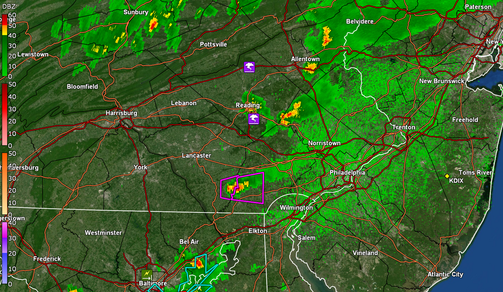
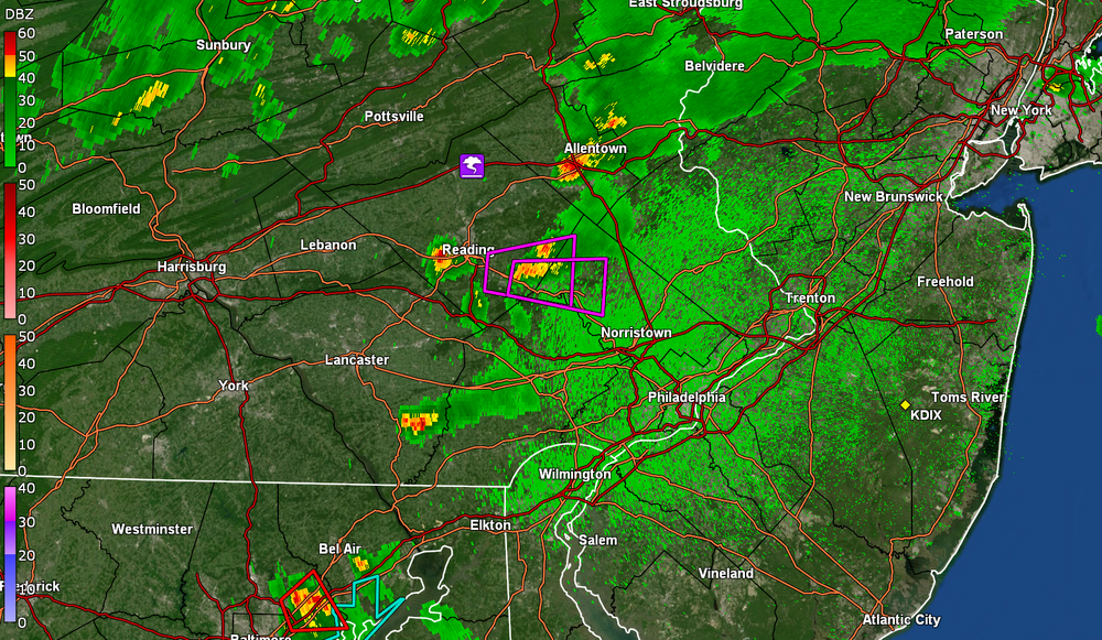
Have a pair of TORs for Lancco and Chesco. I know it is unstable out there for anyone who hasn't already had a pop-up (although some of the pop-ups have been making the humidity worse). Currently 84 with dp 77 here. Got up to a high of 88 earlier (so far).
-
-
-
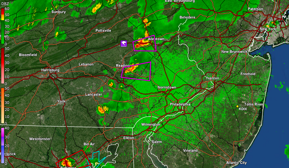
Couple TORs (funnel cloud spotting) up to the N/W and ST Watches up for the CWA. Currently 87 with dp 75.
-
Don't forget to factor this in though - https://www.climate.gov/news-features/blogs/june-2023-enso-update-el-niño-here Depending on how strong the El Nino gets may determine what the stj does with the potential for endless hopes and dreams in here for "phasing". As an obs - I did hit 86 again yesterday and had a warm "low" of 72 this morning. The dps briefly dropped to the low 60s yesterday but it appears the warm front might be on the move, and I am currently partly sunny and 81, with dp 75.
-
Despite the changeable skies yesterday, I did make it to 86 for a high. I ended June with a hard to believe 7.44" of rain, most of it in the waning weeks of the month. Had a low of 68 this morning and it's currently a once again hazy morning with a temp of 78 and dp that still hasn't dropped, and is at 67.
-
Blast from the past! As an obs, that hazy sky capped my high to 82 today (at least so far) and it's currently a partly sunny and hazy 81 with dp 61.
-
There is some discussion of it back in 2012 before it got near here, right in this forum , starting around here -
-
When I was looking for the actual number of miles that defined one, I had found the article about what you are talking about - https://wchstv.com/news/local/thursday-marks-11th-anniversary-of-2012-derecho ETA - NWS write up on it - https://www.weather.gov/lwx/20120629svrwx
-
At least based on spotter reports, this probably is a derecho and today is supposedly the anniversary of the 2012 one.
-
Those "Air Quality Alerts" are like how they did those old "Homeland Security Advisories" - In any case, my temp is now up to 74 and the dp is 64, with hazy skies. And as a sidenote, I had a fledgling robin out on my back patio steps late yesterday afternoon, with a mama feeding it just as I opened the door. The mama was incensed , cursed me out in "robin-screech", and flew to a nearby tree. I still had to go out there so stepped around it to do what I needed to do and came back in. Haven't checked this morning to see if it was still out there.
-
Those "codes" that you are talking about are what the "Delaware Valley Regional Planning Commission" uses to issue their "Alerts" (they are a general alert "type" that doesn't get granular) - That is different from the color-coding used by EPA with their "AirNow" site (and any used for other air quality sensors/monitors), which actually gets into the weeds with PM 2.5 particle amounts. I also have an indoor PM 2.5, PM 10, and CO2 monitor that measures those readings inside (yes geek ).
-
Yeah the graph is just color-coded ranges and that bottom number is reflected in it. But I only mentioned because of how mine is doing ''color coding". I know it's not a pro device but it is supposed to be a decent amateur one and is one of a number of others (a popular one being "PurpleAir") where some have talked about correction factors and whatnot as compared to AirNow (e.g., one discussion about PurpleAir vs AirNow -https://thebolditalic.com/understanding-purpleair-vs-airnow-gov-measurements-of-wood-smoke-pollution-562923a55226). (and to clarify - the top image is my own sensor - an Ambient PM 2.5 out on my patio) Edit to add a wow on mine (and the 8am AirNow)!
-
Bottomed out at 60 this morning and it's currently 70 with dp a little lower than the past couple days, at 63. PM 2.5 (localized) is creeping up! I know different sources use different ranges for color-coding so at least for my Ambient PM 2.5, it listed this -
-
Wow. I had noticed the alert went up and actually saw that it wasn't the usual "orange" one but was a "red" one. Was at the supermarket a couple hours ago and the smoke hadn't quite gotten here but it is hazy here now. I recently bought a (replacement) PM 2.5 meter for outside and it has been creeping up. The humidity hasn't gone down much either and it is pretty muggy out. Currently hazy and 79 with dp 68.
-
They posted a PNS for the assessment of 2 tornadoes but neither there - I know sometimes it can be difficult to pick out a tornado if rain-enshrouded but I expect they go by both radar-indicated and nearby spotters. You can go through the LSRs for 6/26 - 6/27 here to see if there are any from your area - https://www.weather.gov/wrh/TextProduct?product=lsrphi As an obs, there is a strange orb in the sky that I haven't seen much of the past couple days that was not trying to peep out between a deck of clouds. I bottomed out at 64 this morning and am currently at 73 with dp 69.
-
With this latest round now moving past, so far I have 1.21" for the day (0.75" from that last round). That comes out to 5.04" in the past 5 days and 7.44" for the month of June. Currently damp and misty, with steamy windows, a temp of 67 and a dp of 66. There's another band back by Harrisburg and it will be interesting to see if that survives the trip to the east.
-
Rain has picked up here and is running ~1/4"/hr despite the sun wanting to come out. Currently have 1.17" in the bucket for the day (0.71" round 5), with temp 68 and dp 68.


