Hurricane Agnes
-
Posts
9,263 -
Joined
Content Type
Profiles
Blogs
Forums
American Weather
Media Demo
Store
Gallery
Everything posted by Hurricane Agnes
-
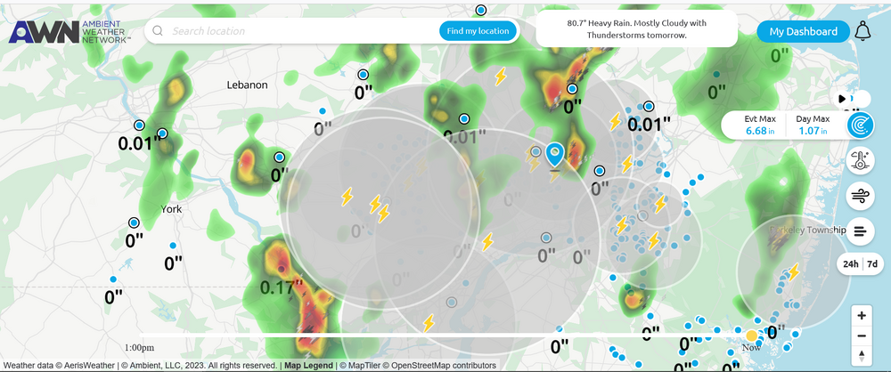
SPC's SWDY1 actually has part of the CWA in a Marginal Risk for today - Checked my data and so far for June, I have had 6.69" of rain (mostly in single/2-day events). Big difference from the 0.31" in May. Currently a mostly cloudy steamy windows day, with temp now up to 67 and dp 67.
-
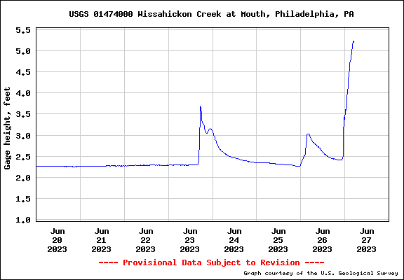
Wissahickon supposedly reported out of its banks earlier. Still up there as of 5 am.
-
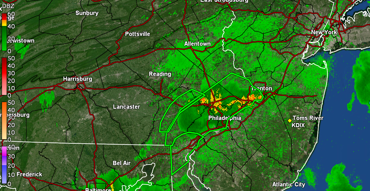
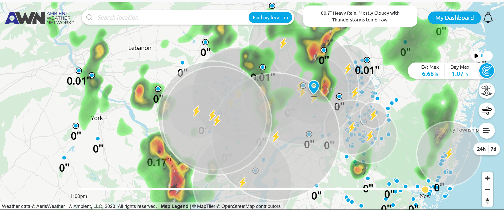
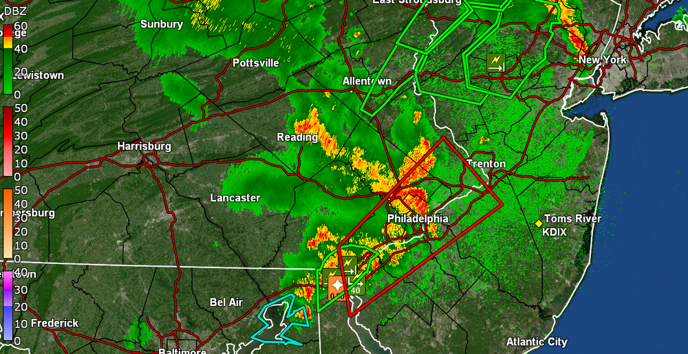
And Armageddon said "I'm not done yet", so between 3:15 - 3:45 am, round 4, complete with a sound and light show, appeared. Currently have 0.45" since 2 am from round 4, and that is on top of 0.47" from round 1, 0 from round 2, and 1.24" from round 3. Total over 2 days 2.16" at post time. Temp is 66 with dp 66.
-
Now up to 1.61" for the day (1.14" from round 3).
-
-
Armageddon has arrived, complete with wall to wall fireworks and 3" - 4"/hr rainfall. Currently up to 1.46" of rain so far today at post time (almost 1" with round 3 alone). Temp 66 and dp 66.
-
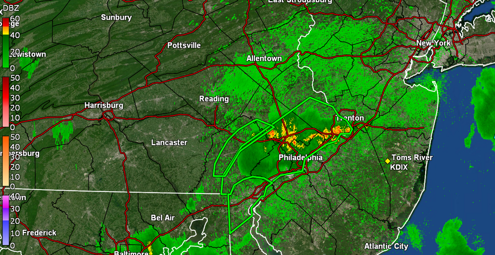
The line seems to have consolidated a bit and is moving east so if it doesn't dissolve away, you might get some of that.
-
Looks like you should be having some incoming though...
-
And the cells were a swing and a miss. Literally 1 to 2 miles to my N/W. My Wyndmoor sis is getting a deluge. Temp down to 72 with dp 67 and hearing on and off thunder.
-
Am surrounded by some cells and now hearing some thunder. Lots of convection around. Might get hit with a little blob coming in from the SW. Temp currently 77 and dp 69.
-
You seem to really be in the new line of fire! Temp has drifted down to 79 here but dp is still in the 70s at 73.
-
SPC up with the area Watches -
-
I've been getting self-destruct sun on and off but have made it up to 86 so far today. Currently overcast and 85 with dp 74.
-
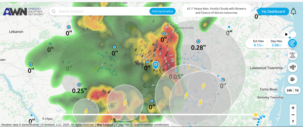
Flood watch just extended down into SE PA. The air is so juicy that I am wondering if it will actually hit the upper 80s today. Currently 79 and mostly cloudy here with an obscene dp of 75.
-
Was watching that little cluster near you. Currently changeable skies here and 71 with dp back up into the 70s again at 71.
-
Was just looking at that!

-
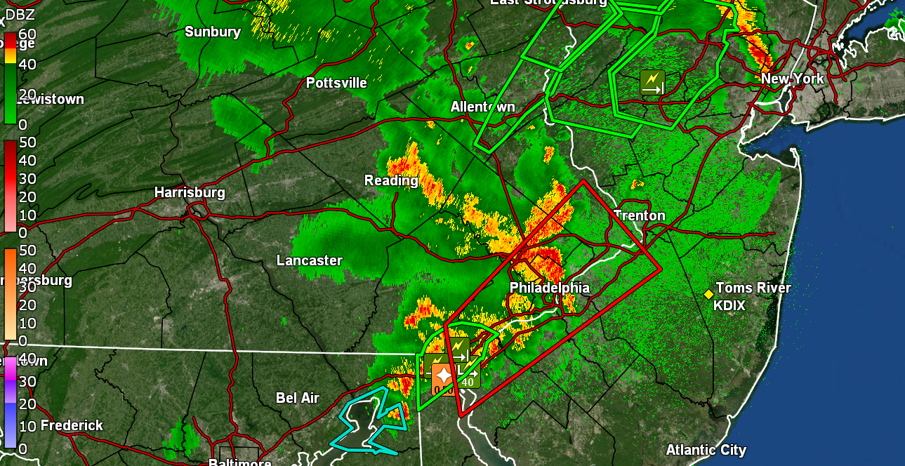
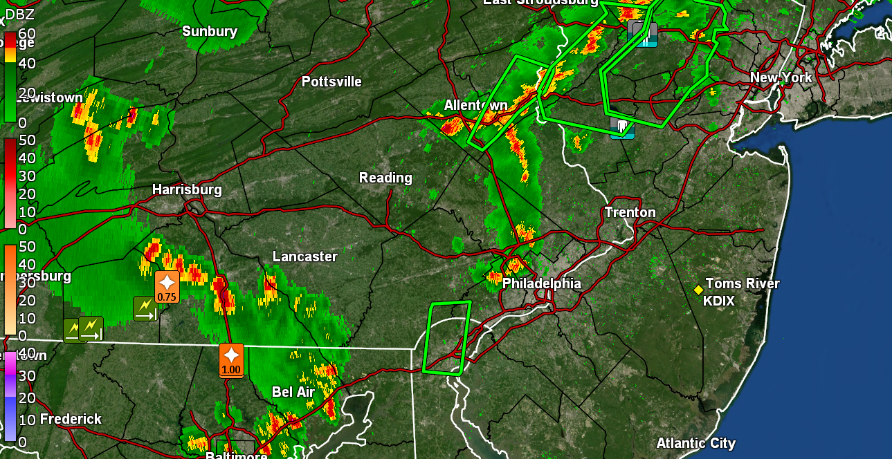
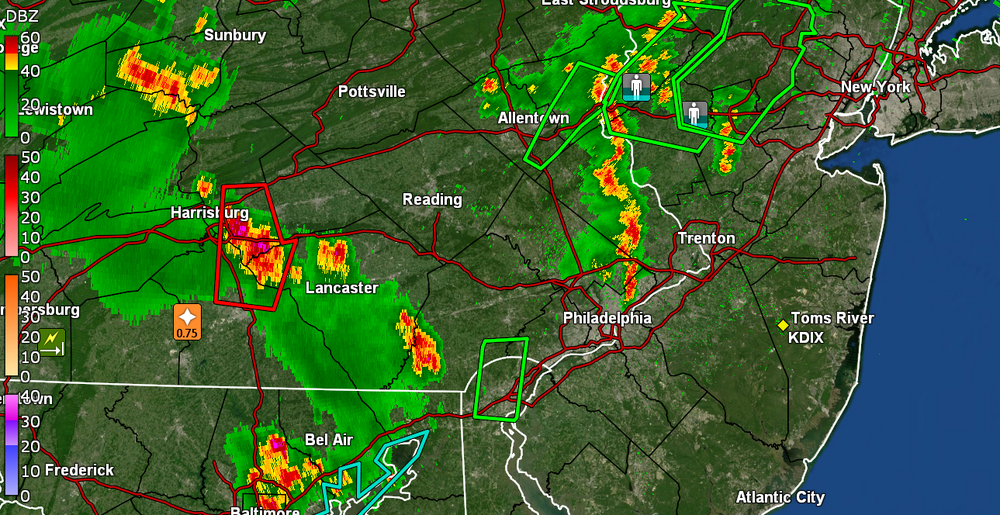
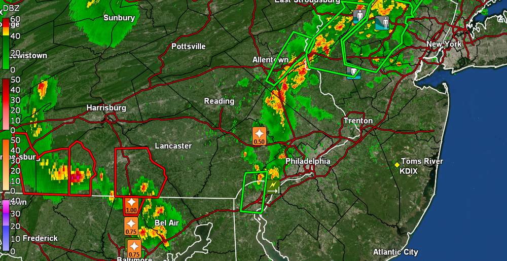
Don't see this too often around these parts - SWDY1 - "Enhanced Risk" for southern part of the CWA.
-
I don't think you'll see the below every day up there - Will see if that verifies!
-
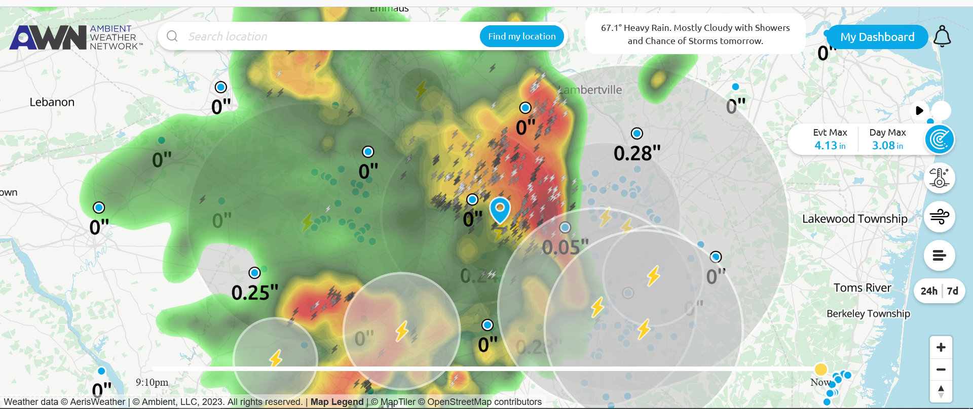
I apparently got under some of that because I picked up a couple more hundreds just before midnight (total 0.03 for yesterday) but then had received another 0.47" just after midnight! I had seen some of it bubbling up before I went to bed but since I got missed by almost all of the stuff yesterday, I figured that would be a miss too. But nope. AND there looks like things have already fired up out west. Currently 68 with dp 68.
-
Finally got a bucket tip. 0.01"! Temp is 73 with dp 69 and very light rain. Literally hundreds of lightning strikes all around but nary a drop of rain until now. I suppose we'll have to see what happens tomorrow.
-
My Upper Darby sis said, quote, "And night fell". She is near some red dot in Delco. Meanwhile, all the storms around here have dropped my temp down to 73 and dp is 66.
-
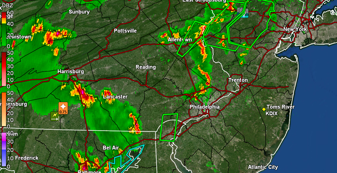
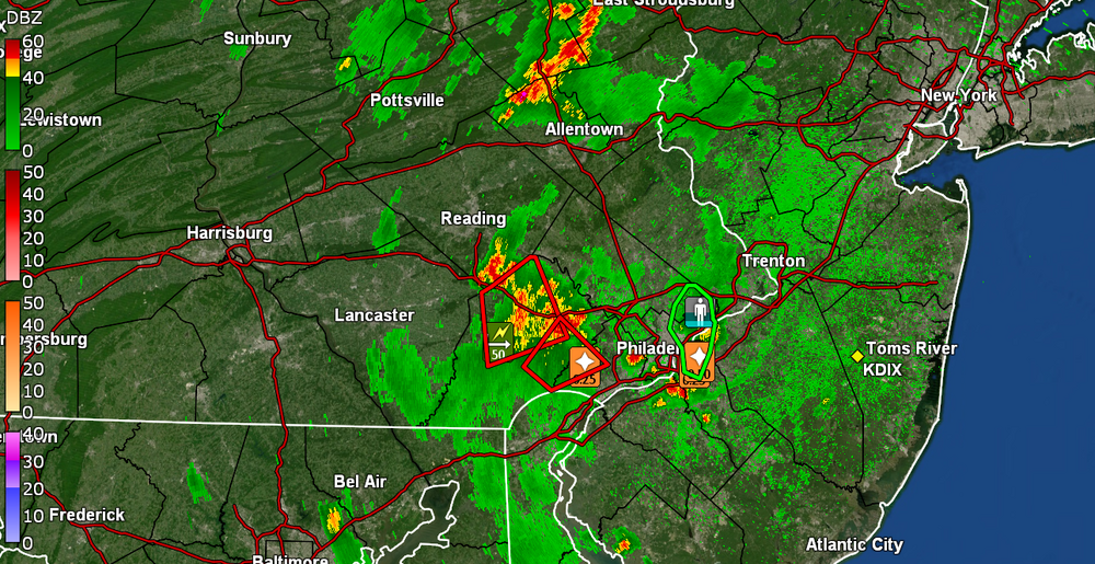
Warnings & advisories going up all over (some of those cells have been sitting almost stationary) -

-
Hearing all kinds of thunder in the area and lightning detector is continually firing up. Nothing directly over me yet though. Temp back up to 81 with dp 72.
-
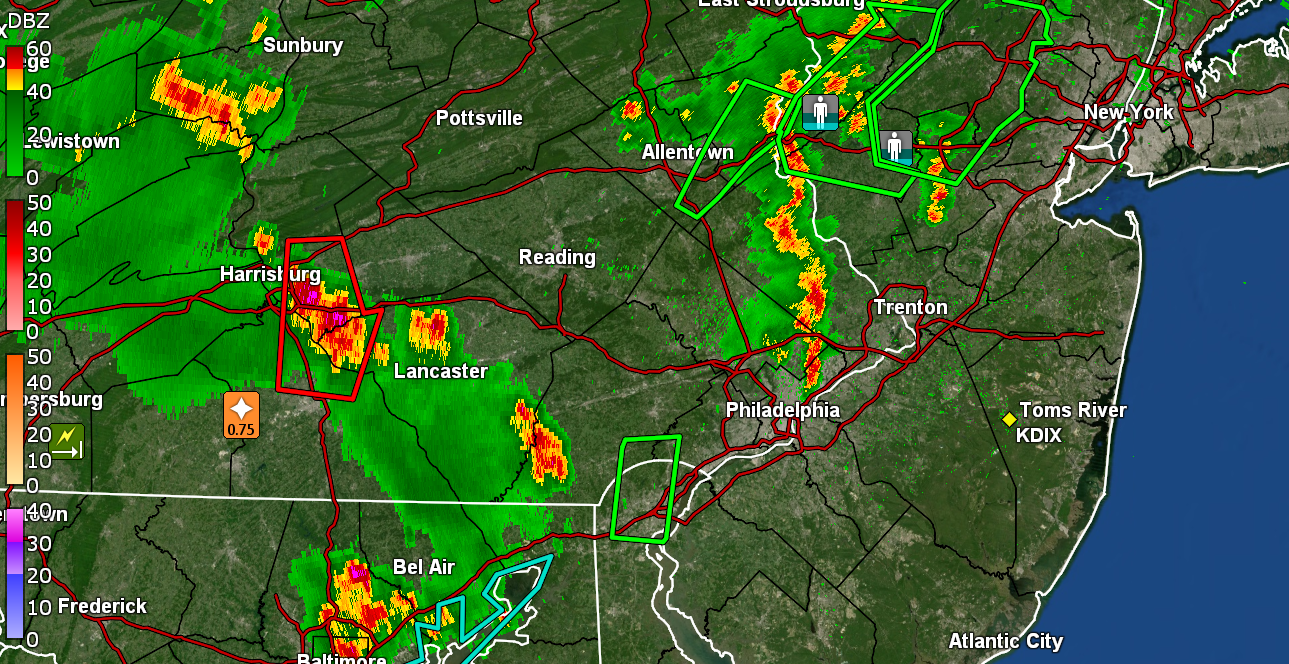
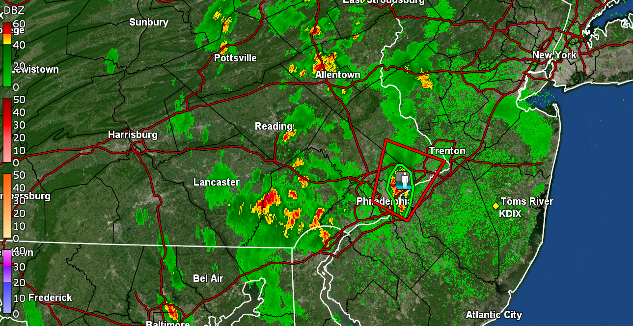
There's popcorn all around me but not over me. Can see it dark in various places but sun has been in and out here so the air is a bit unstable. What is interesting is that the radar seems to be showing a sea breeze front (or maybe east -> west outflow boundaries) that has moved in from Jersey and actually crossed over into the city. I had gotten up to 88 earlier but am now down to 79 with dp 70.
-
My Upper Darby sis texted that she is getting inundated down there. Right now the heaviest stuff is south of me although I have gotten some on and off light non-measurable rain Currently 74 with droplets and dp 72.