Hurricane Agnes
-
Posts
9,263 -
Joined
Content Type
Profiles
Blogs
Forums
American Weather
Media Demo
Store
Gallery
Everything posted by Hurricane Agnes
-
Looks like some of it passed right over Paul!
-
Wow. Blob has basically been undulating in the area. Jackpot zones... LOL I actually put buckets out at times to catch some rain water that I can filter and use for plants inside. I have some that are fluoride sensitive adn they do better with that rain water. Currently 87 with dp 73 and watching the radar closely. I have my patio umbrella up and will leave it up until I *think* I may be getting something because when I have kept it down, it has been dry dry dry.
-
Excellent! Was just looking at the radar. Am hoping I can cash in on some of that. Currently starting to cloud up a bit although the sun is still breaking through, and 88 with dp 74.

-
Yay! Just hit 90 a few minutes ago for my 4th day in a row. Sun had been in and out earlier but now have more scattered cumulus and the temp had been hovering in the low 80s before shooting up. After a warm "low" of 75, am currently partly cloudy and 89 with dp 73. Am watching that line to the west and hoping hoping hoping I can get something from that.
-
So far have had nada of the sky liquid today (nor any since 6/27). I did tap 94 for a high just before 4:30 pm and it's currently partly cloudy and 84 with dp 74.
-
Just saw it back-build at ya! I hit 90 just before noon and my high of 91 so far, just after noon today. Now officially my first "heat wave" of the season, with at least 3 consecutive days of 90 and above. Currently 91 with dp 73.

-
Well after a brief "low" of 73 this morning, have already shot up to 86, with dp 76, as of post time at 9:15 am. Since I missed out on any pop-ups the past week+, time to water the new plantings and containers.
-
LOL I saw a Flood Advisory was issued for that area and across into South Philly. I got a bunch of cumulus out there right now, alternating with haze. Temp crept back up to 88 with dp 75 and the lightning detector is picking up nearby convection (I think the thing has about a 25 mile radius range although it's more realistically around 15 - 20 miles).
-
CONGRATS!!! I saw you also finally got the red tag. Definitely don't be a stranger though. Ray checked in from over that way when he was out in Elko, NV (although probably because of his parents providing some obs too) before finally moving back east. My sister in Delco was under a cell across the river from you (she is in Upper Darby). She texted a bitmoji with a mushroom and "More rain". Meanwhile, I need some kind of pop-up here. Even if a half inch's worth. I managed to hit 94 for a high today and currently am at a hazy 86 with dp 75.
-
I never understood why they didn't "get" that come summer as people start dusting off their stored outdoor summer stuff (chairs, tables, umbrellas, etc), that some might need to buy some replacements or supplements, and if it's there in the store, they will not only pick that replacement stuff up but will often buy other stuff they think is cool (birdbaths, 2nd grills, fire pits, etc), let alone possibly consider some additional cooling options like window ACs and fans. Well my "low" this morning was 73 and I have now hit 91 as a high for the day so far. With the sun in and out and temp bopping around, am currently back up to 91 after sitting at 90 for a bit, with dp 72.
-
I already heard some "back to school" commercial on the radio this past Monday (may have been Staples ). Still had no precip. overnight and there has now been no measurable IMBY since 6/27. Am hoping I can get under some pop-up and not have to whip out the hose. My high yesterday ended up at 91 and it's currently 74 with dp 72.
-
Just got home from my sister's house in Wyndmoor and other than one brief period when there was suddenly a cool easterly breeze coming in (am thinking outflow from some storms nearby), there was nada up here in NW Philly and just across the border in Montco. It didn't even look like it was going to do anything. Looking at the radar at the time, all of the stuff was racing south of me as it moved east. Even got the alerts about the "pause" of the Wawa Welcome America downtown as they were getting hit by a large blob that probably took up the whole southern half of the city. Anyway, currently clouding up and 78 with dp 73.
-
Well... seemed to have been a lot of convection all around me overnight but not a drop of rain. Had a low of 71 this morning and am currently at my high of 90 (so far) with dp 73. Hope everyone has a happy 4th of July and enjoys the rest of the (bbq) day!
-
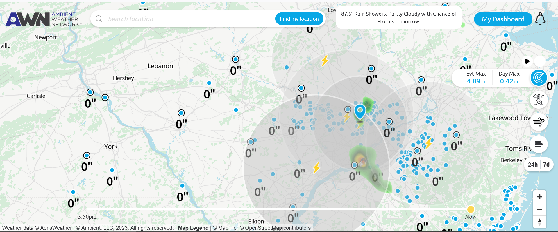
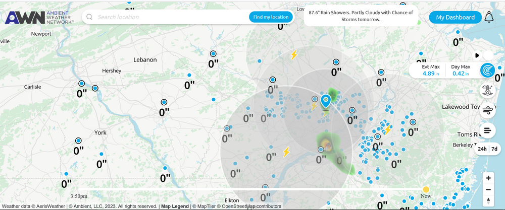
I have an Ambient Lightning detector - https://ambientweather.com/wh31l-lightning-detector Ambient's data site has an option to display the lightning being detected by those with their detectors (you may have seen me post some screenshots of mine among a pile of others). I don't think any of them can determine type but are mainly counting RF emissions from a bolt (that could be made up of many "strikes" ). Lightning maps has a FAQ here - https://www.lightningmaps.org/about/faq which also discusses the other site that displays lightning -Blitzortung.org - https://www.blitzortung.org/en/cover_your_area.php) (that latter one apparently has kits to build your own) As an obs - temp here is down to 76 with dp 71 but no rain yet today (seems most continues to hug the southern PA border).
-
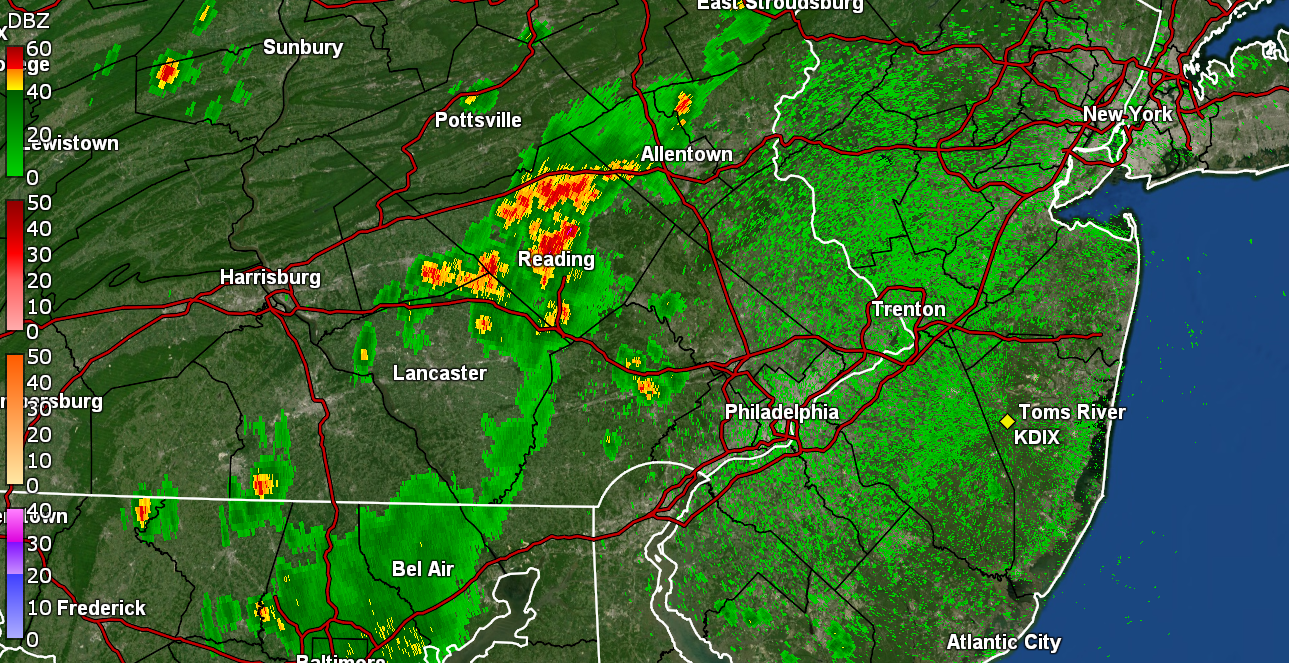
I managed to just tap 90 (89.6) as a high at around 3:15 pm today and it's currently 84 with dp 71. Seems a lot of the more potent stuff continues to ride along the northern MD/southern PA/northern DE border (in counties on either side). I suppose the "cold front" is serving more like a boundary for stuff to undulate along but not enough to form a strong convective line barreling towards the ocean (at least yet).
-
I just checked and I am at 89 with dp 74. And yeah, just some fluffy fair weather cumulus out there. Not the thick deck of hazy stuff.
-
And here we go!
-
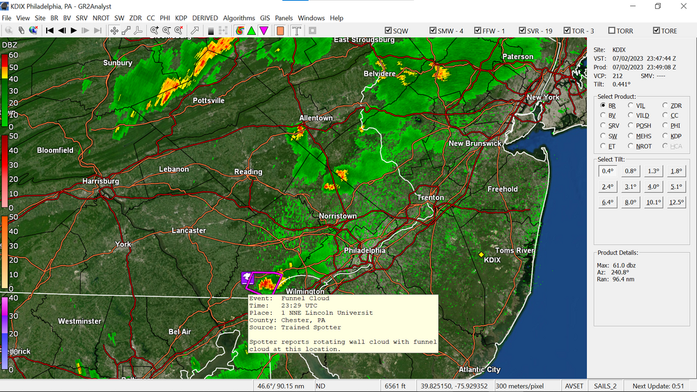
(Our) Ray gets a couple feature quotes! "Channel 10" (is not the NWS). I actually posted a screenshot with the LSR that had been submitted from there by a spotter. I think all of the reports, including in Berks, were some variation of them being a "funnel cloud". As an obs of current conditions IMBY, it's 85 with dp 75. I did hit 86 earlier but the temp has been fluctuating as the sun goes in and out.
-
I don't know what you have your thermostat set for but with mine set for 68 (which is what the guy who last replaced my thermostat and fixed a circuit board for my inside central air blower thingy had set it for to test, and I left it), I just did a temp check and the air coming out of the vents is around 55. That (at least this time of the morning, sortof the "coolest time of the day") is able to keep the house at around 68. As it heats up in the '80s and '90s during the hottest part of the day, the house ends up settling into the low - mid 70s (the latter on the 2nd floor which is where the heat "rises" ), which is fine given the house is a 2-story brick "townhouse" style. Am currently off to the races this morning with a temp of 75 and dp 73 (the low earlier ended up being 73).
-
Am glad to see those who missed out the past week or so, finally cash in. I got nada here. Zero. Zilch. But at this point, that's okay for the moment as I had about 3" of rain during the last week of June. In any case, currently 73, with full moon peeping through the high clouds, and dp 73.
-
Yeah I expect they EAS broadcast to any (enabled) phone within a TOR Warning's area (and have done it with FFWs, SSWs, etc). I know my weather radio (Sangean) will suddenly go to a real loud volume with TORs and I have to scramble to turn it down.
-
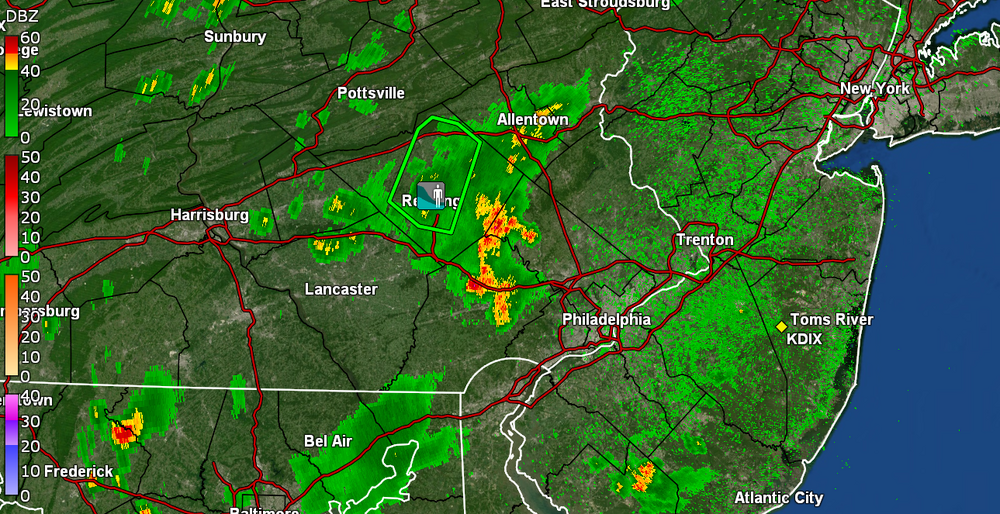
A spotter near Lincoln U reported a funnel.
-
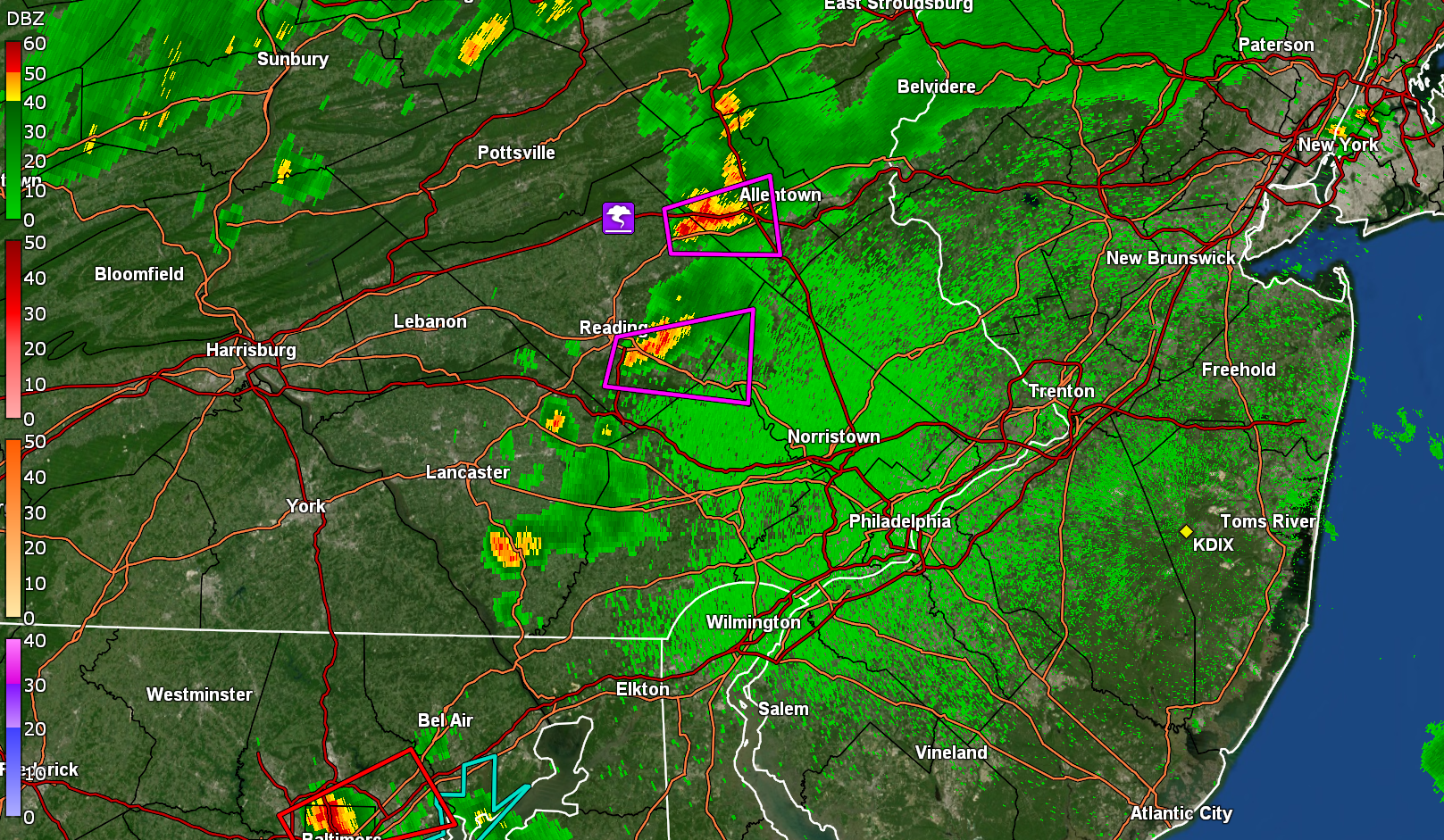
Have a pair of TORs for Lancco and Chesco. I know it is unstable out there for anyone who hasn't already had a pop-up (although some of the pop-ups have been making the humidity worse). Currently 84 with dp 77 here. Got up to a high of 88 earlier (so far).
-
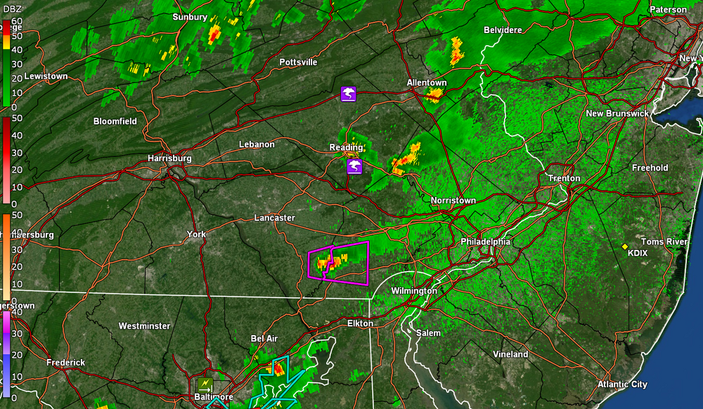
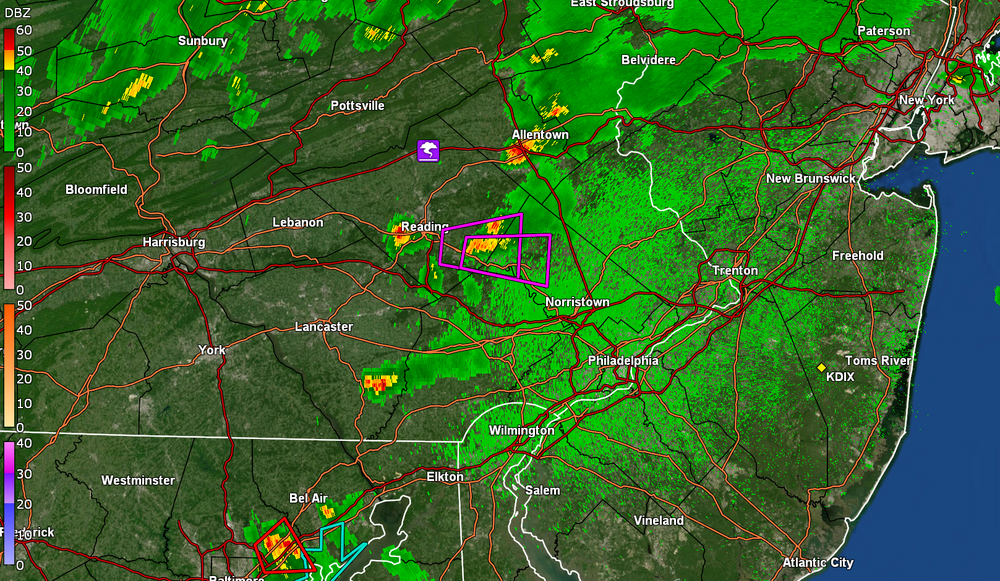
Another TOR lofted including Northern Montco.
-
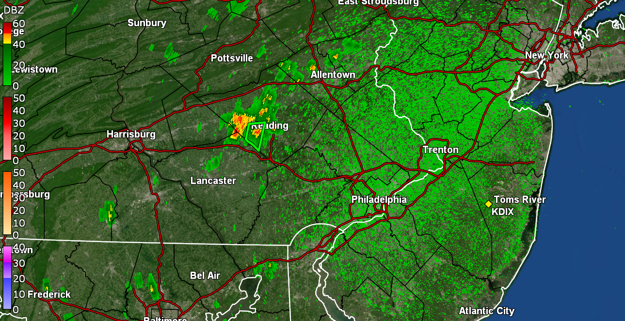
TOR issued near Reading.