Hurricane Agnes
-
Posts
9,261 -
Joined
Content Type
Profiles
Blogs
Forums
American Weather
Media Demo
Store
Gallery
Everything posted by Hurricane Agnes
-
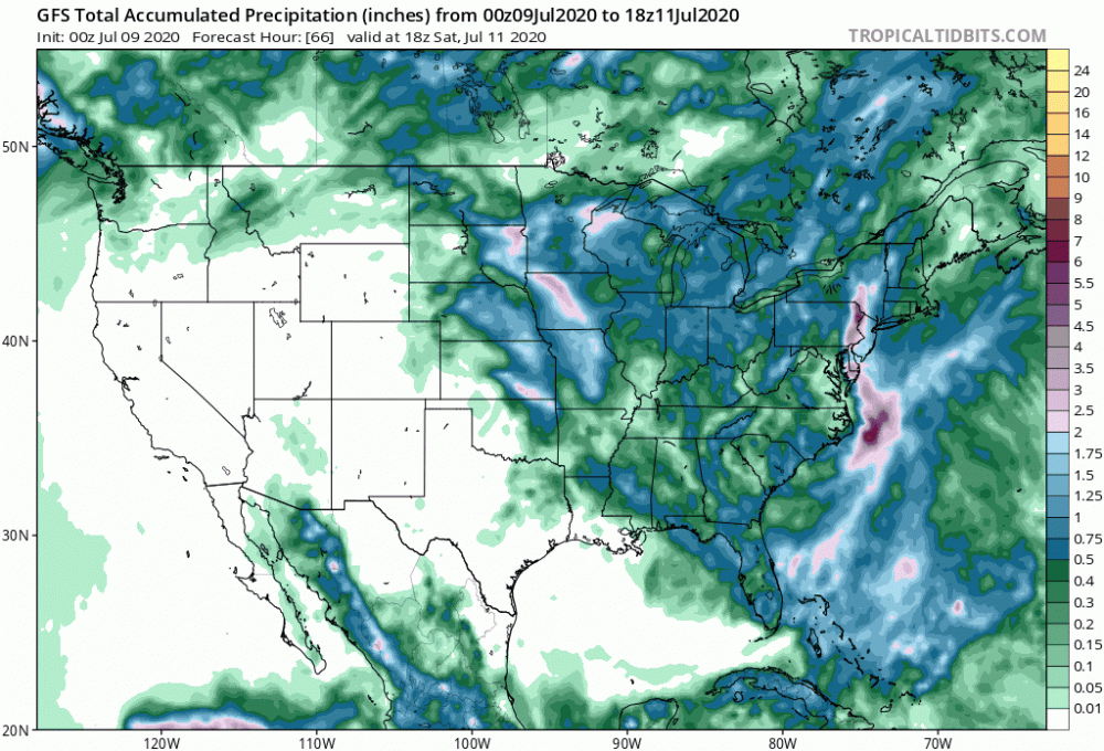
Have gotten some pivot rain but now just some light mist. Up to 3.09" at post time.
-
It'll also reduce the chances of any triple digit temps in the near term.
-
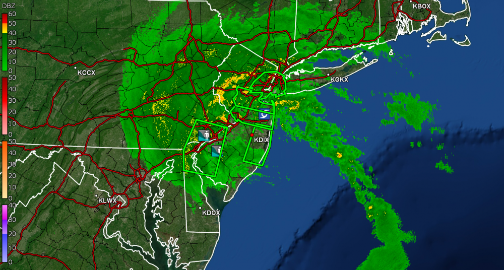
Looks like a dry slot is incoming. Rain has all but stopped. Temp still 73.
-
Just hit the 3.00" mark and it's "lightened up" a bit to 0.64"/hr rates. Have had 6.13" in 3 days. Huzzah!
-
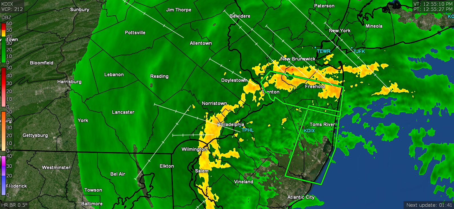
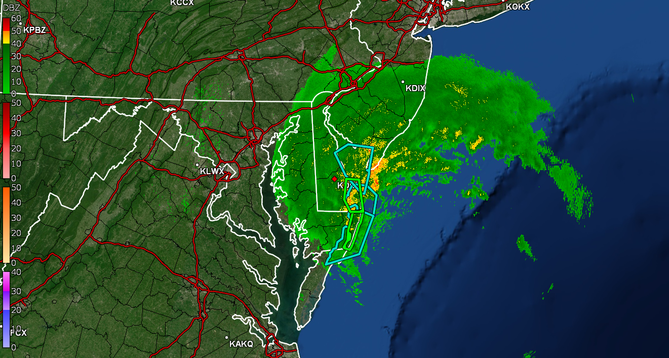
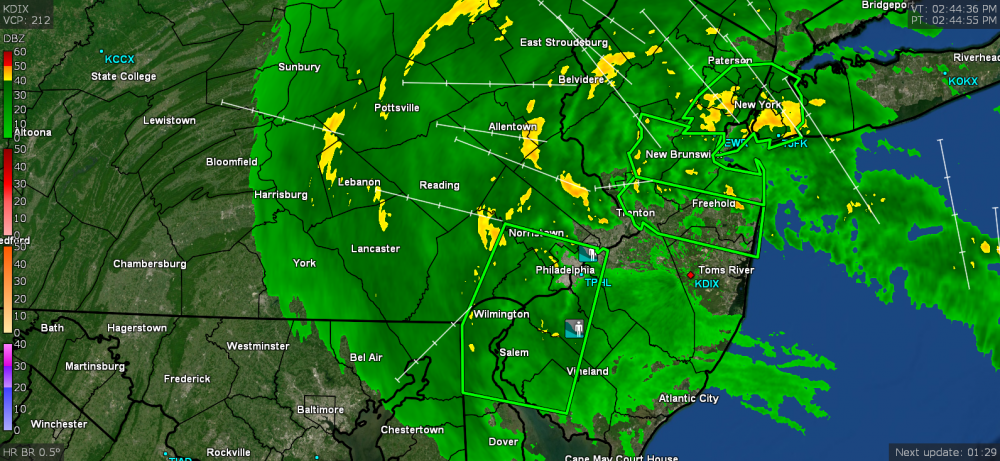
Looks like the heaviest bands have been pushing pretty far inland and there's a fire hose out there pumping it in...
-
The band that is just moving to the NW of me has been laying down 1.49"/hr rates and I'm up to 2.82" now.
-
Window steam alert! Now up to 2.52" with heavy rain and temp holding at 73.
-
Just ticked over the 2" mark for event rain - 2.01".
-
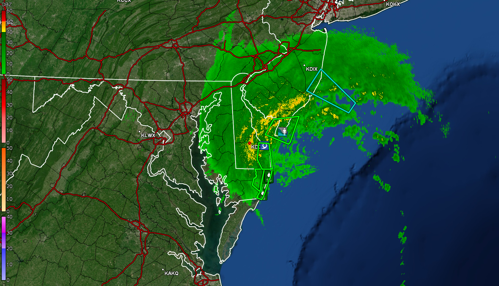
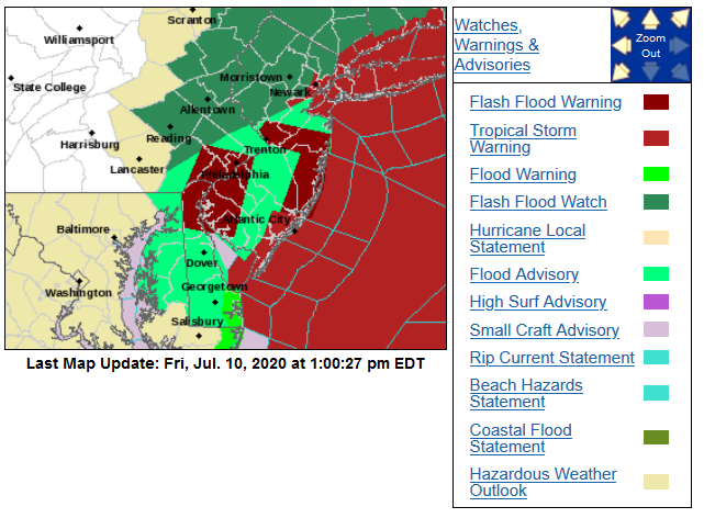
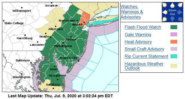
FFW issued for the metro area -
-
Had a heavy band pass through about 5 minutes ago with almost 2"/hr rates. Currently heavy rain and @ 1.82" with temp at 73.

-
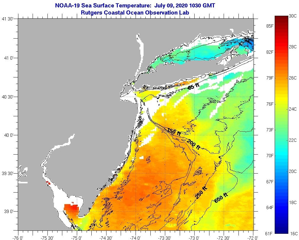
I'm surprised the ssts are this warm off the coast this "early" in the season (image from yesterday before it started churning up this way)!

-
Now at 0.77" here...
-
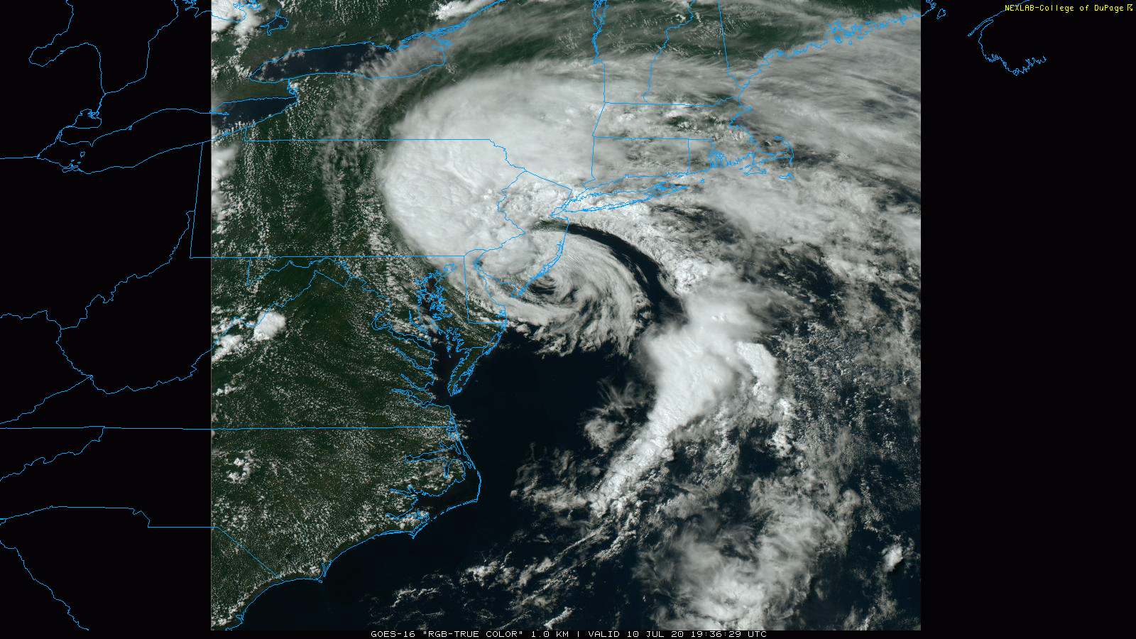
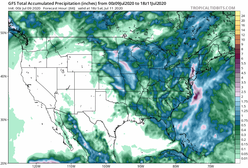
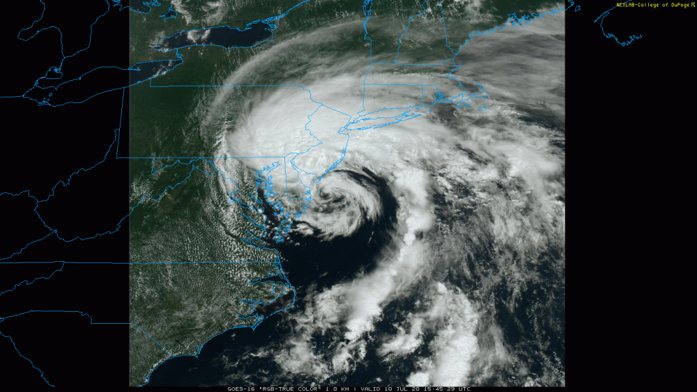
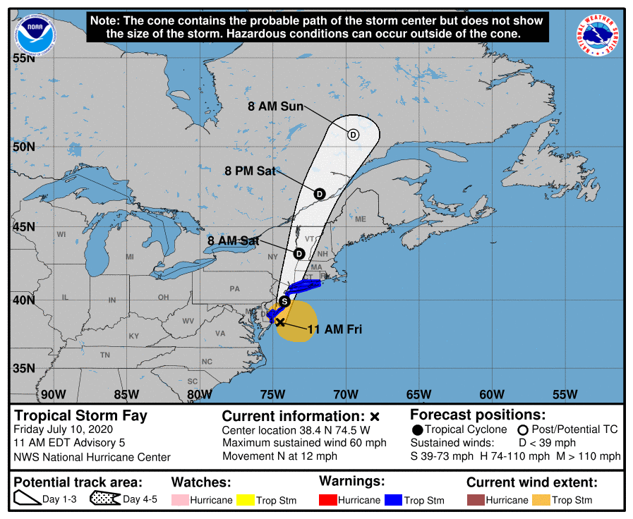
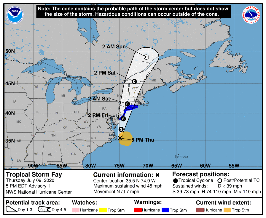
Here's the cone - cutting right up through Jersey! Now have 0.59" rain here.
-
Now getting some moderate rain and am up to 0.20" so far. Temp is 74.
-
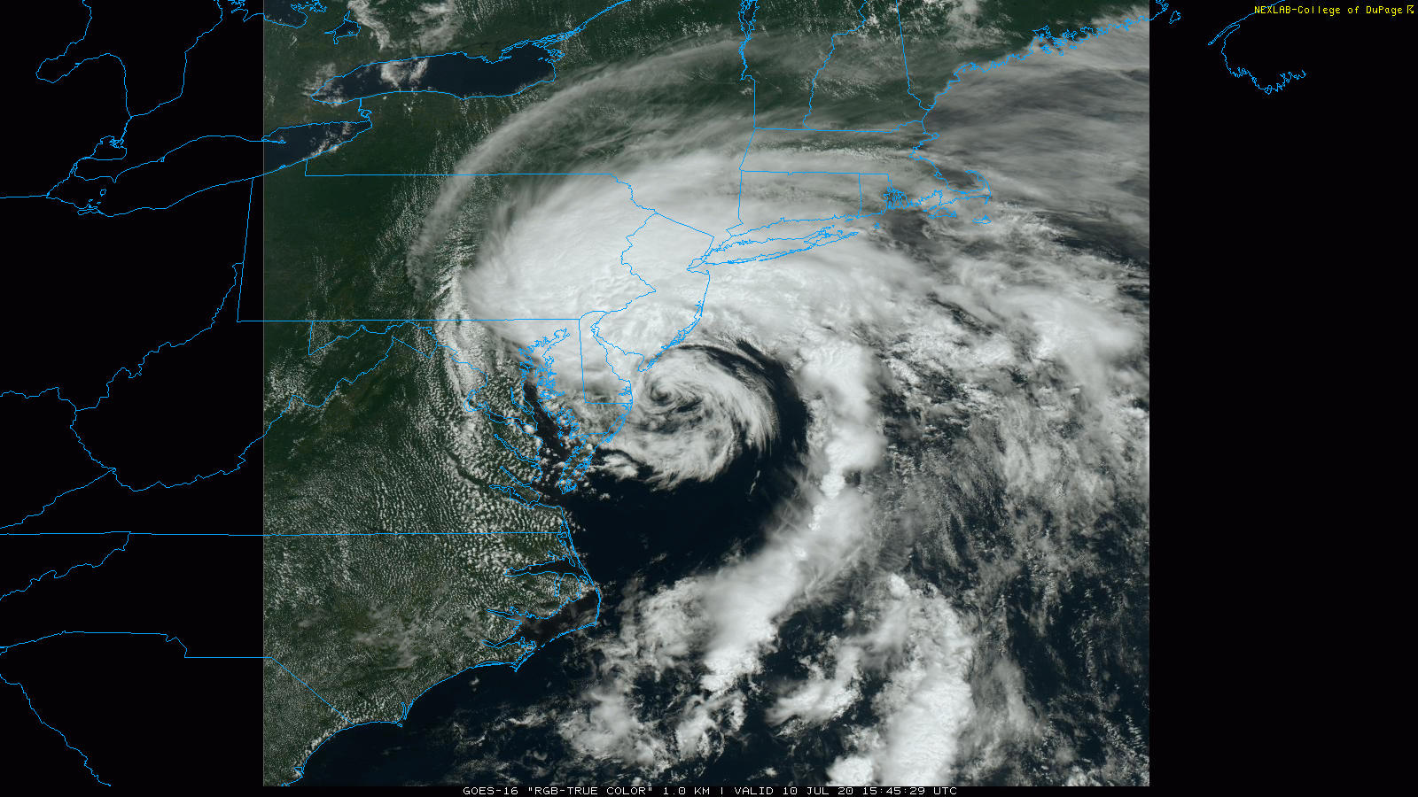
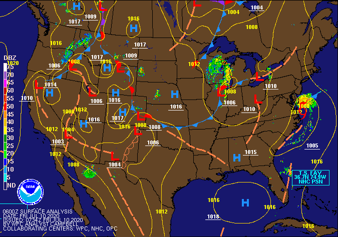
The latest-- TS Fay looks to literally be scraping and slapping againt the coast of Delaware!
-
Getting light rain (at 0.01") and currently 75.
-
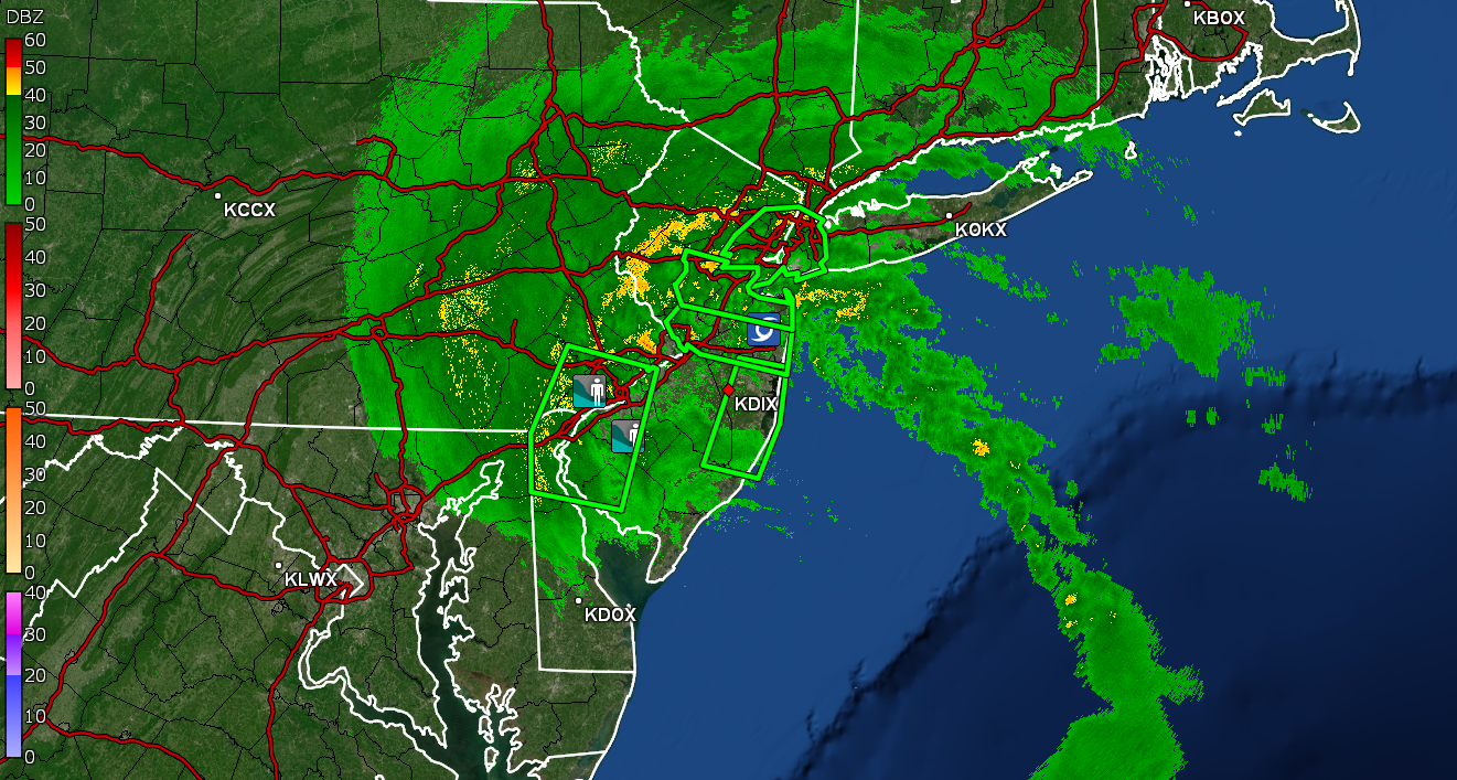
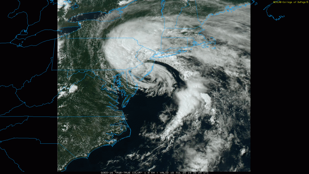
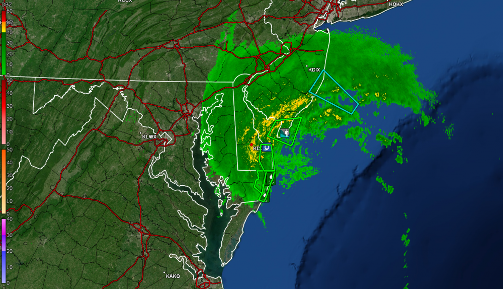
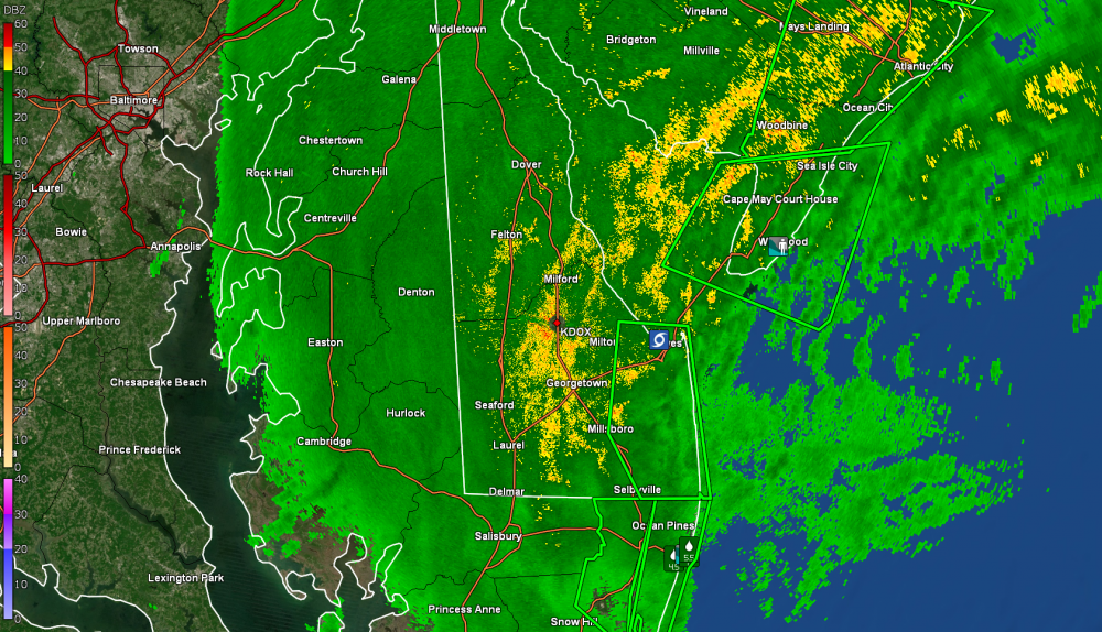
Here is the KDOX view of TS Fay -
-
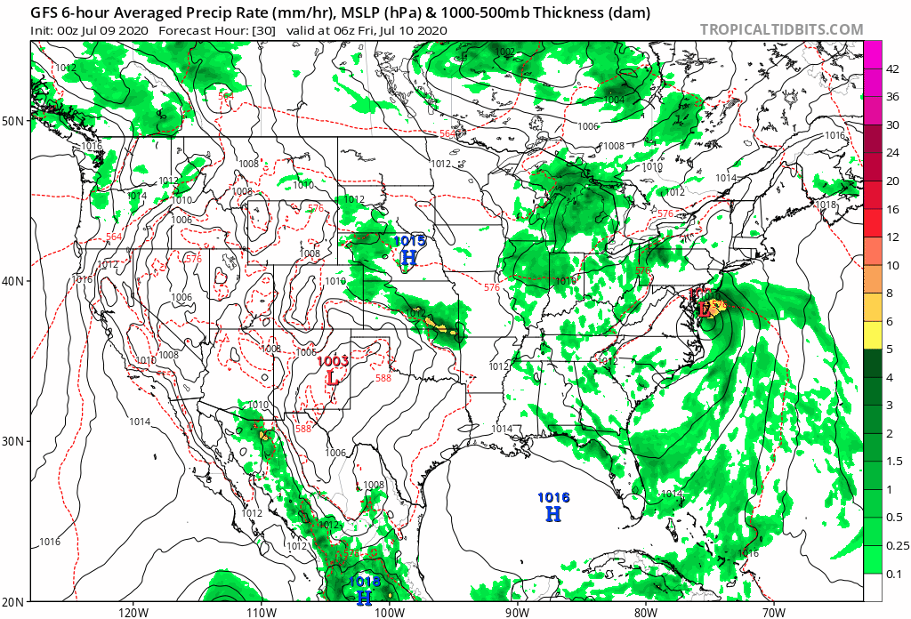
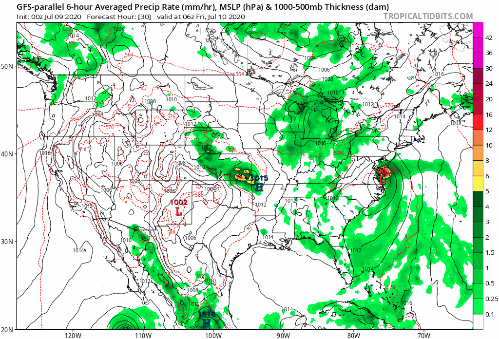
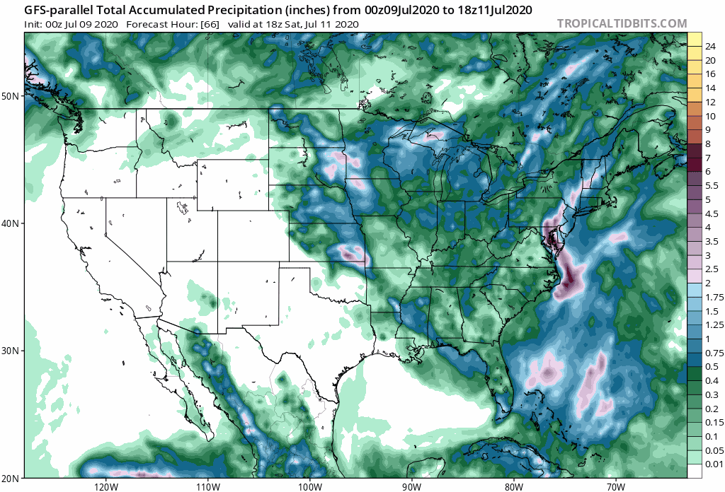
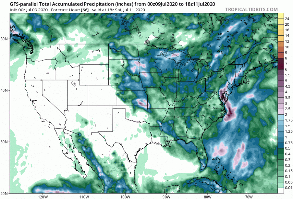
The GFS seems to have the cyclone a bit further north and east versus the GFS-para...
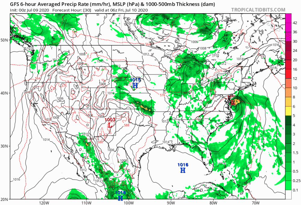
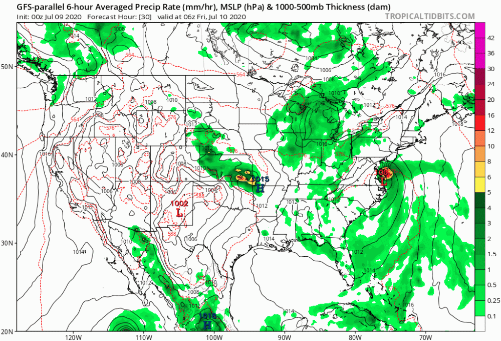
-
I guess to line them up, you'd have this...
-
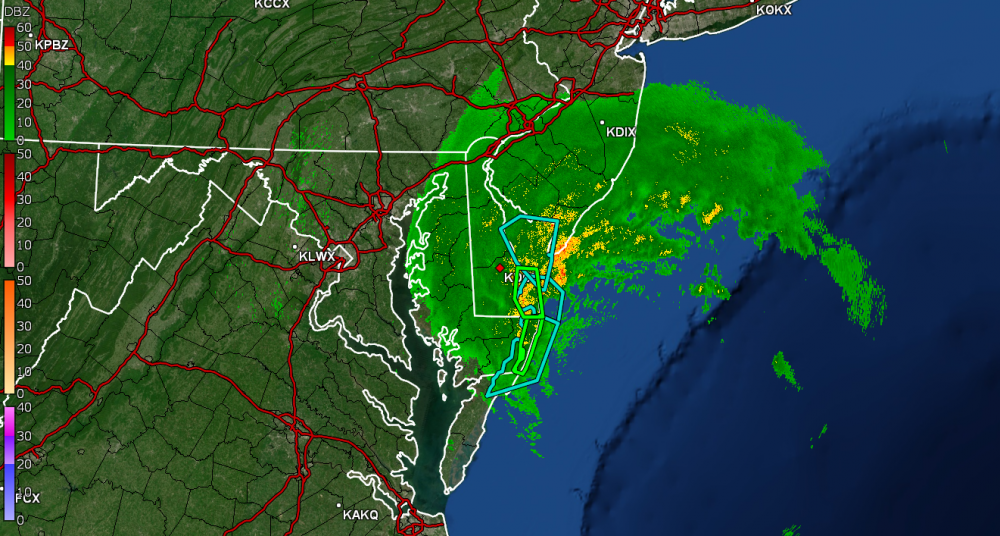
Radar has been lighting up to the south. Currently 75 and overcast here. Overnight/morning statements - For the coastal Jersey counties - For the area -
-
Mt. Holly office issued a statement for here in their CWA about 90 minutes ago - We usually get Hurricane and/or TS remnants most times - and that's usually in the early fall period.
-
I actually made it up to 91 today surprisingly because it didn't look like it was going to do it but it did - right after ~3:15 pm. Currently partly cloudy to the north but starting to cloud up to the south, and 87.
-
The coastal is Tropical Storm Fay now! Don't see one of these very often...
-
Flash Flood Watched issued pretty much everywhere in the CWA - Currently 89 and partly cloudy and humid although it could be worse (dews only in the 60s).
-
Actually made it up to 91 yesterday before it clouded over and stayed generally overcast much of the rest of the day. After I had gone to bed, it looked like we had some lightning around here in the 10:30 pm timeframe but apparently no measurable precip. Currently 73, mostly cloudy and steamy (yup, windows steamed up).