Hurricane Agnes
-
Posts
9,264 -
Joined
Content Type
Profiles
Blogs
Forums
American Weather
Media Demo
Store
Gallery
Everything posted by Hurricane Agnes
-
Sun finally popped out and I got 0.23" total in the bucket for that round and a half. Temp is creeping back up again and now at 69 with dp 66.
-
I'm actually getting rain here at the moment. Got another 0.05" so far. Little isolated line going over me that is south of you.

-
Getting the steamy windows! Temp is down to 65 but my dp is at 64.
-
It definitely was a fast mover! Got 0.18" out of it before it was gone. I know there is supposed to be another round or so later today.
-
Getting a thundershower now. May end up getting under a heavier cell.
-
There's a foreboding looking line of dark clouds to my west as viewed out the window (and of course on radar). My low this morning was 61 and I got up to 72 before the sun disappeared. Currently at 70 with dp 61 and getting dark.
-
https://www.drought.gov/states/Pennsylvania That just changed the goal posts.

-
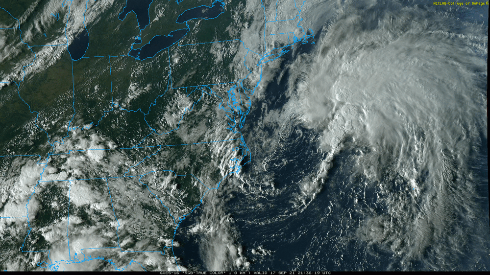
(ETA to fix the lows - must have been looking at the wrong column) Ended up with a high of 71 yesterday after a low of 56. Had a slightly cooler low this morning of 53 and made it to 79 (so far) and it's currently mostly sunny and bopping between 78 & 79 with dp a respectable 54. Will have to see how the convection pans out tomorrow. SPC has the area penciled in for some general thunderstorms - Mt. Holly had a nice clip of Hurricane Sam churning out in the ocean from yesterday. Have been following it including through its ramp-up to a strong Cat 4 and it is now back down to a Cat 3 (as expected). -
-
Ended up with 2.15" yesterday when all the little lines of showers came through. Had a low of 54 this morning and a high of 71 today. With the sun setting in about 10 minutes and calm winds/clear skies, temp is dropping quickly and I'm down to 65.
-
Yeah that little band is coming through here now and has given me another 0.1" for a total of 2.11" so far.
-
There may be another little band of rain to come through here but I've had on and off stuff since my last post that has netted me a total of 2.01" so far for today. It's currently misty and 65 with dp the same.
-
Down to light rain now with 1.62" in the bucket so far. temp is 71 with dp 70.
-
Now up to 3"/hr and up to 0.99" at post time. Getting thunder with this. Temp down to 71.
-
Getting a gully washer with >2"/hr. Currently at 0.36" in the bucket with temp 73 and dp 71.
-
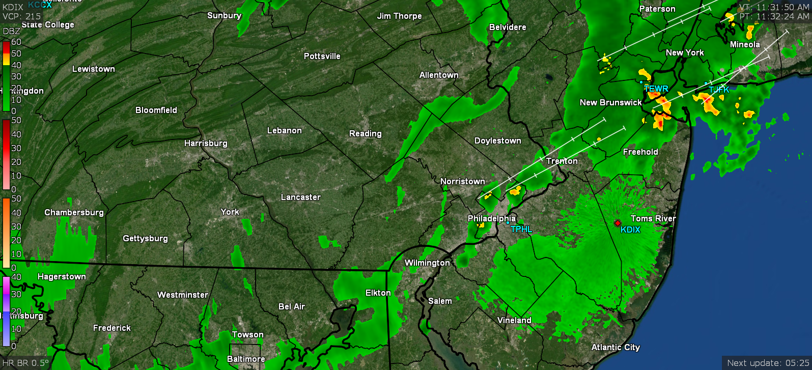
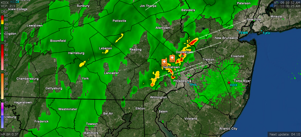
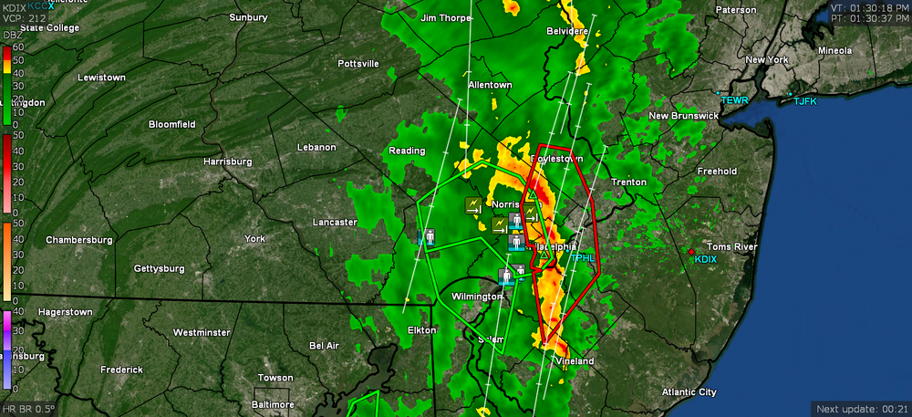
Getting some light rain the past hour (only have 0.01" in the bucket) and some convection nearby. Am under a Severe Thunderstorm Warning. FFW also lofted for parts of the city and adjacent suburbs. Low this morning was 70 and high (that has dropped) was 80. Down to 75 with a little light rain and dp 72.

-
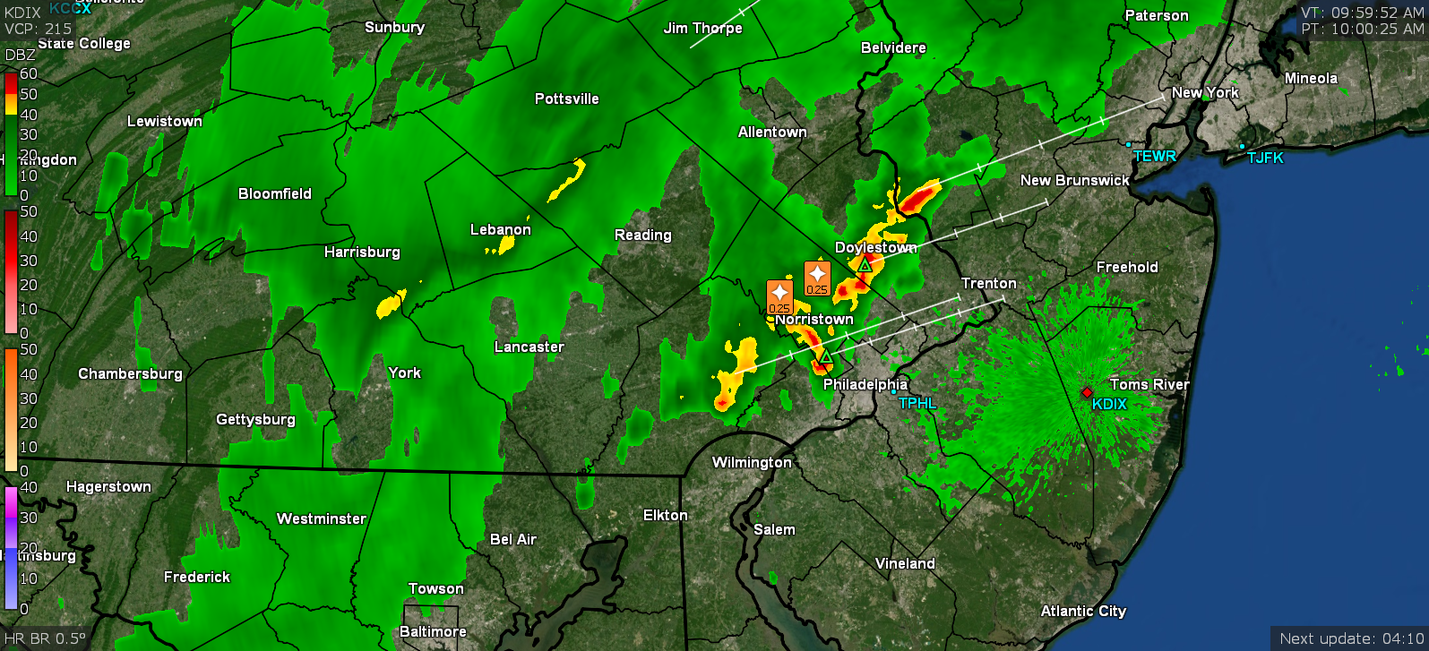
Mt. Holly's Flash Flood outlook - I know we finally got a little chance to dry out the past couple weeks or so (had to pull out the hose for some plants) but will see how this verifies. Had a low of 69 this morning and it's currently mostly cloudy and 72 with dp 70, so definitely sticky out.
-
It ended up radiating a bit more than expected here this morning and my low was 58. Ended up hitting 78 as a high and the humidity, even with the cooler temps, was noticeable. Currently 76 and changeable skies along with breaks of sun here and there, and dp 65.
-
There was speculation in an article a couple days ago of possible landslide collapse into the ocean of one side of the island near the volcano (due to the eruption and all the earthquakes the proceeded it, as well as those still going on) and that possibly causing a large tidal wave - https://www.nzherald.co.nz/world/canary-islands-volcano-could-eruption-cause-landslide-and-mega-tsunami/MEAOBU6BPNYO7QPCIWCNOHVU7A/ But then the "disaster scenario" was apparently pooh-poohed based on some later studies. Here's an interesting explanation about it though from 4 years ago - Currently 76 with dp way down to an amazing 49. I did have to go out and water because despite some 11" of rain last month, and except for a few hundredths of an inch the past couple days, I haven't had a solid rain since around September 9th.
-
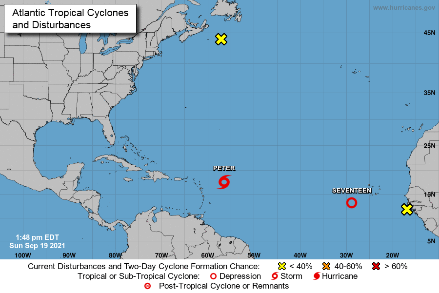
Well after being declared DOA, Odette has awoken again and NHC thinks it may become subtropical or even tropical, and head over that way to take a look. There's a large expanse of ocean between them... but...
-
Had a high of 85 after a low of 68 yesterday, with the dews in the upper 60s. Today is like day and night. Low was 62 and it's currently clear with an all-blue sky and 73 with a dp of 52.
-
-
Had a low of 70 this morning and a high of 77, with some scattered rain that netted 0.03" so far. It's currently 74 and mostly cloudy, with dp 70 and a newly minted TS Odette sitting right off the coast!
-
I actually got 0.25" of rain last night from some cells that blew by here, complete with some chimney-rattling thunder. Had an additional 0.02" of leftovers early this morning so have 0.27" for the event. After a low of 68 this morning, am currently mostly sunny and 78 with dp 69.
-
Nice! Will have to see if that line lasts to reach here... It got up to 88 here today after a low of 70. Currently 81 with dp that has bopped up and down (and briefly hit 66) but is now at 69.
-
Yeah the haze is pretty bad late this afternoon but it's interesting how wide the spread has been today - Mt. Holly is watching for possible action tomorrow - Am keeping an eye on these guys too - Ended up with a low of 68 this morning and a high of 86. The humidity was definitely more noticeable. It's currently a hazy 83 with dp 72.