Hurricane Agnes
-
Posts
9,264 -
Joined
Content Type
Profiles
Blogs
Forums
American Weather
Media Demo
Store
Gallery
Everything posted by Hurricane Agnes
-
SPC penciled in area of concern for convection and possible tornadoes - Low here this morning was 64 and it's currently a muggy 76 with dp 67 and lots of high clouds advecting in.
-
Well he has piloted shuttles off planet surfaces... so... I ended up with a high of 76 yesterday and 81 today, both mornings with lows of 60. You could definitely feel the humidity today however. Currently 71 with dp 66. Mt Holly tweeted about RER high temp ties for 3 CWA sites today -
-
There was a G2 CME earlier in the week so it dimmed the sun. All he kept saying was that suddenly "it went from blue sky to black sky". Had a high of 68 yesterday and 72 today (despite the all-day overcast), with low of 59 yesterday but a wee bit warmer 62 this morning. Currently 68 with dp 64 so expecting maybe some stratus again (and possibly fog) since the winds have pretty much gone calm.
-
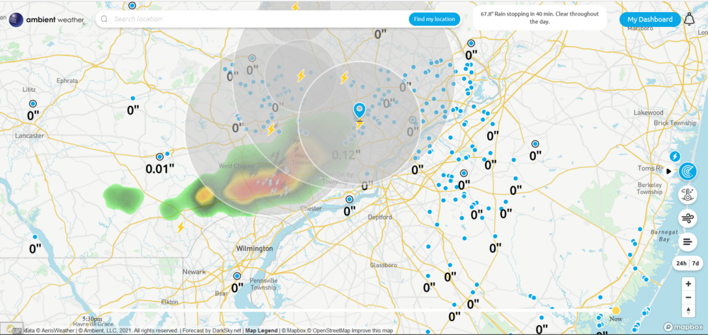
The high yesterday ended up being 69 and I picked up 0.09" of rain sometime between 1 - 2 am. Low this morning was 61 and I think I may have hit my high of 65 with on and off drizzle/rain. That on/off stuff gave me a couple more hundredths of an inch so I am currently at 0.13" for the event so far. Currently 64 with some light rain and dp 63.
-
Made it up to 78 yesterday after a low of 59. This morning's low was a "warmer" 61, where I did have some low stratus form here overnight that quickly lifted before sunrise, but the backdoor front plus the overcast/flow off the ocean, has kept the temps down so far. Currently overcast, with occasional breaks of sun, and 68 with dp 61, and it's not bad out at all.
-
Made it up to 71 yesterday after a low of 62. This morning's stratus lifted pretty quick and had the sun attempting to pop in and out. After a low of 64 earlier this morning, am up to 68 with dp 63, and some occasional sunshine trying to poke through a deck of high clouds.
-
I didn't expect it either given it seemed most of it had been to the north, with some very scattered pop ups here and there south of that band... and although I knew the front was dropping down from that direction and it was overnight, I figured things wouldn't have been as unstable as they apparently became. Before going to bed, I was looking at what appeared to be a convective boundary moving in from the NE and figured that would trickle in enough cooler air to stabilize things but apparently not. The cluster of cells with that heavy rain came up from the SW. So far my low has been 60 and I finally moved up to 62, with dp the same, and it's still overcast and misty.
-
Man you have been getting your careful seeding efforts washed away over and over.
-
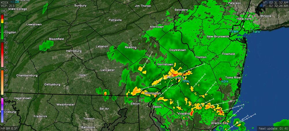
Looking at their tweet and the SPS they put up overnight, it looks like it just missed you to the south - Of course south of there got nailed (and I wish they hadn't drawn that SPS to exclude Philly at that latitude because that rain hit here in NW Philly - i.e., there was no "wall" along the border between Montco/Delco and Philly ). They also posted this (RER for KPHL for 2.3" of rain from that) -
-
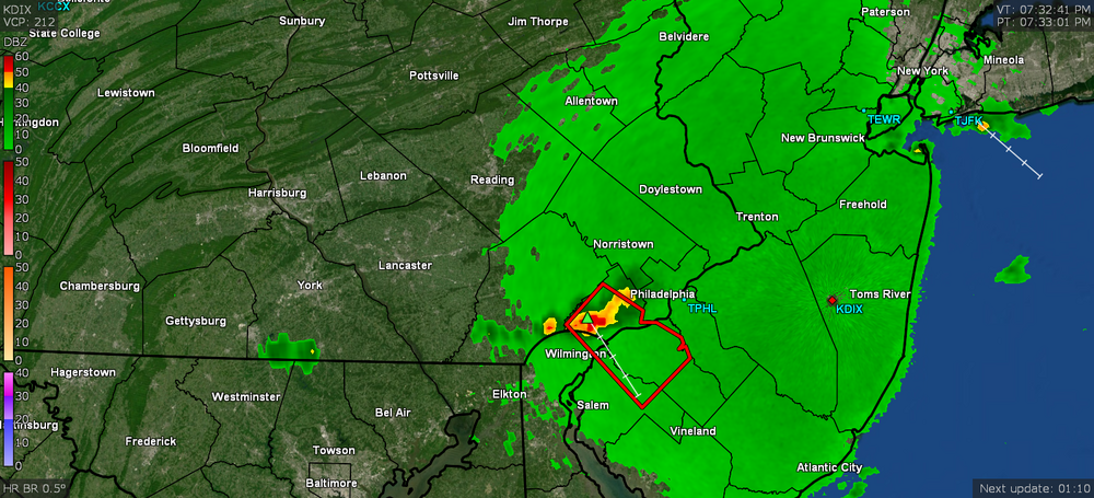
Ended up making it to 80 yesterday but it was muggy as hell when I was out at the supermarket. Heard all the rocking and rolling early this morning between ~1 am - 4 am and was surprised to have gotten nailed with a total of 1.64" when all was about finished before 6 am. The heaviest came between ~2 am - 3am. Currently overcast, misty and 61 (currently my low so far) with dp 60.
-
Low this morning was 66 and have gotten a little passing light rain shower in the past hour depositing 0.01" in the bucket. Currently overcast and 69 with dp 68.
-
Topped out at 81 today and although it went to mainly blue skies once the fog lifted, the clouds eventually rolled in to make it partly sunny much of the rest of the afternoon into the evening. Currently 71 with dp 67.
-
Fog has lifted, sun has broken out, although there is still a bit of a cloud deck overhead. Temp has crept up with the sun and is at 64 and rising.
-
Looking at my station data, I apparently did bottom out just after 3:30 am this morning, so what I posted was after it had already started rebounding. Since then I haven't moved much for a temp - am at 62 with dp 61 and the fog is still around somewhat but definitely not as dense as earlier and is lifting rapidly. Probably at more than 1/2 - 1 mile visibility and rising.
-
Haven't bottomed out yet as far as I can guess but if Mt. Holly folks are looking here, the fog has rolled in here in NW Philly within the past hour. It's maybe 1/10th of a mile or less visibility. Haven't had it like this since maybe the late winter or early spring when there was some snowpack aiding it. Seems to be advecting/oozing in more from the N/NE vs the S. Currently dense fog and 61 with dp 60.
-
Ended up bottoming out at 48 yesterday morning and had a high of 67. This morning's low was a degree higher at 48 but that was brief and am now up to a mostly sunny 72 with a dp that has crept up to 58.
-
Made it to a high of 68 yesterday after a low of 52. Looks like my low this morning was 55 and it's currently 60, with some scattered high clouds advecting in and out, and dp 52.
-
The chart is showing from 1995 - 2005 to show the same scale across decades. Your assertion has been that "there were no major drought's (sic) in the 2000s". I.e., this - The "1999 was a major/extreme drought for perspective" statement is clearly torpedoed by the chart showing 2001 - 2002, not only as a "major/extreme" drought, but with a higher and longer duration of time in "D2", "D3", and D4" levels of drought when compared to 1999. I know many of us remember that year because it was when 9/11 happened and by a "freak of weather nature", there was very little snow in the midatlantic that winter while first responders were at ground zero doing recovery operations. I.e., they were able to work, generally unhindered, throughout a NYC winter. But that lack of rain after September 2001, coupled with a lack of snow that winter, lead to a dry spring and even a record high temp on April 18, 2002 here of 95 - https://www.climatespy.com/climate/summary/united-states/pennsylvania/philadelphia-intl/april And that morphed into an even drier summer, eventually resulting in a number of PA counties experiencing extreme drought conditions. We were finally able to cash in on some of the rain from the remnants of Hurricane Isidore (name now retired) that September (along with some from TS Kyle later) to finally start breaking that drought.
-
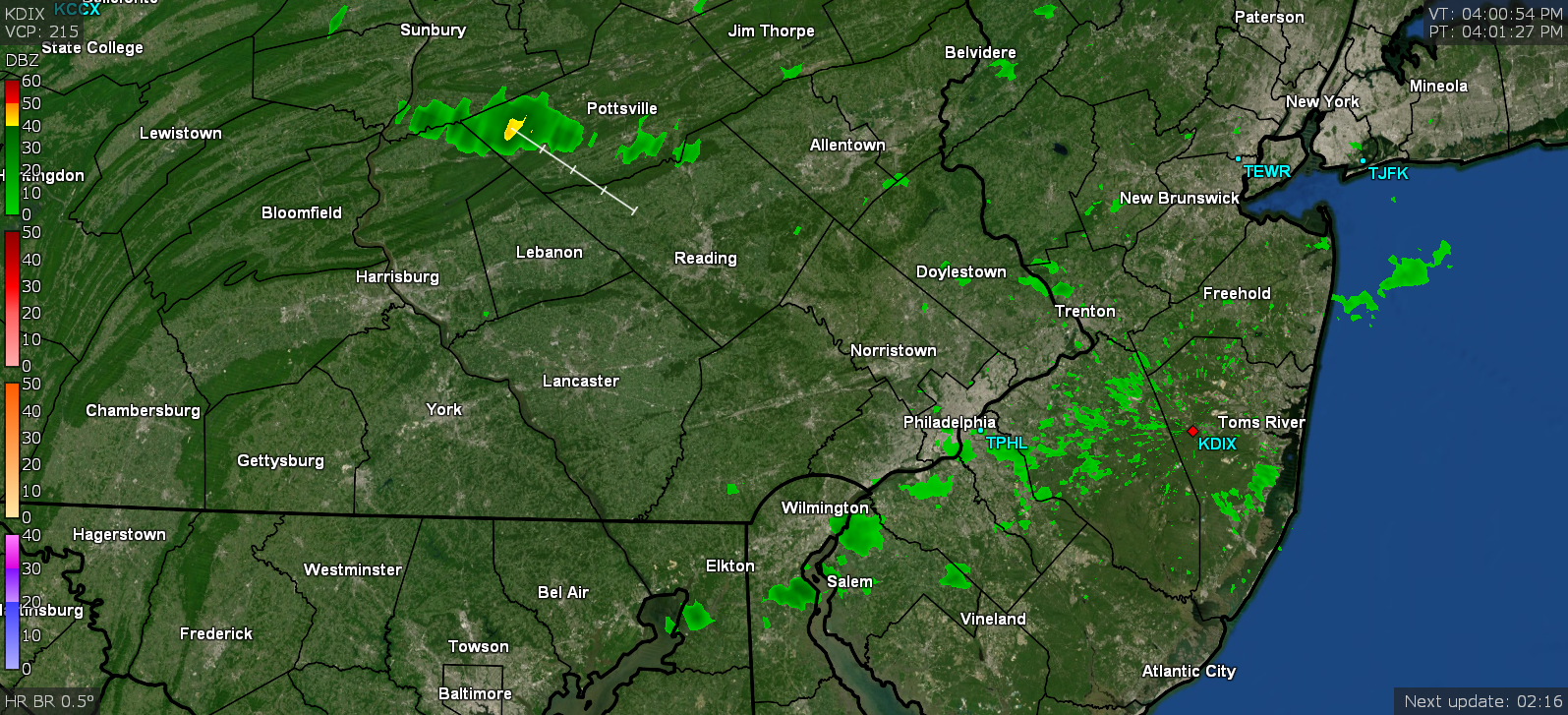
Mt. Holly just threw up a ST Warning for it.
-
My front faces south and have peeped out and yup. Fireworks going that direction. Has been giving my little lightning detector a workout.
-
I think that is going to fringe me to the south but it may be headed right for Kamu! I'm seeing the dark clouds rolling to my WSW. Temp now at 69 with dp 65.
-
I was watching the line of cells sortof break up a bit and reform and had a feeling that the hole in the line went over you. The sun has still tried to come out here and did so a few times. Feels like there some downsloping going on that is keeping temps up a tiny bit, even with the clouds, before the front comes through. My high so far today was 72, but then that was around 9:30 this morning. Currently 70 with dp 65 and mostly cloudy with breaks in the deck for the sun to peep through.
-
And the sun is popping in and out again, although I know it's only a couple hours before sunset.
-
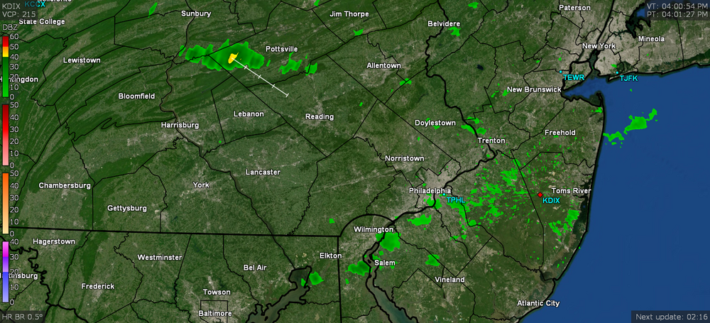
The front is to the north and slowly sagging south so while it's still daytime, I expect they may get something up north and it may start to fizzle after nightfall. I just read Mt. Holly's AFD and they said they were reducing the POP chances... although I know when you have a front hanging around nearby, stuff can randomly pop up. I'm still at 70 with dp 65, so it's still warmish at ground level. There's a few cells up in NW Berks at the moment, aiming right for Cool Mike.
-
Well the sun was of the "self-destruct" category and it clouded up real good again the past hour. Temp is up to 70 with dp 67.