Hurricane Agnes
-
Posts
9,344 -
Joined
Content Type
Profiles
Blogs
Forums
American Weather
Media Demo
Store
Gallery
Everything posted by Hurricane Agnes
-
January 7th First Snow for some N&W folks Discussion
Hurricane Agnes replied to ChescoWx's topic in Philadelphia Region
Ahhh.... I figured there were some folks from out that way around lurking. This must be you --> -
January 7th First Snow for some N&W folks Discussion
Hurricane Agnes replied to ChescoWx's topic in Philadelphia Region
Mt. Holly is throwing some nods to the snowmisers - -
January 7th First Snow for some N&W folks Discussion
Hurricane Agnes replied to ChescoWx's topic in Philadelphia Region
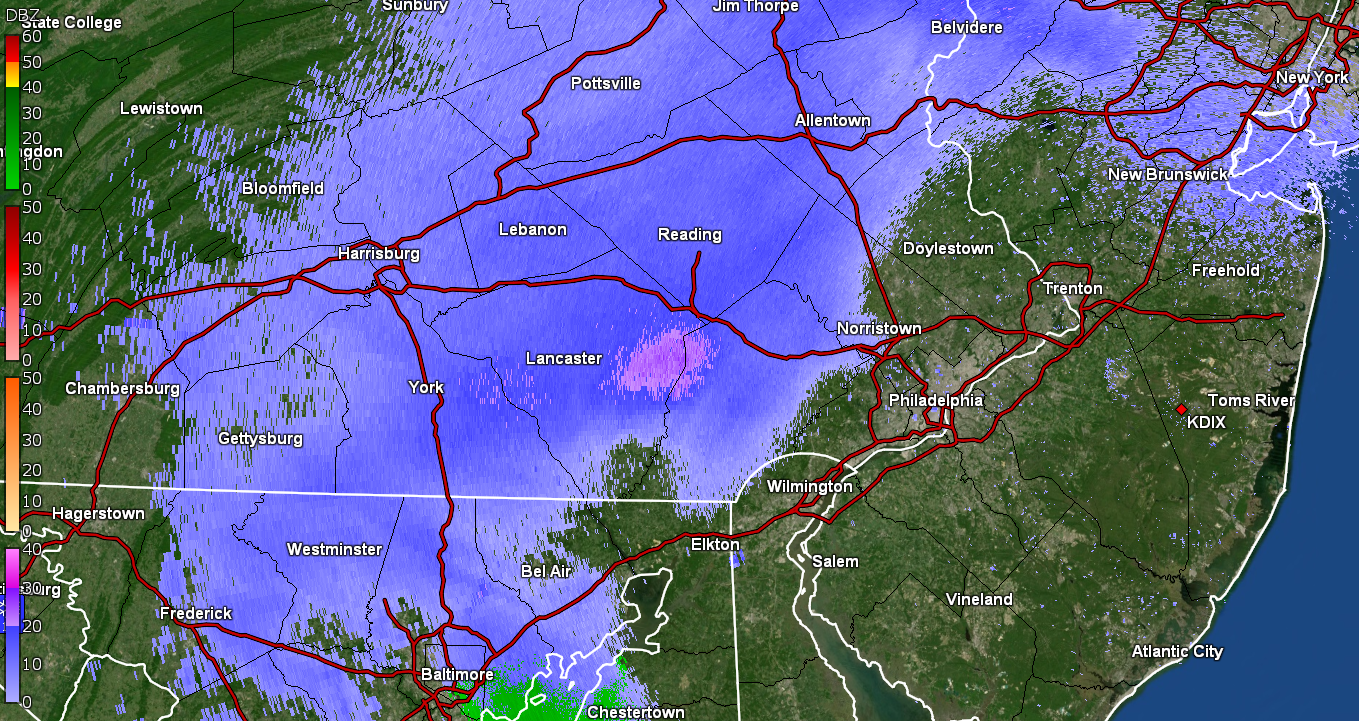
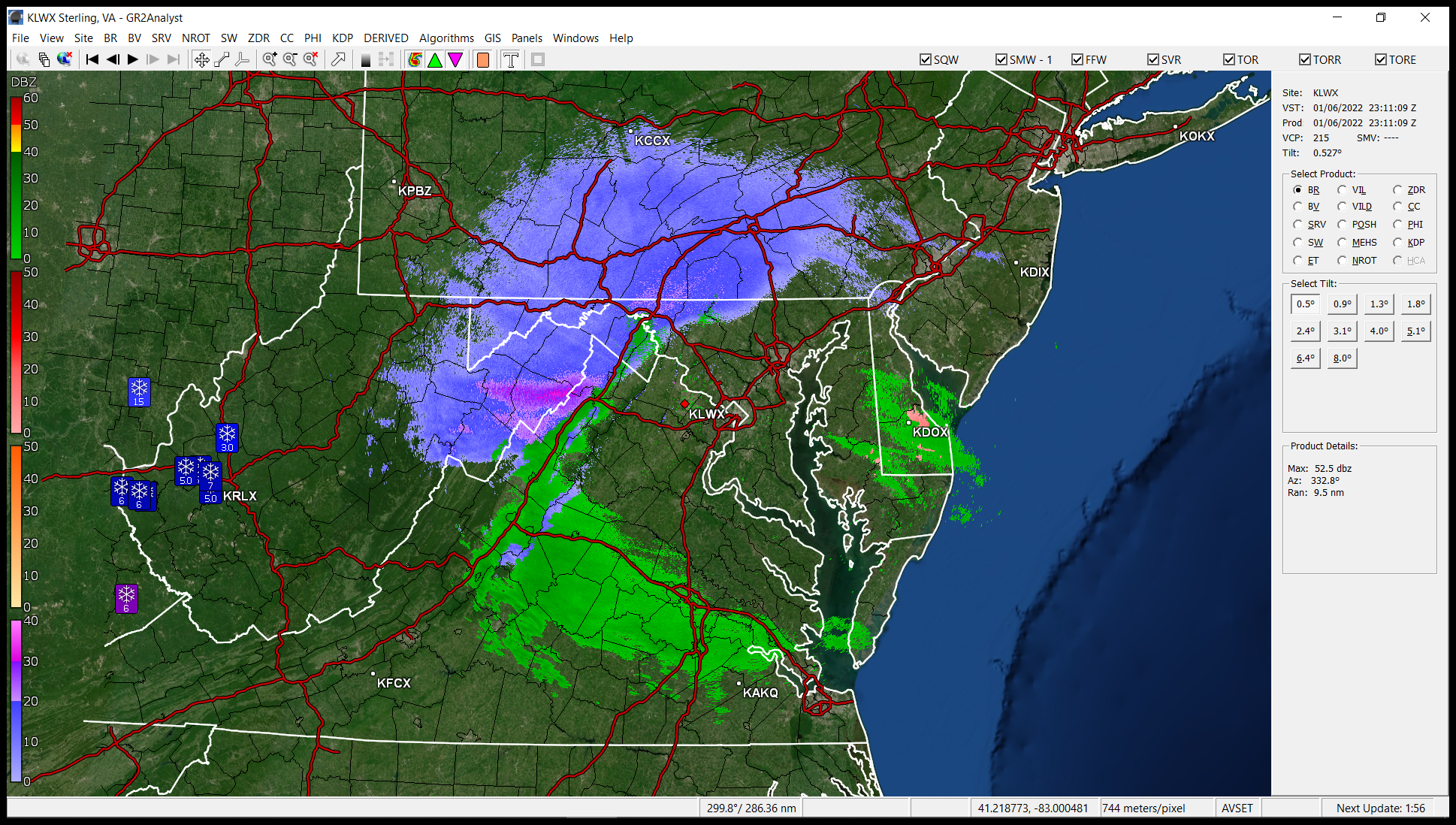
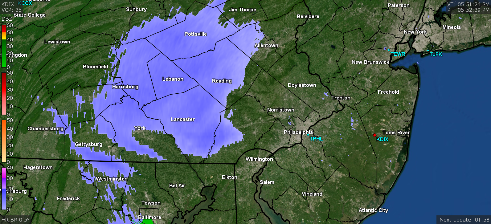
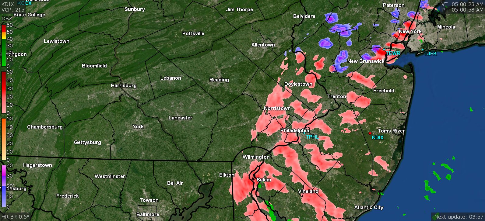
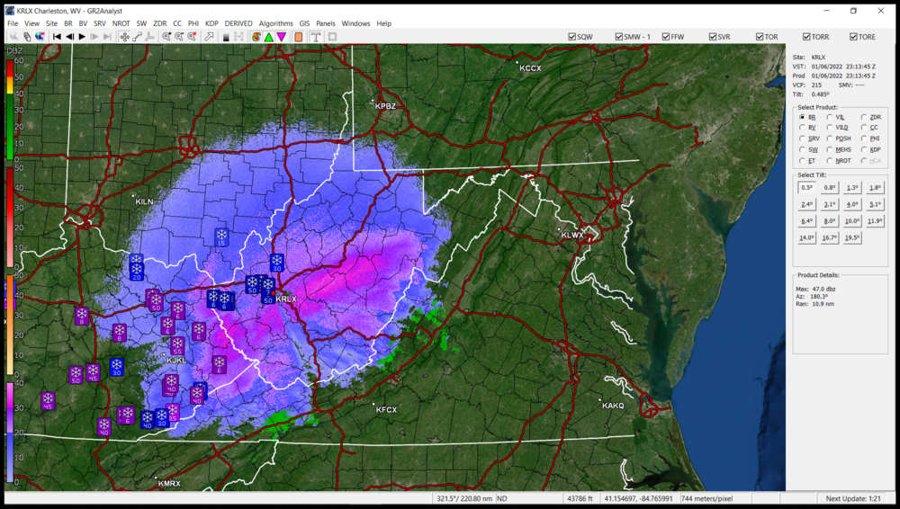
I do have radarscope which is great on mobile but have also been using GR2Analyst to get the finer rez dopplers (in addition to the GRLevel3). I see a blob of something that has to be reaching the ground coming out of Lancaster and moving into Chesco.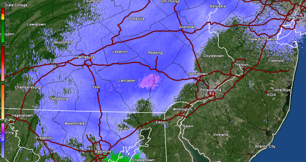
-
E PA/NJ/ DE Winter 2021-22 OBS Thread
Hurricane Agnes replied to JTA66's topic in Philadelphia Region
Actually made it up to 39 today after a low of 33. It was variable with periods of overcast and sun during the daylight in any case. Am down to 34 but that dp depression is pretty significant from earlier today and is down to 18. -
January 7th First Snow for some N&W folks Discussion
Hurricane Agnes replied to ChescoWx's topic in Philadelphia Region
Okay. It looks to be thumping down in central/southwestern WV and eastern KY.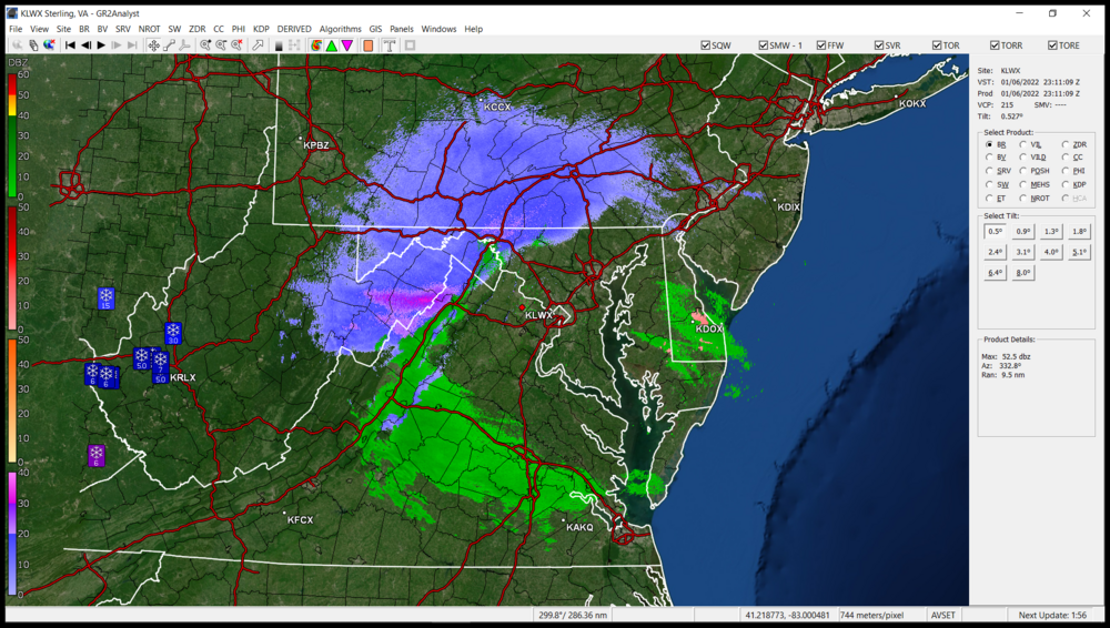
-
January 7th First Snow for some N&W folks Discussion
Hurricane Agnes replied to ChescoWx's topic in Philadelphia Region
Maybe because there are some returns streaming up this way from the SW. I don't know if any of it is reaching the ground but Mike would be the best judge of that since a blob is sitting over that area. is it virga or the real thing yet?
-
January 7th First Snow for some N&W folks Discussion
Hurricane Agnes replied to ChescoWx's topic in Philadelphia Region
WSW for Jersey - And WWA for PA & DE - -
January 7th First Snow for some N&W folks Discussion
Hurricane Agnes replied to ChescoWx's topic in Philadelphia Region
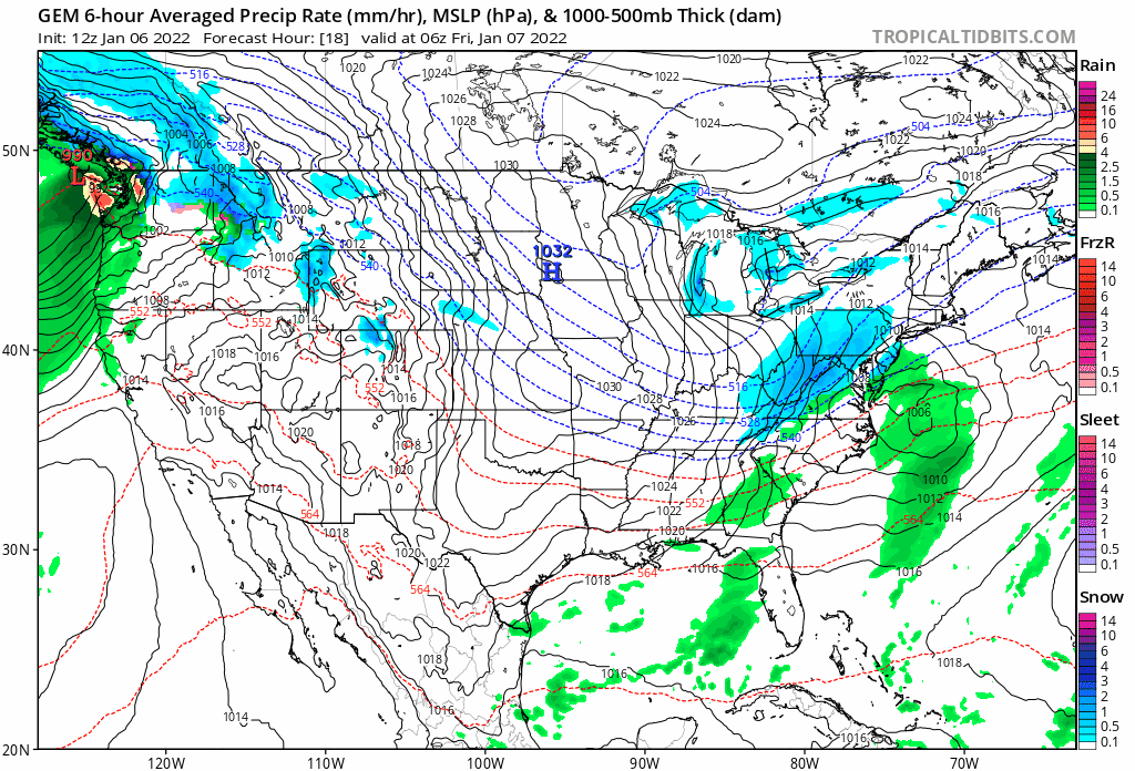
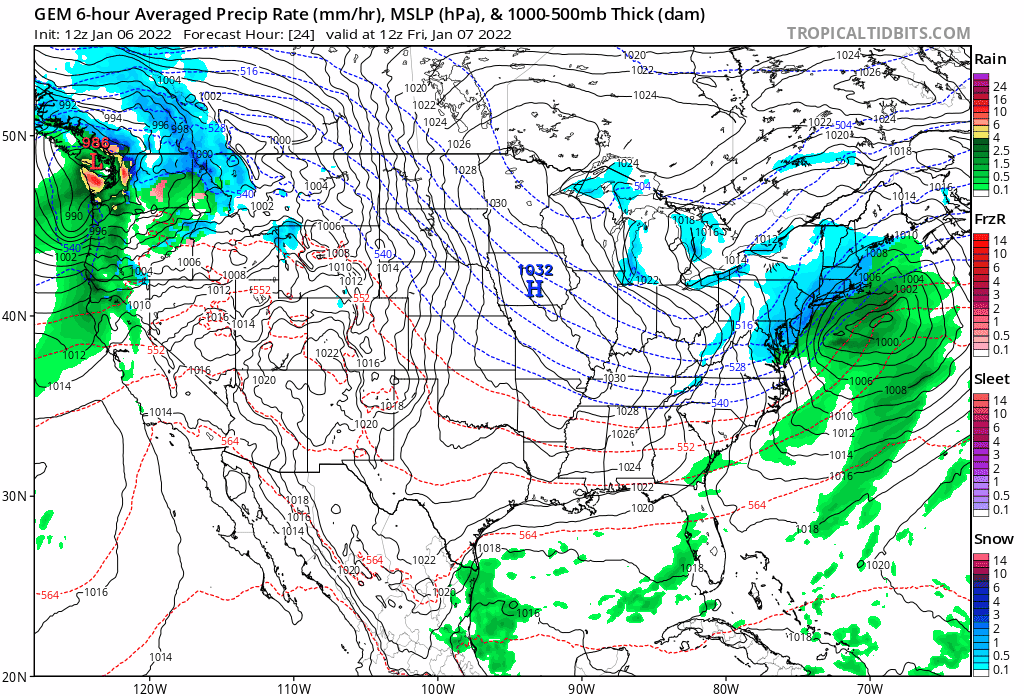
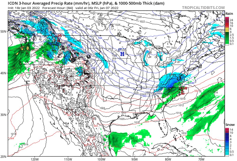
They all seem to be reflecting some variation of the hole which seems to suggest some kind of Miller B (or hybrid Miller B ) and we all know how that goes - 2 rounds where everything "stops" after round 1 and then it jumps to the coast and transfers to a new low and ramps up for round 2. And where it reforms will establish the screw zone before the wrap-around bands finally come into play as it pulls away. -
January 7th First Snow for some N&W folks Discussion
Hurricane Agnes replied to ChescoWx's topic in Philadelphia Region
CMC seems to show the same initial "snow hole" before speeding the thing along to give what appears to be some back end thumping as the storm bombs out on its way to NE.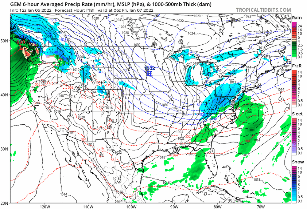

-
E PA/NJ/ DE Winter 2021-22 OBS Thread
Hurricane Agnes replied to JTA66's topic in Philadelphia Region
The latest from Mt. Holly - -
E PA/NJ/ DE Winter 2021-22 OBS Thread
Hurricane Agnes replied to JTA66's topic in Philadelphia Region
WWA's issued - Hit a high of 45 today after a low of 25. Currently 43 and overcast but clearing to the west, with dp 39. -
E PA/NJ/ DE Winter 2021-22 OBS Thread
Hurricane Agnes replied to JTA66's topic in Philadelphia Region
Mt. Holly's call from earlier this morning - Am currently overcast and 34, with dp 32, so whatever was frozen is slowly melting (although those coldest surfaces were pretty cold, but the precip was light). People were scraping the car windows this morning. I saw the alert that the Passyunk Ave. bridge was closed due to icy conditions/accidents. -
E PA/NJ/ DE Winter 2021-22 OBS Thread
Hurricane Agnes replied to JTA66's topic in Philadelphia Region
Have had on and off ZL but it also looks like there may have been some IP at some point earlier (hard to tell on my car since it's white but other cars that are dark-colored appear to almost have a light coating of snow or IP on the roof and hood). Temp is currently 31 with dp 27 so it will be close to melt point soon.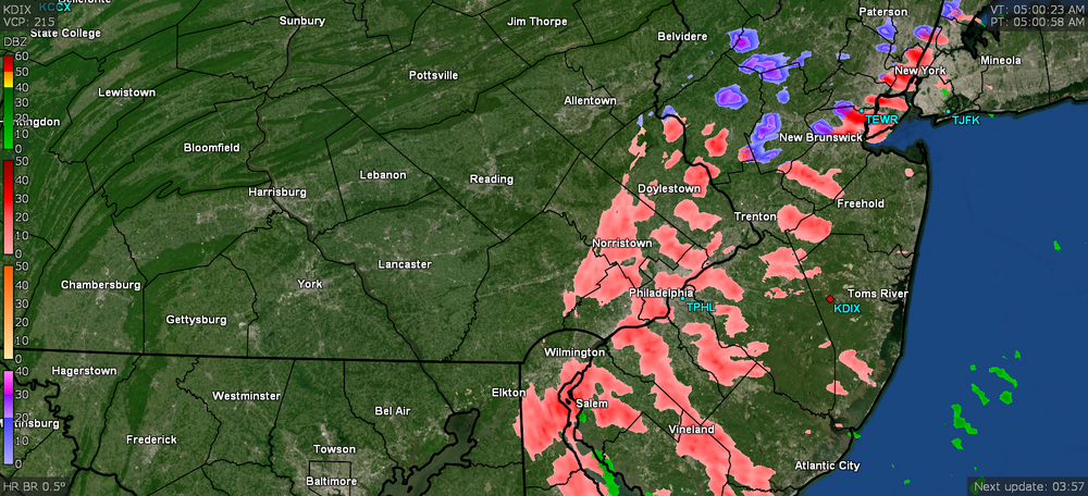
-
E PA/NJ/ DE Winter 2021-22 OBS Thread
Hurricane Agnes replied to JTA66's topic in Philadelphia Region
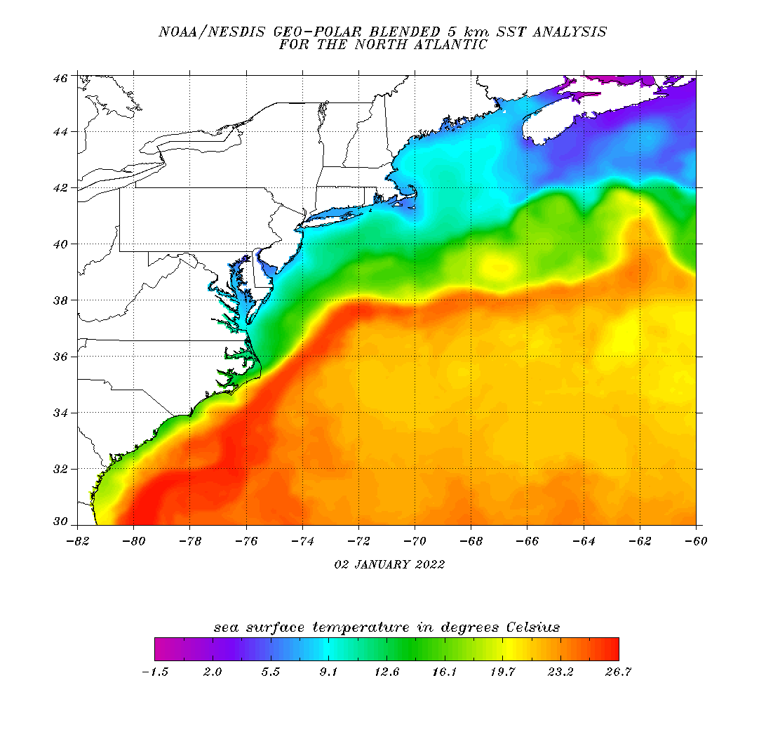
I just found this that illustrated the ENSO state of 2009 - from what would be "the strongest warming event for an El Nino in 30 years" (although it would result in a "moderate" El Nino) - I never thought a season/calendar year would ever break the 1996 winter in my lifetime but here we were. And then 2013/2014 did it again (although not as much as 2009/2010 but still more than 1996). Of course this is the 2nd season in a row with a La Nina so the same sort of dynamics technically shouldn't apply and it is expected to start to fade to neutral this spring and possibly evolve back to an El Nino during the summer. -
E PA/NJ/ DE Winter 2021-22 OBS Thread
Hurricane Agnes replied to JTA66's topic in Philadelphia Region
Mt. Holly's thoughts just tweeted for tomorrow morning (sounds dicey) and Thursday/Friday - -
E PA/NJ/ DE Winter 2021-22 OBS Thread
Hurricane Agnes replied to JTA66's topic in Philadelphia Region
Well a bunch of WWAs just got lofted - Temp here currently 33 with dp 21 after a high of 35. -
E PA/NJ/ DE Winter 2021-22 OBS Thread
Hurricane Agnes replied to JTA66's topic in Philadelphia Region
I was trying to see if there may have been some initial mixing and then a backend thump. The sheer quantity of the first one for some locations was significant nonetheless and unless you had a rapid warmup and near flooding rain (like what happened in 1996 and even that didn't take it all away), then there would have been snowpack still there for the next storm. There is a cool site that had some snow maps of those 2 events (and some other area HECS/SECS over the years) - https://www.weathernj.com/major-new-jersey-snow-storms/ -
E PA/NJ/ DE Winter 2021-22 OBS Thread
Hurricane Agnes replied to JTA66's topic in Philadelphia Region
Probably in 2009/2010 - the banner season where I measured something like 70" IMBY (and almost 58" for the 2010 calendar year alone). And snow on snow for South Jersey/Delaware would have happened with a 2/5 - 2/6/10 storm followed a few days later by a 2/9 - 2/10/10 storm (with Delaware's totals coming in worse in some cases, than Jersey with the 2nd storm) - Winter Storm Feb 5-6, 2010 https://www.weather.gov/phi/02052010 Winter Storm Snowfall Totals Feb 9-10, 2010 https://www.weather.gov/phi/20102010 That first hit left 15" - 24" at the shore and wouldn't have disappeared 3 days later before the next round came in with an additional range of 3" - 12" (depending on location). -
E PA/NJ/ DE Winter 2021-22 OBS Thread
Hurricane Agnes replied to JTA66's topic in Philadelphia Region
So far it looks like my low this morning was 19 (coldest of the season and year so far) and am currently at 20 with dp 12. Am getting a deck of cirrus drifting in but otherwise the sun is in and out. Mt. Holly tweeted out their preliminary snow reports last night - Also had their 11:36 pm list after the above (KPHL finished up with 1") - -
E PA/NJ/ DE Winter 2021-22 OBS Thread
Hurricane Agnes replied to JTA66's topic in Philadelphia Region
Everybody cherry-picked around the GFS & ICON (but then these are all 18Z and will have to see what the 0Zs do). Temp down to 27 here with dp 14.
-
E PA/NJ/ DE Winter 2021-22 OBS Thread
Hurricane Agnes replied to JTA66's topic in Philadelphia Region
Finished up with a trace! Temp is down to 28 with dp 14 and I know it may have still going on in some places after the report, but here was the PNS as of 4pm and you can see who really cashed in within the CWA (KPHL managed 0.5") - -
E PA/NJ/ DE Winter 2021-22 OBS Thread
Hurricane Agnes replied to JTA66's topic in Philadelphia Region
Concern might be for sleet (and we sure as hell had a lot of that last year). Still have some time... -
E PA/NJ/ DE Winter 2021-22 OBS Thread
Hurricane Agnes replied to JTA66's topic in Philadelphia Region
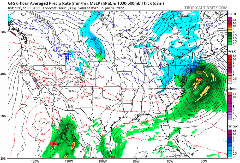
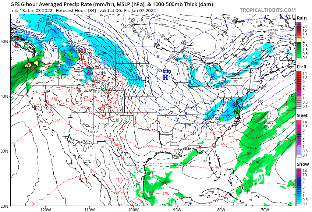
That's why I put up that fantasy GFS 1/16 storm. As shown, it looks "juicy" and if there's enough cold air from the north (and the temps stay below or near normal the next 10 days vs above normal), it could sortof bomb out and provide some evaporative cooling back to the west. -
E PA/NJ/ DE Winter 2021-22 OBS Thread
Hurricane Agnes replied to JTA66's topic in Philadelphia Region
I would agree if it were a PD storm but for early January, after near record-breaking antecedent temps? It's a bit marginal.
-
E PA/NJ/ DE Winter 2021-22 OBS Thread
Hurricane Agnes replied to JTA66's topic in Philadelphia Region
Yeah - this MLK Day specia!