Hurricane Agnes
-
Posts
9,264 -
Joined
Content Type
Profiles
Blogs
Forums
American Weather
Media Demo
Store
Gallery
Everything posted by Hurricane Agnes
-
E PA/NJ/ DE Winter 2021-22 OBS Thread
Hurricane Agnes replied to JTA66's topic in Philadelphia Region
You may be able to generate a loop from this - https://ocean.weather.gov/unified_analysis.php (ETA - it looks like the time frame lets you set multiple days but it appears to have the current day as the end point) -
E PA/NJ/ DE Winter 2021-22 OBS Thread
Hurricane Agnes replied to JTA66's topic in Philadelphia Region
The 12z NAM was doing the same kind of hopscotch moves as the 6z Euro where it started with a weak low going OTS and then suddenly inhaled some nitro that yanked the low back towards the coast and started crawling up it and then shoved it out some and yanked it back in again.

-
E PA/NJ/ DE Winter 2021-22 OBS Thread
Hurricane Agnes replied to JTA66's topic in Philadelphia Region
Did a couple frames. The pulled out view is kinda cool.

-
E PA/NJ/ DE Winter 2021-22 OBS Thread
Hurricane Agnes replied to JTA66's topic in Philadelphia Region
I don't think anyone is doubting that it is going to be a strong and juicy storm. It's been honked about for at least a week or more, with hints early on that it would bomb out. The issue is the dynamics of the digging trough that will drive it's path and how far from the coast it goes. -
E PA/NJ/ DE Winter 2021-22 OBS Thread
Hurricane Agnes replied to JTA66's topic in Philadelphia Region
Well everyone always made fun of the NAM and being "NAM'd". But they did finally fix it so it's not as bad as it used to be in the past and is more tempered. However there seems to be a new physical law - "conservation of the amp" and the Euro has become the keeper of the over-amperage (and is now the new NAM). -
E PA/NJ/ DE Winter 2021-22 OBS Thread
Hurricane Agnes replied to JTA66's topic in Philadelphia Region
Well from the Inkie article I posted upthread, including the rest of Tony Gigi's (rainshadow when he posted here) comment - I think this Euro run might be a bit out to lunch (with a lot of obvious extrapolation going on because it's the 6z), so will have to see what the 12z does with more data. -
E PA/NJ/ DE Winter 2021-22 OBS Thread
Hurricane Agnes replied to JTA66's topic in Philadelphia Region
6z Euro back a bit to the west again as the dance continues but it buries from the coast to I-95.
-
E PA/NJ/ DE Winter 2021-22 OBS Thread
Hurricane Agnes replied to JTA66's topic in Philadelphia Region
Icon is off to the east with the 6z.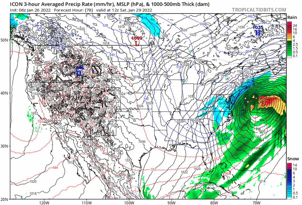
-
E PA/NJ/ DE Winter 2021-22 OBS Thread
Hurricane Agnes replied to JTA66's topic in Philadelphia Region
6z GFS continues the east trend (although obviously it's the 6z so...). It does throw a little more back towards I-95.
-
E PA/NJ/ DE Winter 2021-22 OBS Thread
Hurricane Agnes replied to JTA66's topic in Philadelphia Region
Apparently the system that would impact how the eastern trough will dig must have finally been sampled and triggered the models to send the storm east. Ukie is mirroring the GFS had actually had it more SE than others for awhile now and that trend continues.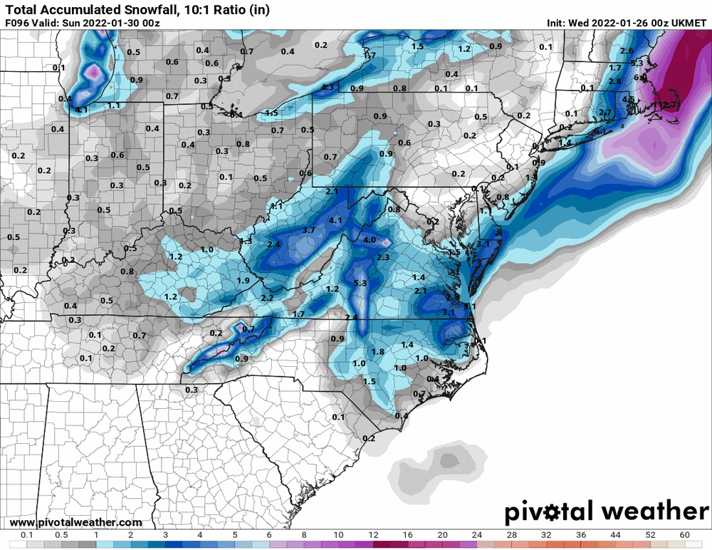
-
E PA/NJ/ DE Winter 2021-22 OBS Thread
Hurricane Agnes replied to JTA66's topic in Philadelphia Region
NBM for 0z...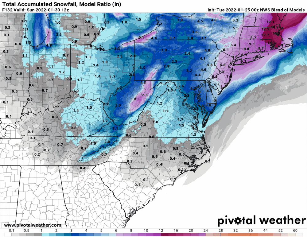
-
E PA/NJ/ DE Winter 2021-22 OBS Thread
Hurricane Agnes replied to JTA66's topic in Philadelphia Region
Philly Inquirer has a hilarious article about this storm. A couple excerpts (I have a sub but it may be paywalled - sometimes with a couple free reads) - https://www.inquirer.com/weather/snow-forecast-philadelphia-weather-winter-storm-20220125.html Pretty much sums it up in here. -
E PA/NJ/ DE Winter 2021-22 OBS Thread
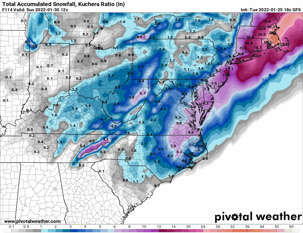
Hurricane Agnes replied to JTA66's topic in Philadelphia Region
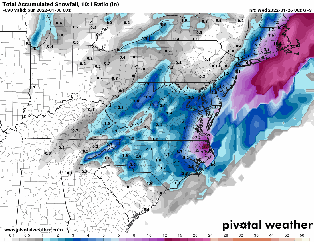
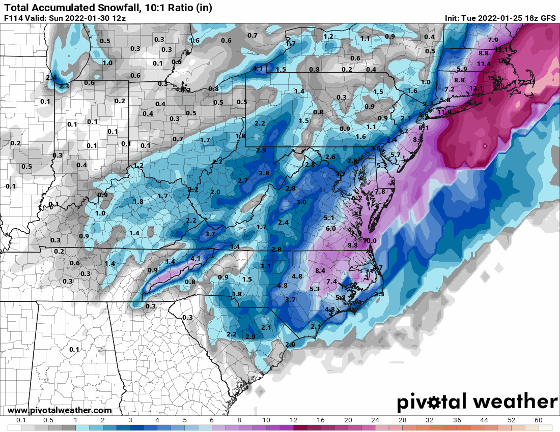
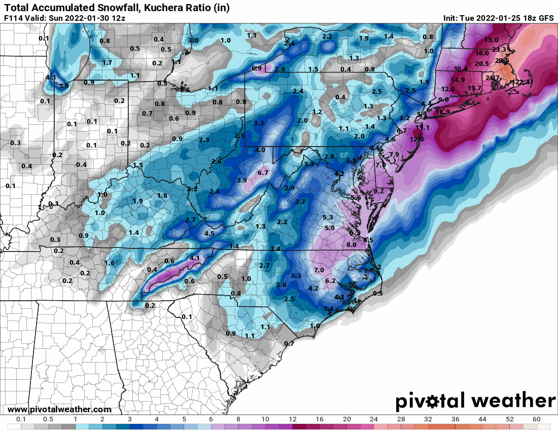
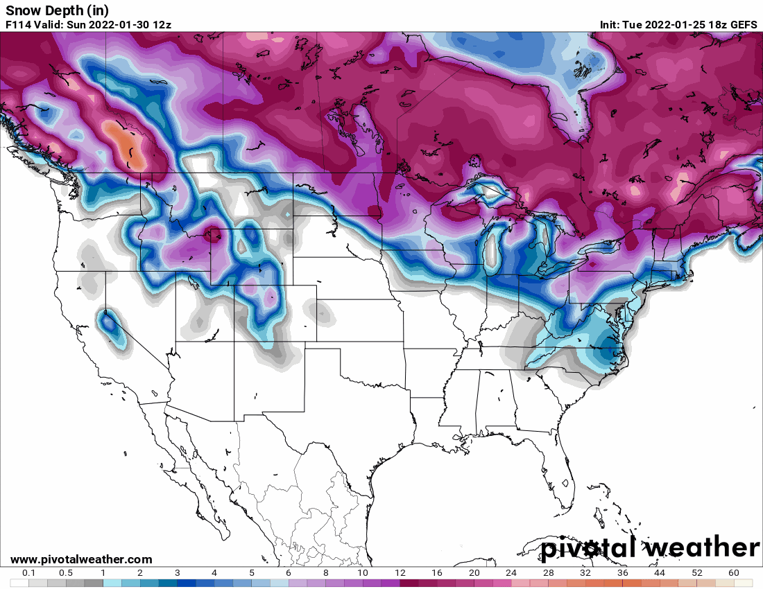
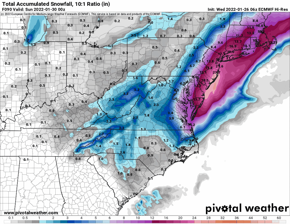
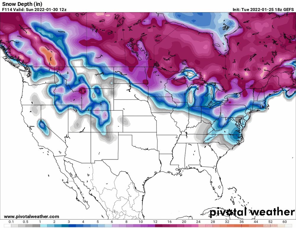
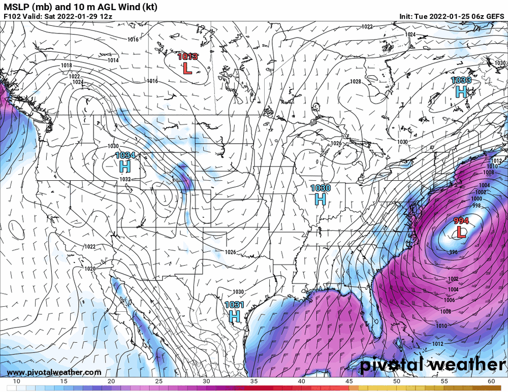
The 18z GFS snow map (10:1 & Kuchera) and GEFS depth (it doesn't go "regional" to show a zoom for inches on the map). Snapshot was what appeared to be the max time frame for accums. And as an obs, I did get up to 41 as a high today but that is history. Currently down to 30 with a plummeting dp at 17.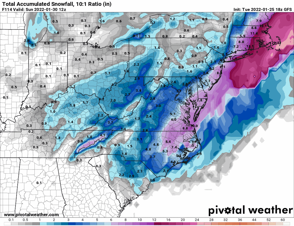
-
E PA/NJ/ DE Winter 2021-22 OBS Thread
Hurricane Agnes replied to JTA66's topic in Philadelphia Region
The trend so far could be what prompted Mt. Holly's Long Term AFD -
-
E PA/NJ/ DE Winter 2021-22 OBS Thread
Hurricane Agnes replied to JTA66's topic in Philadelphia Region
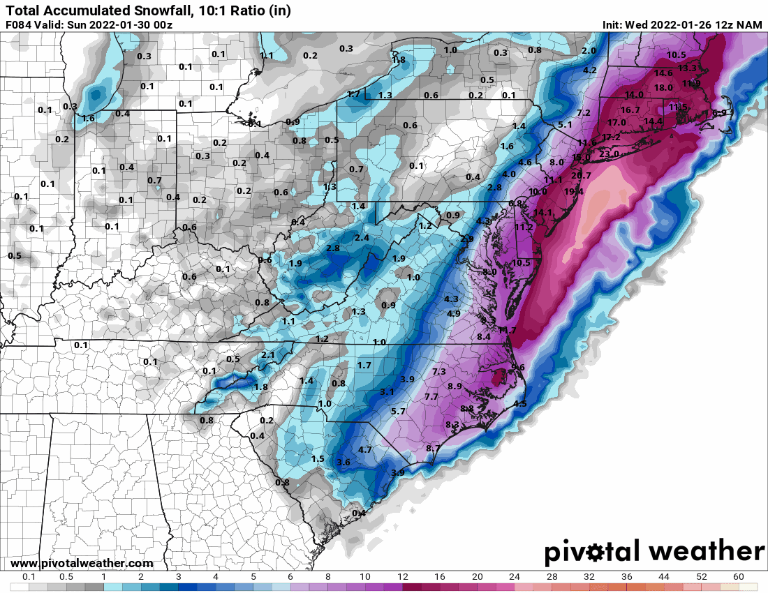
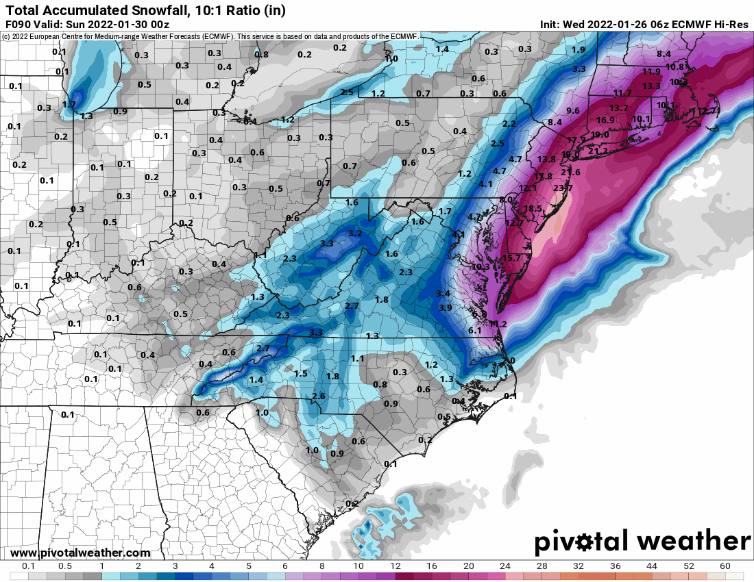
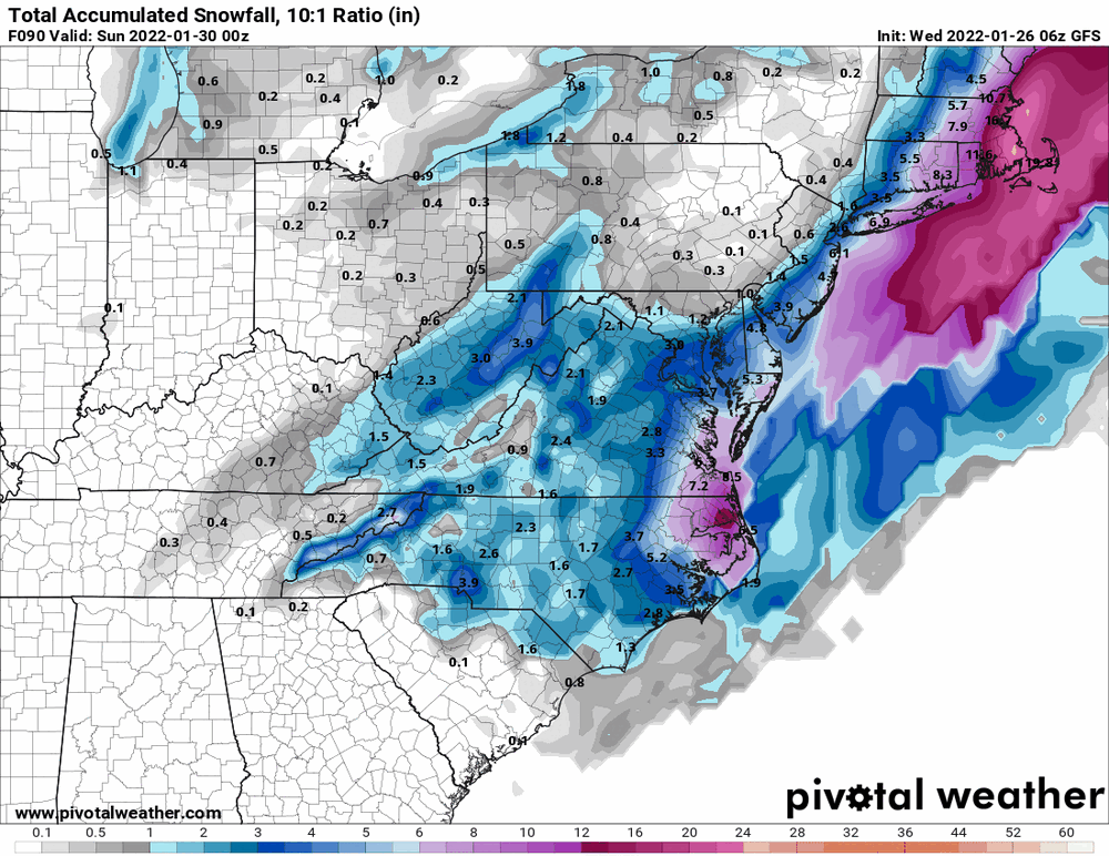
NWS model blend (NBM) accumulated snowfall (Jan 29th - 31st) looks interesting where that has the heaviest being set up.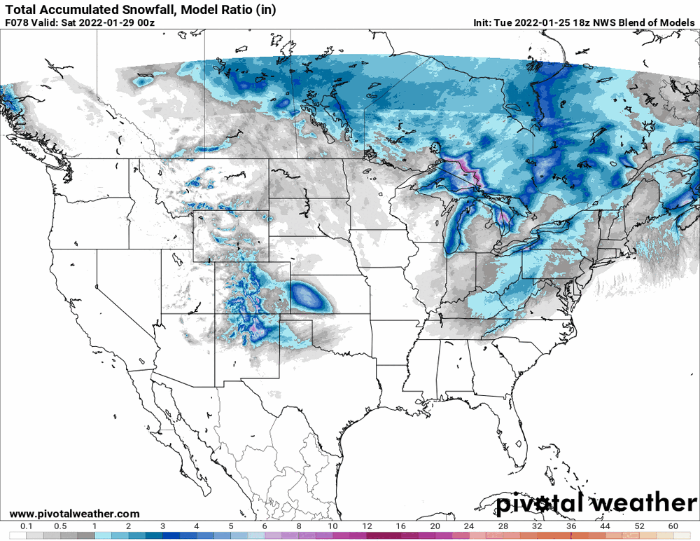
-
E PA/NJ/ DE Winter 2021-22 OBS Thread
Hurricane Agnes replied to JTA66's topic in Philadelphia Region
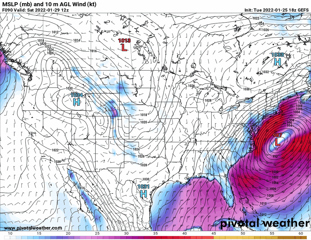
I saw where that explosion was supposedly the equivalent of "100 nuclear bombs". WPC advertising the weekend storm - -
E PA/NJ/ DE Winter 2021-22 OBS Thread
Hurricane Agnes replied to JTA66's topic in Philadelphia Region
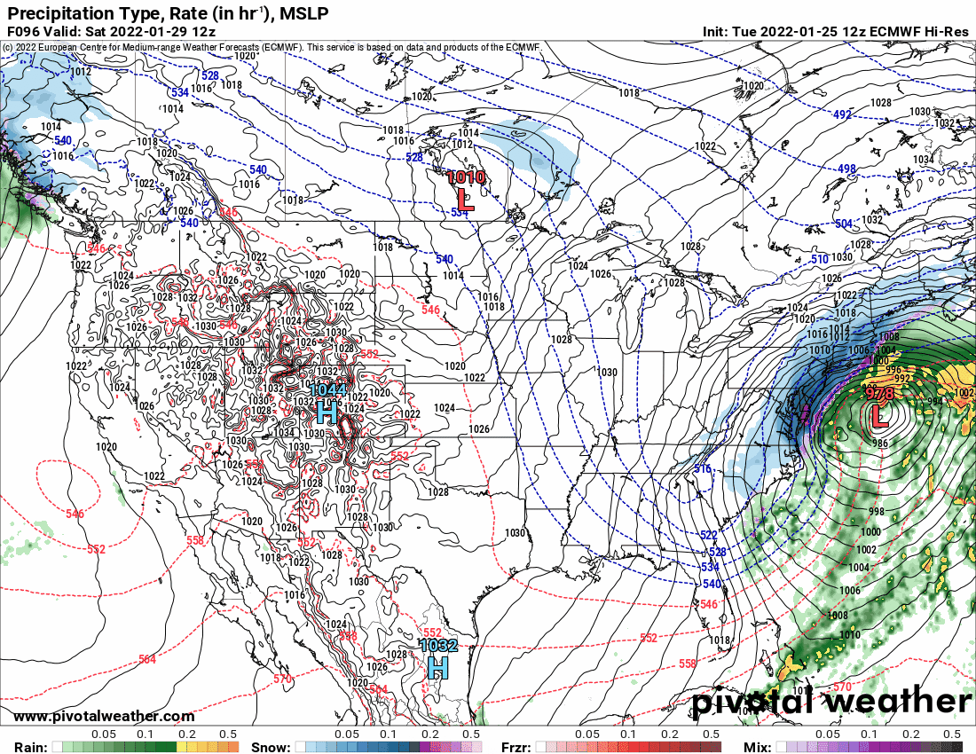
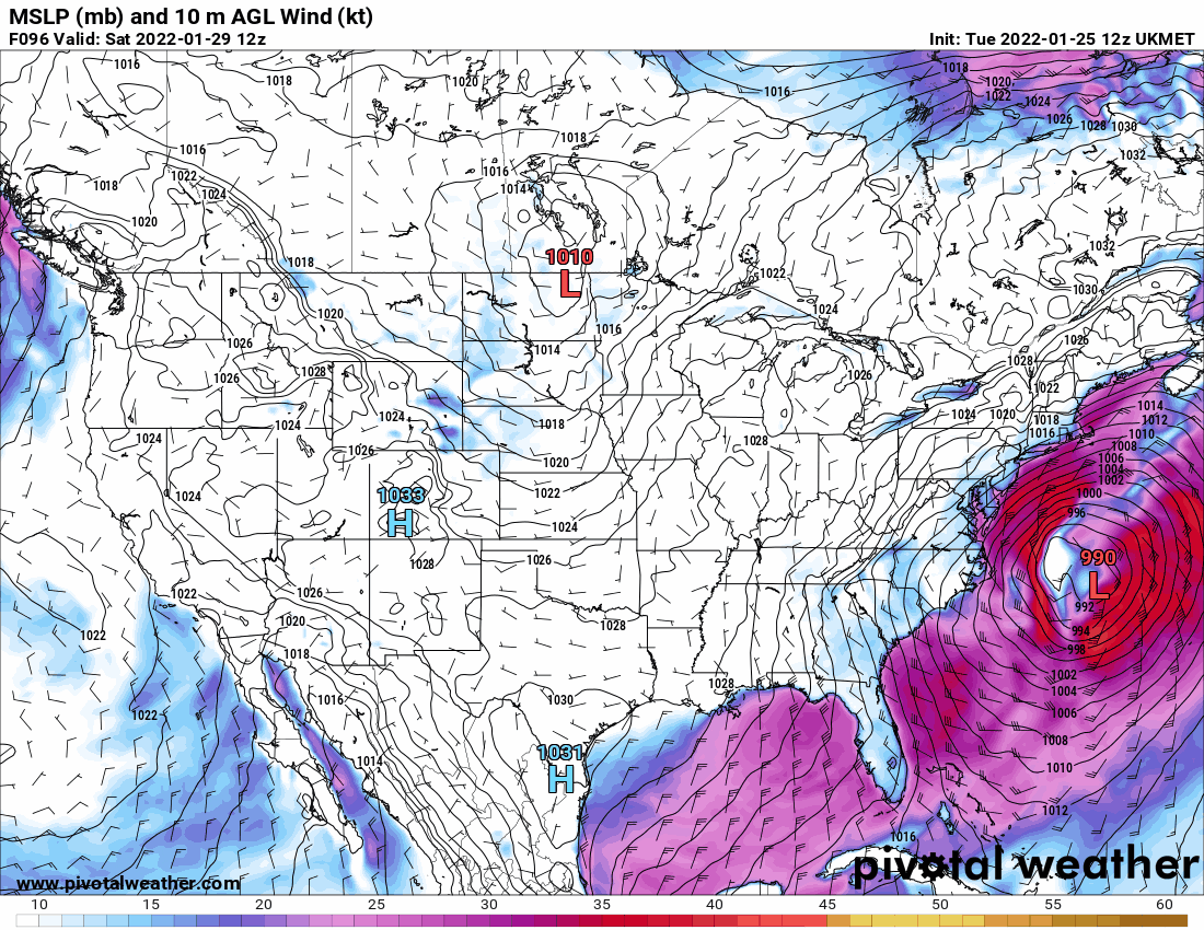
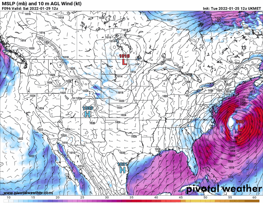
Euro vs Ukie...
-
E PA/NJ/ DE Winter 2021-22 OBS Thread
Hurricane Agnes replied to JTA66's topic in Philadelphia Region
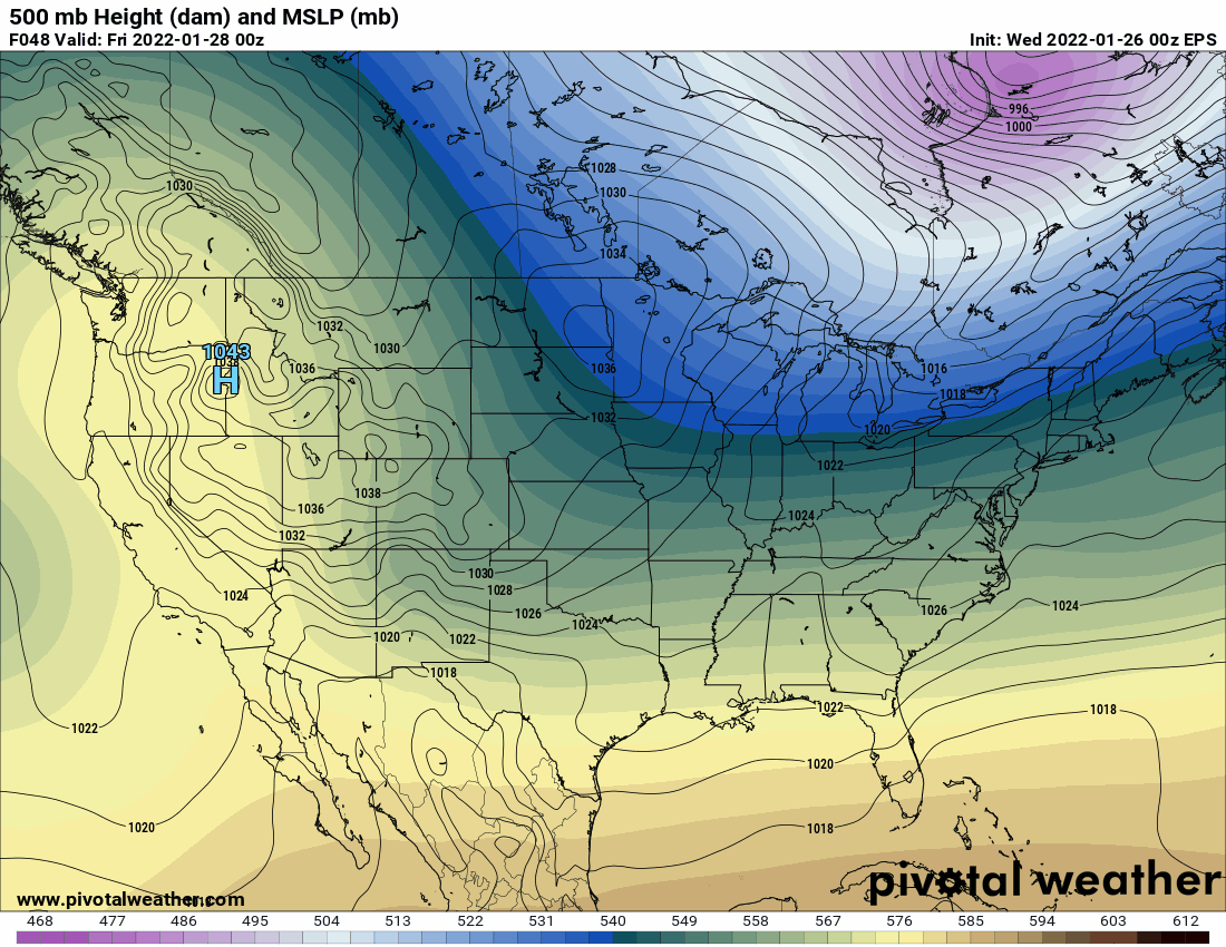
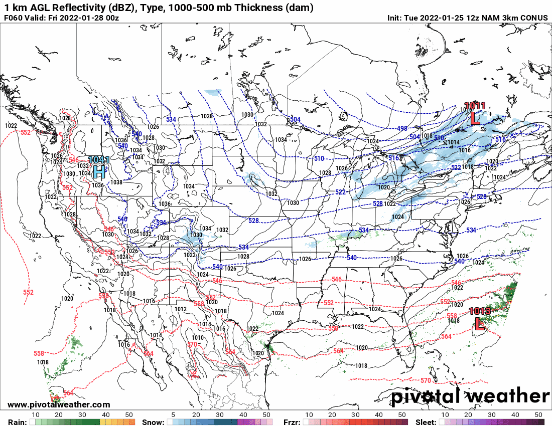
The jinx effect. We are still outside the NAM range but 24 hours before the estimated start, the last panel on the 12z is showing what looks like a zonal flow with little or no trough amplification at all and a low just slip sliding straight OTS from FL! Neither the 6z Euro (also somewhat still zonal then) or GFS (starting to show a tiny bit of positive tilt) have a low at that spot at that time frame. Obviously have to wait for the 12zs and for the NAM to get into range.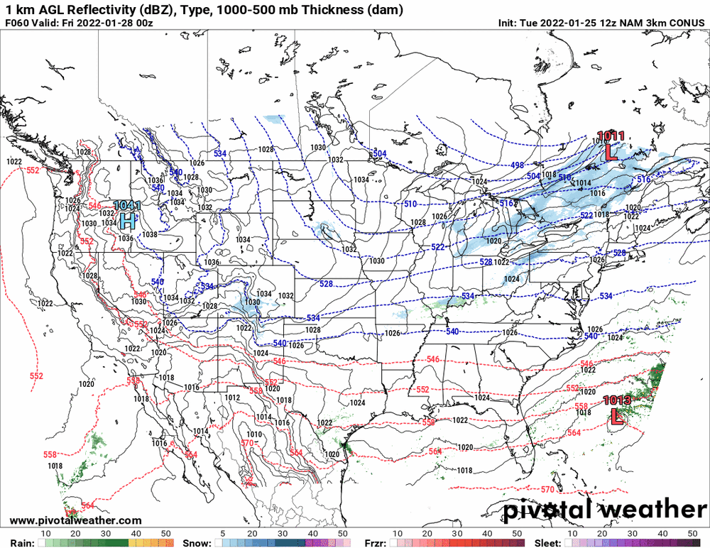
-
E PA/NJ/ DE Winter 2021-22 OBS Thread
Hurricane Agnes replied to JTA66's topic in Philadelphia Region
Here I agree 100% - there ARE climate cycles - and that even includes the sunspot cycle and atmospheric impacts from that. It's just that the man made part has skewed what is going on with the natural cycles and that is preventable. And as an obs - I am now up to 36 with dp 30 and it overcast. There are radar returns sliding to the south over the Delmarva and extreme S. Jersey. -
E PA/NJ/ DE Winter 2021-22 OBS Thread
Hurricane Agnes replied to JTA66's topic in Philadelphia Region
Yes, "man made" changes have altered the temperatures. As Joni Mitchell famously sang in the song "Yellow Taxi" - "pave paradise, put up a parking lot". Thankfully the city (and other urban areas around the country) are tearing up those pavements and barren parking lots and replanting trees and grass to cool the place down. Having trees around does wonders for shading the ground and keeping it from heating up during the day, only to radiate that back out at night. I know during heatwaves here, the temps might still be in the upper 80s late into the night before finally cooling off. -
E PA/NJ/ DE Winter 2021-22 OBS Thread
Hurricane Agnes replied to JTA66's topic in Philadelphia Region
The "man made heat island" is the very definition of a cause of "climate change". I suppose that could be quantitated and you can see what the temps SHOULD be without effects of lots of concrete, asphalt, brick, stone, metal, and industrial exhaust, but that won't reflect the reality. But I know your position on this and it would be really OT in this thread to delve into that. -
E PA/NJ/ DE Winter 2021-22 OBS Thread
Hurricane Agnes replied to JTA66's topic in Philadelphia Region
It's representative of the city of Philadelphia with 1.6 million people. KPNE is in a less populated part of the city (I remember when it was almost completely undeveloped up there in the "Far Northeast" but that has changed substantially too in recent years) and I live about 5 miles from KLOM (Wings Field in Bluebell) but they are always about 3 - 5 degrees cooler than me (where KPHL is about 3 - 5 degrees warmer). So these readings are really for their immediate surrounding areas. I wouldn't expect to have a temp from a unit 35 miles away be representative of me either so I get that. -
E PA/NJ/ DE Winter 2021-22 OBS Thread
Hurricane Agnes replied to JTA66's topic in Philadelphia Region
For those who live in dense residential neighborhoods in the city of Philadelphia, the temps would probably be even higher in their neighborhoods than the airport, where that ASOS is sitting near the river by an unused runway (at least the last overhead shot that I saw of it some time ago). So trying to make the temp "less" does no good for the people who live in the city. There is the need to reflect the reality of their immediate environment and that needs to be factored in for heat advisories or warnings. -
E PA/NJ/ DE Winter 2021-22 OBS Thread
Hurricane Agnes replied to JTA66's topic in Philadelphia Region
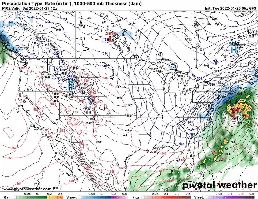
As an obs, I noticed the non-diurnal temp trend last night where I actually hit a high yesterday of 34 about 10 minutes before midnight and the temp continued rising until just after 12:30 am with a high of 35, but had finally been on the downswing. Currently 32 with dp 28. I know it's the 6z but here are the latest GFS and its ensembles.
-
E PA/NJ/ DE Winter 2021-22 OBS Thread
Hurricane Agnes replied to JTA66's topic in Philadelphia Region
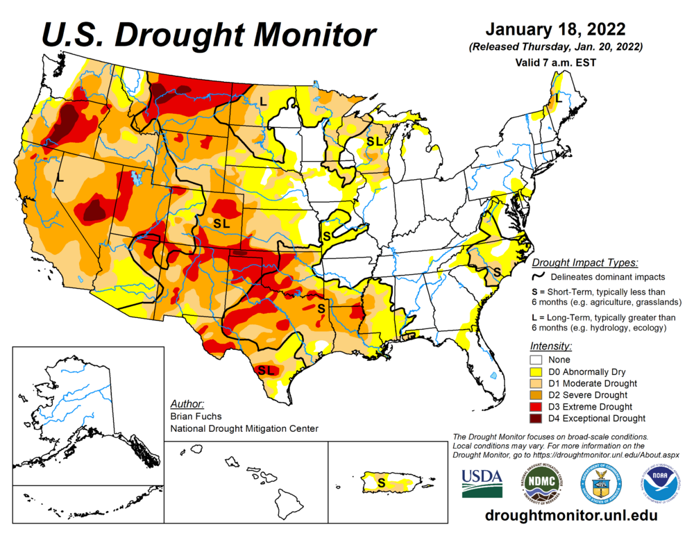
Coastal Washington state hasn't really been dry (in fact, the precip was excessive earlier in the winter) but other parts along the west coast have dried out recently where wild fires have been firing up sortof "off season".