

Mount Joy Snowman
-
Posts
4,984 -
Joined
-
Last visited
Content Type
Profiles
Blogs
Forums
American Weather
Media Demo
Store
Gallery
Everything posted by Mount Joy Snowman
-

Central PA Autumn 2024
Mount Joy Snowman replied to Itstrainingtime's topic in Upstate New York/Pennsylvania
It’s so freakin good. We are only on our first time through. Second season, so a long way to go. I bet it only gets better. Low of 39 here. Heavenly weather ahead. -
Central PA Autumn 2024
Mount Joy Snowman replied to Itstrainingtime's topic in Upstate New York/Pennsylvania
Looks like none of the local stations hit 70. Only 66 at MDT. I’m a bit in the bag after watching the Yanks game and some old episodes of Succession ha. Night all. -
Central PA Autumn 2024
Mount Joy Snowman replied to Itstrainingtime's topic in Upstate New York/Pennsylvania
National high below 100 -- only 95 near Tecopa, CA. National low of 12 near Kirk, OR. All of that to say.........#WinterIsComing -
Central PA Autumn 2024
Mount Joy Snowman replied to Itstrainingtime's topic in Upstate New York/Pennsylvania
Yeah things pretty much went as expected. I bottomed out with a 39, at which I'm currently still sitting. Some rain anywhere in the 240 Hr range would be......nice. -
Central PA Autumn 2024
Mount Joy Snowman replied to Itstrainingtime's topic in Upstate New York/Pennsylvania
That is.....really bad. You never know who they have compiling these lists or how much they're mailing it in, but man, that's quite the oversight. -
Central PA Autumn 2024
Mount Joy Snowman replied to Itstrainingtime's topic in Upstate New York/Pennsylvania
You called? Low of 33 here. Should be a nice couple days to end the week as we head into an absolutely perfect weekend. Dare I say the best fire pit weekend of the year. -
Central PA Autumn 2024
Mount Joy Snowman replied to Itstrainingtime's topic in Upstate New York/Pennsylvania
No airports and no undue influence from any bodies of water, unless you count little ol' Grubb Lake a couple miles to my west ha. All in the land of Suburbia, with elevations ranging from 400-600'. I've said too much. -
Central PA Autumn 2024
Mount Joy Snowman replied to Itstrainingtime's topic in Upstate New York/Pennsylvania
I have an astounding nine active WU stations within a mile and a half of my house. I understand absolutely nobody asked for this information and it probably only excites me, but I felt compelled to provide it anyway. Carry on lads. -
Central PA Autumn 2024
Mount Joy Snowman replied to Itstrainingtime's topic in Upstate New York/Pennsylvania
40 when I left the house, although much cooler through some of the low-lying rurals where I spotted ample frost. Tonight should be colder over here. -
Central PA Autumn 2024
Mount Joy Snowman replied to Itstrainingtime's topic in Upstate New York/Pennsylvania
Yeah they'll probably still be a few tenths AN after this week. We'll see how low they can go (hint: not as low as everyone else ha). -
Central PA Autumn 2024
Mount Joy Snowman replied to Itstrainingtime's topic in Upstate New York/Pennsylvania
Haha thanks. No calculations for me yet, maybe next week. But yeah, AN for the month seems like a safe bet. We should be back close to normal by the weekend and then the ridging being progged should have us safely AN heading into the final stretch. Might get another cold shot or two before the month is out, hard to say, but AN seems like the wise play. Perhaps even comfortably AN, as you say. -
Central PA Autumn 2024
Mount Joy Snowman replied to Itstrainingtime's topic in Upstate New York/Pennsylvania
Low of 40. Back to the grind. -
Central PA Autumn 2024
Mount Joy Snowman replied to Itstrainingtime's topic in Upstate New York/Pennsylvania
I had concerns he was going to be another Hackenberg — a big-armed kid who lacked mobility and the requisite touch and accuracy required to be great, to say nothing of whether he had “it” upstairs. He is winning me over though. You are right about him being placed in a tough system and also lacking stud WRs. I agree he has a chance on Sundays. Scouts will fall in love with his size and arm, and if he can keep displaying that he isn’t a complete statue, then yeah I think he’ll be drafted pretty high. Jury is still out though. A lot of time for things to clarify but trend is up, for now. -
Central PA Autumn 2024
Mount Joy Snowman replied to Itstrainingtime's topic in Upstate New York/Pennsylvania
Temp has dropped 6 degrees, down to 57, in the last hour. Brisk day out there. -
Central PA Autumn 2024
Mount Joy Snowman replied to Itstrainingtime's topic in Upstate New York/Pennsylvania
High since midnight of 68. Currently 63 and the front seems to be blowing through as we speak. Not a drop of rain. -
Central PA Autumn 2024
Mount Joy Snowman replied to Itstrainingtime's topic in Upstate New York/Pennsylvania
How ‘bout. 69 here at 11. Should beat tomorrow’s daytime high by 5+ degrees. -
Central PA Autumn 2024
Mount Joy Snowman replied to Itstrainingtime's topic in Upstate New York/Pennsylvania
My Packers look like they’re hitting their stride. Man, is the NFC North stacked. Tough sledding. -
Central PA Autumn 2024
Mount Joy Snowman replied to Itstrainingtime's topic in Upstate New York/Pennsylvania
Midnight high! By a lot potentially. -
Central PA Autumn 2024
Mount Joy Snowman replied to Itstrainingtime's topic in Upstate New York/Pennsylvania
Warren really is one of the best all-around football players I’ve ever seen. Guy lines up all over the field and just makes plays whenever called upon. I really thought Drew came of age today. I’ve had my doubts but he looked different today. Confidence. Command. All of it. And to do it on the road in that type of pressure game. Big time. Picks be damned. I still think we have a problem with the guy on the sideline and Tom Allen seems to be a big step down from Manny. A couple of losses are likely still in the cards, perhaps even to a resurgent Wisconsin team on the road in a couple weeks, but I’ll enjoy this one. That was fun. -
Central PA Autumn 2024
Mount Joy Snowman replied to Itstrainingtime's topic in Upstate New York/Pennsylvania
Low of 52. Still calling for that midnight high I mentioned a couple of days ago. I’m going to enjoy this heat today because we’ve got quite the chilly week ahead. -
Central PA Autumn 2024
Mount Joy Snowman replied to Itstrainingtime's topic in Upstate New York/Pennsylvania
Low of 48. Had a nice little fire pit last night. Perfect day today. Big day of college football ahead! -
Central PA Autumn 2024
Mount Joy Snowman replied to Itstrainingtime's topic in Upstate New York/Pennsylvania
Lake Clarke, the portion of the river above Safe Harbor Dam. We go out of Long Level Marina. -
Central PA Autumn 2024
Mount Joy Snowman replied to Itstrainingtime's topic in Upstate New York/Pennsylvania
Last voyage of the season…..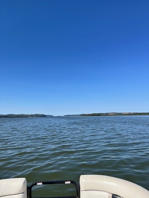
-
Central PA Autumn 2024
Mount Joy Snowman replied to Itstrainingtime's topic in Upstate New York/Pennsylvania
I had a 5.5" snowfall on Feb. 13. Also was close on a couple other occasions, with a 3.1" on Feb. 16 and 3.7" on Jan. 19. -
Central PA Autumn 2024
Mount Joy Snowman replied to Itstrainingtime's topic in Upstate New York/Pennsylvania
They actually bottomed out at 42. Weak sauce compared to most of the rest of the region but not terrible for MDT. National low of 18 near Davis, WV. Also, I am officially declaring a midnight high for Monday. Carry on.


