

Mount Joy Snowman
-
Posts
4,964 -
Joined
-
Last visited
Content Type
Profiles
Blogs
Forums
American Weather
Media Demo
Store
Gallery
Everything posted by Mount Joy Snowman
-

Central PA Summer 2023
Mount Joy Snowman replied to canderson's topic in Upstate New York/Pennsylvania
Bahahahaha, I mean, not that it would have been funny to be in that. But please do tell! Don't think I've been privy to that one. All of them ha. But primarily, for mid/long range I use GFS/Euro and for short term I glance at everything but go to HRRR and 3k NAM first. HREF is great if you can find it and the new RRFS has had its share of wins and has me intrigued. Have not been impressed with the FV3 but still glance at it. Again, all of it. I'm a junkie. -
Central PA Summer 2023
Mount Joy Snowman replied to canderson's topic in Upstate New York/Pennsylvania
Wrong advice is welcomed haha! But yeah, I have been seeing the potential for that midday line for a while now but even if it does pop much of the guidance has it firing east of the river and pulling away quickly. Needless to say, I will be watching the 12z runs closely. As an aside, it can actually be fun trying to outmaneuver storms while on the boat. Not severe obviously but just run of the mill stuff. When you have a weather nut at the helm with a high-def radar in-hand and about a 10 mile length of surface water to traverse, it's actually not all that hard at times to just outrun little cells to to the north or south. Then laugh maniacally as you see others getting dumped on a couple miles away. Hey, it's the little things ha. -
Central PA Summer 2023
Mount Joy Snowman replied to canderson's topic in Upstate New York/Pennsylvania
.13" of rain last evening. Alright kids, help me out. My wife and I are taking some friends out on the boat Friday morning (arriving ~10am). I've been pouring over the guidance all week and I'm pretty secure in the fact that things will be cleared out by then, and tend to do so rather quickly when the disturbance sweeps through. However, there is some guidance (primarily the NAM) that wants to keep some showers lingering around through the mid to late morning hours. I think we'll be in for a mostly beautiful day, in what is a transition day to a beautiful weekend. What say ye? Also, has anyone else noticed that Monday keeps consistently showing up as a day with widespread storms on virtually all the modeling? -
Central PA Summer 2023
Mount Joy Snowman replied to canderson's topic in Upstate New York/Pennsylvania
Looks like you are about to get a good drenching because of course you are…..Harrisburg. -
Central PA Summer 2023
Mount Joy Snowman replied to canderson's topic in Upstate New York/Pennsylvania
Nice little shower that popped up right on my doorstep here. Again, another grass-pleaser. -
Central PA Summer 2023
Mount Joy Snowman replied to canderson's topic in Upstate New York/Pennsylvania
Completely agree. I said the same at the time, and I also concur that we won't see anything like it again. -
Central PA Summer 2023
Mount Joy Snowman replied to canderson's topic in Upstate New York/Pennsylvania
I remember it well. My buddy who runs a pizza shop near the airport called me to say he had almost a foot of snow and I was like what the hell are you talking about haha. See below for LNP's writeup of the event including thoughts from Horst (note this was written before the event ended so totals ended up much higher). Also, I see what you did there with the use of tomfoolery! It was the wintertime equivalent of a summer downpour. What could be called a snow thunderstorm, minus the thunder, dumped more than 4 inches of snow by 11 p.m. on parts of Lancaster County Tuesday, but other parts did not see a single flake. "For some people in Lancaster County, this could be the biggest snowstorm of the season, while for others, they're saying, 'What snow?' " Millersville University meteorologist Eric Horst said. Horst said the wintry deluge was caused by an arctic air mass moving into the area, meeting the tail edge of a storm that dropped a dusting of snow on much of the county earlier Tuesday. "This is where the leading edge of the arctic air is meeting the exiting storm," Horst said. "It's like a boundary, a mini front, that is producing this snow squall." The front produced a curving band of heavy snow, Horst said, and "if you're under it, you're going, 'My goodness.' " Radar seemed to show the storm set up over the heart of Manheim Township, extending on a line from Route 30 near Lancaster city, north toward Neffsville, on up to Lititz and Brickerville. The storm, Horst said, is "remarkably stationary," the type of storm "that sets up over an area and just pounds somebody for an hour or two, like a gutter-gushing thunderstorm would." "It's like a thunderstorm that doesn't move," he said. "So basically, 80 percent of Lancaster County is seeing nothing, but if you're under this narrow band of heavy snow squalls, it's just dumping." The snow began about 8:30 p.m., and by 10:30 p.m., Richard Wolf, who lives near Landis Valley, had "5 inches of snow at my house." "We're getting blasted," Wolf said. PennDOT has responded by putting all 66 trucks on the road, Rick Ferguson, the assistant county maintenance manager, said. "We have a full shift on until midnight and another full shift coming in at midnight," he said Tuesday night. "They'll work until … noon." Though the storm is not hitting the entire county, Ferguson said trucks will do their regular routes "because we don't know where it might move to." -
Central PA Summer 2023
Mount Joy Snowman replied to canderson's topic in Upstate New York/Pennsylvania
Here is a courtesy yard pic for Bubbler. Even those few tufts of brown I believe are just areas where my kids engaged in some sort of tomfoolery ha.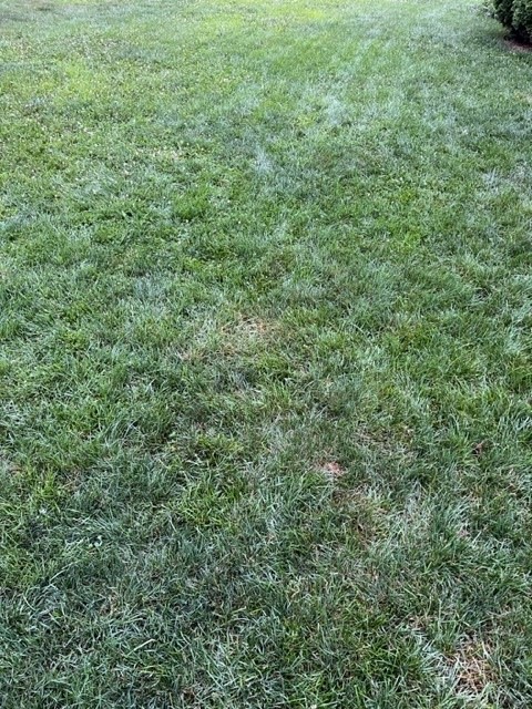
-
Central PA Summer 2023
Mount Joy Snowman replied to canderson's topic in Upstate New York/Pennsylvania
.1” here from that nice little T&L complex that moved through around 3-4am. These little events might not do much for the overall drought conditions but they have sure been keeping the grass happy, especially when timed right (i.e. not falling during peak solar hours). -
Central PA Summer 2023
Mount Joy Snowman replied to canderson's topic in Upstate New York/Pennsylvania
How about 7mph with gusts to 14. -
Central PA Summer 2023
Mount Joy Snowman replied to canderson's topic in Upstate New York/Pennsylvania
My perfect day: 65, partly to mostly sunny, DP 50, and a slight NW breeze. -
Central PA Summer 2023
Mount Joy Snowman replied to canderson's topic in Upstate New York/Pennsylvania
Low of 67 and a three-day rain total of .16". Should be a pretty classic mid-summer type of week. The national high/low are especially notable today for (1) the extreme nature of the high and (2) the first time in a looooong while and perhaps since last summer that I've seen a low above freezing. Anyway, the winners were 128 at Death Valley and Stovepipe Wells, CA and 34 at 'ol reliable Peter Sinks, UT. -
Central PA Summer 2023
Mount Joy Snowman replied to canderson's topic in Upstate New York/Pennsylvania
.08” of rain here. Build the arc. -
Central PA Summer 2023
Mount Joy Snowman replied to canderson's topic in Upstate New York/Pennsylvania
It is disgusting out. That is all. Carry on. -
Central PA Summer 2023
Mount Joy Snowman replied to canderson's topic in Upstate New York/Pennsylvania
A low of 68 here and a robust .07” of rain. I need to sneak a mow in later today before these potential gutter gushers move through. A lot of water to be wrung out from these skies for those who get (un)lucky. -
Central PA Summer 2023
Mount Joy Snowman replied to canderson's topic in Upstate New York/Pennsylvania
No worries mate. I’m actually happy with it. Cooled things off for most of the evening and was a nice peaceful rainfall. I see Harrisburg is being hit again by some popups. Those guys just can’t miss this year ha. -
Central PA Summer 2023
Mount Joy Snowman replied to canderson's topic in Upstate New York/Pennsylvania
I was on the edge of that drenching that Training got. A nice light rain fell for quite a while that amounted to about .06”. Enough to make the grass smile a wee bit. -
Central PA Summer 2023
Mount Joy Snowman replied to canderson's topic in Upstate New York/Pennsylvania
On the board here. Got nicked by a passing storm to the tune of .01”. Drought over. -
Central PA Summer 2023
Mount Joy Snowman replied to canderson's topic in Upstate New York/Pennsylvania
Yes! However, when Ron was my coach it was actually when I was on Mount Joy Red for Midget-Midget (now 12-U). Going back to like 93-94 now. Have many fond memories of Ron and his assistant Wayne. He used to give me rides to practice when my mom couldn’t get home in time. You know him? -
Central PA Summer 2023
Mount Joy Snowman replied to canderson's topic in Upstate New York/Pennsylvania
Oh wow, I’ll have to look into that. Congrats coach! I played on Mount Joy Blue back in the mid 90s and we lost a couple times in the New Era Tournament (now LNP) to the Jeff Smoker-led Manheim teams. Yes that Jeff Smoker, the starting QB for Michigan State and a solid NFL career. I see that Manheim and Donegal are currently playing for the 12-U title. I always get a bit nostalgic going back to Kunkel Field. -
Central PA Summer 2023
Mount Joy Snowman replied to canderson's topic in Upstate New York/Pennsylvania
Was just gonna say something about that. Might yet be some isolated winners tonight, although surely not us haha. Hey, you follow the LNP little league baseball tourney at all? -
Central PA Summer 2023
Mount Joy Snowman replied to canderson's topic in Upstate New York/Pennsylvania
Heck yeah, being in and around water is the one time you kind of want the humidity. Gotta keep that wetbulb temp up on your skin so you don't feel cold when you get out of the water haha. Throw a few back for me, perhaps more than a few. -
Central PA Summer 2023
Mount Joy Snowman replied to canderson's topic in Upstate New York/Pennsylvania
I had the same thought haha. Low of 64 here. Looks like we may see our muggiest weather of this season this weekend. Yuck. -
Central PA Summer 2023
Mount Joy Snowman replied to canderson's topic in Upstate New York/Pennsylvania
Wow, that just happened haha. Great minds..... -
Central PA Summer 2023
Mount Joy Snowman replied to canderson's topic in Upstate New York/Pennsylvania
As I've said before, is it a cold-wave when it's 35 or less for three straight days in January? Oh it's not? Then get the F out of here with that nonsense haha.


