nsof
-
Posts
12 -
Joined
-
Last visited
Content Type
Profiles
Blogs
Forums
American Weather
Media Demo
Store
Gallery
Everything posted by nsof
-
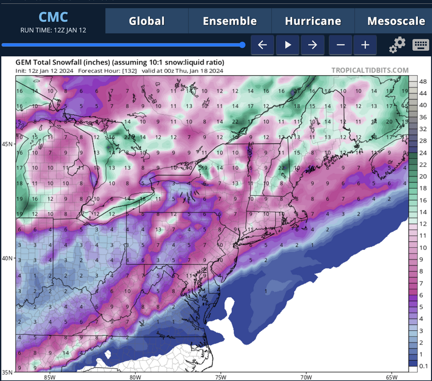
Temps in 20s for entirety of storm so likely more 12:1 or 15:1 ratios (Wish I put any stock in the CMC)
-
Respectfully disagree. Man puts out his forecast and sticks to it, doesn't sh*t talk other Mets, and explains the processes better than most meteorologists. Learned a lot from following him. To each their own though.
-
January 7th First Snow for some N&W folks Discussion
nsof replied to ChescoWx's topic in Philadelphia Region
Don't take that verbatim its probably a feedback error from that purple band to the west -
January 7th First Snow for some N&W folks Discussion
nsof replied to ChescoWx's topic in Philadelphia Region
They pointed at some confidence that there will be mesoscale banding in CNJ or coastal region that gets a solid 6 inches. Worry that if that happens it causes Philly Metro/west of I95 to only get 1-2, similar to last storm. Hope that band doesn't materialize and we just get a region wide ~4 -
Winter of sleet for Philly folk. Rough year. Maybe next time
-
00z runs should be a good tell with new data and samplings. 18z fun to look at though
-
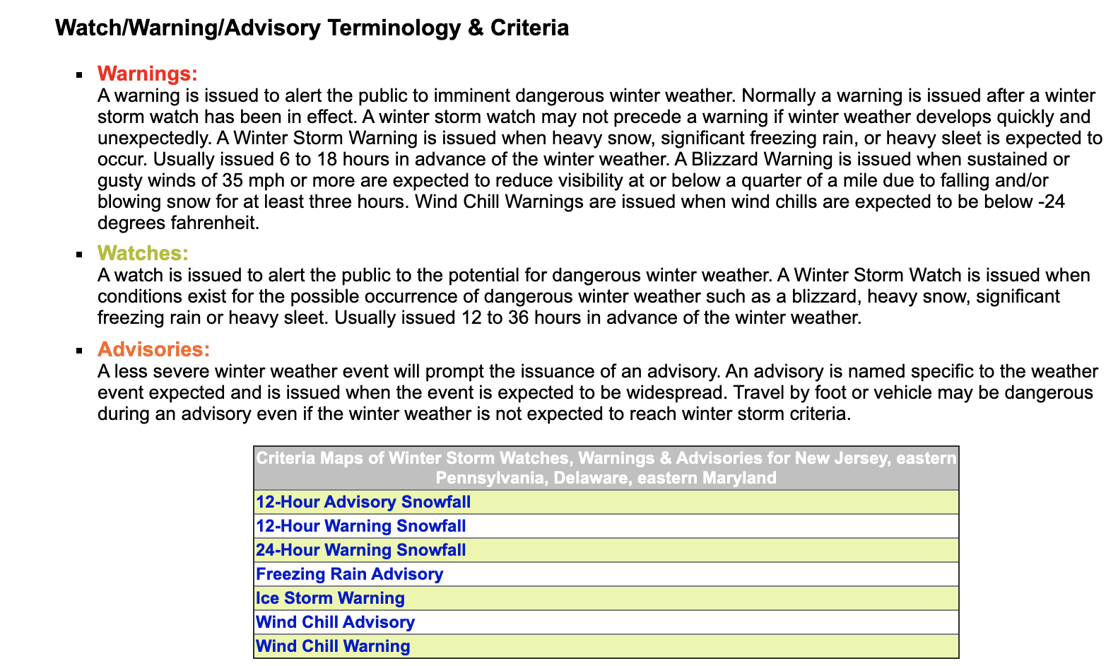
Lol not using your mind. This might help though. https://www.weather.gov/phi/WinterWx#:~:text=Usually issued 6 to 18,for at least three hours.
-
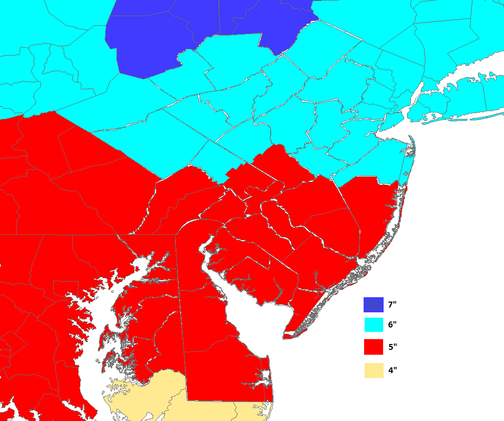
Within 12 hours of the event, here is Mt. Holly's criteria FWIW

-
Watches wouldn't make sense with the storm mainly being tonight-tomorrow morning. Will stay as WWA or be upgraded to a WSW. WSW criteria is also different for SEPA compared to SNJ so it will be interesting to watch.