

TimB
-
Posts
17,206 -
Joined
Content Type
Profiles
Blogs
Forums
American Weather
Media Demo
Store
Gallery
Everything posted by TimB
-
Temps averaging 45/30 and basically staying there for two weeks is still an extended period of above normal temps.
-

Pittsburgh, Pa Winter 2023-24 Thread.
TimB replied to meatwad's topic in Upstate New York/Pennsylvania
Where is iOS getting its data that it has the ridiculous idea that it’s currently 45 on the way to a high of 51? The airports are currently at 56 and nearly every PWS in the county on wunderground is in the mid 50s.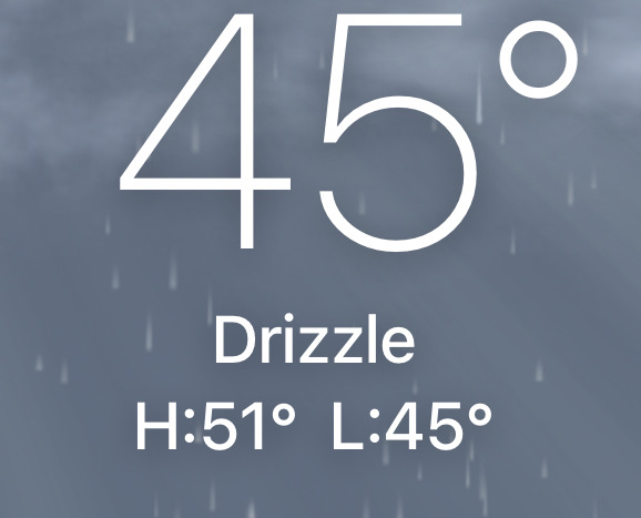
-
Pittsburgh, Pa Winter 2023-24 Thread.
TimB replied to meatwad's topic in Upstate New York/Pennsylvania
2007 drops down that list pretty quickly from here on out. After 1/24, there were only 6 above normal days and February was more than 10 degrees below normal, with a massive cold snap early in the month. If winter ended today, it’d be the warmest at KPIT, breaking the record set (checks notes) last year. -
Pittsburgh, Pa Winter 2023-24 Thread.
TimB replied to meatwad's topic in Upstate New York/Pennsylvania
+16 would be a high of 99 and a low of 80 at peak summer climo. -
Pittsburgh, Pa Winter 2023-24 Thread.
TimB replied to meatwad's topic in Upstate New York/Pennsylvania
The record for fewest days through the end of January with a low at or below freezing at Pittsburgh International is 50, in 2015-16. We’re at 41 right now, so we’ll obliterate that record. Fewest for an entire season is 89. That would seem to be in jeopardy. If we go by calendar years and not seasons, 2023 was the clear winner in this category and it’s not even close (86 vs. a previous low of 93). -
Pittsburgh, Pa Winter 2023-24 Thread.
TimB replied to meatwad's topic in Upstate New York/Pennsylvania
Still could get above that before midnight. -
Pittsburgh, Pa Winter 2023-24 Thread.
TimB replied to meatwad's topic in Upstate New York/Pennsylvania
Temps have surged into the mid-40s with some sunshine breaking through. This has over-performer written all over it. -
Pittsburgh, Pa Winter 2023-24 Thread.
TimB replied to meatwad's topic in Upstate New York/Pennsylvania
Also, glad we missed out on the freezing rain, but is there a reason the advisory is still going? We’ve been above freezing the whole time, haven’t dropped below freezing, and won’t drop below freezing. -
Pittsburgh, Pa Winter 2023-24 Thread.
TimB replied to meatwad's topic in Upstate New York/Pennsylvania
I used to drive a 28 mile stretch of the turnpike every day at that time and my recollection of this event is that there were absolutely zero commuting issues. -
Pittsburgh, Pa Winter 2023-24 Thread.
TimB replied to meatwad's topic in Upstate New York/Pennsylvania
Alright, give me some hope here. I need a recent year where spring arrived in early February but we flipped back to winter afterward. I feel like in recent years, once we flip to spring we either stay there or the cold comes back in late March or April after it’s far too late. -
I’m not even trolling here, but the warm signal on the ensembles for this time period (at least Feb 1-5) is off the charts. I would not hold out much hope for anything that weekend.
-
Pittsburgh, Pa Winter 2023-24 Thread.
TimB replied to meatwad's topic in Upstate New York/Pennsylvania
That’s what I’m saying. If we’re going to have havoc on the roads, which we will with 0.01” or a half inch, we might as well get a proper ice storm. -
Pittsburgh, Pa Winter 2023-24 Thread.
TimB replied to meatwad's topic in Upstate New York/Pennsylvania
2/20/19, I think. -
Pittsburgh, Pa Winter 2023-24 Thread.
TimB replied to meatwad's topic in Upstate New York/Pennsylvania
.01” of freezing rain just doesn’t do anything for me. -
Pittsburgh, Pa Winter 2023-24 Thread.
TimB replied to meatwad's topic in Upstate New York/Pennsylvania
Mid 20s tomorrow morning seems too cold. -
Pittsburgh, Pa Winter 2023-24 Thread.
TimB replied to meatwad's topic in Upstate New York/Pennsylvania
There does seem to be a little break between the unseasonable late week warmth and the unseasonable early February warmth, both of which seem to be a sure bet at this point. Hopefully something pans out in that window. -
Pittsburgh, Pa Winter 2023-24 Thread.
TimB replied to meatwad's topic in Upstate New York/Pennsylvania
And with the warm start expected for the shortest month of the year, I don’t see how we don’t get our 8th above normal month in a row. -
Pittsburgh, Pa Winter 2023-24 Thread.
TimB replied to meatwad's topic in Upstate New York/Pennsylvania
Is that another band SW of the city I see? -
Pittsburgh/Western PA Banter & Complaint Thread
TimB replied to blackngoldrules's topic in Upstate New York/Pennsylvania
Well said. It just sucks we couldn’t break the streak. That said, and I said it yesterday too, I don’t think yesterday’s event was a bust. The advisory verified as a countywide average. But to those who weren’t under the death band, yesterday will be just another day it snowed. -
Pittsburgh/Western PA Banter & Complaint Thread
TimB replied to blackngoldrules's topic in Upstate New York/Pennsylvania
Lol I should have specified, when this snow is gone. I’m not irrational enough to think snow will completely be a thing of the past in 5 years. -
Pittsburgh/Western PA Banter & Complaint Thread
TimB replied to blackngoldrules's topic in Upstate New York/Pennsylvania
@Burghblizz5 years from now when the snow is long gone and the death band is long forgotten, especially by those who weren’t under it, that 2.9 in the record book is all we’ll have to remember this event by. Sorry, but that’s just a fact. -
Pittsburgh, Pa Winter 2023-24 Thread.
TimB replied to meatwad's topic in Upstate New York/Pennsylvania
Only need to get to Dec. 22. -
Pittsburgh, Pa Winter 2023-24 Thread.
TimB replied to meatwad's topic in Upstate New York/Pennsylvania
Lol. The streak continues. No advisory level snowfalls at PIT in 678 days. 23 to go for 2nd place. -
Pittsburgh/Western PA Banter & Complaint Thread
TimB replied to blackngoldrules's topic in Upstate New York/Pennsylvania
Alt -
Pittsburgh/Western PA Banter & Complaint Thread
TimB replied to blackngoldrules's topic in Upstate New York/Pennsylvania
Maybe that’s the guy who impersonated you. It’s really just my sock.


