

TimB
-
Posts
17,223 -
Joined
Content Type
Profiles
Blogs
Forums
American Weather
Media Demo
Store
Gallery
Everything posted by TimB
-
Gives you an idea of how ridiculous the pattern would have to be to squeeze out a T in September. It’s really not plausible (but again, it’s happened once in Pittsburgh). As for records, verbatim that gives us a high of about 43 at PIT on 9/29. We have 5 September days in our records with highs in the 40s, none since 1950, and none with a high below 46. MDT has done it once: a high of 48 on 9/28/1984.
-
We’re talking about a low center that retrogrades from Scranton to Traverse City, MI in 36 hours.
-
Indeed, not counting on a cut-off retrograding low.
-

Western PA/Pittsburgh Fall Weather Discussion
TimB replied to Ahoff's topic in Upstate New York/Pennsylvania
Clown map time: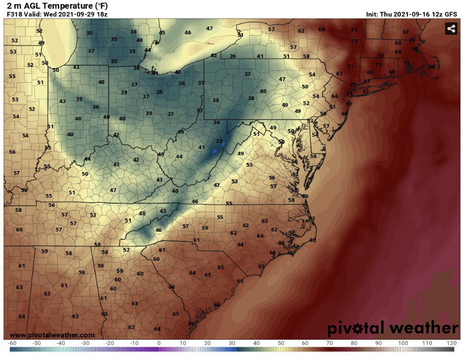
-
Verbatim, would probably be a T at PIT. Temp at 18z on 9/29 is 38.
-
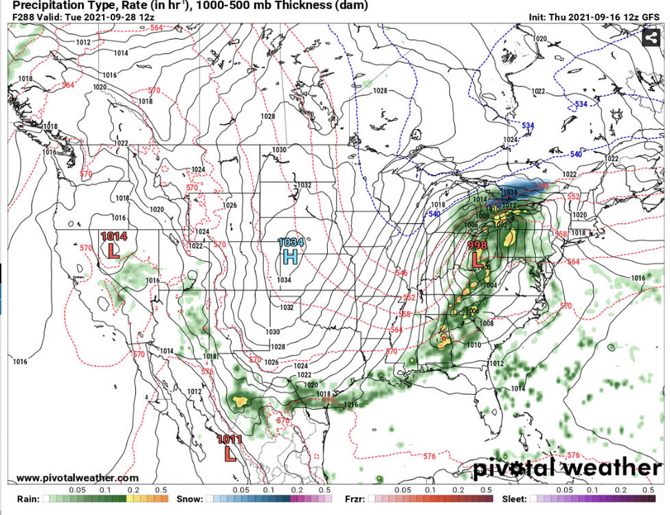
540 line is down to TN/GA line.
-
GFS in mid-winter form already:
-
I think this adjusts down another notch with this afternoon’s release.
-
Western PA/Pittsburgh Fall Weather Discussion
TimB replied to Ahoff's topic in Upstate New York/Pennsylvania
Has kept PIT from getting past 64 so far. Achieving 15 more degrees this afternoon to get to the forecast high will be difficult with September sun angle. -
Western PA/Pittsburgh Fall Weather Discussion
TimB replied to Ahoff's topic in Upstate New York/Pennsylvania
Also hope this fog holds on as long as possible and cuts into our high temp today. -
Western PA/Pittsburgh Fall Weather Discussion
TimB replied to Ahoff's topic in Upstate New York/Pennsylvania
It’s definitely been better than what I was dreading. The humidity has been brutal, but even that broke last night, if only for 12 hours or so. Don’t think I’ll complain too much about a stretch in September where we only get into the low 80s (maybe mid-80s a day or two if we overperform). PBZ’s one forecaster that actually writes good discussions had this to say:
-
All of the models seem to be on board with that mid-week frontal passage. Overnight runs were exactly what I wanted to see.
-
Hey, isn’t September 29th pretty much the same sun angle as....the sun angle of the Blizzard of 93?
-
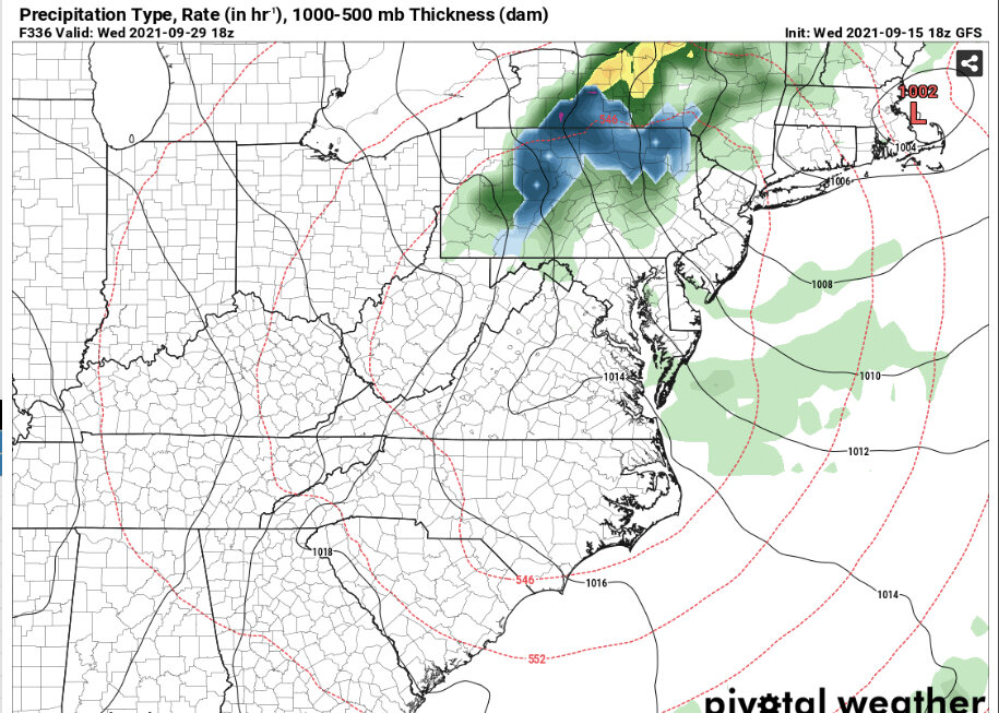
MDT is at 41 with rain on that panel. But the big news is, digital snow for PA has officially begun.
-
Some areas of Potter/Tioga get 6+” Kuch.
-
EC keeps the ugly dewpoints over all of PA through the end of its run.
-
12z GFS does what it should in September. Warm -> cold front in 8 days or so -> seasonable with mostly sub-60 dewpoints -> chilly with a 540 line through almost all of PA (actually dips to the VA/NC border at the end).
-
65? Foreclosure doesn’t sound like comfort to me, and that’s what I’d be facing if I set mine at 65.
-
Not 2. 0.2
-
Even the remaining “heat” over the next week could probably be more accurately described as “warmth”, save for maybe a day here or there.
-
The end is in sight. CMC does something different and rebuilds the ridge in that timeframe after a less decisive frontal passage and retrograding trough.
-
The last couple days of that run do look spectacular. Lock it in.
-
18z GFS gets a bit toasty late in the run again. In better news, October will be within view on the GFS by morning.
-
Just looked at the earlier parts of the GFS run, which suggest 90 is still in play for me early next week, when my normal high is 73.
-
Looks like we’re right in the battleground between the trough and the ridge at the end. That would be fairly seasonable.


