wx_observer
-
Posts
280 -
Joined
-
Last visited
Content Type
Profiles
Blogs
Forums
American Weather
Media Demo
Store
Gallery
Everything posted by wx_observer
-
The severe thunderstorm warning for the cell that went through Springfield ma says that 80 mph winds were observed. Damage threat: destructive according to NWS
-
We're hilly and wooded up here too, so it's a lot harder to see something coming from further away than somewhere that is largely flat. On top of it, we don't get tornados up here often and have a population less prepared for them. Kind of like getting a winter storm warning in a southern state for only a couple inches of snow. At least basements are pretty common in most of New England.
-
Geez, I can't remember the last time SPC gave us a 10% probability of a tornado. Sounds like it's going to be spicy today.
-
If this info is correct, 2023 was the 4th wettest on record in Worcester. If we keep up the same rate we've had so far in 2024, we would probably surpass that. https://www.extremeweatherwatch.com/cities/worcester/year-2023
-
Nope. No. NO more rain. Not when the water table is already so high that I'll need a dinghy and water wings to do the laundry if we get any more.
-

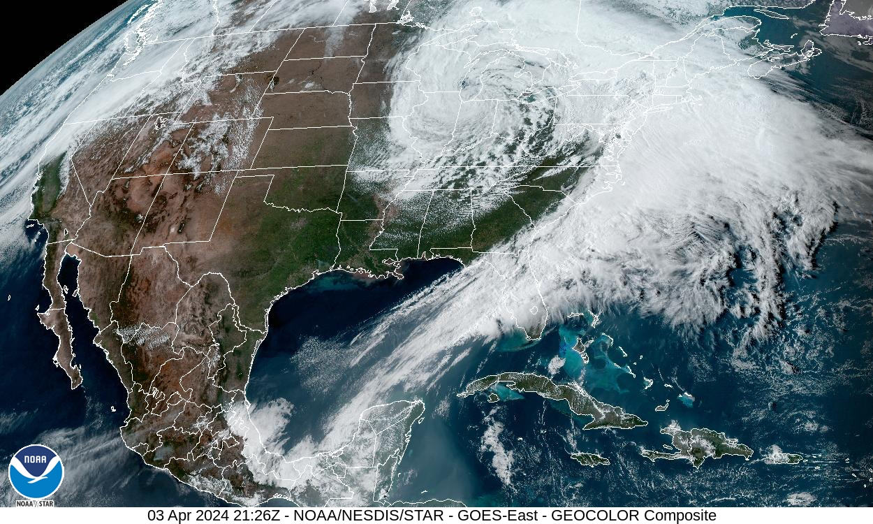
Significant Miller B Nor'easter Apr 3rd-4th OBS
wx_observer replied to wxeyeNH's topic in New England
According to MyRadar, southern Maine over to Laconia NH has between 40-50% without power. What a mess. -
Significant Miller B Nor'easter Apr 3rd-4th OBS
wx_observer replied to wxeyeNH's topic in New England
Mostly flipped to snow now in central MA. It's like concrete out there between the layer of sleet and wet heavy snow. -
Significant Miller B Nor'easter Apr 3rd-4th OBS
wx_observer replied to wxeyeNH's topic in New England
More lightning in central MA. Mostly sleet, with some snow mixed in. -
Significant Miller B Nor'easter watch, Apr 3rd-4th
wx_observer replied to Typhoon Tip's topic in New England
Not really wanting winter weather anymore, but you have to admit, this is impressive:
-
Significant Miller B Nor'easter watch, Apr 3rd-4th
wx_observer replied to Typhoon Tip's topic in New England
Sounds about right...so bring it home. We really don't need school cancelling / power outage level snow in April. -
Significant Miller B Nor'easter watch, Apr 3rd-4th
wx_observer replied to Typhoon Tip's topic in New England
Ice pellets here in central MA, around 800' elevation. -
Significant Miller B Nor'easter watch, Apr 3rd-4th
wx_observer replied to Typhoon Tip's topic in New England
Yikes, don't send it this way. The .25 inches of ice we got a week ago did enough damage here... -
Significant Miller B Nor'easter watch, Apr 3rd-4th
wx_observer replied to Typhoon Tip's topic in New England
Maybe in January or February? The garden is calling....I'm about ready for 60F with sun for a several day stretch now. -
It was a Flop... February 2024 Disco. Thread
wx_observer replied to Prismshine Productions's topic in New England
Waking up to a little fresh powder in central MA this morning.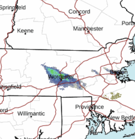
-
I'm right at the border of N and S ORH county, and we have a dusting of snow so far.
-
24 hours ago folks were talking about how NYC kids were going to have a remote learning day for nothing more than white rain, and now they're in a meso for heavy snow bands.
-
NEAR TERM /UNTIL 6 PM TUESDAY EVENING/... 10 PM Update... The southward trend continues with 00z NAM, HRRR, WRF-ARW and WRF-NMM. Lowered accum north of the MA Pike where confidence is highest in less snowfall. As a result converted some of the warnings to advisories and dropped the advisory for NW MA. May have to lower amounts further south but no changes made along and south of the MA and will await full 00z model suite before making any changes.
-
Adding to the epic bust factor…is MA and Boston telling all nonessential state and city employees to stay home tomorrow.
-
If only the slowly deflating balloon sound effect could be added to this….brrrrrffftttttttttttpppphhhhhhphphph
-
Slow motion train wreck right there.
-
When a picture is worth 1,000 busts.
-
The model shifts are surprising on their own. What seems even more surprising is how confident NWS was in their forecast prior to the shift. This was not a low confidence forecast late morning today.
-
Ours closed 2 hours AFTER. Go figure...
-
Why does bust seem like such an understatement for what happened today?
-
I heard one on the back porch today. Didn't see it, but I know it was there.