

SnowenOutThere
-
Posts
3,473 -
Joined
-
Last visited
Content Type
Profiles
Blogs
Forums
American Weather
Media Demo
Store
Gallery
Posts posted by SnowenOutThere
-
-
5 minutes ago, TSG said:
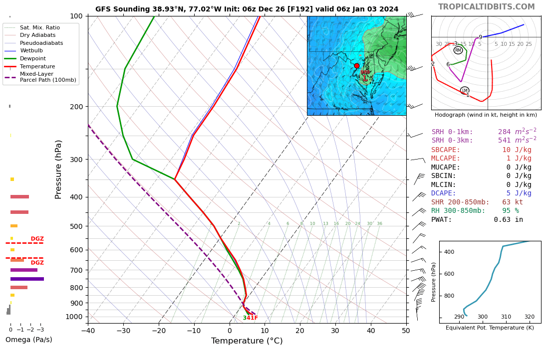
i'm going to disagree pretty strongly on this point. The boundary layer up to ~900mb is torched from 2.5 days of Southwest/South flow starting on the 31st. Yeah these kind of storms can bomb out and make up for less than ideal temps, but there's no real cold for the storm to pull down from the N/NW. The panel below says it all, >0C 850s all the way to Maine... 45-50F surface coming in at 20kts off the Atlantic over NJ/DE. That's just not a recipe for snow in the Mid-Altantic in my experience, bombing cyclone or not.

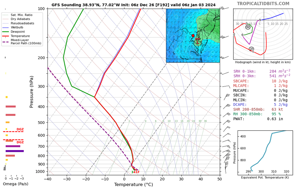
Okay what about this one where the low is further south and 850s aren’t torched?
-
 1
1
-
-
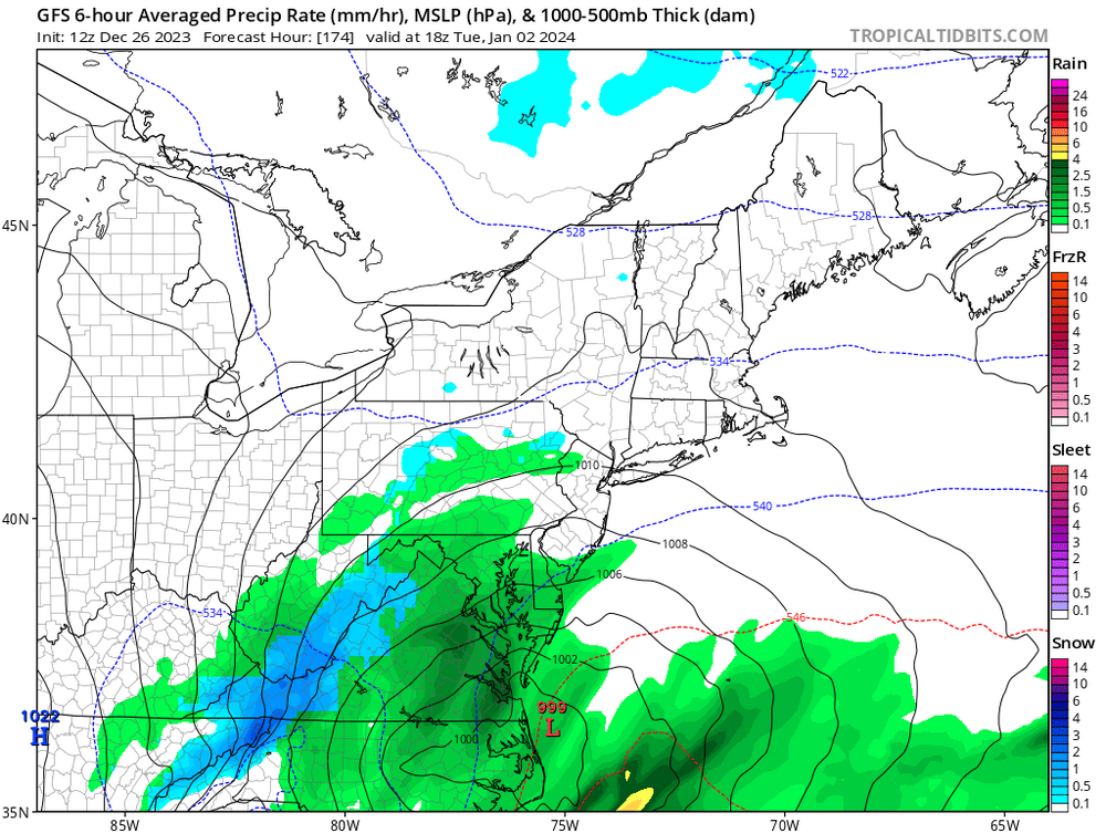
Ik a lot of people are focused on 6z GFS output near the 3rd for good reason but it also shows the wave near the 7th as a string costal that’s a little too far south. Even if we take the GFS output for the 3rd verbatim we still have chances later that week! Agree it is concerning though …
-
3 minutes ago, WxUSAF said:
Don’t hold us in suspense!
I got you

-
 6
6
-
-
1 minute ago, WxUSAF said:
Wooo baby, GFS brings some Christmas magic!!
Temps in the low 20s too
-
5
-
-
14 minutes ago, SnowenOutThere said:
Gfs boutta cook too with the wave after‼️

‼️LET IT COOK ‼️
-
3
-
 2
2
-
-
Just now, Terpeast said:
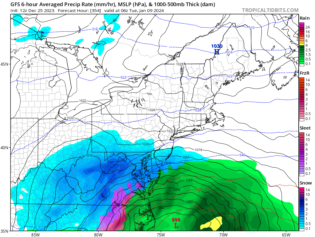
FWIW 12z op gfs shows a bomb off the coast Jan 3. BL a tad too warm verbatim, but it’s very close. Jan 5-6 wave a bit weaker, but with better cold air. I think I’d rather have it switch places. Weaker wave with marginal air, then bombs away on Jan 5.
Usual disclaimer: it’s the op gfs so this analysis is mostly just for fun
Gfs boutta cook too with the wave after‼️
-
2
-
-
3 minutes ago, Kevin Reilly said:
LOL did you see the 12z GFS the same storm was 972 275 miles out and on January 3rd. As I said it will come west it did now split the difference in 12z GFS and 18z GFS and BOOM!
Those are two different waves not the same one. 18z gfs is still out to sea with the energy the 3rd
-
1
-
-
4 minutes ago, NorthArlington101 said:
Aren’t we smart enough not to engage folks looking for attention in the LR thread?
It’s fine imo if it’s a quick response that doesn’t really give them anything
-
2 hours ago, stormy said:
Wow!! Both the ECM and GEM give much of Augusta County 2 inches of rain during the next 168 hrs..
This Nino is producing. Many Valley folks have been praying for a wet Winter. December is making a solid contribution.
19 minutes ago, Weather Will said:I am excited about January, but a couple weeks ago there was some hope of a discrete threat they'd upcoming week, that has since fizzled. I am sincerely grateful about the upcoming rain this week, we need it....WB 12Z GFS.

Interesting new angle of attack we’re seeing … they’re evolving (devolving?)
-
1
-
-
22 minutes ago, stormtracker said:
Listen, hold off on the storm talk until I return from Mexico on the 2nd. If you root for a storm and it comes on the 1st, there’s going to be mysterious “server down” messages on the board from like 12/30-1/1. I’m at a bar at DFW waiting on my next flight and Cape’s posts have mitigated the anger that i paid $37 for a shrimp po boy and a beer. I don’t need this stress worrying about 1/1.
Where is Chuck and his fever dream posts when you need them?
I’m also not here till the 2nd so I’ll slip you an extra 5 bucks if that mysteriously happens.
-
19 minutes ago, WxUSAF said:
Are you looking at literally anything besides the snow map?
lead poisoning strikes again
-
3
-
7
-
-
8 minutes ago, WesternFringe said:
I teach HS math, like algebra, geometry, calculus, stats, etc.
In my 21st year. I have my PhD and should really go teach preservice teachers in college, but I just really love teaching high schoolers.
If (when) I ever need help in my ap pre calc or AB next year I now know who to ask.
-
1
-
-
@Ji are you finally happy … for 6 hours at least?

-
1
-
 2
2
-
-
41 minutes ago, Ji said:
Yes we need blue to show up on maps if this pattern change stuff is real. It’s really the most important thingI mean eventually but the possible "window" for a storm is like 14 days away ... you should know better
-
1
-
1
-
-
18 minutes ago, brooklynwx99 said:
even that first look is serviceable since the Atlantic looks nice. one would even argue that you'd want a slight -PNA with a -NAO
That would be good for some decent front end thump then rain/dry slot storms right?
-
1
-
-
48 minutes ago, WxUSAF said:
Oh LAWD she comin’!
Once again I want to friendly ask who made models only go out to 384
-
1 minute ago, Ji said:
Yea best run yet. The weeklies snow map is weenie even for weeniesIf you’d like to post it the digital snow thread could always use an addition
-
2 minutes ago, CAPE said:
Latest weeklies with a more impressive -NAO heading into mid Jan, and not much to say about that Pac look. Just damn. Cold air won't be a problem between the EPO ridge and TPV position.

That would be a great overrunning pattern with the Nao locking confluence to our north.
-
2
-
-
53 minutes ago, WxUSAF said:
Dang I hope we get a radar look like this again this winter with a temp about 30F colder
I’d prefer 40 degrees colder to be safe
-
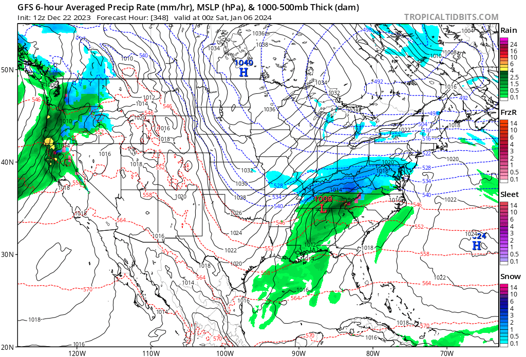
Lots of talk about the 27-29th, if we manage to get a good storm track cold air will most likely be a pretty large issue (excluding the transient high idea which is timing we just won't know till later) because good, deep cold isn't really anywhere near us. A pretty good representation of the issue is with the snow depth map of North America, for those wondering, yes ... its worse than 2015. That said, even if it doesn't snow on us that storm would probably help lay down some good snowcover to our north, setting us up for later as the pattern becomes more favorable.

-
1
-
-
6 minutes ago, Eskimo Joe said:
Quick search shows no Winter Storm Warning for DC since 2019. Could be wrong.
What about Jan 3rd 2022?
-
5 minutes ago, NorthArlington101 said:
I think I like what it's doing at 102. CMC-ish but better with the vort positioning, is my trying-to-get-better-at-reading-maps read.
Manages to have a slightly more optimal phase, overall a positive change
-
2
-
-
Euro might be more interesting than its 0z run
-
1
-
-
2 minutes ago, aldie 22 said:
I don't know guys...this seems like a longshot to me
This seems like one of those storms that sometimes show up on the models but will pretty much never actually happen. Who knows maybe we'll get lucky, after all it somehow managed to snow this Monday.
-
1
-


Dec/Jan Medium/Long Range Disco
in Mid Atlantic
Posted
I feel like we are leaving something out … must just be my imagination!