

SnowenOutThere
-
Posts
4,006 -
Joined
-
Last visited
Content Type
Profiles
Blogs
Forums
American Weather
Media Demo
Store
Gallery
Posts posted by SnowenOutThere
-
-
Just now, MillvilleWx said:
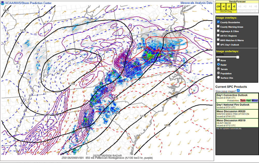
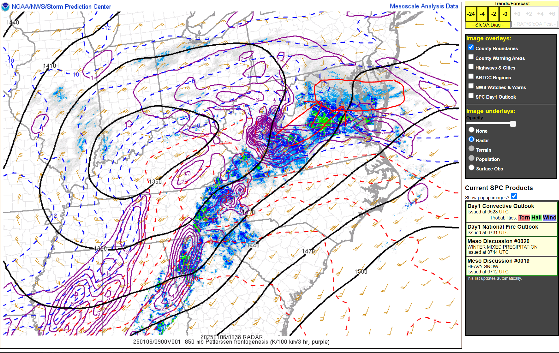
Mesoanalysis still has the best 85H FGEN well to the south closer to CHO and points southwest. This will migrate northeastward over the next several hours with the best forcing likely positioned in that circle above the arrows. This is the area that could see a steady 1-2"/hr rate period that will last 3-6 hrs before it moves off to the east and that's when the rates will subside before the next round comes through later today. By then, many inside that circle will be at 6-12" and then we wait for the bonus snow with the vort pass to our south. Good times here y'all with the best still to come!
Cannot wait. Any chance of thundersnow with this forcing or no?
-
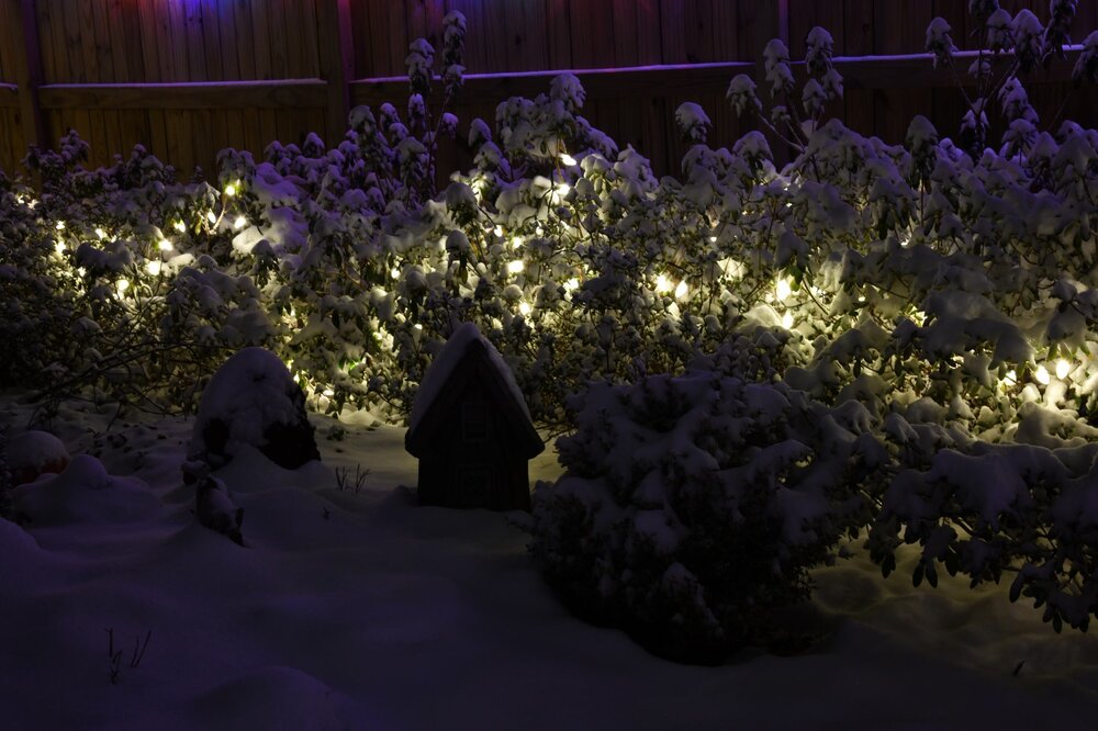
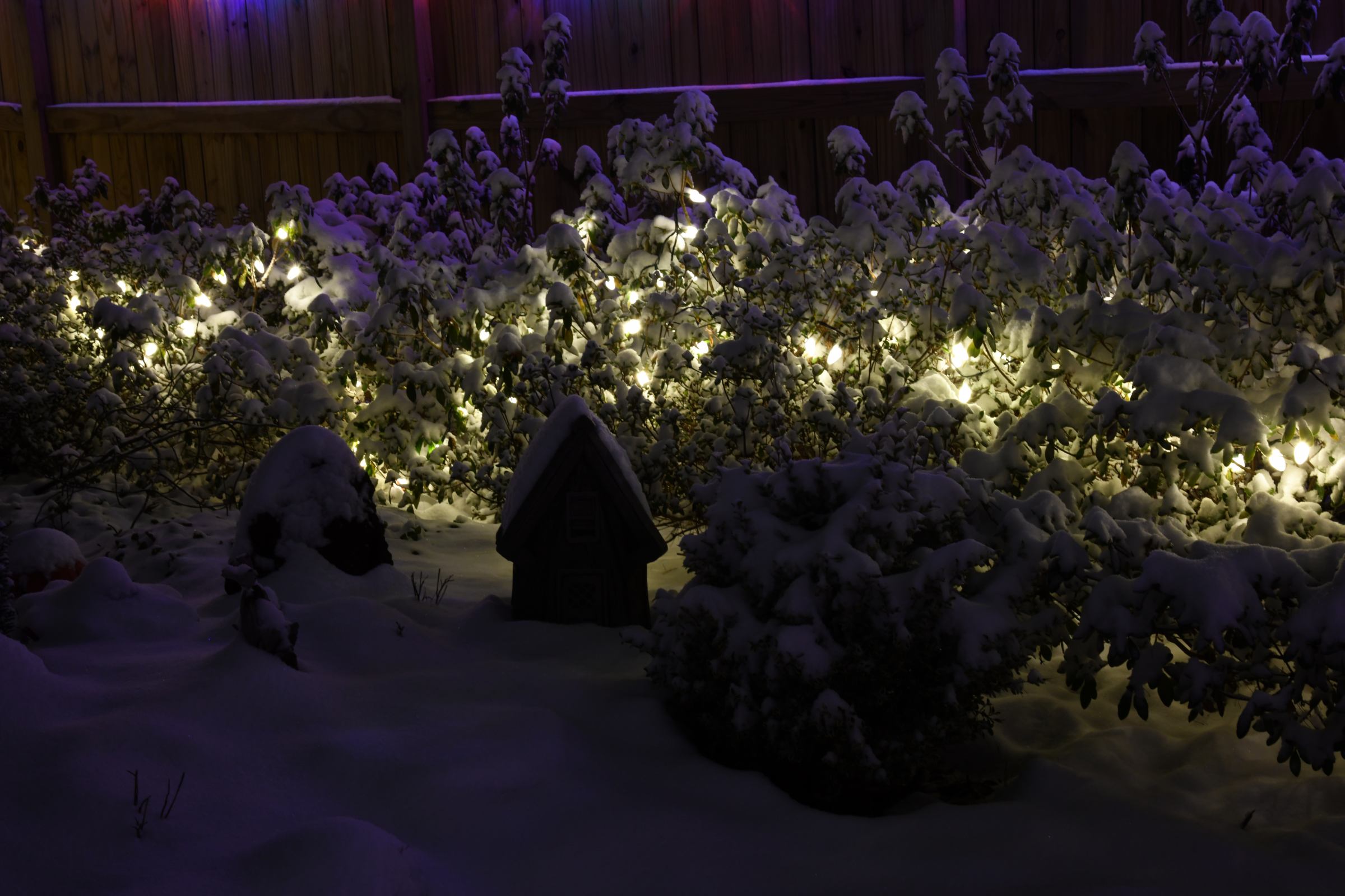
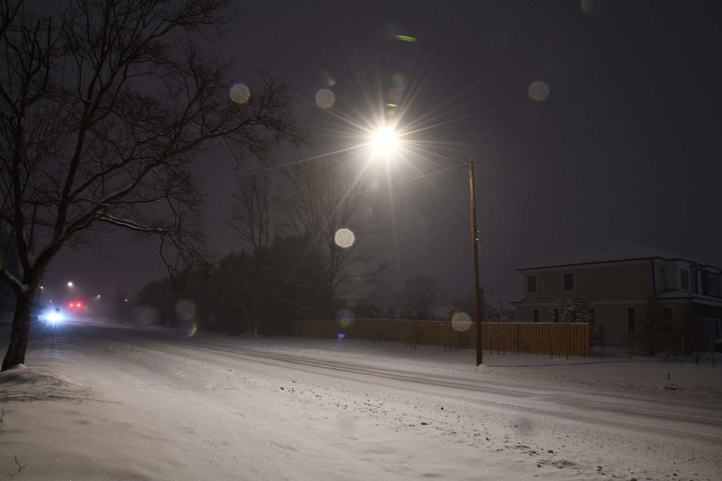
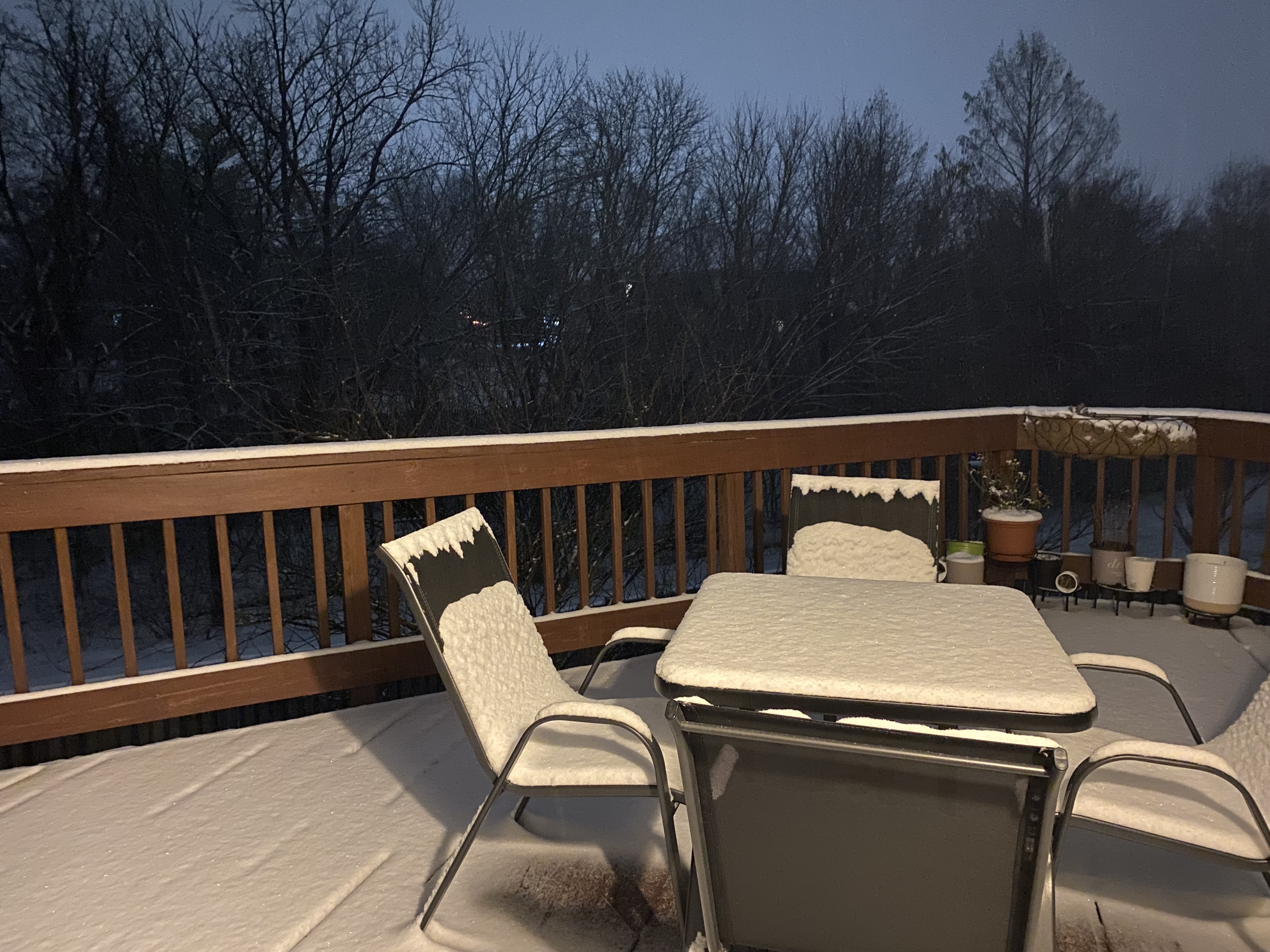
Pictures from this morning taken on a D850 with 24-120 f/4 lens


-
 4
4
-
-
Just now, MillvilleWx said:
I'd say within the next few hours is when we'll hit the heaviest part for you guys. I'm a little later and linger longer out my way. Sweet spot right now is just to the east of you which has been well modeled by CAMs thus far. Still a solid storm for your area for sure.
My bar right now is to beat the Jan 3rd storms 7.4 inches which seems pretty likely at this point! Would be nice to try and get over 10+ to make it the biggest storm since 2016
-
1
-
-
Just now, MillvilleWx said:
430am Measurement
3.5" on the nose
SN to SN+ 25.4/24.9
Those 10-12" totals are looking pretty realistic for this area now.
When do you think the heaviest bands setup out near Reston?
-
3 minutes ago, Terpeast said:
Heavy snow. 25/23. Best rates of the night
Can’t wait for the heavier bands to start approaching me. Just measured 3.2 so have held a steady .8 inch per hour rates since 2:30am
-
2.25 inches at 3:30am near Reston, so roughly .8 inch per hour
-
31 minutes ago, Terpeast said:
Being on the north side of heavy stuff flakes will be small. But should fatten up when the firehose is right on top of us. You’re a bit east of me so you should do a little better
When should the firehose really get going? Would be nice to sleep a little more till then
-
Recorded 1.8 inches of snow near Reston
-
2
-
-
20 minutes ago, Terpeast said:
Surpassed 1” in Ashburn

I assume that since you’re pretty close by You’ve had the same snow type as me. Woke up after a 2 hour nap and expected some larger flakes but still seems to be coming down pretty well, so should I be worried at all by the pixie dust nature of the snowfall so far?
-
Super small pixie dust flakes have started in reston, only at 74% humidity so still got a ways to go
-
1
-
-
1 minute ago, deer said:
any minute now
Reston always likes to be the last location to start snowing in these storms
-
1
-
-
In the last 10 minutes my weather stations humidity has shot up to 70% and dew point from 12 to 21 degrees
-
While some of us near DC wait for the snow to start the 0z GFS for next weekend looks fun if you head over to the long range thread
-
1
-
-
Just wondering if this apparent dry area on radar is actually real or just the result of the radar. I’m aware there’s sometimes some issues looking southwest from sterling

-
Been trying to nap since 7:30 but caved and checked the forum to see the what the high res models where showing, seems like everything is still looking great. Hopefully will be able to fall asleep some till it starts snowing
-
2
-
-
30.9 degrees and thickening clouds
-
Does any met want to chime in on if thundersnow could even be a possibility for anyone in the forum? I know Kansas City and some other places have had some with this storm so far
-
1
-
-
3 minutes ago, Ravens94 said:
Going to be a great run area wide
Pre coastal
.thumb.png.1d409367aa7db28fb86438187d6bd3ea.png)
Well we at least get one more run of HRRR going crazy with foot plus totals
-
1
-
-
31 minutes ago, WxUSAF said:
To those about to be NAM’d, we salute you
Turns out this was pretty much all of us
-
Just now, LP08 said:
3k still going at 0z Tuesday with the coastal forming.
Can't wait for the stuff over Ohio if it can make it to us

-
The wraparound stuff should still be decent (if not better) than the 18z runs
-
1
-
-
Just now, Terpeast said:
Thermals do appear cooler this NAM run. Will check 3k too
It gets rid of the sleet that has been plaguing NOVA at 12z Monday

-
1
-
-
Just now, SnowenOutThere said:
Nam def will be south, may be not great for the northern crew which has been hugging it but still early in its run.
18z top 0z precip through hour 30


-
Nam def will be south, may be not great for the northern crew which has been hugging it but still early in its run.
-
 5
5
-
 2
2
-

.png.00b7b2ef638ce16badb12dc8396aa028.png)
January 5-6 Thing Storm Obs
in Mid Atlantic
Posted
3.5 inches of snow as of 5am and flake sizes have increased as I start to get into the band hitting terpest right now. Though from 4:30 to 5am snowfall rates decreased from .8 to .5 an hour, I assume from subsidence as the band got closer.