

SnowenOutThere
-
Posts
4,006 -
Joined
-
Last visited
Content Type
Profiles
Blogs
Forums
American Weather
Media Demo
Store
Gallery
Posts posted by SnowenOutThere
-
-
1 minute ago, clskinsfan said:
18Z HerpaDerp is south. We might be in trouble.
")

It actually shifted a bit north from 12z, it just cut off most of the storm then
-
 1
1
-
-
RAP (fwiw) seems wetter and has a wide swath of foot 12+

-
1
-
-
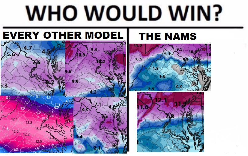
This is pretty much the state of the storm right now. (@stormtracker if this needs to be moved to banter)
-
 5
5
-
-
50 minutes ago, stormtracker said:
We're surprisingly well behaved in the storm mode thread. What's going on with yall?
I got you, give me a second to make a meme
-
Coastal should be done by now

-
5
-
 1
1
-
-
2 minutes ago, stormtracker said:
All in all, doesn't seem to be anything different that jumps out. Little less coastal enhancement
The vort weakens more than the 12z run which probably explains why its both colder and worse with the coastal. Result is a smidge colder and an asshair drier (for around DC at least)
-
1
-
-
GFS is out and running. No real change through hour 18 besides maybe a bit more confluence and a tinny bit stronger low
-
Just now, MillvilleWx said:
Oh yeah. I would say 5” at the worst and 10-12” if everything just breaks perfectly. I’d say 6-10” is a great call for your neck of the woods. I’m sure that’s what Sterling and WPC are rolling with as well. The backend fun with the vort pass is going to be the biggest question mark and if that breaks properly, there will be a lot of happy people in here.
When do you think we could have a good handle on the vort pass and backend snow situation? It seems that the models that are the best with the WAA for my area sorta miss with the backend and vise versa. Want to make an updated forecast for my friends and family but am waiting for more agreement on that last part, and thanks for the post!
-
21 minutes ago, MillvilleWx said:
I imagine you do well with this setup. Sterling/Ashburn area should stay most, if not all snow. Hopefully the early morning hrs on Monday are nice and thumpy
Since you’re giving out snowfall ranges for various places do you think the Ashburn/Reston area should be in a solid 6-10 range? Seems like at this point the WAA should get us well and if we’re lucky with the coastal we could her higher end amounts
-
2 minutes ago, peribonca said:
We've been screwed like this in the past... Hope it's not onto something
either way it still gets us to 7ish inches by the end of its run with at least 2-6 more with the coastal fluff so not even a bad run verbatim, but is a little worrying if it nudges any further north
-
6 minutes ago, WxUSAF said:
3k is the one to care about soon
I know its the NAMs at range but should NOVA be worried about the weird dry slot it shows with the WAA?

-
9 hours ago, Wxdavis5784 said:
It’s been forever. Even my 18 year old barely remembers 2016…
As someone who is that age I don’t remember anything much before 2016 besides glimpses of storms. I vaguely remember the 2016 blizzard but wish I could recall more about it. The Monday system may be the first time I can truly remember getting 10+ inches of snow (ig Jan 2019 counts too but yk what I mean)
-
3
-
 1
1
-
-
Fwiw NAM 3k is slightly colder than the 12z upstairs
-
Seems to have a more expansive dry slot which isn’t great
-
1 minute ago, Terpeast said:
No real changes on the surface yet.
At hour 60 the sleet line is ever so slightly south (from cutting through fx county to being just south)
-
2 minutes ago, SnowenOutThere said:
That was incredible! Thunder snow, watching the clouds come in, the progression from melted flakes to a snow globe, this may be one of my favorite winter events ever.
Hell of a way to get .1! As someone too young for the 2014 squall this was a first time thing. Should have a timelapse up later
-
1
-
-
That was incredible! Thunder snow, watching the clouds come in, the progression from melted flakes to a snow globe, this may be one of my favorite winter events ever.
-
1
-
-
Heard a rumble of thunder, sadly not snowing as the cell that produced it slid to my north. Reminds me a lot of summer
-
3 minutes ago, clskinsfan said:

Remember we only use 10-1 when it shows the most snow
-
Is anyone out near Winchester or in that band able to confirm if its 1. actually reaching the ground 2. rain or snow
-
19 minutes ago, WxUSAF said:
My wag at GFS sounding analysis for immediate 495 area is that 12z Monday is probably snow with heavy rates and a tiny layer at freezing more or less. 18z is probably sleet with lighter rates and a wider warm layer. Reminder that as we get closer, NAM and Euro profiles will be more accurate for assessing p-types.
p.s.: we all should be rooting HARD for that ULL/CCB snow area to verify/intensify/biggify. Soundings for that are gorgeous. That is some 12-15:1 champagne powder on the GFS.
Is there any great way to tell a sounding between borderline sleet and snow? I know roughly that 600 feet plus of warm nose is where trouble happens but hard to tell if thats on the sounding maps.
-
3 hours ago, Weather Will said:
Nice run WB 6Z GFS!


The funny part is that the storm is almost split in two around the DC area with roughly half of the snowfall from the WAA and half from the coastal. Not sure I would really want to bet on the coastal giving that much but who knows.
-
1 minute ago, yoda said:
Ukie is south lol
Significantly so too, some of the forum even gets fringed
-
1
-
 1
1
-
 1
1
-
-
Light snow hour 198


January 5-6 Thing II: STORM MODE
in Mid Atlantic
Posted
NAM seems slightly south with the primary, but its extremely early in its run