SnowenOutThere
-
Posts
5,666 -
Joined
-
Last visited
Content Type
Profiles
Blogs
Forums
American Weather
Media Demo
Store
Gallery
Everything posted by SnowenOutThere
-
 For those wondering yes this is how we know we're in true midseason form. BTW @psuhoffman what's your advice for debating people.
 -
My favorite weather hiking is arguably the Shenandoah's in a good upslope event. Frankly its otherworldly to ascend into the cloud deck and go from showers to a downpour on the mountainside. While I love my snow hikes rain hikes are even more dynamic. Hoping I get some opportunities for that this spring with temperatures around 60.
-
Please God let the HRRR be right it has me nearly reach 70 degrees tomorrow.
-
Ehhhh its progression makes sense sadly. Not saying its right but with this pattern we are relying solely on timing so a situation where the 50/50 is too progressive and we end up without any cold at all is possible. Though I guess it's a less damning storm in terms of PSU's climate change book if that happens.
-
I think that makes sense. We have a loaded up storm that will bring precip so its just a matter of if there is enough cold to take advantage (assuming the track isn't terrible).
-
I agree with this. The past 10 years or so have been historically bad and not the sole fault of climate change. Frankly, if it was just climate change alone causing such a dramatic shift then I wouldn’t be in college right now because clearly our planet is mega fucked so id live up the life I had left. Thankfully, it’s not our baseline and instead just bad patterns and climate change together. We will get good winters again but they’re just harder to come by. As a last note I think this storm is a great read like you said but only if we get a “perfect track”. I mean if we get a primary in the Ohio valley or west it’s raining even if it was 1700.
-
Welcome to the hobby! You should’ve been here for the legendary PSU runs of 2024 and 2023 and those perfect track storms. Just diabolical low in the perfect position and 35 degrees plus heavy rain. Something I’ve found to help is I go on hikes into the mountains during those perfect track storms cause they’re still cold enough (for now lmao) to get accumulation. Though it’s sad because I’m only another 1000 ft up or so (which moist adiabatic lapse rate is 4ish degrees) and that would be our base climo a hundred years ago
-
Yeah dude I’m not here to say it won’t get cold or snows gonna disappear forever. Climate change takes time. Im here to say on balance we lose stuff on the margins. Additionally, that gfs run won’t be true (and god knows it won’t be right till the day after the event) but they still show a “real” possibility bound by our physical laws. That storm happens in some possible world; though hopefully not our own.
-
I agree that the setup is flawed. So does PSU. That’s not really our point though. The point is that we need to still snow on flawed setups like this one, if not, then we’re stuck waiting for years to get a good winter. As a note to that yes it’s 12 degrees now but our super cold pattern has been super dry! That’s normal, and that’s okay but shows why we need to be cold enough in our non super cold patterns.
-
Learning about this stuff in my atmosphere and weather course this fall really shows how just objective it all is. I remember I had to learn and derive the whole solar forcing equation and calculate the temperate of earth based on the suns output. In the observed temp equation there are three variables. 1. Solar forcing 2. Albedo 3. Greenhouse gas absorption. That’s it. You can do the math and it all checks out. Then everything else falls from there. Storms ride baroclinic boundaries and the polar jet. Both of those shift north in response to our temperature. To emphasize it will snow again we will get a HECS again but gradually our chances slowly run dry until we’re all fighting for scraps over a 50 mile frozen shield on any storm that doesn’t have a great pattern.
-
While we’re dancing around the elephant in the room I’m going to address it. Look at the fucking 0z GFS Technically it’s a win! It snows for the NOVA and north crew. But seriously what the hell are we doing with our lives if we have a pure coastal low and the area of frozen in the dead of winter after 2 weeks of extreme cold is that small. I mean there’s almost no frozen on the north side! That’s not normal! It’s not a shit the blinds pattern. This is direct evidence that our planet has changed and I’m tired of dancing around that fact. If we lose storms like these then our lives are waiting for the one in 10 years shots like this January and praying chance lines up.
-
Ah, got it. Basically part of our ridge bridge problem isn’t necessarily the actual height lines but instead that the thickness lines of the of 500mb chart keep going up… which is related to the hyposometric equation… which states warmer air takes up more thickness in the atmosphere… which means the atmosphere is warming up and the result are new “ridges” on the charts. Funny how it all comes back to that one thing.
-
Quick question but what is causing that central US ridge bridge to the NAO? We even seem to have a decent Atlantic and if the PNA isn’t killing us yet then what would it be?
-
Man now it’s just like the winters I remember on this forum.
-
Was this your window from a couple days ago?
-
If we're rating this winter I have two very different takes. From the meteorological/winter being cold angle this has been a solid B+ or A- considering its the longest I've seen snow OTG. We also have been brutally cold and had a really dynamic storm to kick off the stretch. Not to forget December also felt like a winter month again with some minor snowfalls! Really helped sell a solid three months of classic winter. One more major synoptic event and I think the winter hits solid A territory from a purely weather perspective. Now, from my personal perspective for why I enjoy winter... I cannot really but this above B tier. I think I lean B- or C+ because frankly this snow/sleet combination has sucked for all my usual winter activities. I can't go on my hikes, go out on drives to take pictures, or even move around college easily. Add onto that at college the only way to really get where I want to go (without relying on UVA's questionable bus service) is walking as the ice took my bike out of the picture and its been a somewhat miserable stretch of weather. A very unique and interesting experience but man I would kill for some 60 degree days and the ability to go on a hike or play tennis without dying on an ice rink! That said, I cannot rate it much lower than maybe C because it has delivered snow with some interesting events. I loved the December storms and our January artic squall. My hikes out to WV were great too and helped fill in the gaps but at this point I'm done with out snowcrete and looking forward to either a warmup or legitimate snowstorm. Additionally, how the Jan 25th storm shook out just sorta was a bummer and probably alters forever how I will interact with the hobby which is unfortunate but needed.
-
Winter Storm Threat *Technical* Discussion. No Op Run PBP or Snow maps
SnowenOutThere replied to CAPE's topic in Mid Atlantic
Honestly with 12z I'm not even sure if you could call the bit of low pressure in the Ohio valley a primary. From how I'm seeing the setup it appears to be an extension of the main low pressure system across the southeast states. -
Went from a congrats Chicago cutter with us blasting into the warm sector to a congrats Pittsburg Ohio valley low setup. Big change is also the placement of the high from promoting the S return flow/torching to more of CAD look that allows us to maybe get a thump of snow.
-
Winter Storm Threat *Technical* Discussion. No Op Run PBP or Snow maps
SnowenOutThere replied to CAPE's topic in Mid Atlantic
Its primarily a miller A solution IMO. Looking at the H5 map of vorticity (which approximates upper air diffluence and consequently lift in the lower levels) we can see that the main energy of the system on the GFS is over the Gulf Looking at the surface pressure map around 12 hours later we can see that there is a nudge of pressure going up the Ohio valley (due to the H5 amplifying the surface across the East coast) which does indicate a bit of a miller B/C depiction. However, the real meat of the storm is in Georgia after tracking across the Gulf states. This is really just a miller A but without enough blocking in place to prevent the H5 diffluence from promoting some surface cyclogenesis in the Ohio valley. In order to prevent this storm from cutting we just need the NS to promote enough confluence to prevent the 925/850 low from going up the valley like what happened on Jan 25th. Generally we want either more confluence or the wave to eject from the SW earlier while we still have that cold air push. -
Man it’s been a while since we’ve seen a classic 1-95 gradient like that.
-
Big Charlottesville win on this one I love to see it cause that week is hell for me school wise
-
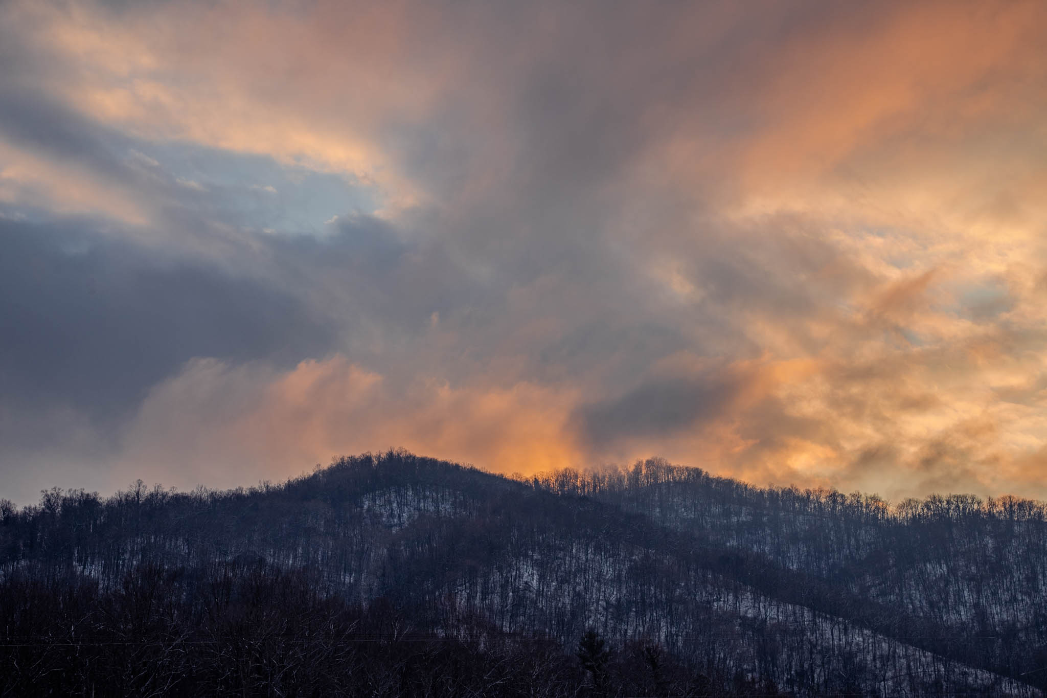
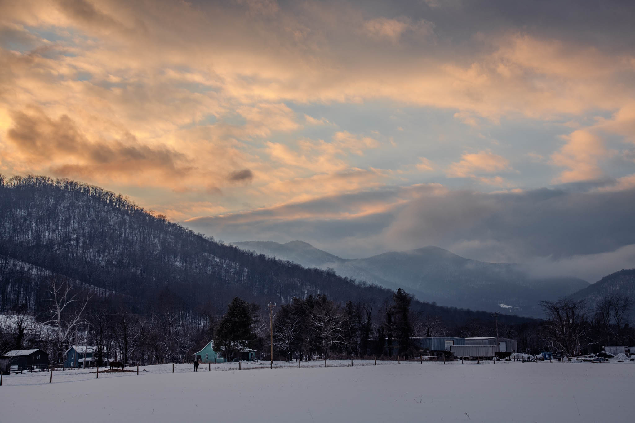
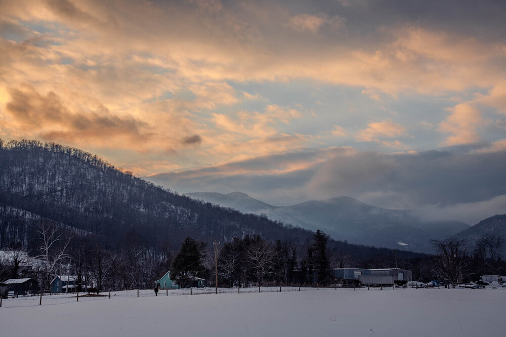
While Skyline Drive unfortunately closed before I could reach it I instead explored the backcountry and foothills on my way to Whiteoak Canyon trailhead. Managed to get some beautiful sun as it set across the country which was an unexpected but welcome surprise.

- 553 replies
-
- 20
-

-
Agree with this take. Phasing both streams is how we get back to Jan 25th but now without the insane cold to keep us from raining. Instead, allowing the first NS to go by gives us 1. a chance for a light event 2. cold air. Then whatever happens out west happens.
-
Heavy snow with fluffy dendrites outside cvill