WXNewton
-
Posts
879 -
Joined
-
Last visited
Content Type
Profiles
Blogs
Forums
American Weather
Media Demo
Store
Gallery
Everything posted by WXNewton
-
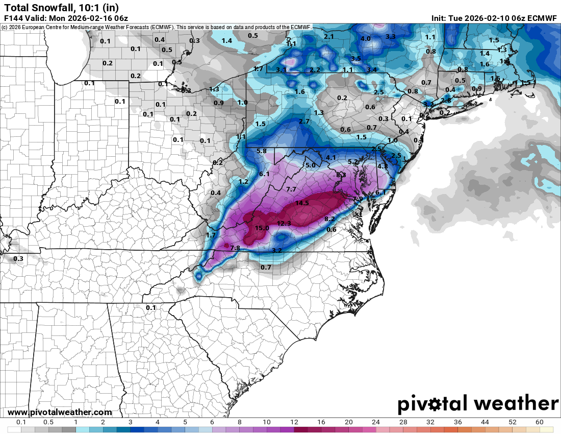
Boys, we just got NAM'ed for Sunday. Get your shovels ready!
-
EPS cut back too, still just a hair over an inch though. 6z EPS-12z EPS
-
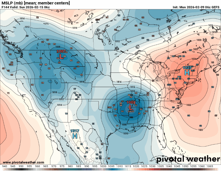
Euro back south even more than 06z. Mostly rain for everyone. Low was weaker and didn't pull as much cold air into the system. Not a terrible look, just need the High stronger and the low a little stronger. It's pretty much looking like a Miller A rainstorm at this point. If this trend keeps up that low may track right across the Gulf.
.gif.398d8308c02a00657cc05eac10f64a27.gif)
-
Yep, definitely could use it!
-
Euro looks to be holding the energy back longer, appears it's once again going to eject out further south.
-
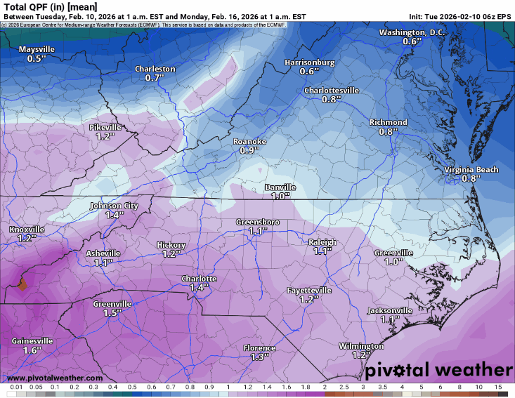
12z EuroAI says don't count on much rain either, let's push the precip from Macon to Columbia!
-
First GEFS run in 4 runs to put some snow back in WNC. Not much but definitely had some members colder and further south.
.gif.3721356f00243865866e268cb5376302.gif)
-
Canadian going to come in further south too and more pronounced wedge.
-
This run went from 52 on 06z to 38 in MBY another tick like that and we might be in business. This is why I love weather, just went we think we can predict the future 5 days out, it changes drastically in 6hrs!
-
Definitely worth watching some more! Between now and Thursday, models should sway either one way or another. If there's going to be a wintry side somewhere, I'd feel good about western border counties through central western VA, also any ice potential could go as far south as 40 in the heart of the CAD areas. I think we will see some model agreement over the next few days. What was interesting on that Euro run vs last night is the low pressure was quite a bit stronger and further north but definitely more wintry looking. It will be interesting to see what the next 48 hrs trends are. Also, on this run you can see the high pressure stayed more anchored in the Northeast-Eastern Canada and the low pressure above the Great lakes kind of died out a little bit.
.gif.ff0140d51bda20012bb9764a25b9909a.gif)
-
Shouldn't have looked, now I will be chasing another cycle! 6z EPS, ticked back south too with some totals.
.gif.03b32c0f8a4cd39bedd056a32672dc73.gif)
-
FWIW the 06z Euro is an absolute crush job and much colder for N NC MTNs and a lot of VA! Also, temps not too far off this run all the way back down towards I40. Temps change between 00z and 6z is crazy!


.gif.30bb3f8456703c9834d68cfa7fc27453.gif)
-
Crazy and we are sitting at 25.7 off the MTN!
-
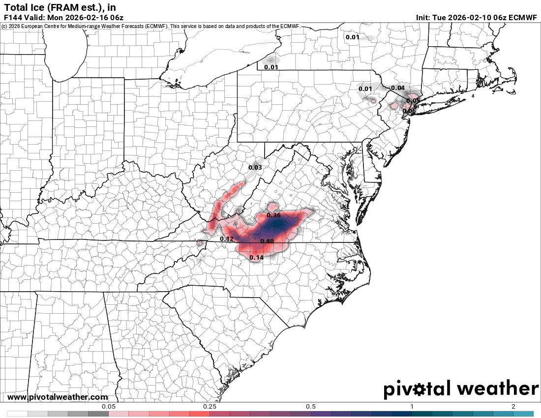
Verbatim, 12z UKMET was a nasty ice storm for Ashe, Watauga, Avery and Allegheny counties.
-
I am sorry, I forgot that was a sore one for you! It's all fun and games until your neighbor gets 8-10" and you're looking a the bare ground. I will not mention it again!
-
I like the sounds of that! Let's have a little March 1st 09 bowling ball roll through!
-
At this point, I don't think it's as much of the strength of the high pressure as it is the amount cold air available to transport south. The overall picture definitely lends towards a cold rain, unless something changes with the depth of cold that will be available.
-
Definitely stronger signal this run.
-
12z Euro shifts way south this run, I suspect EPS will reflect that as well. Still rain for most but CLT went from 58 at 6z to lower 40s this run. Continue to lead with ens at this point bc ops are still out there when they shift like this over a 6 hr period lol.
-
12z Euro still likes a little chance at some flurries/snow showers Friday morning AVL to the sw MTNs.
-
Definitely cooled off some, but not much of a sign of a CAD. Looks suspicious to me that it would move that far south, but temps really don't reflect much of a change.
-
16 days today with sleet still in shady spots around the yard. I don't remember another time where it has remained for so long.
-
Yeah I agree, the track and setup pretty much scream Miller-B so if anything were to fall as anything frozen more than likely going it's to be zr or sleet. My point is the models don't have it figured out yet and a lot folks seem to be writing it off. I feel like anytime a wedge setup could happen we won't really have the answers until almost go time, especially if the models are somewhat close over the next few days with temps in the mid 30s.
-
12z GEFS definitely with a colder push and much more pronounced wedge this run, it's not over yet!
.gif.c5ccb952d960dcd4f0062f6d70cb3005.gif)
-
12z GEFS definitely building the high in stronger this run, might still look decent for WNC.