StormfanaticInd
-
Posts
2,065 -
Joined
-
Last visited
Content Type
Profiles
Blogs
Forums
American Weather
Media Demo
Store
Gallery
Everything posted by StormfanaticInd
-
And arrogant. Lol
-
Of course with a la nina possibly coming on there is a potential we could torch this winter if the southeast ridge is too strong
-
You are always so negative. Lighten up. Lol smh
-
BUT NOT ALWAYS!!! QUIT PUTTING WORDS IN MY MOUTH!!!
-
The fall weather pattern can often give hints to the winter pattern but not always
-
Upcoming patern.
-
This pattern in the winter would be active
-
This storm could be a sign of things to come. One can only hope
-
Would have definitely been a storm to remember
-
If only this were January
-
Lol Probably not for a while.
-
Big time pattern change underway. Much cooler weather on the way
-
System this week is giving me winter vibes
-
Early yet though
-
-
Noticing blocking tendencies on the gefs already. Interesting
-
2021 Short/Medium Range Severe Thread
StormfanaticInd replied to Hoosier's topic in Lakes/Ohio Valley
I'm used to getting weenied. I agree. Very electrical storms for September -
2021 Short/Medium Range Severe Thread
StormfanaticInd replied to Hoosier's topic in Lakes/Ohio Valley
This fall is show signs of being active severe weather wise. Something we haven't seen in a while -
2021 Short/Medium Range Severe Thread
StormfanaticInd replied to Hoosier's topic in Lakes/Ohio Valley
Impressive storms in Michigan -
2021 Short/Medium Range Severe Thread
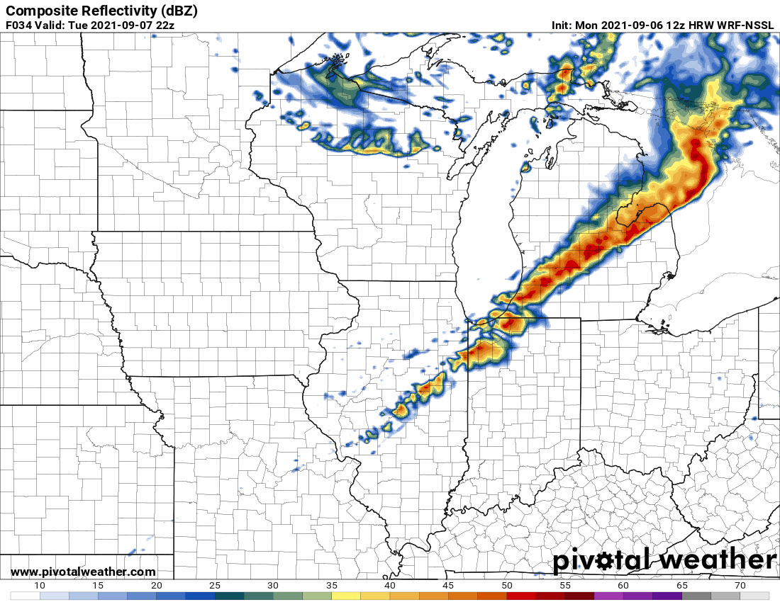
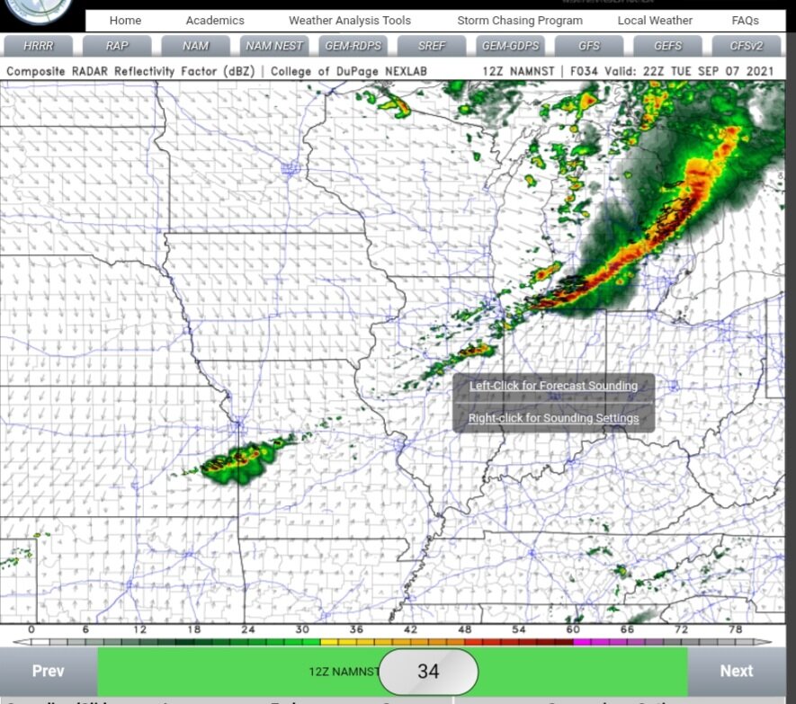
StormfanaticInd replied to Hoosier's topic in Lakes/Ohio Valley
Impressive line of of storms on this model to
-
2021 Short/Medium Range Severe Thread
StormfanaticInd replied to Hoosier's topic in Lakes/Ohio Valley
3k nam has an impressive squal line
-
2021 Short/Medium Range Severe Thread
StormfanaticInd replied to Hoosier's topic in Lakes/Ohio Valley
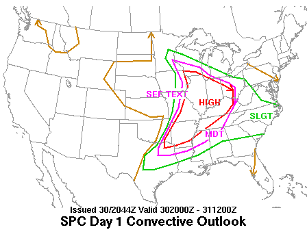
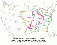
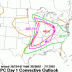
I think we end up seeing an enhanced risk for tomorrow. Pretty strong Windfield for this event -
KIWX An upper level trof will amplify over the eastern CONUS downstream of an anomalously strong upper ridge over the North American Rocky Mountains. Temperatures will become briefly warmer Tuesday ahead of an approaching cold front associated with the amplifying trof. GFS has been consistent the past 4 (6hr) runs with mass fields and general timing of the front. The 00Z GFS still favors a cold front passage from late Tuesday afternoon into early Tuesday night providing a diurnally favorable time for convection. Low level theta E will surge northeast in a narrow band during the day Tuesday. In addition to the advection of a modified elevated mix layer (EML), mid levels winds from 50 to 75 knots and thermal profiles of CAPE values reaching 1500 to 2000 J/Kg indicate favorable chances for damaging thunderstorm winds. The CIPS analogs continues to support chances for severe weather as very strong mid level winds develop. Have been keeping a watch on an analog from 9/10/1992 which matches mass fields quite well and portends in a severe direction
-
From KIND A closed upper low and associated surface low are progged to track through the northern Great Lakes Region on Tuesday. This will be a quick moving system though with any shower/thunderstorm chances out of the area by Tuesday night. However, thunderstorms will be a threat on Tuesday afternoon/evening as the environment destabilizes in the warm sector of the surface low. Southwest surface flow will push daytime highs back into the mid to upper 80s for a day with dew points in the 60s. With the moderate instability and forcing, would not rule out isolated strong thunderstorms at times.
-
They usually always underplay our area