
Brian D
-
Posts
3,023 -
Joined
-
Last visited
Content Type
Profiles
Blogs
Forums
American Weather
Media Demo
Store
Gallery
Everything posted by Brian D
-
March 26 2012: This is the record early ice-out date on Mille Lacs Lake. 2007: Temperature records are shattered across much of central and southern Minnesota and west central Wisconsin. The following records were set: 69 at Alexandria, 75 at Mankato, 77 at Little Falls, 79 at St. Cloud, 81 at Minneapolis-St. Paul and Eau Claire, 82 at Redwood Falls, and 83 at Springfield. For Thursday, March 26, 2026 1913 - The Ohio River Basin flood reached a peak. Ten inch rains over a wide area of the Ohio River Basin inundated cities in Ohio, drowning 467 persons, and causing 147 million dollars damage. The Miami River at Dayton reached a level eight feet higher than ever before. The flood, caused by warm weather and heavy rains, was the second mostly deadly of record for the nation. (David Ludlum) 1954 - The temperature at Allaket, AK, plunged to 69 degrees below zero. (The Weather Channel) 1971 - Parts of northern and central Georgia experienced their worst snow and ice storm since 1935. Two day power outages ruined two million eggs at poultry hatches. Two persons were killed when a tree landed on their car. (25th-26th) (The Weather Channel) 1987 - A cold front crossing the Plateau Region produced high winds in Utah causing some property damage. Winds gusted to 51 mph at Salt Lake City. (The National Weather Summary) (Storm Data) 1988 - Twenty cities in the southwestern U.S. reported new record high temperatures for the date. Afternoon highs of 73 degrees at Flagstaff AZ, 90 degrees at Sacramento CA, 95 degrees at Santa Maria CA, 95 degrees at Los Angeles CA, 99 degrees at Tucson AZ, and 100 degrees at Phoenix AZ set records for March. (The National Weather Summary) 1989 - The Easter Bunny brought record warm temperatures to the central U.S. while such records were still welcome. A dozen cities reported record warm readings, including Dodge City KS with an afternoon high of 88 degrees. Strong southerly winds gusted to 51 mph at Dodge City, and reached 55 mph at Salina KS. (The National Weather Summary) (Storm Data) 1990 - Fair weather prevailed across the nation for the second day in a row. Freezing temperatures were reported in the Middle Atlantic Coast Region in the wake of an early spring snowstorm. Afternoon highs were again in the 70s and 80s in the southeastern U.S., and for the ninth day in a row, temperatures in the southwestern U.S. reached the 90s. (The National Weather Summary)
-
Saw my first flash of the year in the Feb 18 blizzard. Thundersnow is very cool!
-
March 25 2007: Record warmth stretches from southern Minnesota to western Wisconsin with 72 at Owatonna, 77 at Menomonie, WI, and 80 at Eau Claire, WI. 1981: An F2 tornado hits Morrison county and does $25,000 worth of damage. For Wednesday, March 25, 2026 1843 - A second great snowstorm hit the northeastern U.S. The storm produced snow from Maine all the way to the Gulf of Mexico. Natchez MS received three inches of snow, and up to 15 inches buried eastern Tennessee. Coastal Maine received 204 inches of snow that winter. (David Ludlum) 1914 - Society Hill, SC, was buried under 18 inches of snow, establishing a state record. (Sandra and TI Richard Sanders - 1987) 1934 - A spring storm produced 21 inches of snow at Amarillo TX in 24 hours. However, much of the snow melted as it fell, and as a result, the snow cover was never any deeper than 4.5 inches. (David Ludlum) 1948 - For the second time in less than a week airplanes were destroyed by a tornado at Tinker AFB in Oklahoma City OK. A March 20th tornado destroyed fifty planes at Tinker AFB causing more than ten million dollars damage, and the March 25th tornado destroyed another thirty-five planes causing six million dollars damage. The first tornado struck without warning, and caused more damage than any previous tornado in the state of Oklahoma. The second tornado was predicted by Fawbush and Miller of the United States Air Force, and their accurate tornado forecast ushered in the modern era of severe weather forecasting. (The Weather Channel) (Storm Data) (The National Severe Storms Forecast Center) 1975 - The town of Sandberg reported a wind gust to 101 mph, a record for the state of California. (The Weather Channel) 1987 - Heavy rain left rivers and streams swollen in Kansas and Nebraska, causing considerable crop damage due to flooding of agricultural areas. The Saline River near Wilson Reservoir in central Kansas reached its highest level since 1951. March rainfall at Grand Island NE exceeded their previous record of 5.57 inches. (The National Weather Summary) (Storm Data) 1988 - An early season heat wave prevailed in the southwestern U.S. The high of 93 degrees at Tucson, AZ, was a new record for March. Windy conditions prevailed across the central and eastern U.S. Winds gusted to 60 mph at Minneapolis MN, and reached 120 mph atop Rendezvous Peak WY. (The National Weather Summary) (Storm Data) 1989 - A Pacific storm brought wet weather to much of the western third of the country, with heavy snow in some of the higher elevations. La Porte CA was drenched with 3.56 inches of rain in 24 hours. Up to 24 inches of snow blanketed the Sierra Nevada Range. (The National Weather Summary) (Storm Data) 1990 - Temperatures dipped below zero in the Northern Rocky Mountain Region. Hardin MT was the cold spot in the nation with a morning low of 10 degrees below zero. Freezing drizzle was reported in the Southern Plains Region, with afternoon highs only in the 30s from the Southern High Plains to Missouri and Arkansas. (The National Weather Summary)
-
I noted this active wx pattern in my Holiday forecasts for April 1, and Easter weekend. Rough part is that I still can get some sn/ice out of this, especially at night/early morning.
-
Nice day today with highs around 40. Looks like a mix coming for Wed-Thurs. Then a quick shot of cooler wx.
-
March 24 1851: Minnesota experiences an early spring 'heat wave' with 60s and 70s common. For Tuesday, March 24, 2026 1912 - Residents of Kansas City began to dig out from a storm produced 25 inches of snow in 24 hours. The snowfall total was nearly twice that of any other storm of modern record in Kansas City before or since that time. A record 40 inches of snow fell during the month of March that year, and the total for the winter season of 67 inches was also a record. By late February of that year Kansas City had received just six inches of snow. Olathe KS received 37 inches of snow in the snowstorm, establishing a single storm record for the state of Kansas. (23rd-24th) (The Kansas City Weather Almanac) (The Weather Channel) 1987 - A winter-like storm in the central U.S. produced blizzard conditions from South Dakota to western Kansas. Snowfall totals ranged up to 24 inches at Neligh NE, with 19 inches at Winner SD. Winds gusting to 60 mph created twelve foot snow drifts in Nebraska stranding thousands on the highways. (Storm Data) (The National Weather Summary) 1988 - Thunderstorms developing along a cold front produced severe weather from Minnesota to northeastern Texas. The thunderstorms spawned ten tornadoes, including one which injured five persons near Raymondville MO. (The National Weather Summary) (Storm Data) 1989 - Low pressure off the coast of Virginia brought heavy rain to the Middle Atlantic Coast States, and heavy snow to the Northern Appalachians. Cape Hatteras NC was soaked with 5.20 inches of rain in 24 hours, and snowfall totals in Vermont ranged up to 12 inches. Winds gusted to 52 mph at New York City. (Storm Data) (The National Weather Summary) 1990 - The storm system which produced heavy snow in the Lower Missouri Valley the previous day, spread heavy snow across parts of the Upper Ohio Valley and the Middle Atlantic Coast Region. Snowfall totals of 2.2 inches at Philadelphia PA and 2.4 inches at Atlantic City NJ were records for the date. Up to six inches of snow blanketed southern Ohio. In the Middle Atlantic Coast Region, snow coated the blossoms of cherry trees which had bloomed in 80 degree weather the previous week. (Storm Data) (The National Weather Summary)
-
March 23 1966: A snowstorm brings a foot of snow to southern Minnesota. For Monday, March 23, 2026 1913 - A vicious tornado hit the city of Omaha, NE. The tornado struck during the late afternoon on Easter Sunday, and in just twelve minutes cut a swath of total destruction five miles long and two blocks wide across the city killing 94 persons and causing 3.5 million dollars property damage. (David Ludlum) 1916 - Pocatello, ID, received a record 14.6 inches of snow in 24 hours. (The Weather Channel) 1987 - A blizzard raged across western Kansas, and the panhandle of Texas and Oklahoma. Pampa TX received 21 inches of snow, and winds gusted to 78 mph at Dodge City KS Altus OK. Governor Hayden declared forty-six counties in western Kansas a disaster area. In southwest Kansas, the storm was described as the worst in thirty years. (The National Weather Summary) (Storm Data) 1988 - Thunderstorms developing along a strong cold front spawned tornadoes near Roberts ID and Bridger MT. Strong and gusty winds prevailed in the western U.S. Wind gusts in the southwest part of Reno NV reached 89 mph. (The National Weather Summary) (Storm Data) 1989 - Charlotte and Wilmington, NC, reported rainfall records for the date as showers and thunderstorms prevailed in the southeastern U.S. Freezing rain glazed parts of North Carolina and southern Virginia. Gale force winds produced a heavy surf along the coast of North Carolina. (The National Weather Summary) (Storm Data) 1990 - An upper level storm system produced heavy snow in the Lower Missouri Valley. Snowfall totals ranged up to nine inches at Kansas City MO, with eight inches reported at Falls City NE, Columbia MO and Saint Louis MO. Thunderstorms produced heavy snow in the Kansas City area during the evening rush hour. (The National Weather Summary) (Storm Data) 2007 - A trailer is thrown through a bowling alley as a tornado moves through Clovis, NM. About 100 homes and businesses are destroyed, at least three schools are damaged and telephone poles are snapped. Thirteen tornadoes struck a dozen communities along the New Mexico/Texas border. Two people were critically injured. 2011 - A series of tornados are spawned from severe thunderstorms in Pennsylvania. In Hempfield Township dozens of homes and a high school auditorium where students are rehearsing a play are severely damaged.
-
Rain showers moved through last night. Snowpack dwindling quickly. Although highs today will be around freezing so not so much today.
-
March 22 1991: A historic ice storm begins during the afternoon and ends as heavy, wet snow on the 23rd. This event coated the city of Duluth with as much as 6 inches of ice. The 850-foot WDIO TV tower was toppled. 4 million pine trees were damaged or destroyed with the heaviest damage at G.C. Andrews State Forest near Moose Lake in Pine County. NOTE: That makes 2 historic events in my area in 1991 with the other being the "Halloween Blizzard", but I was still in the Army when this happened. 1952: A snowstorm dumps 13.2 inches on the Twin Cities. For Sunday, March 22, 2026 1920 - A spectacular display of the Northern Lights was visible as far south as Bradenton FL, El Paso TX, and Fresno CA. At Detroit MI, the display was described so brilliant as to blot out all stars below first magnitude. (22nd-23rd) (The Weather Channel) 1936 - A great flood crested on rivers from Ohio to Maine. The flood claimed 107 lives and caused 270 million dollars property damage. (David Ludlum) 1954 - Six to ten inch rains caused the Chicago River to overflow its banks. (The Weather Channel) 1987 - An intense storm produced heavy snow in the southern and central Rockies, and high winds from southern California to West Texas. Wolf Creek Pass CO received 24 inches of snow, and winds gusted to 69 mph at Ruidoso NM. Blizzard conditions were reported in eastern Colorado. (The National Weather Summary) (Storm Data) 1988 - Rain and high winds battered the Northern Pacific Coast Region, with wind gusts to 78 mph at Ocean Shores WA. The high winds uprooted trees and down power lines. Ten cities in the northeastern U.S. reported new record low temperatures for the date. Eight cities in the central U.S. reported record highs. Southerly winds gusting to 60 mph helped push the mercury at Ottumwa IA to a record warm reading of 83 degrees. (Storm Data) (The National Weather Summary) 1989 - Six cities in the Great Lakes Region, and three in southern Texas, reported new record low temperatures for the date, including Alpena MI with a reading of 9 above zero, and Brownsville TX with a reading of 38 degrees. (The National Weather Summary) 1990 - A surge of arctic air kept temperatures in the teens and 20s during the day in the north central U.S., and heavy snow fell over parts of Montana. Record warmth was reported in the western U.S.,and in Alaska. Phoenix AZ reported a record high of 94 degrees, and the town of Barrow, located along the arctic coast of Alaska, reported a record high of 20 degrees. (The National Weather Summary)
-
March 21 1953: A tornado hits the northern St. Cloud area. High winds from thunderstorms are experienced from Martin to Stearns County. For Saturday, March 21, 2026 1932 - A tornado swarm occurred in the Deep South. Between late afternoon and early the next morning severe thunderstorms spawned 31 tornadoes in Alabama, Mississippi, Georgia and Tennessee. The tornadoes killed 334 persons and injured 1784 others. Northern Alabama was hardest hit. Tornadoes in Alabama killed 286 persons and caused five million dollars damage. (David Ludlum) 1952 - Severe thunderstorms spawned thirty-one tornadoes across Arkansas, Tennessee, Missouri, Mississippi, Alabama and Kentucky. The tornadoes killed 343 persons and caused 15 million dollars damage. Arkansas and Tennessee each reported thirteen tornadoes. The towns of Judsonia AR and Henderson TN were nearly wiped off the map in what proved to be the worst tornado outbreak of record for Arkansas. A tornado, one and a half miles wide at times, left a church the only undamaged building at Judsonia. (David Ludlum) (The Weather Channel) 1987 - A winter storm in the Northern High Plains Region produced blizzard conditions in western South Dakota. Winds gusted to 70 mph at Rapid City SD, and snowfall totals ranged up to 20 inches at Lead SD. The high winds produced snow drifts six feet high. (The National Weather Summary) (Storm Data) 1988 - Bitterly cold weather prevailed across the northeastern U.S. Portland ME reported their coldest spring day of record with a morning low of 5 above, and an afternoon high of just 21 degrees. Marquette MI reported a record low of 15 degrees below zero. (The National Weather Summary) (The Weather Channel) 1989 - Snow blanketed the northeastern U.S. early in the day, with six inches reported at Rutland VT. Morning and afternoon thunderstorms produced large hail and damaging winds from southwestern Mississippi to southwest Georgia. (The National Weather Summary) (Storm Data) 1990 - The first full day of spring was a cold one for the eastern U.S. Freezing temperatures damaged 62 percent of the peach crop in upstate South Carolina, and 72 percent of the peach crop in the ridge area of South Carolina. Elkins WV, which a week earlier reported a record high of 82 degrees, was the cold spot in the nation with a morning low of 16 degrees. (Storm Data) (The National Weather Summary)
-
March 20 1991: An early season tornado hits Faribault county from Bricelyn to Wells. For Friday, March 20, 2026 1924 - A late winter storm in Oklahoma produced nearly a foot of snow at Oklahoma City and at Tulsa. (David Ludlum) 1948 - The city of Juneau received 31 inches of snow in 24 hours, a record for the Alaska capitol. (20th-21st) (David Ludlum) 1984 - A severe three day winter storm came to an end over the Central Plains. The storm produced up to twenty inches of snow in Colorado, Nebraska and Kansas, and left a thick coat of ice from eastern Kansas across northwestern Missouri into Iowa. (Storm Data) 1987 - A storm produced blizzard conditions in Wyoming and eastern Nebraska, and severe thunderstorms in central Nebraska. Snowfall totals ranged up to 12 inches at Glenrock WY and Chadron NE. Thunderstorms in central Nebraska produced wind gusts to 69 mph at Valentine, and wind gusts to 76 mph at Bartley. (Storm Data) (The National Weather Summary) 1988 - Squalls in the Great Lakes Region left up to eight inches of new snow on the ground in time for the official start of spring. Unseasonably warm weather prevailed in the western U.S. Seven cities reported new record high temperatures for the date, including Tucson AZ with a reading of 89 degrees. (Storm Data) (The National Weather Summary) 1989 - Snow and high winds created blizzard conditions in western Kansas to usher in the official start of the spring season. Thunderstorms produced severe weather from east Texas to Alabama and northwest Florida, with nearly fifty reports of large hail and damaging winds during the afternoon and evening hours. (The National Weather Summary) (Storm Data) 1990 - The northeastern U.S. was in the midst of a snowstorm as spring officially began at 4 19 PM. Snowfall totals in the Green Mountains of Vermont ranged up to thirty inches, and up to 15 inches of snow was reported in the Catskills and Adirondacks of eastern New York State. Totals in eastern Pennsylvania ranged up to 12 inches at Armenia Mountain. The storm resulted in one death, and forty-nine injuries. (The National Weather Summary) (Storm Data) 2005 - An F1 tornado hits South San Francisco. Trees are uprooted. At least twenty homes and twenty businesses are damaged, including the city's new fire station. 2006 - Grand Island, NE, receives 17.8 inches of snow in 24 hours, breaking the old local record for the most snowfall in a day by 4.8 inches. 29.7 inches in 48 hours also breaks a record.
-
Natural A/C not always welcome. I get it!
-
Going to be a beautiful day with highs around 50 imby. Lots of snow to melt. Astro Spring today, so might as well get it going.
-
Well, well, what do we have here? Another system tracking S of the Lake pumping moisture over the colder Lake air on Sunday. This could be interesting, but a little over done me thinks.
-
March 19 2012: This is the 4th day in a row that the Twin Cities reaches at least 79 degrees, and the 8th record high in a 10 day span. 1977: An energy emergency finally ends in Minnesota. It was caused by the extended cold. For Thursday, March 19, 2026 1935 - Suffocating dust storms occurred frequently in southeastern Colorado between the 12th and the 25th of the month. Six people died, and many livestock starved or suffocated. Up to six feet of dust covered the ground. Schools were closed, and many rural homes were deserted by tenants. (The Weather Channel) 1950 - Timberline Lodge reported 246 inches of snow on the ground, a record for the state of Oregon. (The Weather Channel) 1956 - The second heavy snowstorm in just three days hit Boston. Nearby Blue Hill received 19.5 inches contributing to their snowiest March of record. (David Ludlum) 1987 - A storm in the western U.S. produced rain and snow from the northern and central Pacific coast to the northern and central Rockies. Heavier snowfall totals included 13 inches at Clear Creek UT, 12 inches at Snow Camp CA and Glacier Park MT, and 10 inches at Kayenta AZ. Wind gusts reached 54 mph at Winslow AZ. (The National Weather Summary) (Storm Data) 1988 - Seven cities in California and Nevada reported record high temperatures for the date as readings soared into the 80s and lower 90s. Los Angeles CA reported a record high of 89 degrees. Five cities in south central Texas reported record lows, including El Paso, with a reading of 22 degrees. (The National Weather Summary) 1989 - Six cities reported new record low temperatures for the date as cold arctic air settled into the Upper Midwest for Palm Sunday, including Marquette MI with a reading of 11 degrees below zero. (The National Weather Summary) 1990 - Rather wintry weather in the eastern U.S. replaced the 80 degree weather of the previous week. Freezing temperatures were reported in northern sections of the Gulf Coast States, and snow began to whiten the Northern and Central Appalachians. Up to eight inches of snow was reported in western Virginia. (Storm Data) (The National Weather Summary) 2003 - Denver digs out from the second-biggest snowstorm in the city's history. Almost two and a half feet of wet snow over 36 hours shuts down the city. The month ends as Denver's snowiest March on record.
-
March 18 1968: No one was hurt when an early season tornado touches down in Watonwan County. For Wednesday, March 18, 2026 1925 - The great Tri-State Tornado occurred, the most deadly tornado in U.S. history. The tornado claimed 695 lives (including 234 at Murphysboro IL and 148 at West Frankfort IL), and caused seventeen million dollars property damage. It cut a swath of destruction 219 miles long and as much as a mile wide from east central Missouri to southern Indiana between 1 PM and 4 PM. The tornado leveled a school in West Frankfort IL, and picked up sixteen students setting them down unharmed 150 yards away. Seven other tornadoes claimed an additional 97 lives that day. (David Ludlum) 1971 - High winds accompanied a low pressure system from the Rocky Mountains to the Great Lakes. Winds gusted to 100 mph at Hastings NE, and reached 115 mph at Hays KS. High winds caused two million dollars damage in Kansas. Fire burned 50,000 forest acres in eastern Oklahoma. (17th-19th) (The Weather Channel) 1987 - A storm in the central U.S. produced up to 10 inches of snow in western Nebraska, and up to six inches of rain in eastern sections of the state. The heavy rains pushed the Elkhorn River out of its banks, submerging the streets of Inman under three feet of water. (The National Weather Summary) (Storm Data) 1988 - Light rain and snow prevailed east of the Mississippi River. Fair weather prevailed west of the Mississippi. (The National Weather Summary) 1989 - A storm in the western U.S. produced heavy rain in California, with heavy snow in the Sierra Nevada Range. Venado CA was drenched with 5.40 inches of rain in 24 hours. A dozen cities in the eastern U.S. reported new record high temperatures for the date, including Baltimore MD with a reading of 82 degrees. (The National Weather Summary) (Storm Data) 1990 - Heavy rain caused extensive flooding of rivers and streams in Georgia, with total damage running well into the millions. Flooding also claimed six lives. Nearly seven inches of rain caused 2.5 million dollars damage around Columbus, and up to nine inches of rain was reported over the northern Kinchafoonee Basin in Georgia. (Storm Data)
-
0.6" of fluffy snow last night. Looks like Spring will continue with seasonably warm conditions coming up the next few days mainly due to warmer mins.
-
-Sd's near shore to -10's inland across N MN. Ash Lake -23, and Seagull Lake -21 up near the border are the lowest I've seen just with a quick look. Top 5 cold snap this morning. WAA event coming later today.
-
Yeah, you know it's getting cold when structures start popping. My deck pops a lot when that happens, and when we have a svr cold snap for a longer period, my house starts to pop. Makes you jump its so loud. Have to replace some deck screws every few yrs because they break.
-
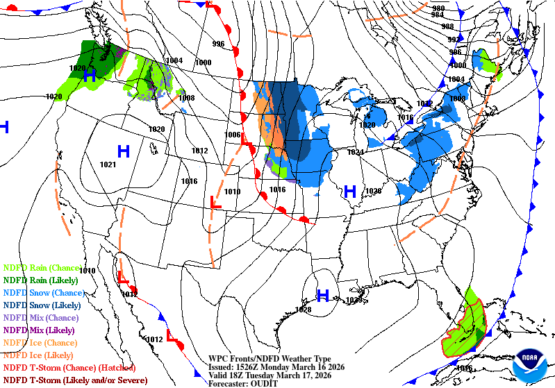
March 17 2012: The Twin Cities hits 80 degrees, a new record for St. Patrick's Day and the warmest temperature during the warmest March on record. Amazingly, the high also reached 79 on March 16, 18, and 19 this year. 1965: The Great St. Patrick's Day Blizzard hits northern Minnesota. Two feet of snow dumped at Duluth. 19 inches at Mora. ^^What a contrast in wx we can have in March ^^ For Tuesday, March 17, 2026 1892 - A winter storm in southwestern and central Tennessee produced 26 inches of snow at Riddleton, and 18.5 inches at Memphis. It was the deepest snow of record for those areas. (David Ludlum) 1906 - The temperature at Snake River, WY, dipped to 50 degrees below zero, a record for the U.S. for the month of March. (Sandra and TI Richard Sanders - 1987) 1987 - A powerful spring storm produced severe thunderstorms over the Central Gulf Coast States, and heavy snow in the High Plains Region. A tornado caused three million dollars damage at Natchez MS, and six inches of rain in five hours caused five million dollars damage at Vicksburg MS. Cactus TX received 10 inches of snow. Western Kansas reported blizzard conditions. (The National Weather Summary) (Storm Data) 1988 - A winter storm produced heavy snow from the northeast Texas panhandle to the Ozark area of Missouri and Arkansas. Up to fifteen inches of snow was reported in Oklahoma and Texas. Snowfall totals in the Ozark area ranged up to 14 inches, with unofficial reports as high as 22 inches around Harrison AR. (The National Weather Summary) (Storm Data) 1989 - Strong northerly winds ushered snow and arctic cold into the north central U.S. Winds gusted to 58 mph at Sydney NE and Scottsbluff NE, Cadillac MI received 12 inches of snow, and International Falls MN reported a record low of 22 degrees below zero. (The National Weather Summary) (Storm Data) 1990 - Showers and thunderstorms associated with a slow moving cold front produced torrential rains across parts of the southeastern U.S. over a two day period. Flooding claimed the lives of at least 22 persons, including thirteen in Alabama. Up to 16 inches of rain deluged southern Alabama, with 10.63 inches reported at Mobile AL in 24 hours. The town of Elba AL was flooded with 6 to 12 feet of water causing more than 25 million dollars damage, and total flood damage across Alabama exceeded 100 million dollars. Twenty-six counties in the state were declared disaster areas. (The National Weather Summary) (Storm Data)
-
Just curious, but do you send pics to NWS MQT?
-
I have an aunt, who has passed now, who grew up in the UP. When she was young, they would get storms sometimes that looked just like that when it was over. Crawling out the 2nd story window to get out. LOL! The principal would sometimes look out the window out over the Lake, and if it was getting real dark out there, he would shutdown the school, and send them home. Old school way of doing things.
-
Decent forecast, although a WAA event bringing snow as temps warm up.

-
Chilly morning with +/- sd's across N MN.
-
March 16 1930: The temperature at the Minneapolis-St. Paul International Airport tops out at a record 71 degrees. For Monday, March 16, 2026 1942 - Two tornadoes, 24 minutes apart, struck Baldwin, MS, resulting in 65 deaths. (David Ludlum) 1975 - A single storm brought 119 inches of snow to Crater Lake, OR establishing a state record. (The Weather Channel) 1986 - A small but rare tornado touched down perilously close to Disneyland in Anaheim CA. (Storm Data) 1987 - Softball size hail caused millions of dollars damage to automobiles at Del Rio TX. Three persons were injured when hailstones crashed through a shopping mall skylight. (The National Weather Summary) (Storm Data) (The Weather Channel) 1988 - A winter storm produced heavy snow in the Central Rockies. Winds gusted to 80 mph at Centerville UT. Eighteen cities in the southeastern U.S. reported new record low temperatures for the date, including Tallahassee FL with a reading of 24 degrees. (The National Weather Summary) 1989 - A winter storm brought heavy snow and high winds to the southwestern U.S. Winds gusted to 60 mph at Lovelock NV, Salt Lake City UT, and Fort Carson CO. Snow fell at a rate of three inches per hour in the Lake Tahoe area of Nevada. (The National Weather Summary) (Storm Data) 1990 - Thunderstorms developing ahead of a cold front produced large hail and damaging winds from northwest Florida to western South Carolina. Thunderstorm winds gusted to 75 mph at Floridatown FL. Sixteen cities across the northeastern quarter of the nation reported record high temperatures for the date. The afternoon high of 78 degrees at Burlington VT smashed their previous record for the date by 23 degrees. New York City reported a record high of 82 degrees. (The National Weather Summary) (Storm Data)


