
r3w
-
Posts
44 -
Joined
-
Last visited
About r3w

- Birthday 11/28/1989
Recent Profile Visitors
727 profile views


-
2023 Mid-Atlantic Severe Wx Thread (General Discussion)
r3w replied to Kmlwx's topic in Mid Atlantic
Scorching hot and clear skies in the SoMD area, a good storm would be nice...I'm guessing it'll be mostly junk for us though. -
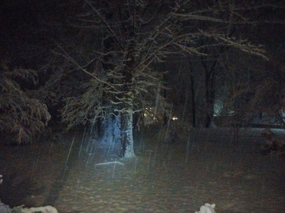
Still off & on in Calvert, 2.5" on the front step. Phone cam is awful with low-light but here's a pic.
-
Coming down pretty heavy now here, clumping up on the ground fast with this little band overhead.
-
Getting our first few flakes now in the Calvert County area.
-
Nothing yet here in the SOMD area. Wish it was a bit colder but at least its cloudy now, 36F. We'll see how things go toward the evening.
-
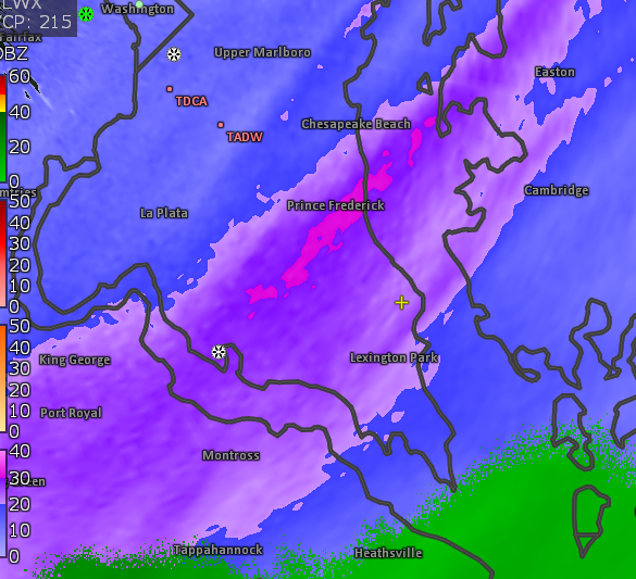
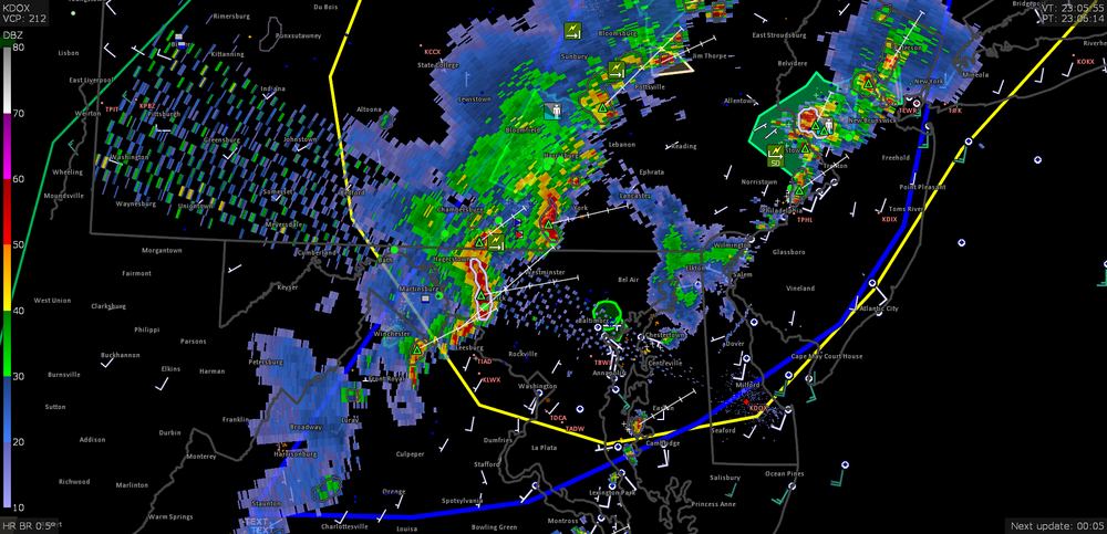
Really weird scan from KDOX a few minutes ago lol, I've seen many weird little anomalies but this one is new to me.
-
I think we have a bit of the Potomac River "bubble" going on here in the Southern portion of MD, storms have really struggled to sustain themselves as soon as they get over the water. I guess it just has a way of stabilizing the environment.
-
Sunny here in Calvert, nice and hot out, 87F. Feels like a day for storms so far.
-
Really liking the 18z NAM, looks good for the DC area into Southern MD...tapered expectations, of course.
-
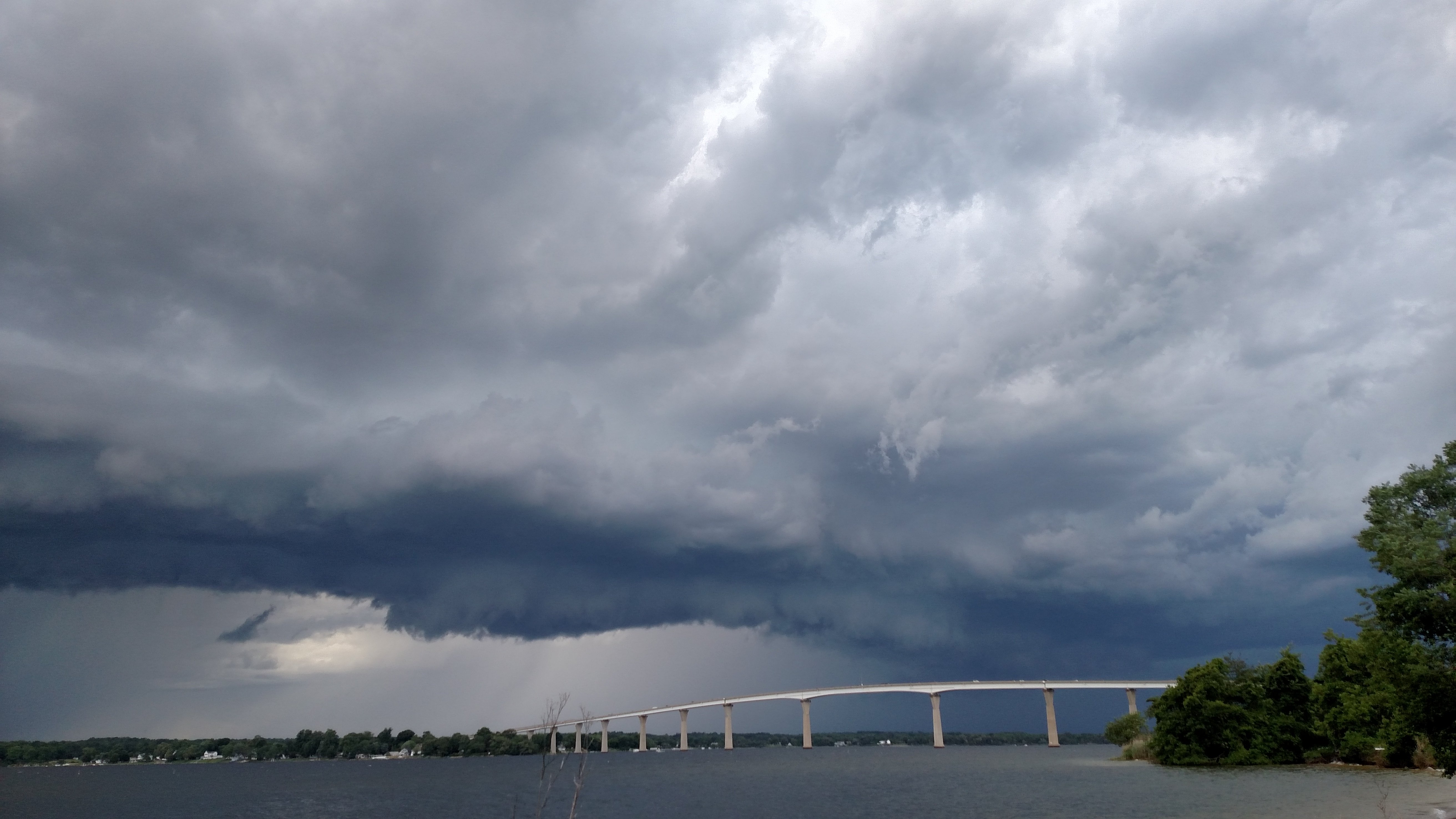
Not bad...actually got a pretty good storm here, two actually...I managed to catch up to one as it passed over around Chesapeake Beach, turned around just in time to watch another near my place in Calvert, rare good luck in timing today...
-
15Z HRRR looks okay for MD (my area planted squarely in the SLGT) but our luck has been pretty sour so far this season.
-
I'm not an expert either but I've noticed it watching storms over the years as well, the Potomac seems to either inhibit or enhance the storms we get, I'm sure there's also the usual "sea breeze" attributes at play. I was too young during the La Plata 2002 event to understand it, but I've read that it intensified substantially over the water before hitting La Plata. That storm packed a punch yesterday, I saw that most of it ended up around St. Leonard but there was some decent velocities on radar on the Southern end that ended up over Calvert, little to no precip, seemed like a dry microburst. Sky looked pretty wild too.
-
Welp...didn't get the lightning I'd hoped for...lol but some nasty winds on that southern-most cell tore through St. Marys & Calvert though, just got power back on here. Had a tree come down on the substation apparently.
-
Looks like there's some hail in that bigger cell over Spotsy, it's 72/54F around the Calvert area right now, I'll be satisfied just hearing some thunder honestly.
-
Looking better than expected so far.


