MN Transplant
-
Posts
17,813 -
Joined
-
Last visited
Content Type
Profiles
Blogs
Forums
American Weather
Media Demo
Store
Gallery
Everything posted by MN Transplant
-
1.5" - 12/16
-
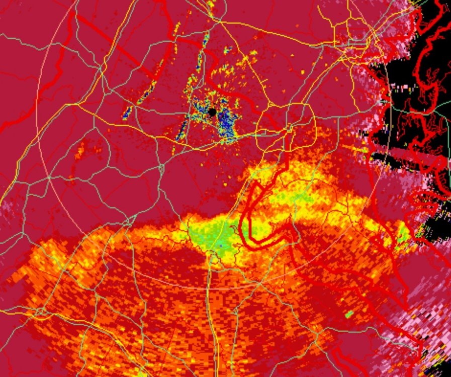
December 16-17, 2020 Winter Storm Obs/Nowcasting
MN Transplant replied to WxUSAF's topic in Mid Atlantic
1.5” before the switch. The CC line was dead on. Technology is amazing. -
December 16-17, 2020 Winter Storm Obs/Nowcasting
MN Transplant replied to WxUSAF's topic in Mid Atlantic
Clumps of snow falling. -
December 16-17, 2020 Winter Storm Obs/Nowcasting
MN Transplant replied to WxUSAF's topic in Mid Atlantic
1” on the board. Nice job by the HRRR. -
December 16-17, 2020 Winter Storm Obs/Nowcasting
MN Transplant replied to WxUSAF's topic in Mid Atlantic
You can see the CC line get shunted off to the east. Looks ok for another 1-2 hours in the DC area (better NW of course). -
December 16-17, 2020 Winter Storm Obs/Nowcasting
MN Transplant replied to WxUSAF's topic in Mid Atlantic
I'm hoping we can fight it off for a while, at least. -
December 16-17, 2020 Winter Storm Obs/Nowcasting
MN Transplant replied to WxUSAF's topic in Mid Atlantic
-
December 16-17, 2020 Winter Storm Obs/Nowcasting
MN Transplant replied to WxUSAF's topic in Mid Atlantic
Rooftops are turning white. Winner! -
Yeah, the low tucking in and stalling before scooting east really plays well for NW areas.
-
The 3km NAM has a QPF problem with upslope over low-to-moderate terrain. Hence the 4”+ at Camp David. Those values can be ignored.
-
The maps are out of control. Harrisonburg with 24” in 6 hours? Come on.
-
It looks like the two low situation is due to a meso-low from the NC thunderstorm complex on the 3km NAM. Not sure that it plays a huge role in the thermal profile up by us.
-
DC Beltway gets a last moment stick save at 3z with the back side whitening the ground on the 3km.
-
Nice line of thunderstorms in NC on the nest. No comment necessary for the DC area.
-
This does not hold for the 3km.
-
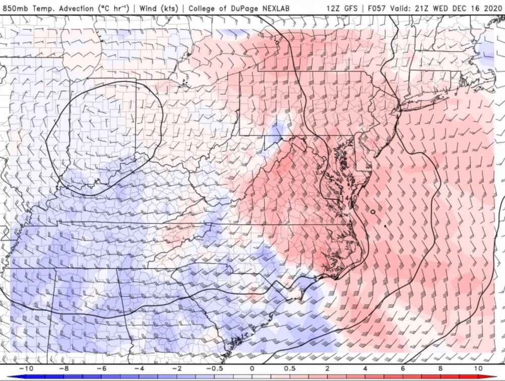
NAM comes in hot and heavy. 18z R/S line is about DCA and then it blows north by 21z. In that period, however, there is ~0.5” precip. The longer that the transition holds off, the better we can do on the front end.
-
Stuck in a meeting, but the big win from the euro run is that the changeover in my neck of the woods is ~3pm and after 0.3”+ of qpf.
-
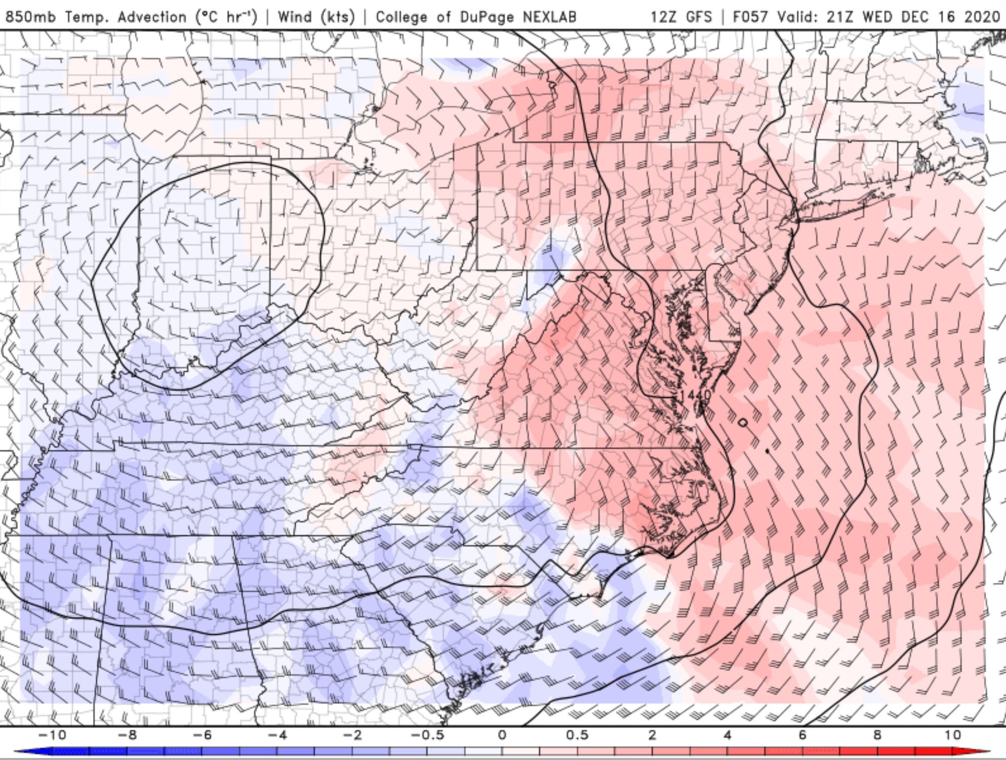
The problem, though, is that it really comes together so late that we don't get a huge benefit from it sliding to our S anyway. Without the 850 low cranking up earlier, we are just awash in warm air advection.
-
So, the good news from the GFS is: 1) ever so slightly quicker onset 2) 850 track is off the coast 3) it still likes the backside deformation band
-
DP in the DC metro at 00z Thursday is 36°. That's most of what I need to know.
-
3k tracks the low west of Norfolk too. Problem is that the 850 low runs north of DC. There is a realistic potential that areas inside the DC Beltway get non-accumulating snow on the front end and miss the deformation on the back end. Trace is absolutely in play.
-
That’s a 30”+ run for the two systems for you.
-
NAM is a torch. Low from Wilmington to west of Va Beach. Still irrelevant.
-
The offense and defense played it right there with Tampa. The Special Teams...not so much.
-
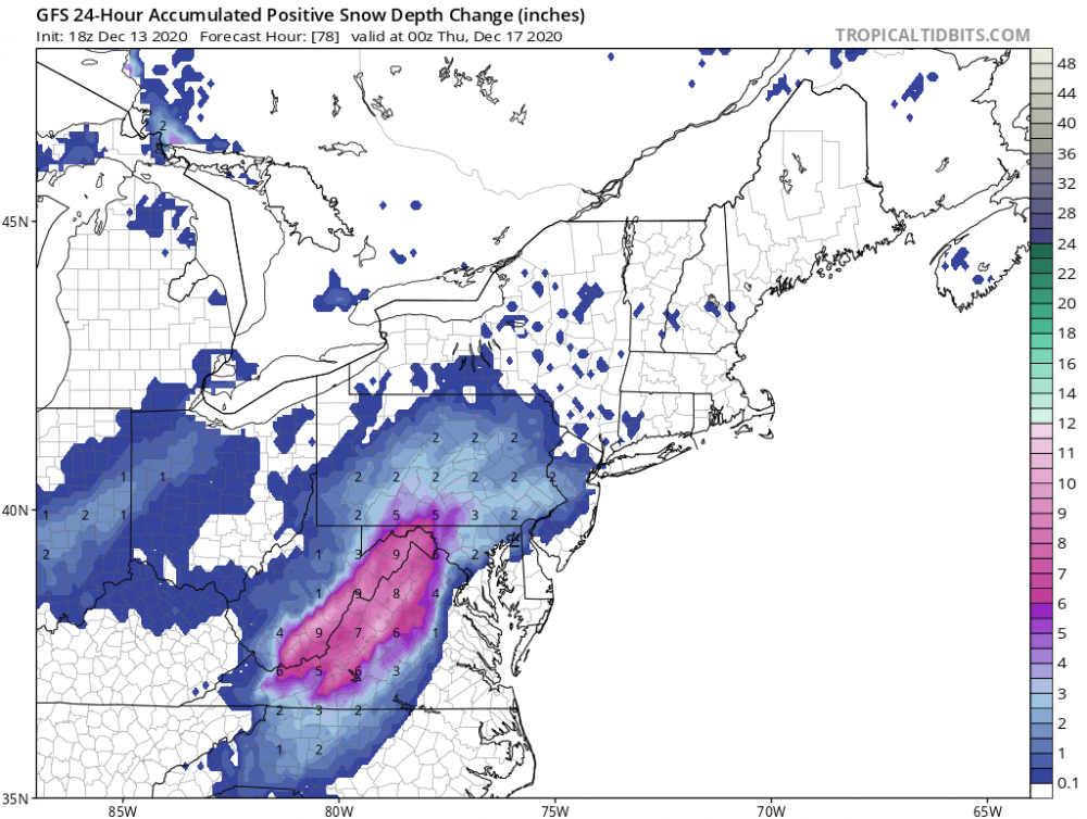
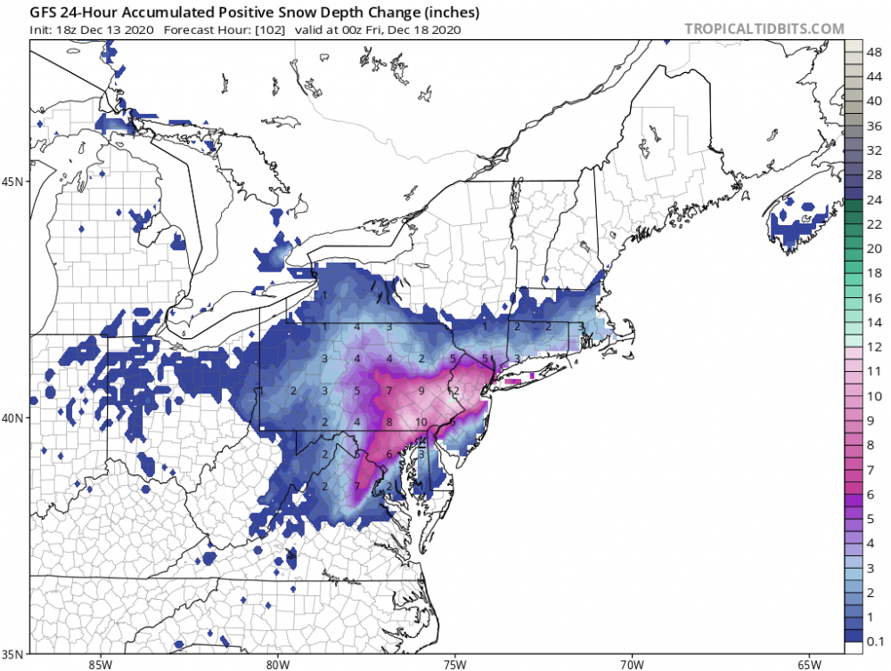
Always worry about depending on the backside, but that’s how we’ll play the game. New snow depth up to 00z Thursday, and then after.