stormdragonwx
-
Posts
512 -
Joined
-
Last visited
Content Type
Profiles
Blogs
Forums
American Weather
Media Demo
Store
Gallery
Everything posted by stormdragonwx
-
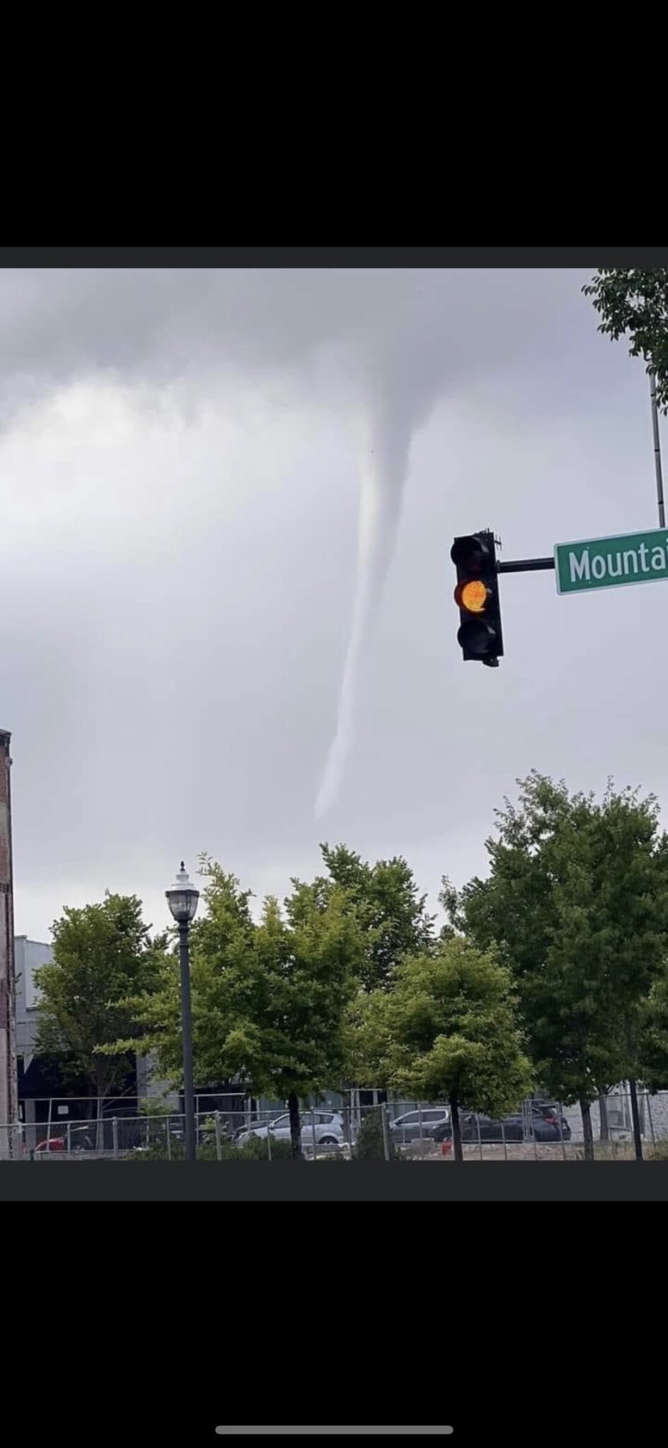
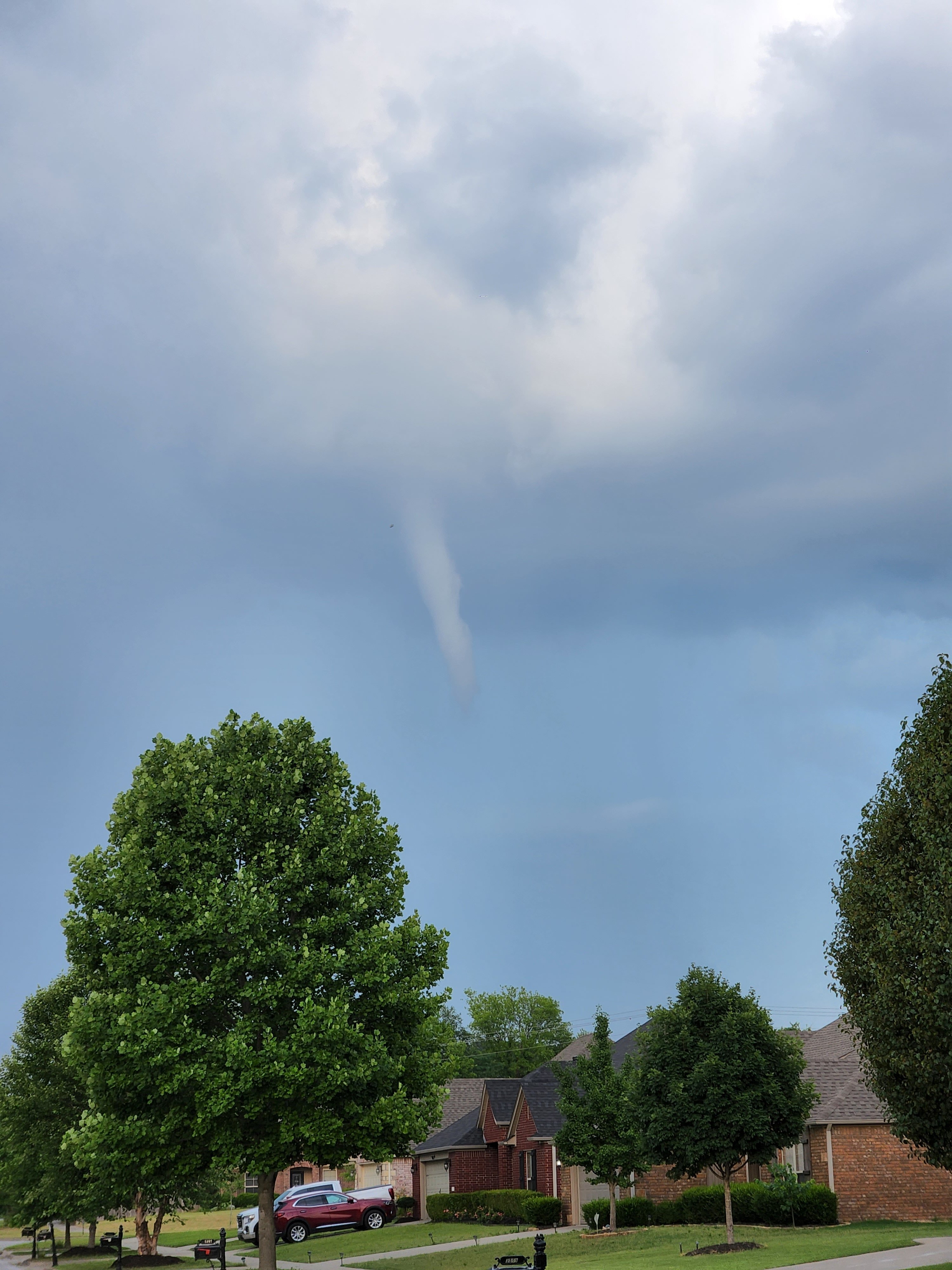
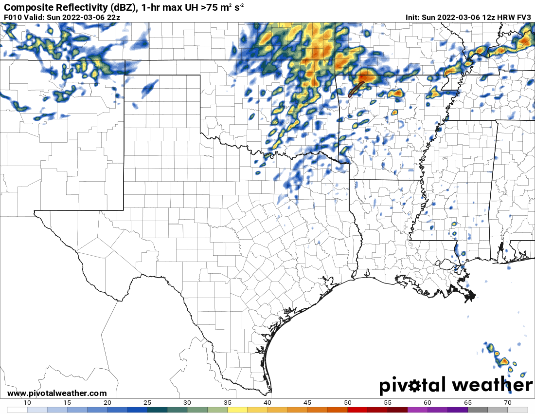
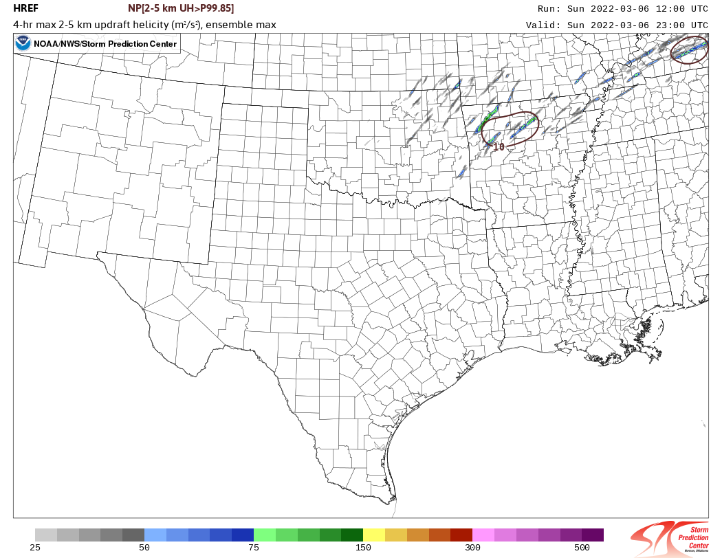
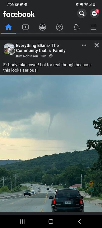
Haven't been on in a bit, but this interesting little guy happened last week here in Fayetteville. It was a non-severe rain shower that was in the process of dying that spawned this. First pic was literally right up the road from me. Totally freaky. It was a legit funnel with rotation. A failed landspout is what local meteorologists were calling it since it didn't reach the ground.


-
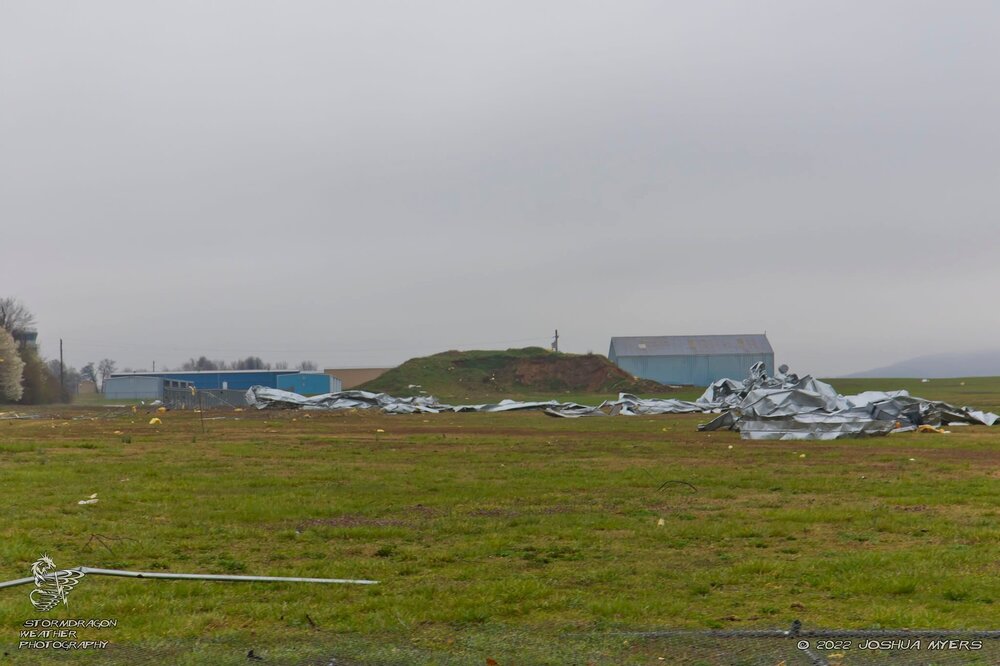
Been curious about that too. Been wanting to know what it's width and intensity was. It is safe to say if it did form over and/or hit an urban area it would have caused devastating damage, especially with it's slow forward motion.
-
 KTLX radar is down with a probable tornado just to the east. Not ideal. https://www.facebook.com/NWSNorman/posts/362992379199734
 -
So for some reason after having to reformat the hard drive and reinstalling Windows and other software on an older storm chase laptop of mine (still using Win7) my GRLevel3 program refuses to load radar data but I have stable internet with polling enabled. It gives the InternetOpenURL Failure code upon testing. Its version 2.92 which worked perfectly fine before the reformat. Doing some additional testing, I discovered it still works perfectly fine on one of my older desktop machines that uses Win7 which seems to rule out an issue with the software no longer supporting Win7 considering both machines ran perfectly fine with it before. Thoughts?
-
Yeahhhh as I feared, calling it a bust.
-
Intrigued that the SPC upped the probs slightly for today. Maybe it's because I'm cynical but it feels too cool outside (52 here in Fayetteville, AR at 11:30) and there's too much considerable cloud cover lingering considering its almost noon over much of the highlighted area. We would have to have some rapid clearing and heating to destabilize the area for any supercells to form this afternoon. Even for parts of Eastern Oklahoma where the 5% is. Thoughts?
-
Welp... chasers who were out there be like: https://giphy.com/clips/justin-homer-simpson-bushes-backs-away-cOzyUgoJljvhut2G0E
-
The next few days (Tues/Weds in particular) will indeed be interesting. Something like 5/20/2013 or 5/20/2019? it could swing either way. (yes there's a reason why I chose those two similar dates)
-
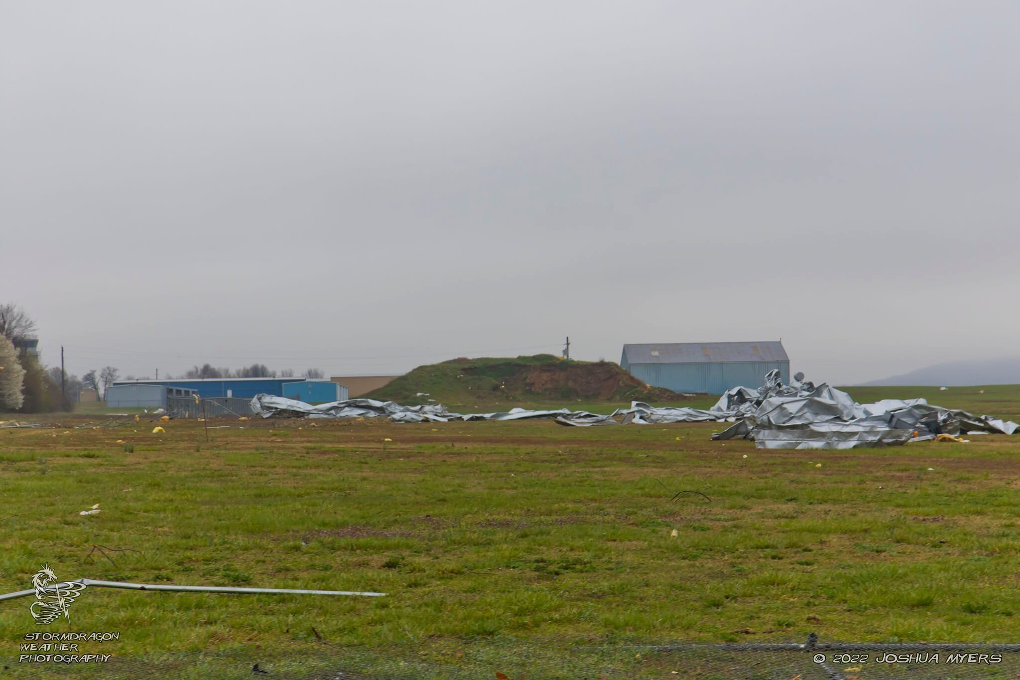
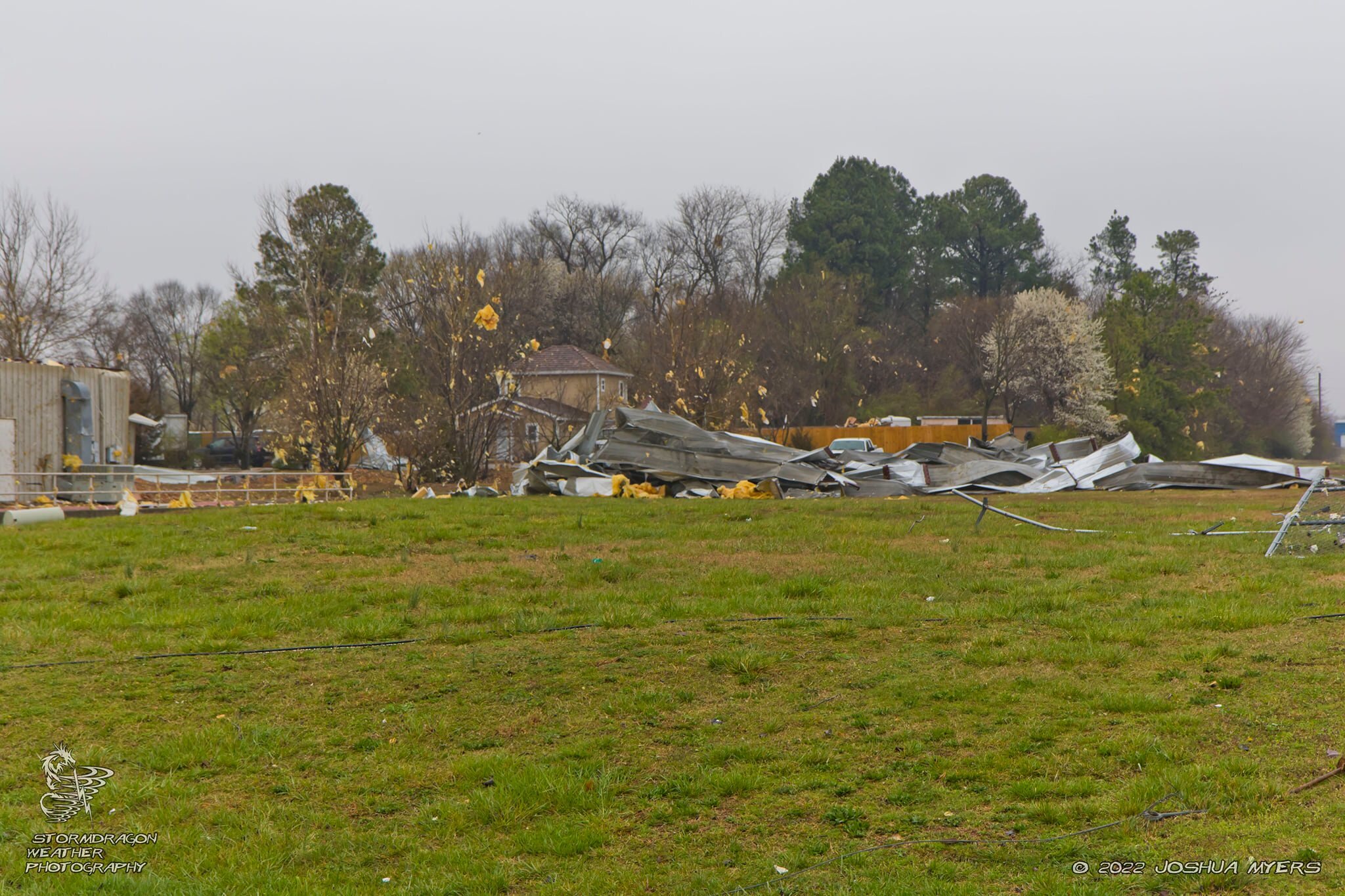
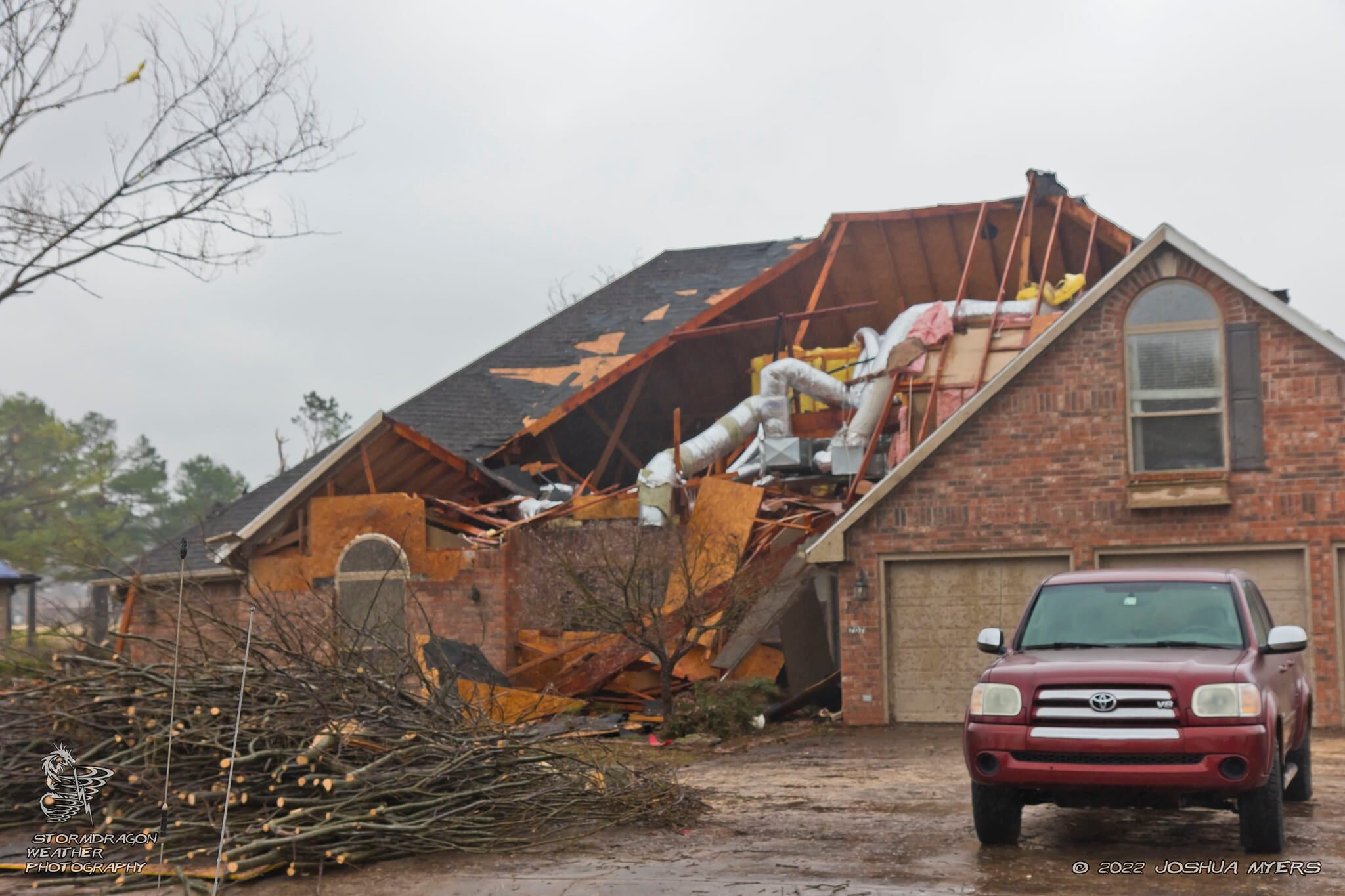
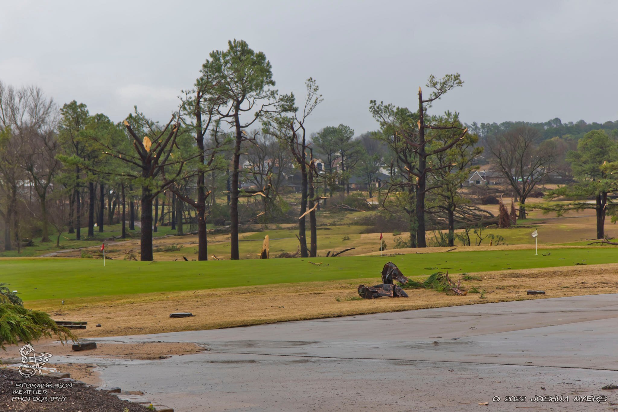
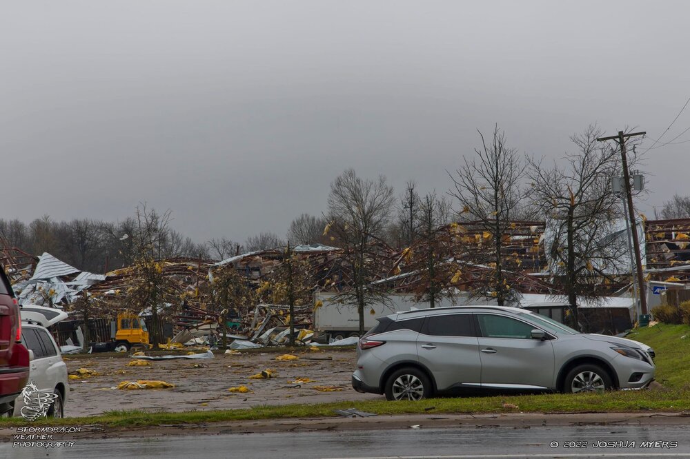
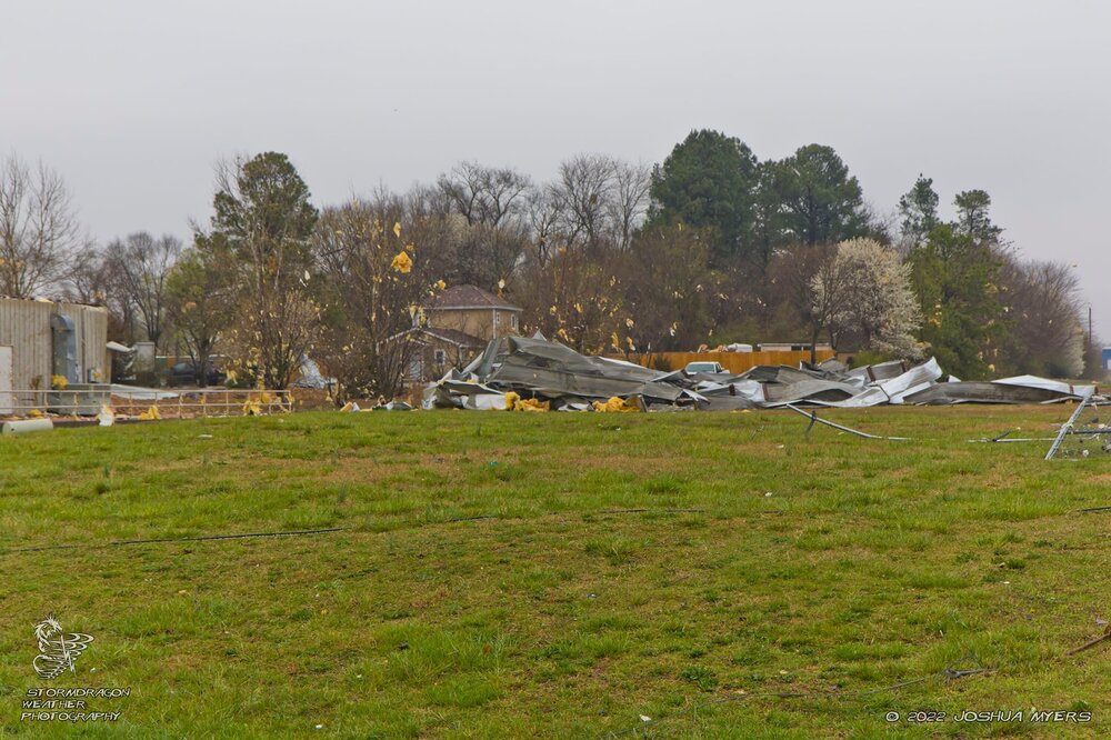
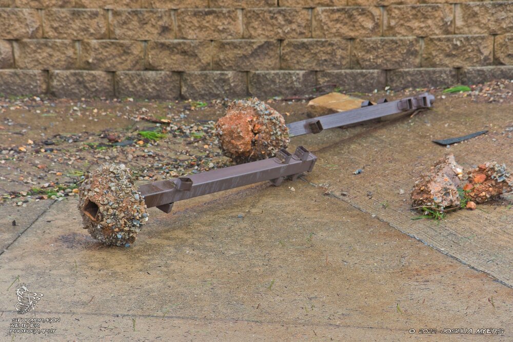
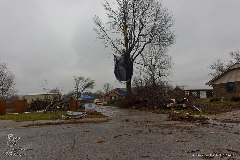
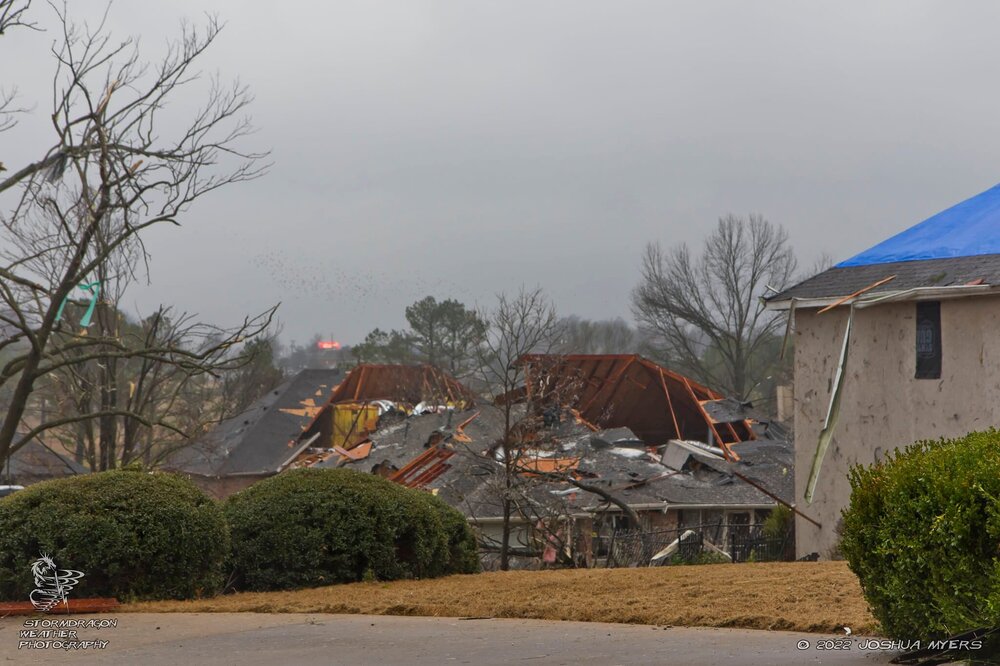
There was a lot of extensive damage around the Nilfisk Plant & Warehouse with debris lofted and deposited across much of the Springdale Municipal Airport across the road. There was also some impressive scenes with many trees and fence posts twisted and ripped clean out of the ground. The Malco Razorback Theater below the mall also sustained damage along with a large cell tower that was destroyed.
-
A few photos from around the Springdale, AR area of the high end EF-2 possible EF-3. (NWS Prelim Rating)


-
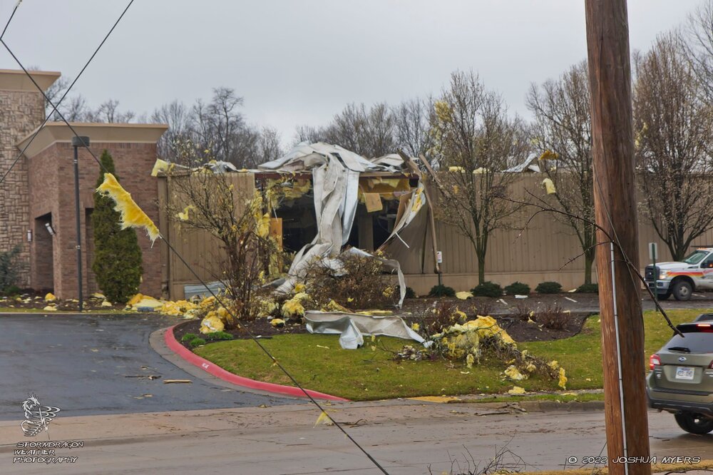
Yes both Springdale and Fayetteville. I've been looking at the damage myself. Several businesses and an elementary school was trashed. Minor damage also occurred by the NWA Mall and Razorback Movie Theater. a country club was heavily damaged along with dozens of trees and a destroyed cell tower up the road. I will post up a couple pics after awhile.
-
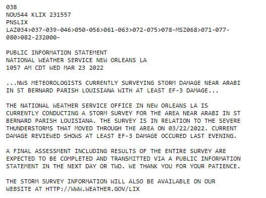
NWS NOLA initial surveys calling it AT LEAST EF-3 damage.
-
Man that city can't catch a break...
-
I might end up eating my words later, but looking at current trends I am now getting the feeling yesterday was the bigger of the two days. We will see. I just got a feeling this will be a messy storm mode setting up which will hamper the tornado threat.
-
The driver be like: "Don't mind me, just re-enacting that scene from "Twister" is all."
-
SPC maintains Mod Risk on the new SWODY1. The 15% hatched area has expanded quite a bit though.
-
So with tomorrow, are we thinking the SPC will be more or less likely to pull the trigger on going High Risk in wake of what happened today?
-
SPC hinting at a possible Mod Risk Upgrade in TX for I-35 and E in future outlooks via the 12z update. https://www.spc.noaa.gov/products/outlook/day1otlk.html
-
Moderate Risk maintained on the new D2 w/15% hatched tornado risk, I believe this is one of the first few D2 outlooks to feature such a high tornado risk since they started doing D2 tornado risk maps?
-
Not to discount the risk as is but if that CA gets closer to 90 then I'd be very concerned for you folks down there.
-
MO/KS/AR/OK 2021-2022 Winter Discussion
stormdragonwx replied to JoMo's topic in Central/Western States
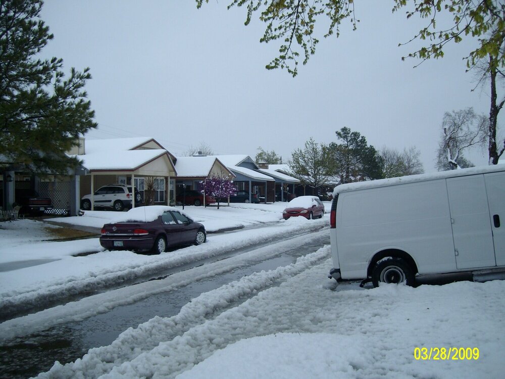
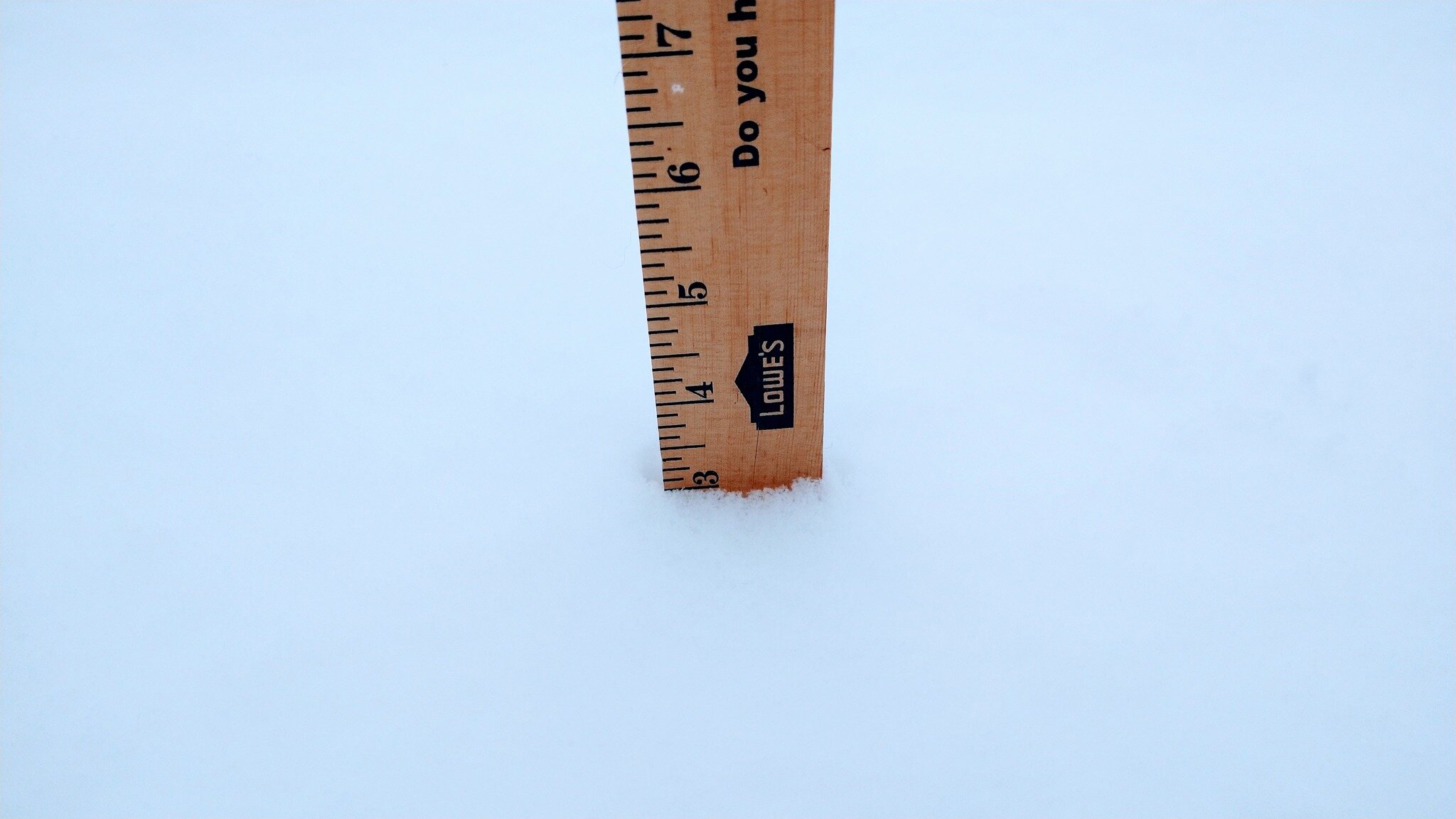
Got a solid 3" with moderate snow still falling at this hour in E Fayetteville, AR. Will probably see another inch before the dry slot kills it.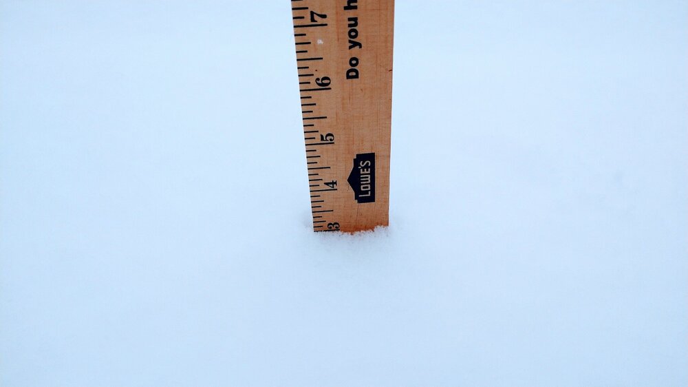
-
MO/KS/AR/OK 2021-2022 Winter Discussion
stormdragonwx replied to JoMo's topic in Central/Western States
T-Minus 12 hours before the fun begins. Thinking 2-4" in my area. -
MO/KS/AR/OK 2021-2022 Winter Discussion
stormdragonwx replied to JoMo's topic in Central/Western States
Safe to say the end of the week is gonna get fun. -
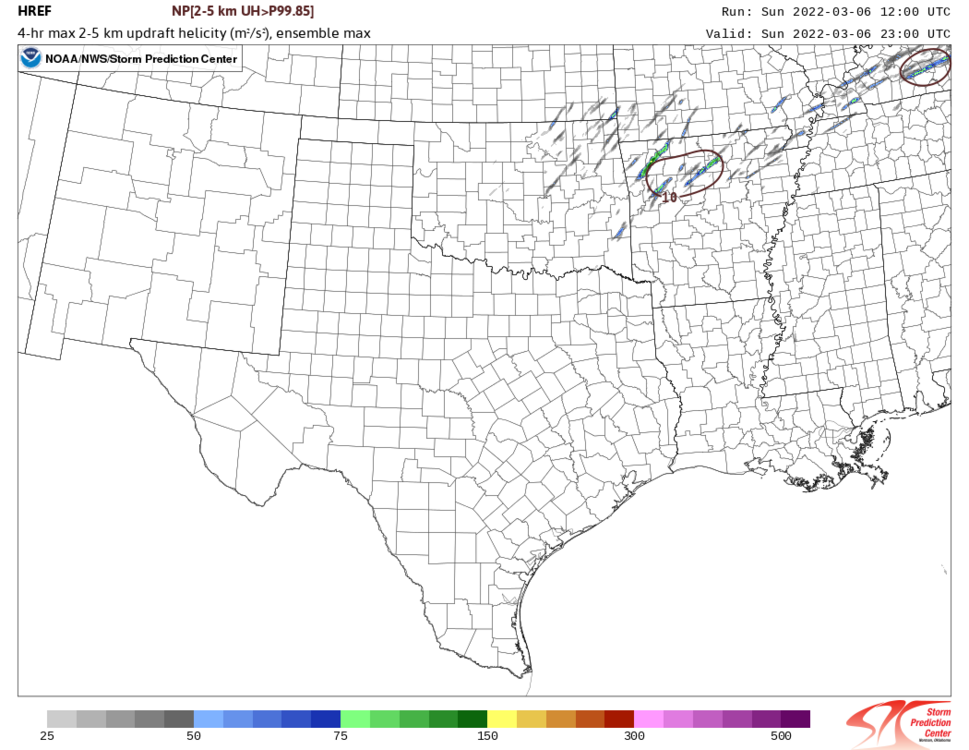
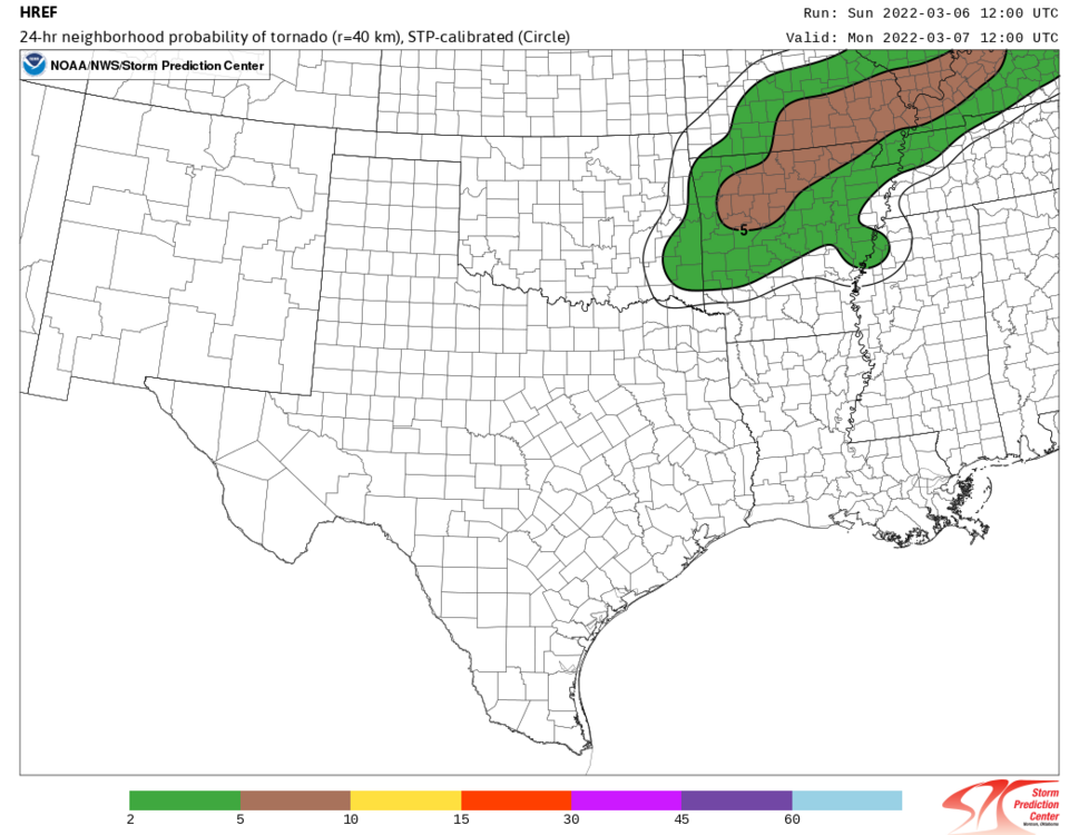
Thoughts on NC AR today? While I don't expect a repeat performance of what we saw in Iowa yesterday, im thinking things could get interesting later. EDIT: Meso Discussion is out, Tornado Watch likely for said area. https://www.spc.noaa.gov/products/md/md0207.html

-
MO/KS/AR/OK 2021-2022 Winter Discussion
stormdragonwx replied to JoMo's topic in Central/Western States
So who thinks we might squeeze out one more decent snowstorm across the Southern Plains/Ozarks? I remember in the 90's 00's that was a regular thing in March. Including some of our biggest, wettest snowfalls.